May 2-3, 2015
After our stay on Tanner Butte, in early May we decided to try a similar trip to Tomlike Mountain. We started early (early!) from the Herman Creek Trailhead Saturday morning, ambled up the Herman Creek Bridge Trail and PCT to its junction with the Herman Creek Trail near Wahtum Lake, got back on the Herman Creek Trail for a short jaunt to its junction with the unofficial but well-marked trail up Tomlike, then finally made it up to near the summit of Tomlike to camp. On Sunday, I took a quick sunrise stroll down the Woolly Horn Ridge a couple miles to where the trees start again, then we headed back to the car via the Herman Creek Trail.
Saturday
1.
We leave the house at five, and, although it’s only forty-five minutes to the trailhead, Krista still manages to sleep soundly pretty much the whole way there. I love that.
The sun’s rising, dyeing the river red and making the clouds over Hood River appear holy. The gorge is east of Portland, so I’m always driving into sunrise on the way out and into sunset on the way back. I always want to stop to take photo, always wish that the freeway were more like a trail so that I could just jump off for a second and fiddle with the camera, take a few pictures, maybe drink a little water. But of course freeways don’t work that way.
I have this memory – I’m not at all sure that it’s real – of driving in the gorge with my grandma and dad when I was something like twelve. I was all black finger nails and pre-teen angst and my grandma was all elder grace and my dad was pulling over on the shoulder so someone could pee. I don’t know if it really happened, but I always think of it, whatever it is, as I pass through that strange phase of highway after the city ends but before the wilderness begins.
If my grandma were here now, in this light, I imagine that we’d pull over to take pictures. Maybe she’d take pictures. Pictures on film that she’d get printed. Prints on which she would write, in her fastidious Gothic Scandinavian script, some bare details about when the thing was taken. “Portland, Autumn 1997. Columbia Gorge. Eric and Robin.” I have a picture labeled like that from when I was a kid. “Cape Cod, 1987. Baby Robin.”
2.
When we arrive, there are already a few cars at the trailhead, with another – a chipper dayhiker who will pass us in a powerline meadow a quarter mile in – arriving just as we leave.
In short order we split off the Herman Creek Trail, on a cutoff that leads to the PCT. Before they rerouted the PCT directly into Cascade Locks, it exited at Herman Creek. Our cutoff used to be the main trail. I imagine the early 1970s, hundreds of ragged hikers walking where we are now, 2000 miles from Mexico and only a few hundred from Canada. It would have been late summer, the trees just beginning to turn red. The trail was wilder then – more an idea than a thing. There’s an old rusty PCT blaze here on the back of an old tree, facing in a direction no one would ever look. It’s probably the only one left on this trail, presumably spared from removal by its strange placement.
The cutoff crosses Herman Creek on a posh bridge originally built, I suspect, for horses. The morning light is lovely on the low creek.

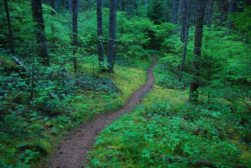
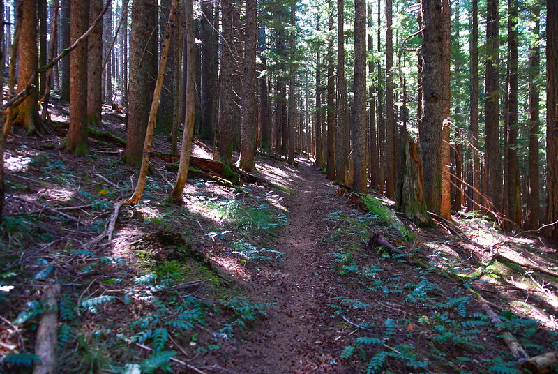
After the bridge the trail ascends lightly in heavy green forest. Every imaginable shade of green, bits of yellow and blue on the periphery.
3.
Krista yells over a green meadow for me to stop. She wants to take a picture. I do my best to pose – I’m terrible at having my picture taken. My face never looks right. (Does anyone ever think their face looks right?) She fiddles with her camera for a little, looks carefully at the screen, then gives me a thumbs up.
But I don’t keep moving just yet. I watch as she kneels down, trying to get a good shot of something in the brush. Flowers. She takes the most beautiful flower pictures. They’re composed in a way that mine never are – dividends from a year in art school and a decade in design. The trick, she tells me, is to look not just at the flower, but at the shape it leaves in the blurry background.
I watch as she take pictures. She’s just bought a new camera, a small one that fits in the hip belt pocket of her backpack, one she can take out easily on the go. I’ve been carrying a large Nikon thing and she’s been going without. But now that she’s gone one, she’s stopped, kneeling in the foliage.
I think about how ridiculously lucky I am. We met when early in college, when I was a pompous teenager, just a year or two removed from high school rap rock angst. When I was first reading philosophy, pretentiously talking about things I didn’t really understand. When I turned 21 and drank more than I probably should have. When I finished my masters and floated for a year, unsure of what to do. When I went away to more grad school in Eugene, hating the place for not being Portland. When my parents got divorced. When I came back to Portland, moved back, into an apartment with her the summer we got married.
And she’s still here, kneeling in the foreground foliage, pausing to take a picture as our blurry background bounds by.
Sea Blush:
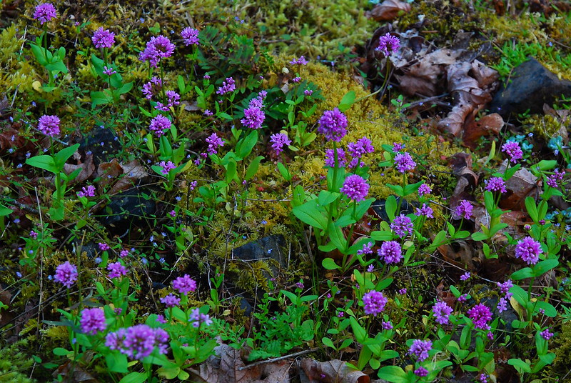
Phlox:
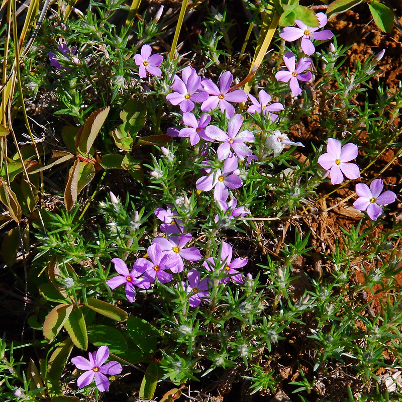
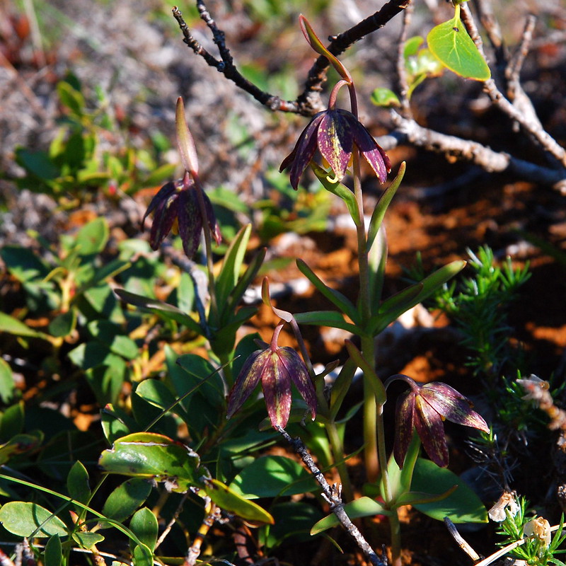
Chocolate Lily:
4.
Having only eaten a couple handfuls of trail mix each, we stop at the Red Rock Viewpoint, maybe 3000′ up, for some breakfast. The last time I was there, it was during a thunder storm, and the views were good, but harrowing.

This morning they’re considerably calmer.
As we’re luxuriating with coffee and oatmeal (if you’ve never had it, try putting some dried coconut cream in yours some time), a couple of friendly women come up on their way to do a loop up to the Benson Plateau and down Ruckel Creek. They call it “the loop.” It’s a funny thing that happens in the gorge. People will have read about a trail or a hike somewhere, and think that everyone they see is on the same trip. “We’re doing the loop.” “How much further is it?” What is “it”?
5.
We wait a little to give our friends some space, then continue up past Teakettle Spring – which is running, but barely – to the Benson Plateau. The PCT up here is eerily quiet and straight. For several miles I feel like I’m sleepwalking.
6.
I wake up a few miles later at another viewpoint, this time of Tomlike, Chinidere, and the headwaters of the eastern fork of Herman Creek. I first found this place last year, wandering lost in the snow. Today it’s all sun.
We eat lunch here, legs in the light and bodies in the shade. Then, just a few steps later, we stop at Smokey Springs, the last reliable water for the rest of the day, where I sit by the small creek for twenty minutes filtering six liters of water and filling two other bottles with unfiltered stuff for cooking. Enough for tonight and breakfast tomorrow.
Where does all this water come from? There’s no snow up here anymore, probably won’t be for six or seven months. But still fresh water springs from the ground a few hundred feet above where I’m sitting. Last time I was here, in the snow, it was obvious. There was water because there was melting snow. But now what?
When I was a kid, I used to pour water on the driveway to watch the patterns it made on the way to the street, branching at pebbles, pooling at cracks, cascading once it reached the inch deep ravine running down the right side of our driveway to the mailbox and the perennial puddle at its base. And there was a stream in the woods near our house, which ran strong in winter and spring, forming pools deep enough to dunk your head if you didn’t mind the mud. Those woods were so big and wild to me then. The way I walk now, it would take five minutes to get from one end to the other. I wonder what I’ve lost.
The water then, in the stream by our house, it had to be coming from somewhere. But where? It ran even when it hadn’t rained in days. I didn’t worry about it then, of course. The stream was just sometimes there, sometimes not. I think about it a lot now. The precariousness of it all. The spreading, empty streambads. What it means that sometimes the sources of streams dry up, that sometimes the end of snow up high means the end of water down low. And I think about the tinder left behind when the streams go dry. It’s going to be a smokey summer.
7.
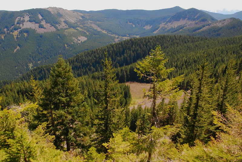
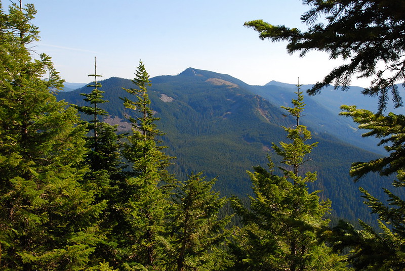
We continue on the PCT through the increasingly beautiful, open talus slopes just south of the Benson Plateau. I really love this stretch. Here’s Tomlike, from across the drainage:
Looking south from an open spot on the PCT:

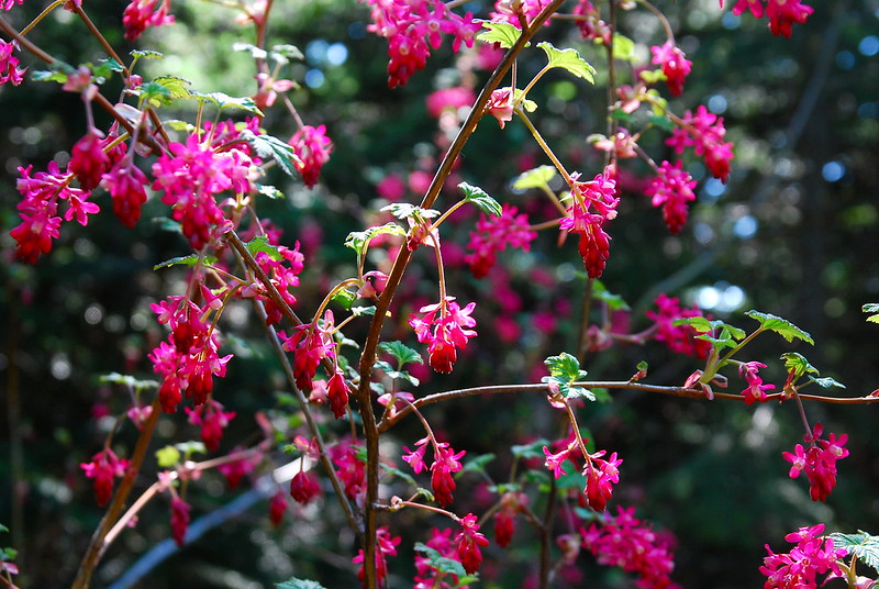
Currant!
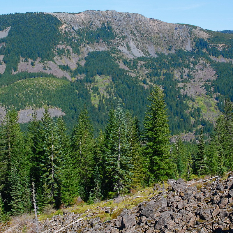
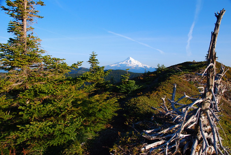
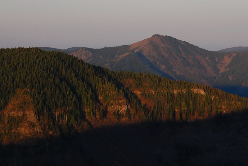
After the trail rejoins the forest, there are a couple excellent viewpoints looking south and west-ish, but at first I’m not sure exactly what I’m looking at. I think this is Indian Mountain, looming over the headwaters of the west fork of Eagle Creek.
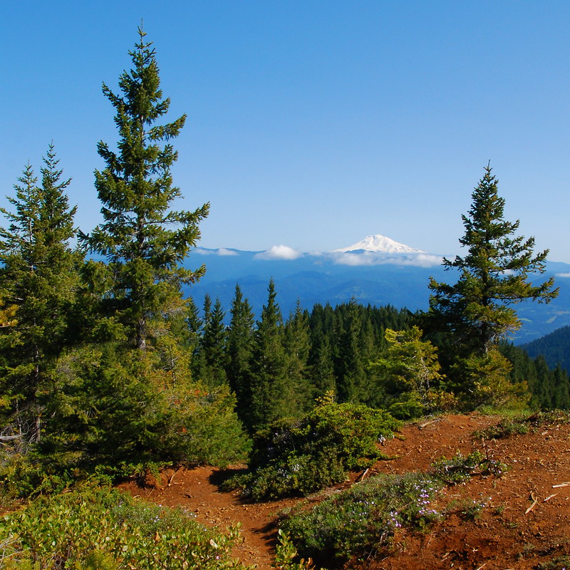
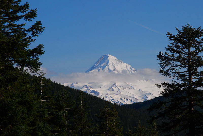
Oh, and Mt. Hood! Preposterously close:
There isn’t much of it, but in one of the clearings there’s even some paintbrush. I have this issue with saying that every wildflower I see is my favorite, but this is… totally my favorite.

8.
Soon we’re walking east past the tangle of trails around Wahtum Lake, then past the lake, over the first snow we’ve seen all day – dirty wet patches of it that’ll be gone in a week. We run into the first people we’ve seen since the Plateau: four backpackers looking for camp, having given up on Mud Lake as a bad job. I suggest maybe Wahtum, and think vaguely about asking if they want to backtrack with us to Tomlike – they seem like a nice group – but they want to keep moving, so we wish each other luck and go our separate ways.
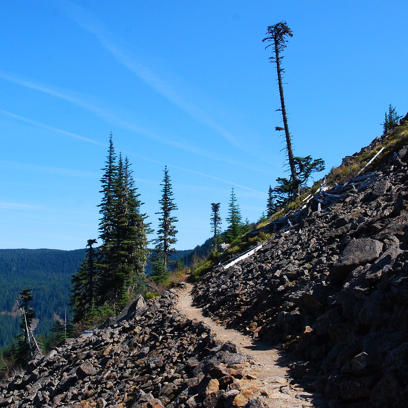
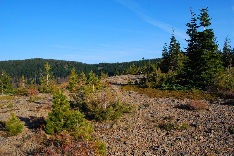
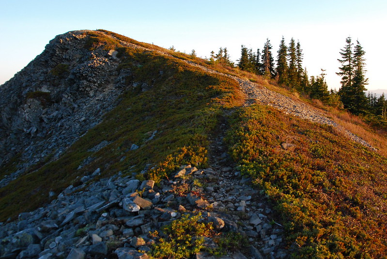
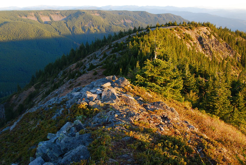
A short while later we’re at the very obvious turnoff for Tomlike (look for two large cairns on the north side of the trail, just east of the Anthill Trail junction), then we’re doing our best to follow the trail along the Woolly Horn Ridge as it shifts from a well-defined single track into a braided series of faint paths.
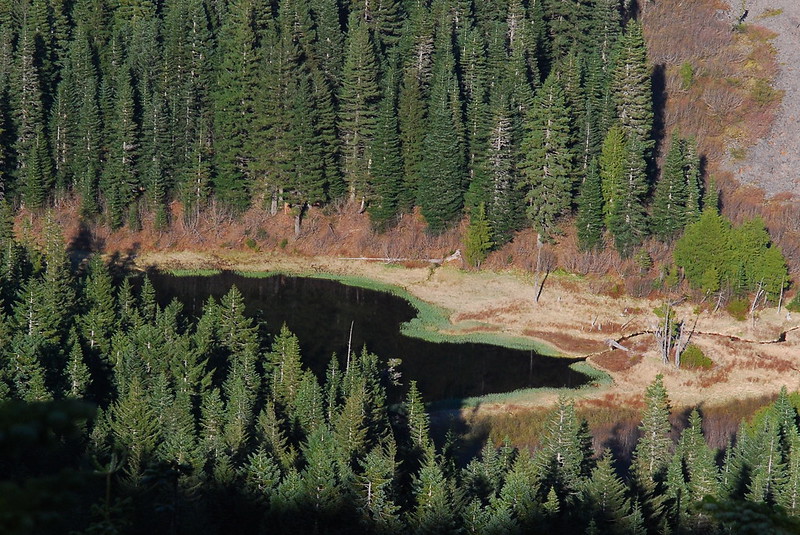
The first views come maybe a quarter mile up the ridge. Here’s Mud Lake. I probably wouldn’t want to camp there either:
And here’s the first flat spot in the ridge, maybe another quarter mile further. Definitely a possibility for camping, but we decide to keep walking.
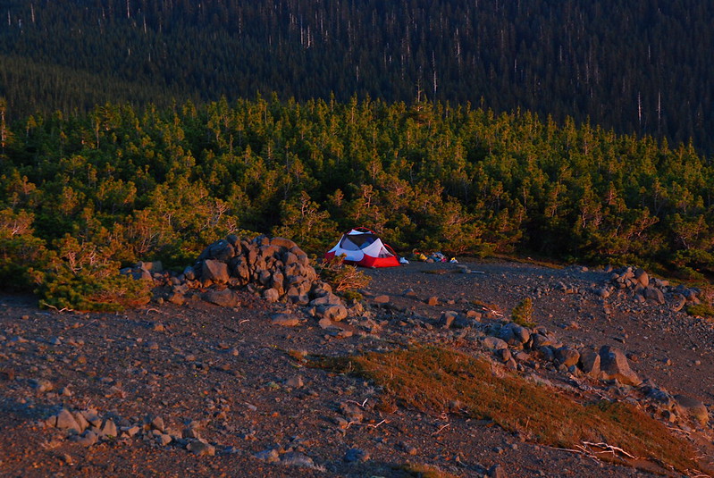
9.
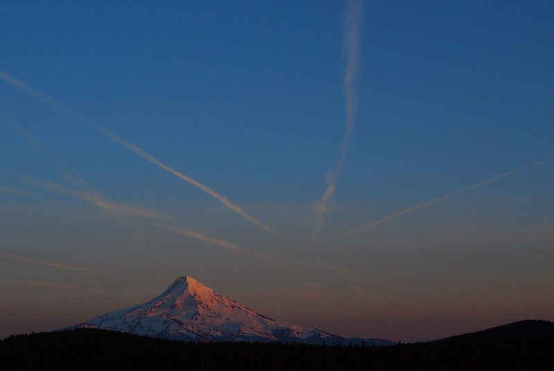
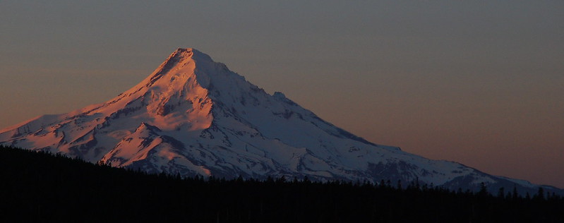
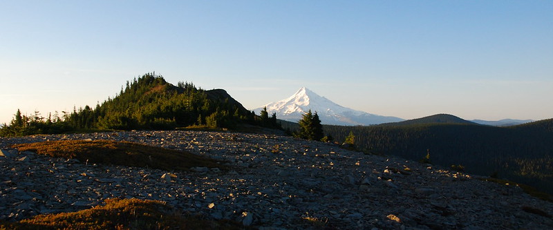
At the last clearing before the final push to the summit, we find a large flat spot from which all the larger rocks have seemingly already been removed. Perfect. We set up camp and I go for a short evening stroll to the top to see what I can see. Here’s the view looking south, back down the ridge, at Mt. Hood:
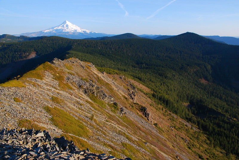
And here’s the view looking north, of Mt. Adams peeking (peaking?) over Nick Eaton Ridge:
I have a thousand versions of this picture:
10.
In my academic life, I’ve spent the last few years writing about how histories, difficult histories, get deposited into places and practices – monuments, museums, habits, holidays… What’s most interesting to me is how the past sometimes ossifies in places where no one looks for it, like street names that no one thinks about or statues that fade into the landscape.
I don’t have any difficult history here – come to think of it, I don’t have any difficult history anywhere – but I do have history. The last time I was here was on my birthday, in the middle of the longest walk I’ve ever taken. I’d rushed down too quickly, too eager to move on to the next peak. But I built a little cairn just off the main path where I sat for a while watching the clouds. And I see the cairn now, as I stare over the ridge in the fading light. The stones have shifted, loosened up. A few have fallen back on the ground. But the thing’s still standing. I put a new stone on top, then amble back to camp for warm clothes and dinner.
When I get back to camp, Krista’s a little chilled – despite the unseasonable warmth, it’s seriously windy – so I make dinner as we chat through the tent mesh and she warms up in her sleeping bag. We eat in the tent, passing the pot of macaroni and cheese back and forth, cozy in our sleeping bags as the sun drops over Mt. Hood.
Sunday
11.
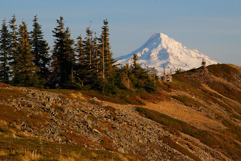
I wake up at sunrise the next morning, and go for a walk down the ridge again to see what it looks like now with the light coming from the other side.
This is probably my favorite place in the gorge:
Here’s the view looking west toward Tanner Butte, where we were a few weeks ago:
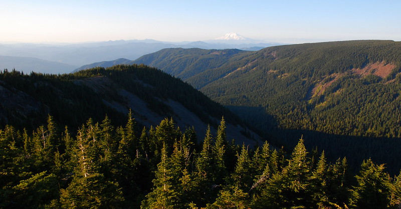
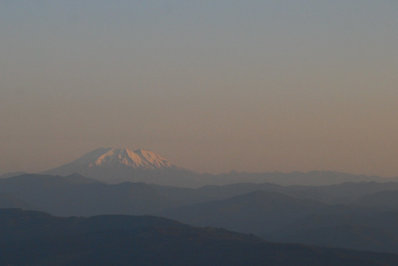
And the view north, to St. Helens, where we’ll be in a few weeks:
And the view of the Benson Plateau, where we just were:
Time spreads out up here.
12.
Descending down the north side of the Woolly Horn Ridge is such a treat. I could spend at least a day just wandering around. Maybe a half mile past the summit is another flat spot, an ancient looking camp with clearings for tents and a lived-in fire ring now sporting small sprouts of green grass.

13.
When I get back to the tent Krista’s still sleeping – she’s elected to hit the “Husband Snooze” button – but we eventually eat a leisurely breakfast and pack up. The walk down Herman Creek is, as usual, gentle and gently pretty. A few miles in we stop at Cedar Swamp to soak our feet in the east fork of Herman Creek, and to filter what little water we’ll need for the six or seven miles back to the car.
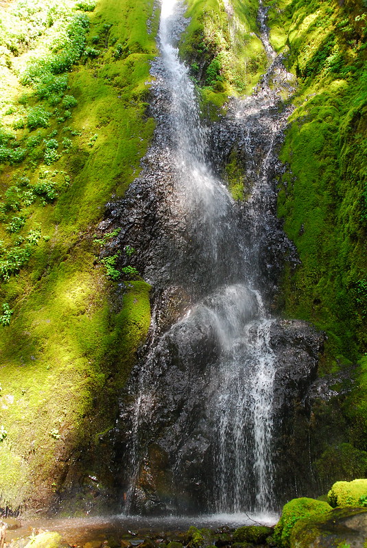
We’d been expecting a ton of campers, but only see a few people, mostly dayhikers on their way up. We stop again at Casey Creek Camp for lunch, where some insistent chipmunks look longingly at our crumbly tortillas, then continue on to Nick Eaton Falls, which provides some much-appreciated mist in the rapidly warming day.
When we get back to the trailhead in the mid-afternoon the parking lot is only maybe halfway full, but there are cars dotted a ways down the road. I guess a lot of people came and went, somewhere, while we were up in the hills. Before we start home, Krista pauses to show me a wildflower picture she took on the way down, while I was busy tromping ahead.
