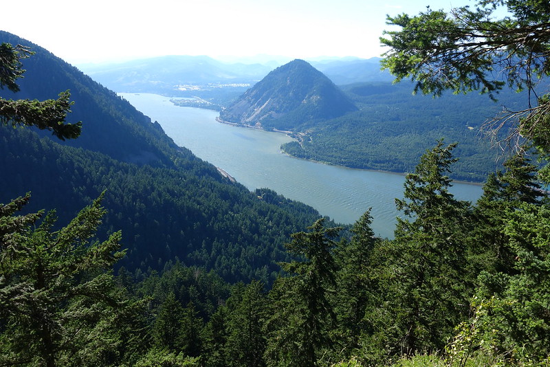
I spent the Fourth of July weekend rambling across the Gorge from Angel’s Rest to Defiance, summiting the ten major named peaks—Angel’s, Devil’s, Larch, Nesmith, Tanner Butte, Indian Mountain, Chinidere, Tomlike, Greenpoint, and Defiance—on the way.
I’ve been dreaming about this trip for a long time—much longer, in fact, than I’ve been even vaguely capable of doing it. When I first got back into hiking, I would marvel at people putting in 20 and 25-mile days. I struggled with 10. But I knew I wanted to go longer, and I worked really hard to get there. To get here. I don’t think there’s any right way to hike, but now, after a few years, I’m so thankful to have a body that can do it.
July 1: Angel’s Rest TH to Tanner Creek
Angel’s Rest, Devil’s Rest, Larch Mountain, and Nesmith Point
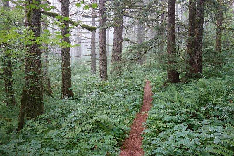
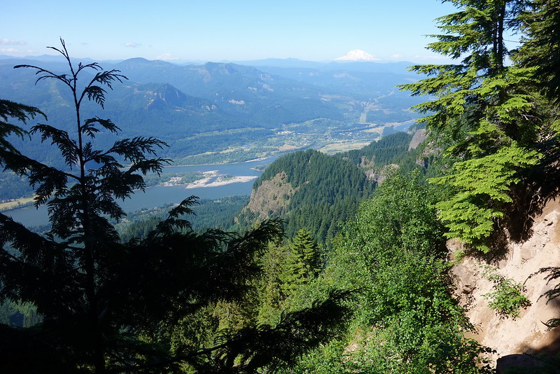
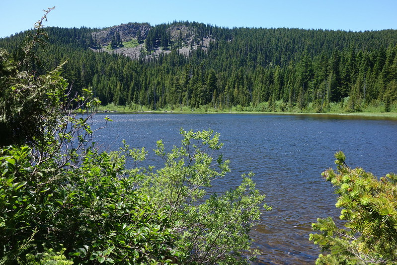
We sleep sorta late, and Krista drops me off at the already-full Angel’s Rest Trailhead just after seven. I fuss with my pack and all for fifteen minutes—I need to position that Snickers exactly right for when I need it—then set out, up through light rain and thick clouds.
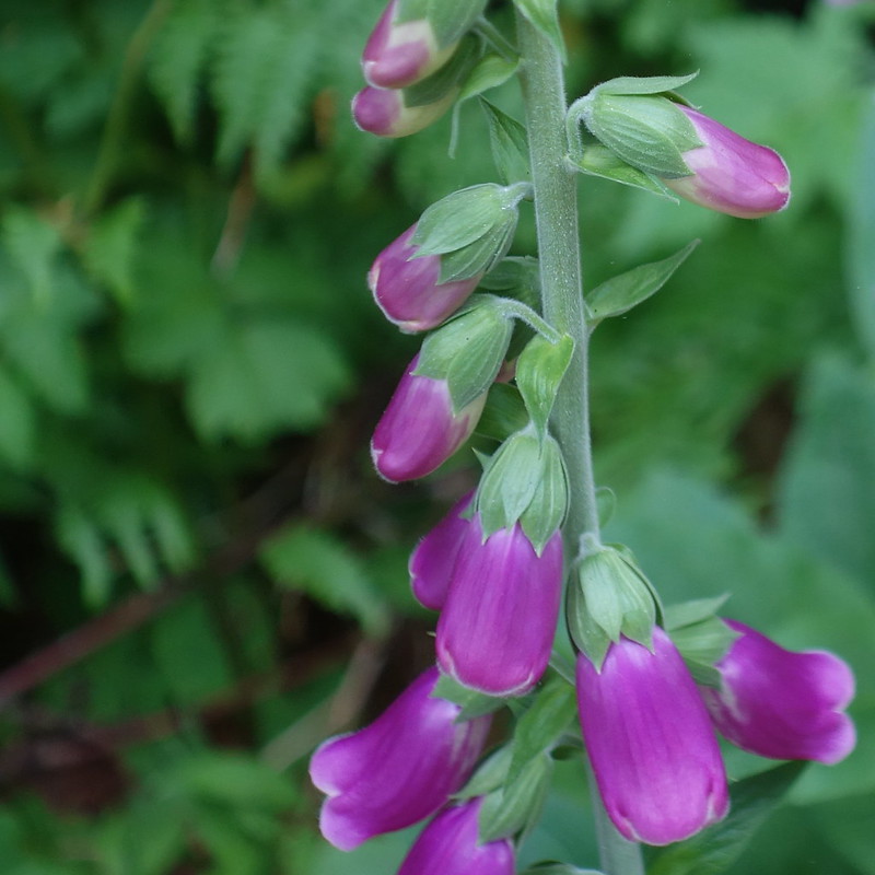
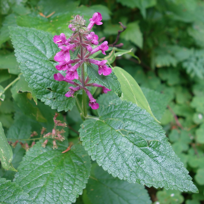
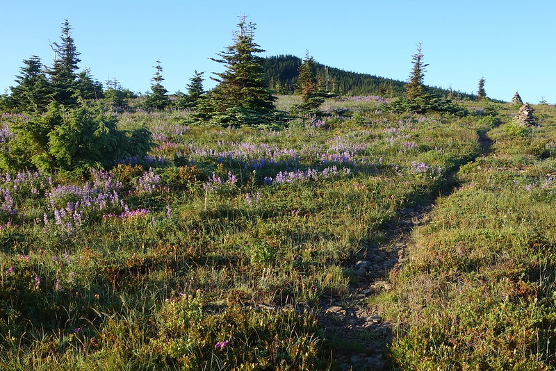
I’ve never been to Angel’s Rest in summer—it’s always been a sort of winter hike for me, once the high country’s snowed over—but it’s beautiful now: a thousand blooming flowers, and a thousand shades of green. The views up top are… subdued, but no matter.
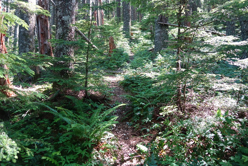
From Angel’s, I follow Foxglove Way up toward Devil’s Rest. It’s much brushier than I remembered, but easy all the same, and utterly charming in the mid-morning fog.
Then a long downhill—first to the old Multnomah Basin Road, then to Multnomah Creek—where I stop for a quick breakfast between the forks.
The Larch Mountain Trail’s as broad and beautiful as ever. I haven’t really seen anyone all day, but a couple miles from Larch Mountain proper they come: first a trickle then a torrent, all smiling, looping down into the crater from up top. My favorite’s a group of four: two parents, each with a young kid on their back, all singing the theme song to some show I’ve never seen.
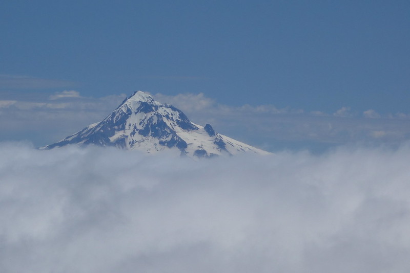
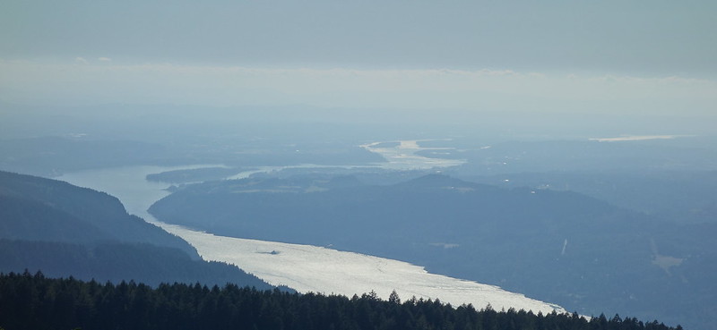
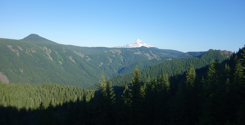
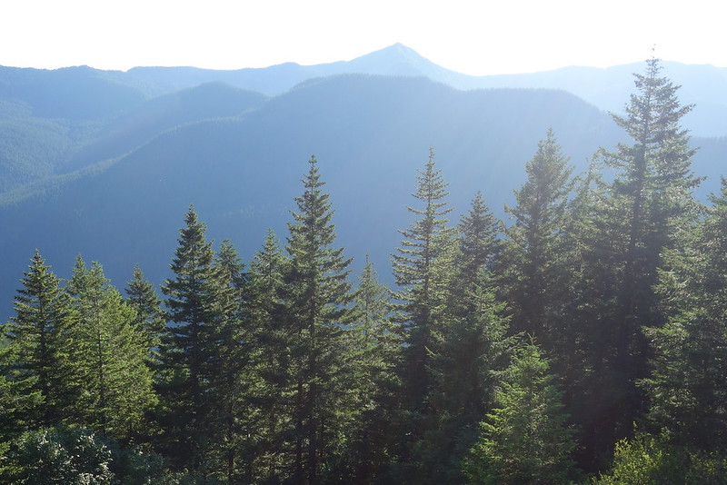
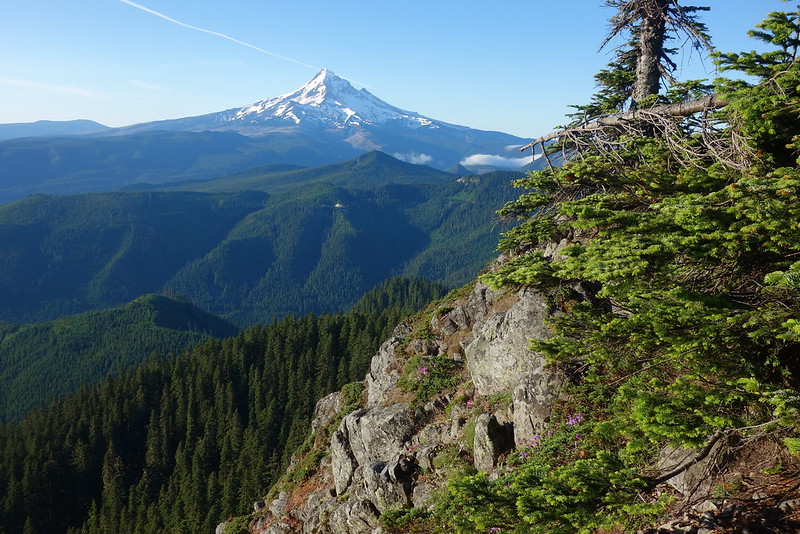
Just before the top, the trail suddenly pops out of the fog. I’m above a sea of clouds, and all the distant peaks are islands. Sherrard Point is packed, but I hang out for a while all the same, eating Starbursts and watching the waves lap up on Mt. Hood.
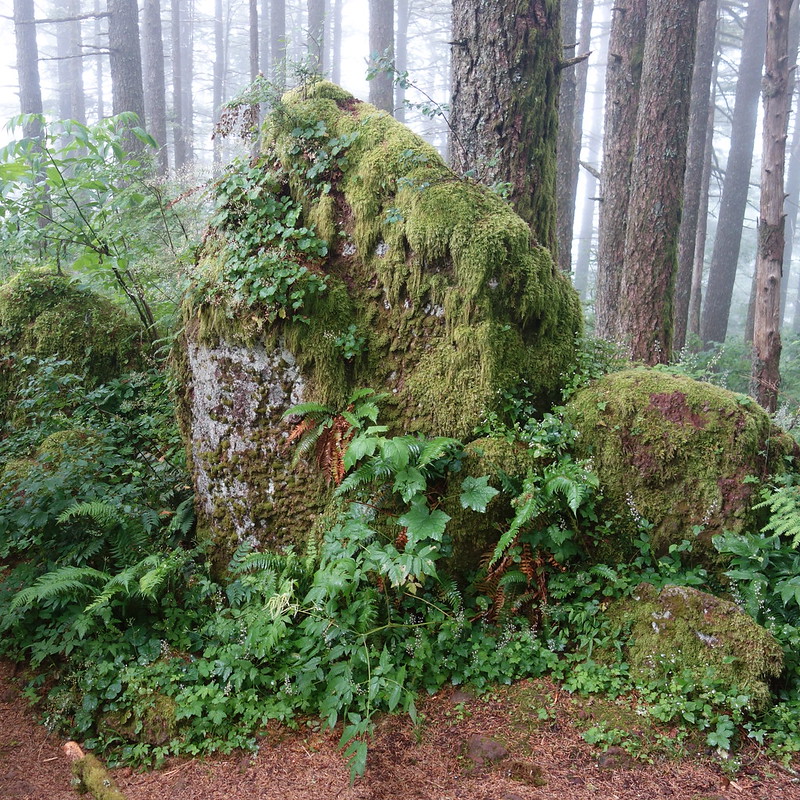
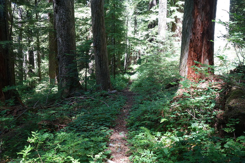
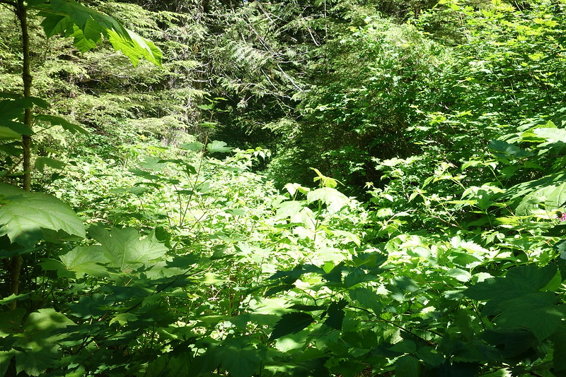
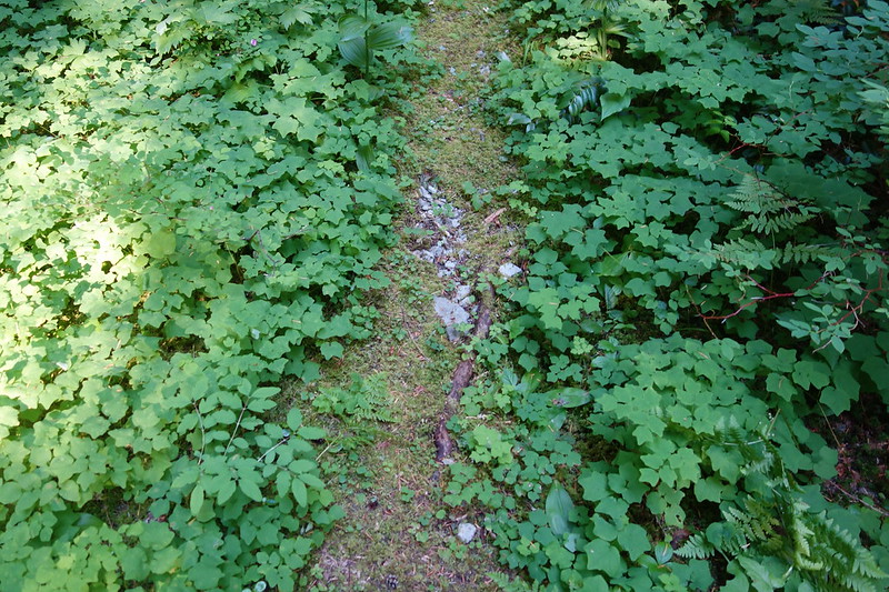
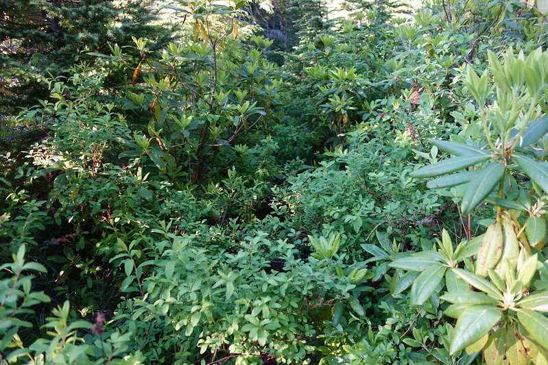
The upper Oneonta Trail’s similarly packed, but after turning off onto Bell Creek, I don’t see another soul all day. I’ve always loved Bell Creek, but this is my first time in summer. It’s astounding how brushy it can be. The first mile’s just lovely, but then it’s just choked with devil’s club and slide alder and every plant all at once. The trail’s here, somewhere, but it takes a bit of faith to see it.
Still gorgeous, though.
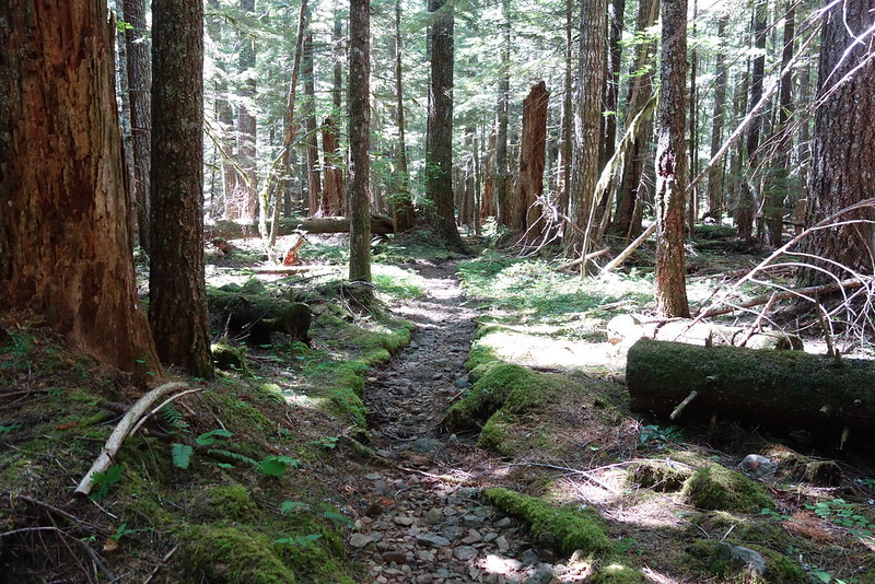
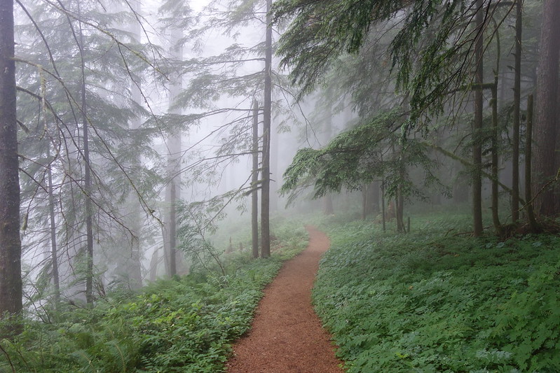
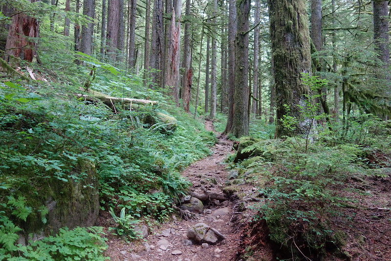
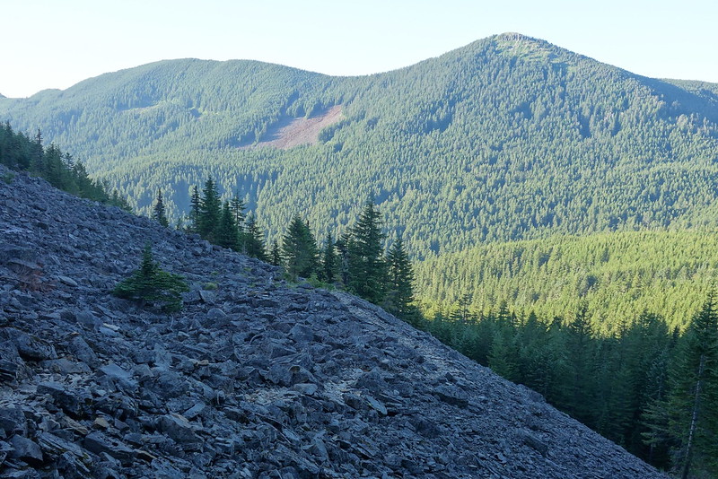
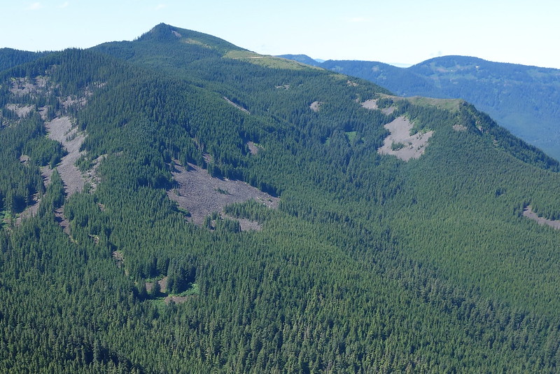
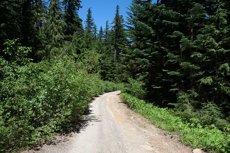
After the Horsetail junction, the walking gets easy again, across several forks of Horsetail Creek, and up through the open woods toward Nesmith Point.
I love the views around Yeon Mountain.
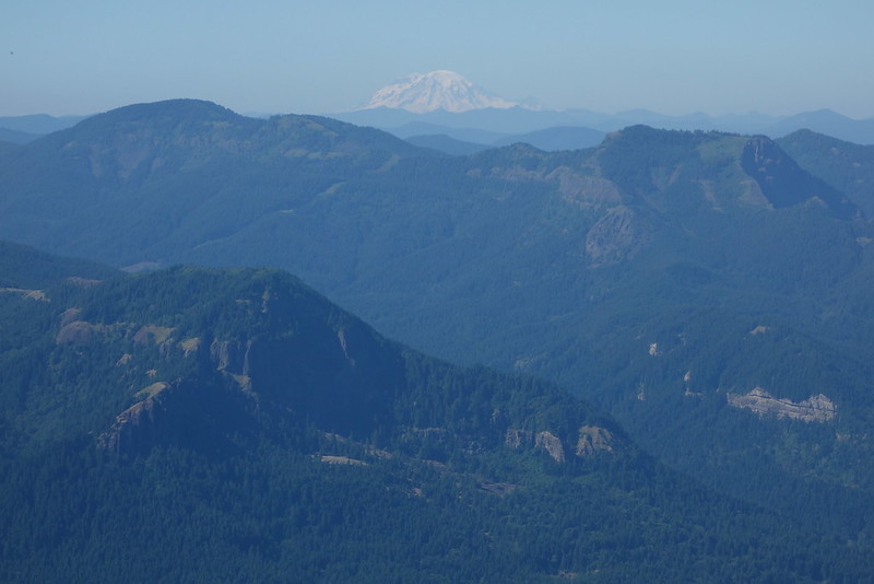
And I love the views from Nesmith, too, even if they require a little more neck-craning to get.
I make it to Nesmith around five, and decide to push on, down to Tanner Creek.
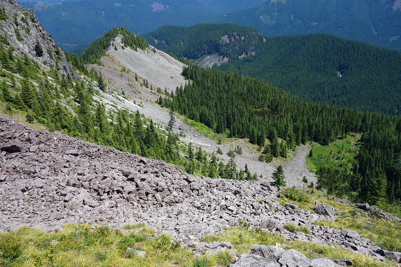
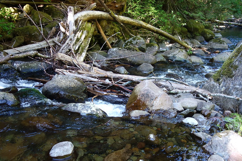
The Tanner Creek drainage poses the only real difficulty with this route. There are a couple nice camps just east of Moffett Creek and the powerlines, but then the next good camping is all the way down Tanner Creek and back up to Dublin Lake. In addition, the trails in the Tanner drainage are in uniformly rough condition.
So I ramble down into the drainage with the idea of bivying somewhere along Tanner Creek, though if one were less pressed for time (or more particular about campsites), it may be best to camp either before or after.
In any case, from Nesmith, I ramble down the Moffett Creek Trail, as it fades in and out among beargrass and brambles.
I love the stretch just east of Moffett Creek, through powerline meadows and to the rim of Tanner’s massive canyon…
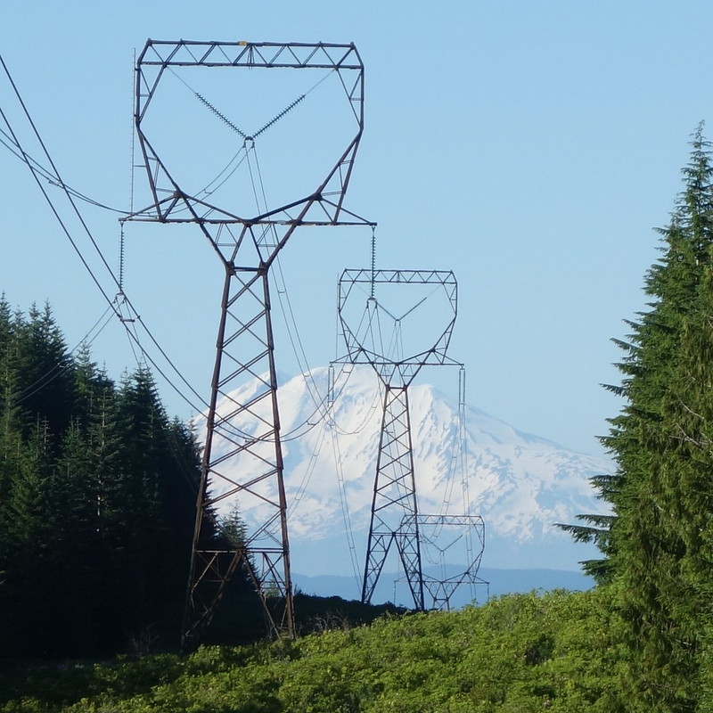
… even if the trail leaves a little to be desired.
The trail down to the creek’s generally much better than I thought it’d be, but there are a few rough spots. And the trail’s essentially gone for the last thirty feet down to the water. I love this sort of thing, but also worry that these trails are fading into nothing. There are so many people in the Gorge, so many overcrowded places. A few boots on the ground could do this place good.
I cross the creek on a couple logs, then hurry through the Tanner Creek Trail, just as the sun starts to seriously fade. I’m so tired. I stop at a minor feeder stream, and watch something fly a few feet above the water. In the failing light, in my tired stupor, I almost think it’s a fairy.
(It’s actually a Mud Dauber—a sort of wasp—out for an evening smoothing.)
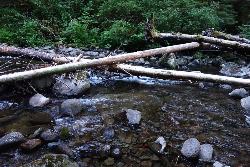
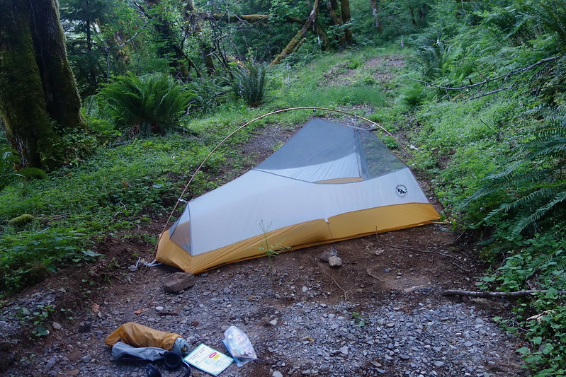
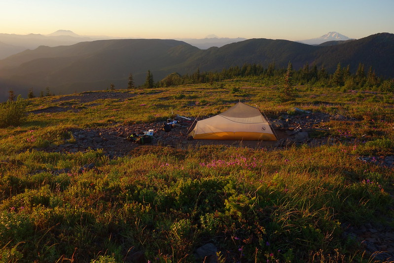
Camp’s a pullout off Road 777, near enough the powerlines to hear their hiss through the evening wind. It’s considerably more idyllic than it sounds.
July 2: Tanner Creek to Indian Mountain
Tanner Butte and Indian Mountain
I wake up Sunday morning to an absolute riot of birdsongs—overlapping, ascending, and swirling, coming from everywhere all at once, a crystalline fog of blooming, buzzing, beautiful confusion.
When we talk about the beauty of this place, we almost always talk about how it looks—the waterfalls and flowers and distant hills. But lying in my tent with my eyes closed, just barely awake to the world, I think about the strange gift of hearing it: this flowing, fleeting thing, gone the second I try to grasp it.
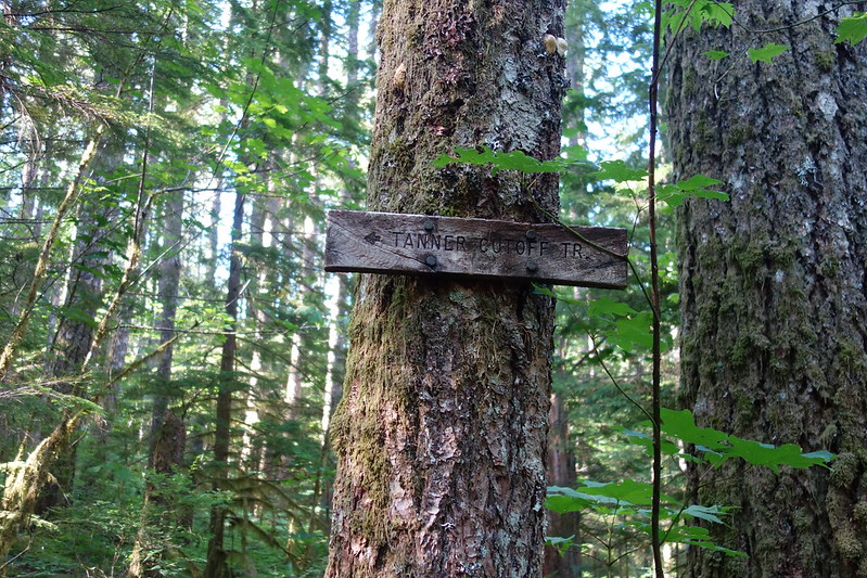
Eventually the sun grows strong and the bird songs fade, replaced by the steady buzz of powerlines, and I set out, back along Tanner Creek and up the Cutoff to Tanner Ridge.

The Cutoff trail’s in pretty good condition, all things considered—certainly better than Moffett—but there are several nests of ground wasps, now all distinctly un-fairy-like, which make the going somewhat more… circumspect.
Joining Tanner Ridge, I see my first people since turning onto Bell Creek yesterday: a lovely younger couple, wonderfully excited, “just out for the day.” The woman beams: “Isn’t it just the perfect day to be out?” It is, and we leapfrog for a couple miles along the ridge, on our ways to Tanner Butte.
Just before the Butte, I scuttle off trail to take care of some, uh, morning business, and end up in something of an incident. I’m crouched behind some trees, taking care of things, when I suddenly, and simultaneously, realize three things: (1) my spot is nowhere near as well-hidden as I thought it was; (2) my friends are about to pass; and (3) I’ve got a terrible charley horse, which is about to make me fall over.
Well I do in fact end up falling over, and they do in fact end up passing. In that order. I try to look up and make an appropriate face—what exactly is the right face for this situation? I try something between earnest embarrassment and rakish indifference—but they’re too kind to look too closely, and we all go our separate ways. Or, rather: they go their way, and I hide in the bushes until they’re well passed.
Anyway, I wait for a while, then ramble up to the Butte, feeling a little sheepish, but also resplendent amid the mountains. Such a funny contrast.
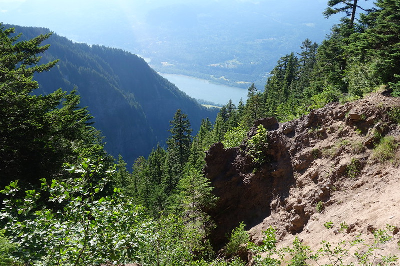
Looking back over Tanner Creek, the way I came…
Tanner Lake:
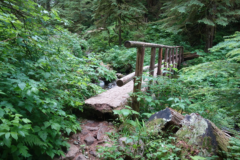
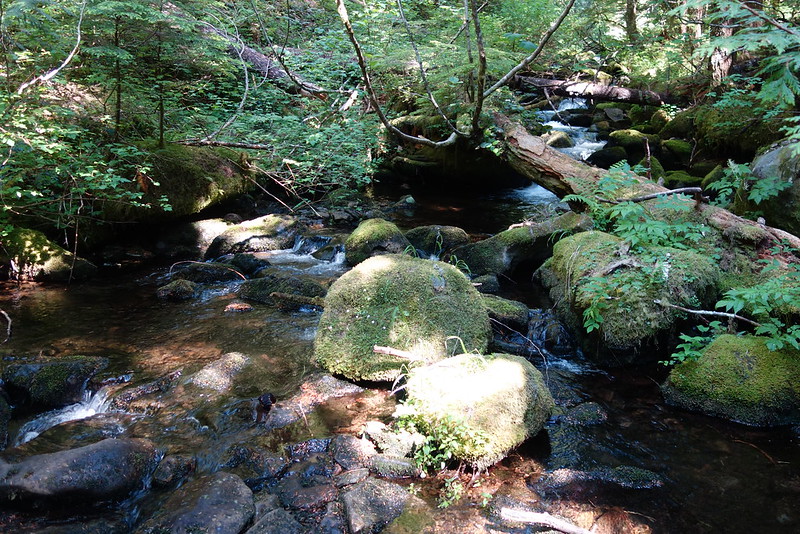
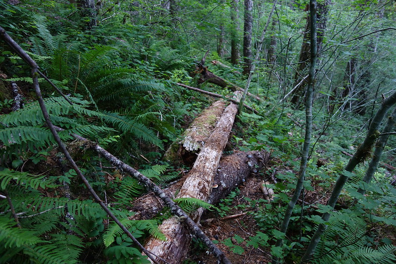
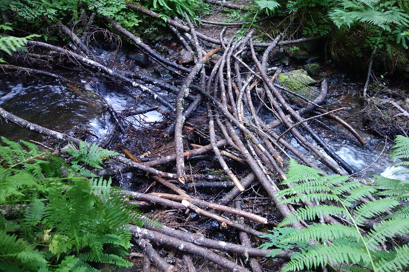
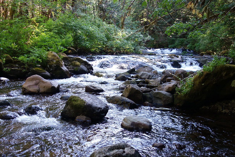
The Eagle-Tanner’s in great condition, and I make good time through the Thrush Pond and Cedar Springs, then down to the upper crossing. The only significant obstacle’s a thicket of blowdown just before the crossing, maybe an eighth of a mile long.
I cross easily on a tangle of branches just down from where the trail meets the creek, then take a long lunch on the side, feet in the water, watching the rapids above.
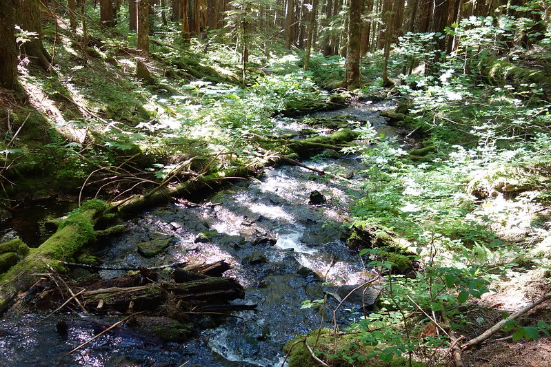
Joining Eagle Creek is like merging onto a fast freeway, and it’s easy walking past beautiful camps and across several streams to the Indian Springs Trail junction.
I don’t know if it’s the heat or the steepness or the accumulated miles or what, but heading up Indian Springs I just sort of bonk. Slowly, though, the views start coming, and an early evening wind comes to cool things down and help me up the mountain.
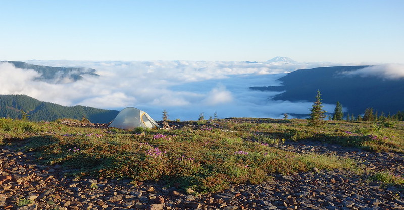
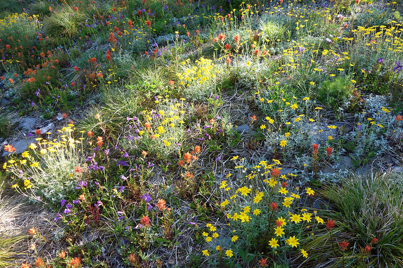
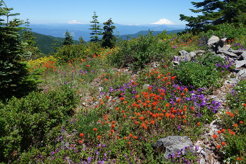
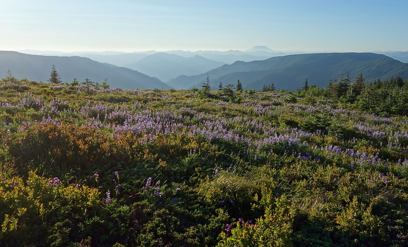
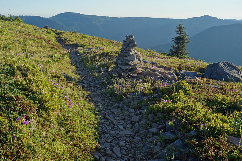
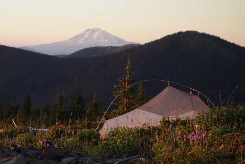
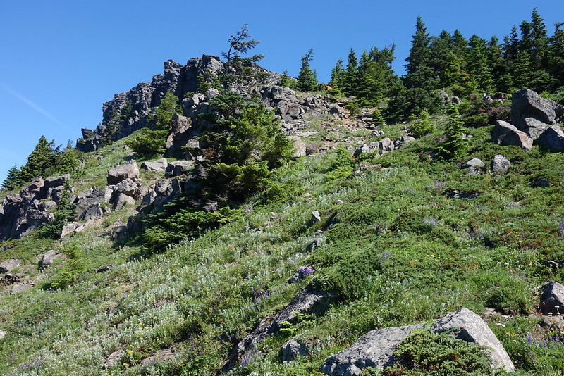
There’s a single car parked at Indian Springs—I’m always a little surprised that you can drive here—but the owner’s nowhere to be found. I turn south on the PCT, and almost immediately emerge into beautiful, blooming, sunset meadows, stretching out above the headwaters of Eagle Creek. Until now, I’ve only ever been here with clouds and rain. It’s such a shock to see this place in its best light. I sit down aside on of the massive cairns and just stare.
Eventually the wind begins to chill and the sun begins to set, so I setup camp in a clearing below the PCT, and cook a quick dinner behind a small windbreak, watching the light fade through the far, familiar hills.
July 3: Indian Mountain to Starvation TH
Indian Mountain, Chinidere, Tomlike, Greenpoint, and Defiance
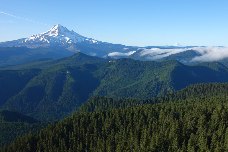
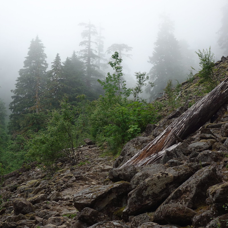
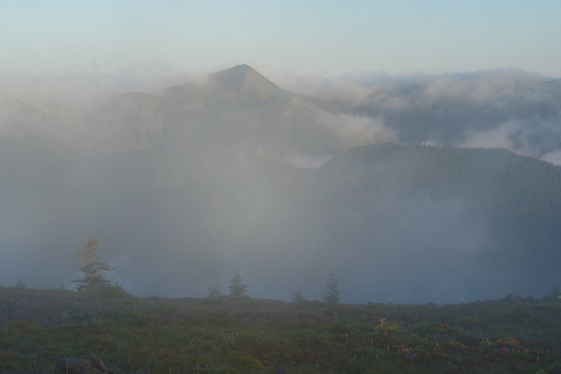
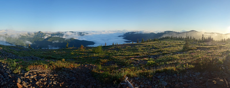
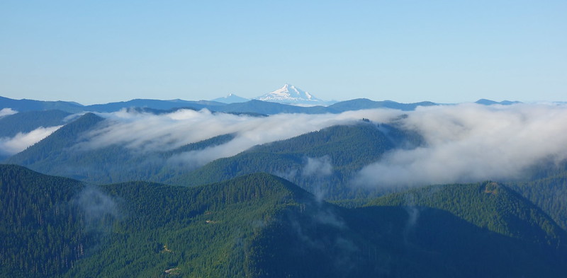
I wake up Monday morning to thick fog all around camp, jump out for long enough to decide I don’t want to deal with it, and go back to sleep. When I wake up again half an hour later, the clouds have receded, revealing another world of distant islands, just emerging in the sunrise light.
It’s still early—right around six—so I decide to take a quick jaunt to the summit proper before heading out.
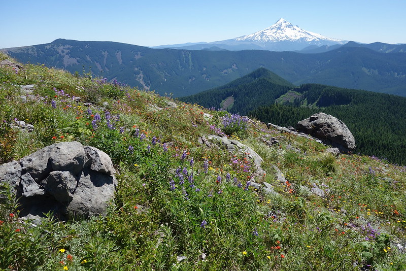
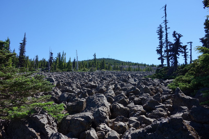
The trail’s mostly an old road, running from the weather station to an old lookout just short of the top. As with the fields below, until now, I’ve only ever seen the summit in thick fog. It turns out there are mountains!
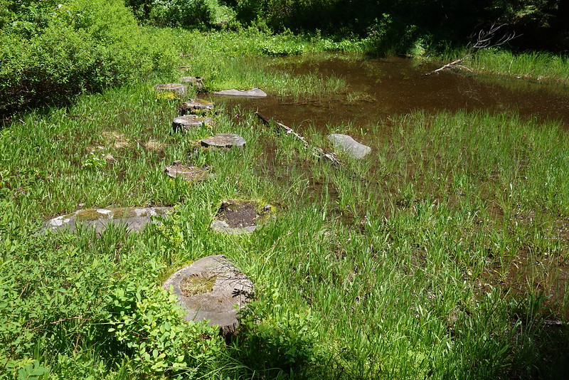
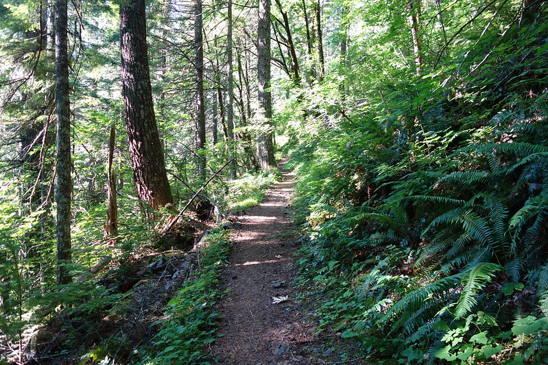
After a couple minutes up top, taking pictures in every possible direction, I scurry back to camp and down the luxuriant trail to Wahtum Lake, where there are hordes of holiday campers, piled on top of each other cooking breakfast.
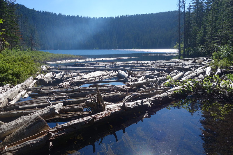
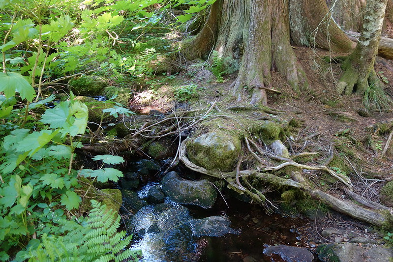
I cross at the logs and set up in a vacant lakeside spot to cook breakfast. There are people everywhere along the shore, knee deep in the water eating sausage, throwing rocks, laughing. And there are backpackers, too: a lot of families, parents with big packs and kids with whittled walking sticks.
While filtering water, I watch a couple about my age looking for a way to cross the shallow-ish section just east of the logs. I want to yell out that there’s an obvious crossing just a little further, but it doesn’t seem to be my place, and in any case the woman seems to know what’s up. But then I witness the most hilarious example of Dude Being a Dude I think I’ve ever seen:
The man begins wading in, saying grimly something like “We have to cross here, before the rapids.” (Rapids?) The woman protests—“I think there’s a better way just down here?”—but dude persists, until he’s up to his waist. She goes around, seemingly crossing easily on the logs, and circles back. Meanwhile, he’s up to his chest, hoisting his pack above his head.
He makes it across eventually, after some jostling. And as I’m packing up, I hear him tell the woman, sagely, that “those logs must be new.”
They’ve been here for decades.
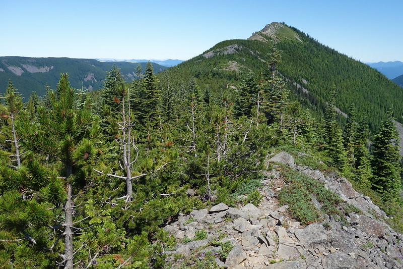
But soon enough I’m out of Disneyland, and up Chinidere, looking back on my camp for the night…
… and to Tomlike, looking up at my favorite mountain in the Gorge.
From Tomlike, I take the Anthill to Rainy-Wahtum, then amble up the old road toward Greenpoint. Looking east from here at the patchwork of clearcuts and logging roads always makes me impossibly sad at what could have been. The Gorge got protected, but just beyond, there’s this.

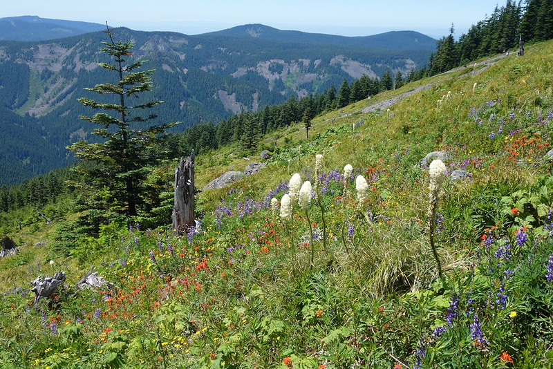
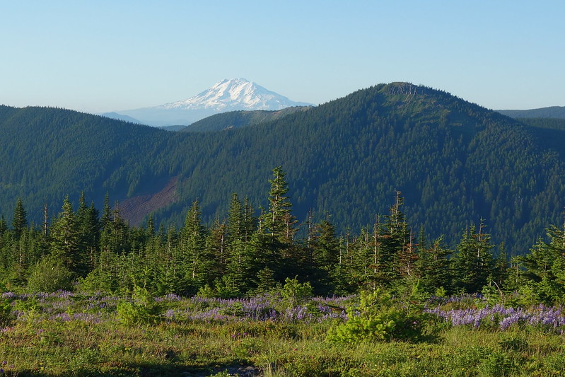
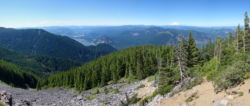
Soon enough, though, I’m up Greenpoint, looking over at Rainy Lake and my final summit of the trip.
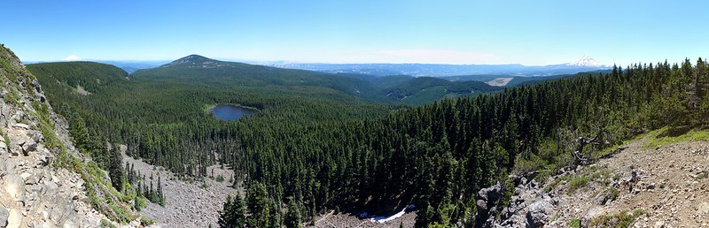
There are a few ways to get to Defiance from Greenpoint. My favorite is to walk down to Rainy Lake, then take the road to the upper Defiance Trailhead. Rainy’s like Wahtum—full of holiday crowds—but I also meet a wonderful woman, out for a while, walking from Cascade Locks to Hood and back, smiling about the strangeness of her route.
I sort of bonk on the way up Defiance—I guess it’s a rule this trip that I have to bonk at least once a day—but I make it up all the same, and say hello to possibly the least scenic view in the Gorge.

Then it’s just back down to the river. A whole lot of down.
The last couple miles into Starvation are ridiculous—I feel like a tape machine slowing, running out of batteries—but eventually I make it to the Old Highway, back in the land of falls and easy water.
Krista and I have planned to meet at Starvation around eight, and it’s just around seven, so I sit for a while at the base of Cabin Creek Falls with my feet in the water, looking through pictures from the trip. I’ve been on all these trails and to all these places before, but going through like this, all at once, felt different. It’s like I’d seen bits and pieces, but never really seen—and heard, and smelled, and touched—it all at once, as the unified thing it actually is.
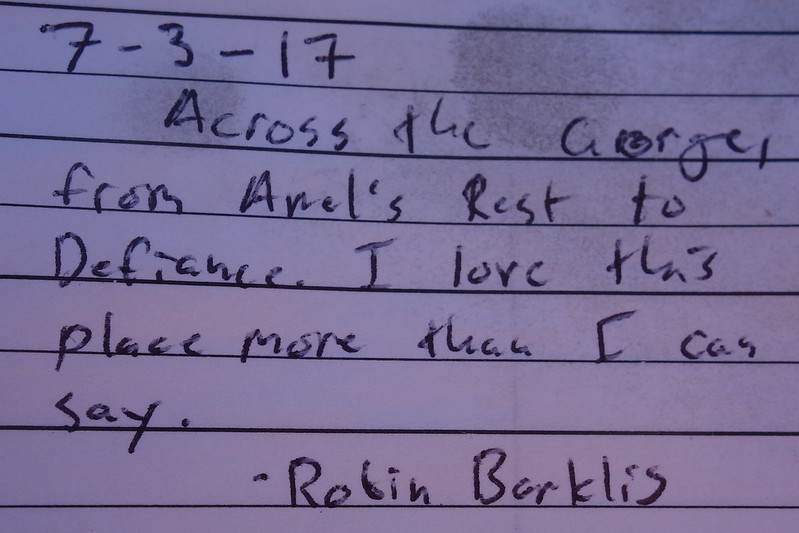
Scrolling through, I stop at one of the summit register on top of Indian Mountain. Staring at my melodramatic nonsense, I start to tear up.

looks like a really beautiful place to go and experience nature. Beautiful photos too! Well done.