1.
There’s this theory I heard when I was a kid to explain the feeling we get looking down from high places—that feeling of not-quite-fear, or at least not fear of the height itself, but the fear that we almost might jump, that we might try to fly.
The idea is that somewhere way back in time—before we were us, before we were humans—we were creatures who could jump from tree to tree, swinging through the sky on slender limbs. Maybe before that we were something grander still, gliding through sky or sea unguided by trees. Maybe once we were birds.
So when we look down from high places, we see in part with the old eyes of those ancient creatures, and those eyes see a world to which we’re less rigidly bound. A world where we can fly. But that vision fights with the real one—the one where we’re grounded, walking creatures—and the distance between the two—between sky and air, now and then—gives us vertigo.
2.
It’s spring, 2018, and we’ve been collecting first editions of those old Spring and Manning hiking guides that The Mountaineers published in the early 70s: 101 Hikes in the North Cascades, 102 Hikes in the Alpine Lakes… We read them at night before bed, and dream about what those places were like when the books were written.

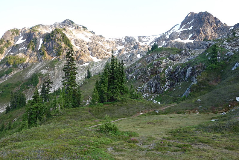
In the North Cascades book, Manning describe a grand loop around Glacier Peak—like the Wonderland around Rainier, but a little longer and considerably more remote. It pieces together bits of other trails: a path, already faded in the 70s, through the Napeequa River Valley, which he describes, again already in the 70s, as a sort of abandoned Shangri La; a trail, then well-maintained but since abandoned, up the White River; the Pacific Crest, which he calls, after Beckey, “the new Crest Trail”; and finally a pass over a ridge then threatened by mining, but since saved, in part by Spring and Manning’s efforts, and made wilderness.

I love routes like that, ones that are pieced together, not preset. So I read Manning’s description a dozen times, then bought a bunch of old maps and started to plan my own trip.
- Start on the Chiwawa River Road, drive up as far as our little car can make it, then ford the Chiwawa River—there was a bridge decades ago, and a campground on the other side, but both are gone now—and climb up Little Giant Pass.
- Descend into the Napeequa, ford the Napeequa River, and climb up to Boulder Pass.
- Drop from Boulder into the White River, and bushwhack, via either the White River or Indian Creek, to “the new Crest Trail.”
- Follow the Crest north over White and Red Passes, over Fire Creek Pass, down into Milk Creek’s massive drainage, over into the Suiattle, and finally up Miner’s Ridge.
- Leave the Crest Trail, climb over Buck Creek Pass, and return, finally, to the car via Buck Creek and the Chiwawa River Road.


3.
I make a vague plan to do the route in summer 2018, but things get in the way, and I spend the next winter and spring still dreaming with those old maps and older books.

Reading in bed at night, I feel the distance between the life I’m living—the life of comfortable beds and cozy cats and Christmas decorations—and the wilderness the books describe, the deep valleys and high ridges and miles of untouched terrain. I take out the compost after dinner then linger outside in light rain, imagining what it would be to be here but without the warm, dry light of our apartment a few hundred feet away. And I feel the same sort of vertigo one does when looking down from great heights—the vertigo of living in two worlds at once, and of having histories at home in both.
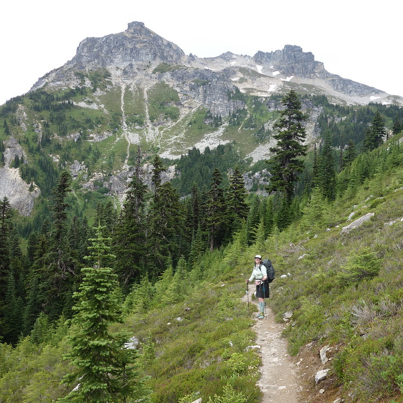
Spring comes, then summer, and we make a plan to go. Krista’s found a trip she wants to take too—straight up the PCT, through most of Section K—so we’ll be there together, in a way, even if we know too much to plan a specific place to meet.

Wow, that intro really got my spirit aching for the woods, the day after winter solstice. It’s only natural right? Beautifully written, thank you!