Man, I love Mount Hood. Like, in a possibly unnatural, “Robin, I don’t think grown men usually feel that way about mountains” kind of way. Two thirds of the adults and at least half of the kids in Portland have Mount Hood tattoos, but it’s always the same one: the northwest face that you can see from city. The other day I saw one that had Barrett Spur (if you’re looking from Portland, the big mass on the left) on the wrong side. Afterward, the whole word seemed backward. I’m only sort of kidding. I kinda want a Mount Hood tattoo too, but it wouldn’t be like that. It would be of crevasses in the Elliot Glacier or the rocks above Mississippi Head or the Yocum Ridge cliffs or or or… you get the idea.
So anyway, I’ve been dreaming about doing the Timberline Trail for a while, but it’s a thin window between the water crossings being safe and the first snow. Maybe next year? In the meantime, the nice thing about Hood – or, okay: one of the many nice things about Hood – is that it’s close enough for easy dayhikes.
This one was sort of like two hikes in one. The first, from Timberline Lodge to Paradise Park, is probably one of the most popular hikes on Mount Hood. It’s classic, and classic for a reason, but crowded in that Disneyland / Multnomah Falls / Jesus this is how REI stays in business kind of way. The second, from the edge of Paradise Park to above Mississippi Head and Zigzag Canyon and back to Timberline along the Palmer Lift, was off trail, empty, all rock and snow and ash.
#1
#2
But I’m getting ahead of myself.
We were at a wedding the night before, where I, um, overindulged a little, so I was feeling a little worse for wear when we woke up early-ish to head out. We made the bleary drive to Timberline, and were immediately greeted by the mountain, which was apparently feeling similarly foggy.

“Man, it’s always the champagne toast that gets you.”
We quickly made our way through the throngs of people around Timberline to the Zigzag Overlook. We hadn’t been here since early last October. Cool to see the contrast.
Notice the ninja thru-hikers hiding on the hillside?

“So. All we have to do is walk over that thing.”
The walk down the canyon was, as usual, pretty and uneventful. We ran into several groups of backpackers heading back to Timberline. One, a family with kids who couldn’t have been more than twelve or thirteen, were just finishing the entire Timberline Trail. When I asked them about the Elliot crossing, the dad told me about some exposure, but one of the kids made a face like “No, dad, it was nothing.” I love that.
The Zigzag crossing was a bit of a traffic jam, with a group of at least a dozen Boy Scouts or something in matching shirts gumming up the works. We decided to take a short break by the falls to let the traffic clear.

Zigzag Falls. I can never get a good picture of the creek (river?). Maybe I need a drone…
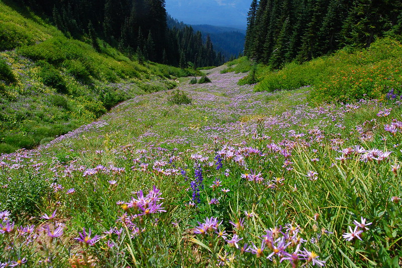
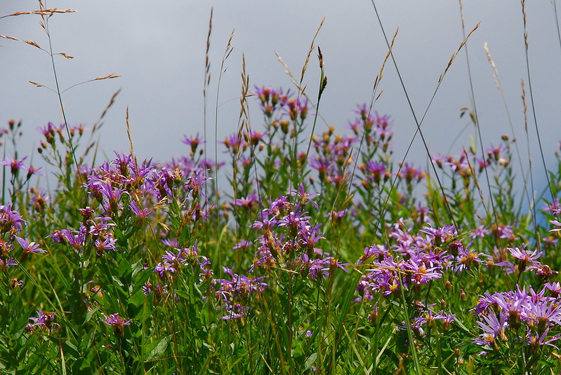
And then… flowers! It was mostly these purple, Aster-like ones that I can’t name, with little bits of lupine and paintbrush thrown in for good measure.

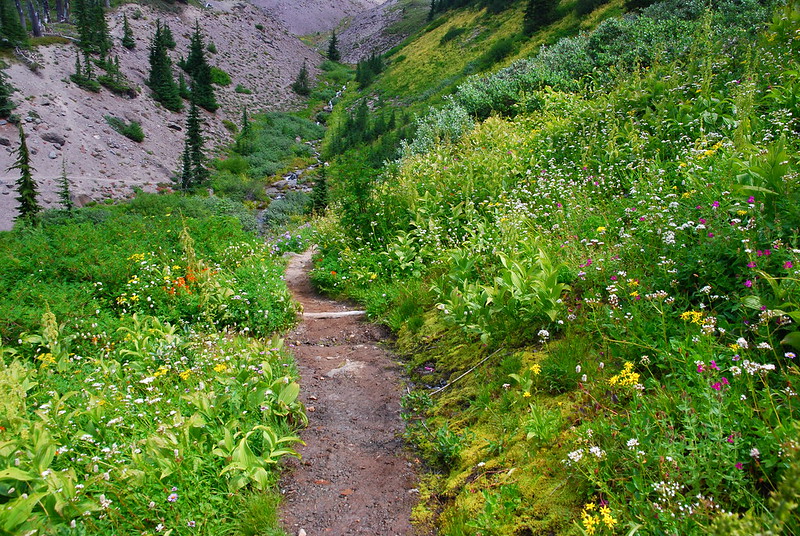
The beginning.
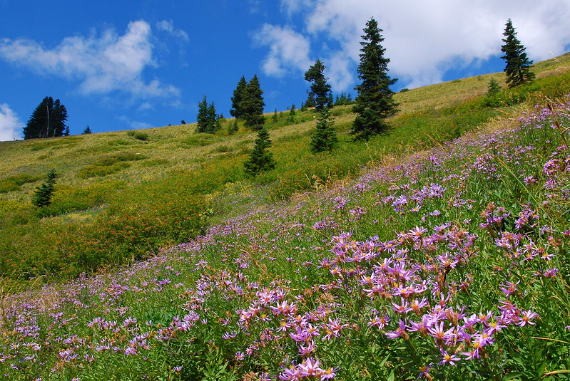
The possibly-Aster purple things were a little past peak, but still did a great job of painting the hills.
See what I mean?
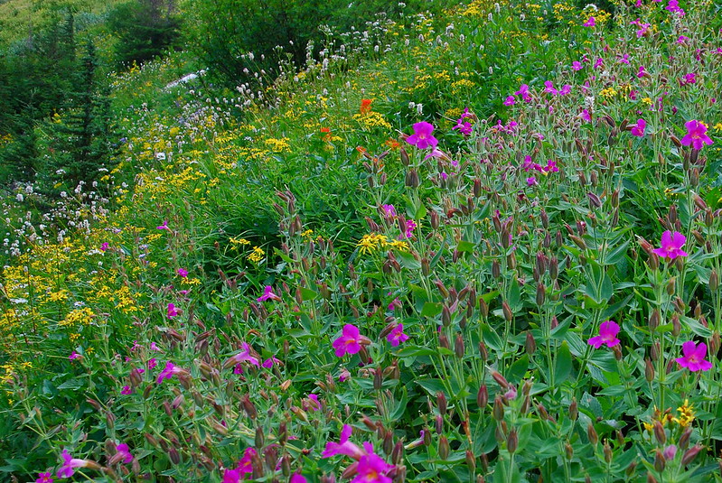
Around Lost Creek, things got a little more diverse.
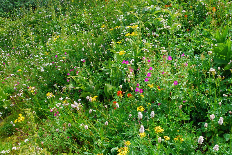
Flower party!
“Can I come?”
“I’ll bring the water!”
I took thirty versions of this picture.
This one too.
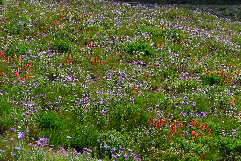
Finally, some paintbrush! Took fifty versions of this one.
After wandering around for a while taking way too many pictures, we eventually hit Split Rock, and split off for a little lunch. I think it’s a rule that someone from every group has to climb to the top.

I like the single tree.
Oh oh, I get the name now.
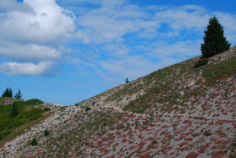
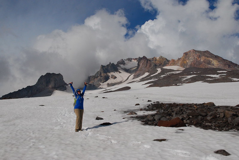
We’d been watching the clouds all day to assess the viability of heading over Mississippi Head. Just as we were finishing lunch, they started to dissipate, at least at the lower elevations, and we decided to give it a go.
The go sign.
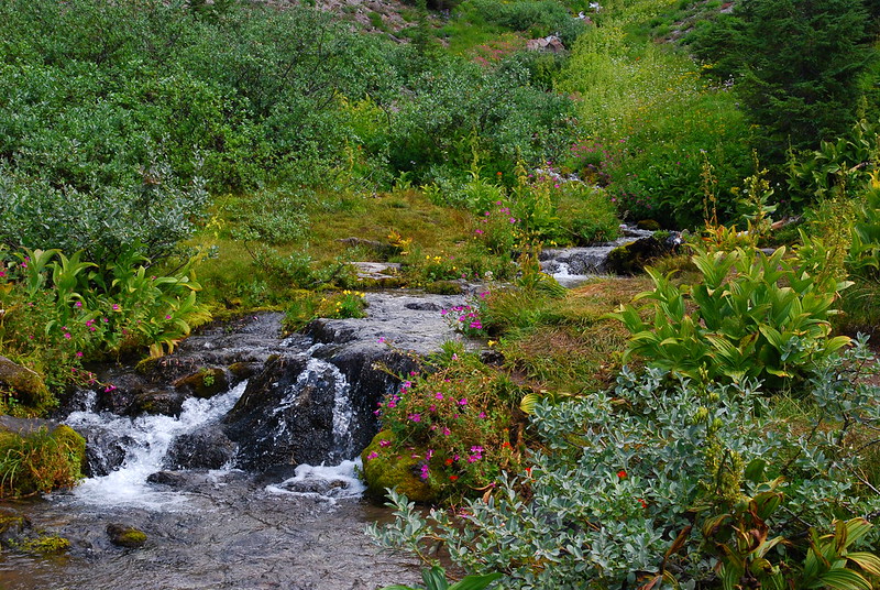
From Split Rock, there’s a path-type thing that you can easily follow to a really nice overlook at maybe 7000′ with good views of the mountain and its snowmelt waterfalls. While sitting there staring, we were joined by a friendly pair of hikers, Dan and Deborah (sp?), who had followed us up from Split Rock. It’s always wonderful to run into people who are just excited to be out. We let them mosey ahead, while we stayed back watching the water.
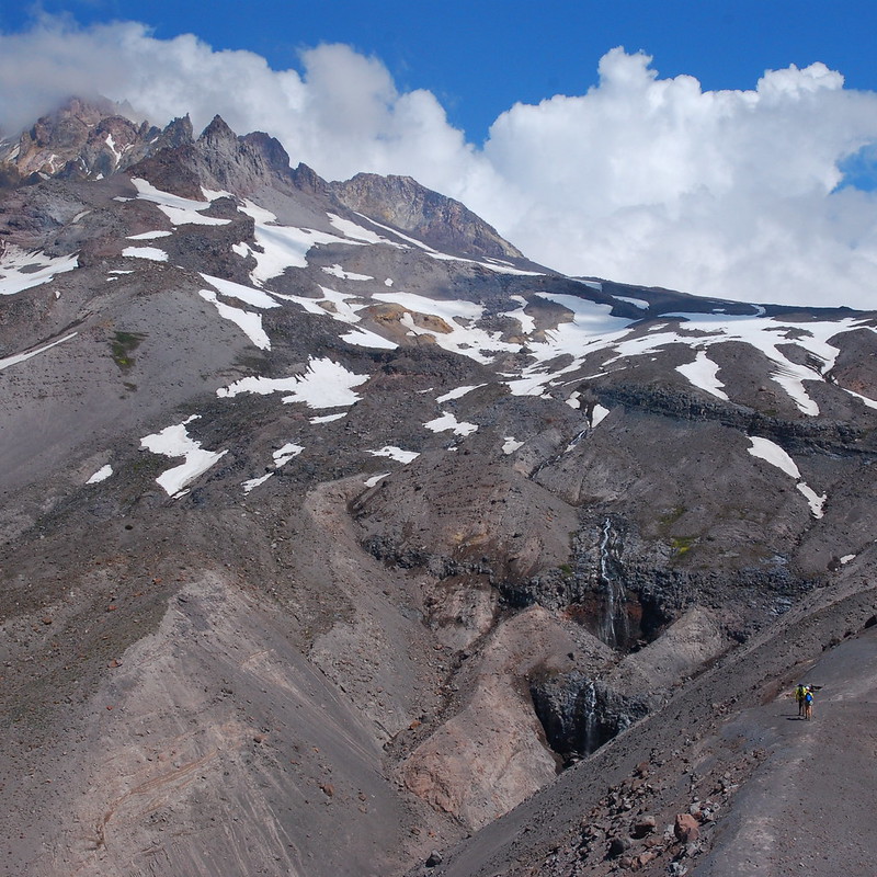
View from the overlook. Our friends are in the bottom right for scale.
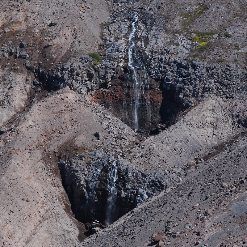
Waterfall closeup.
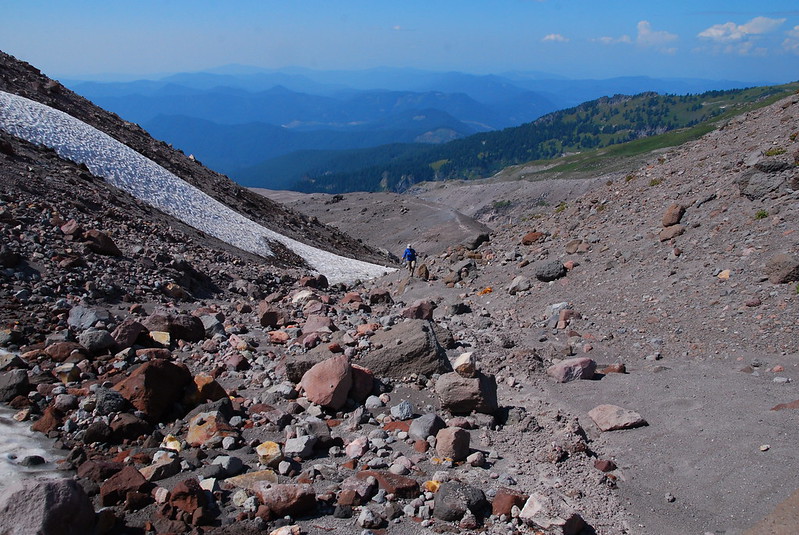
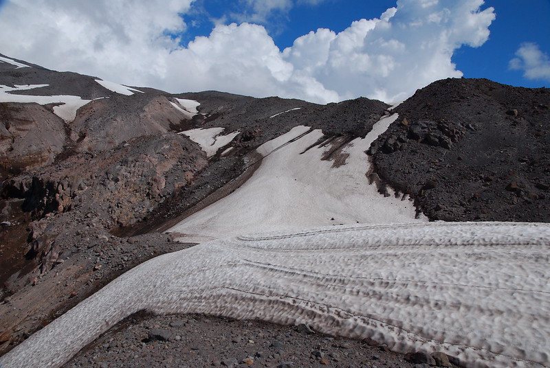
From the overlook, the trail more or less disappears, and it’s really just up and up, mostly on ash and rocks. It’d be nice to do this earlier in the season, when there might be more snow to hold things together.
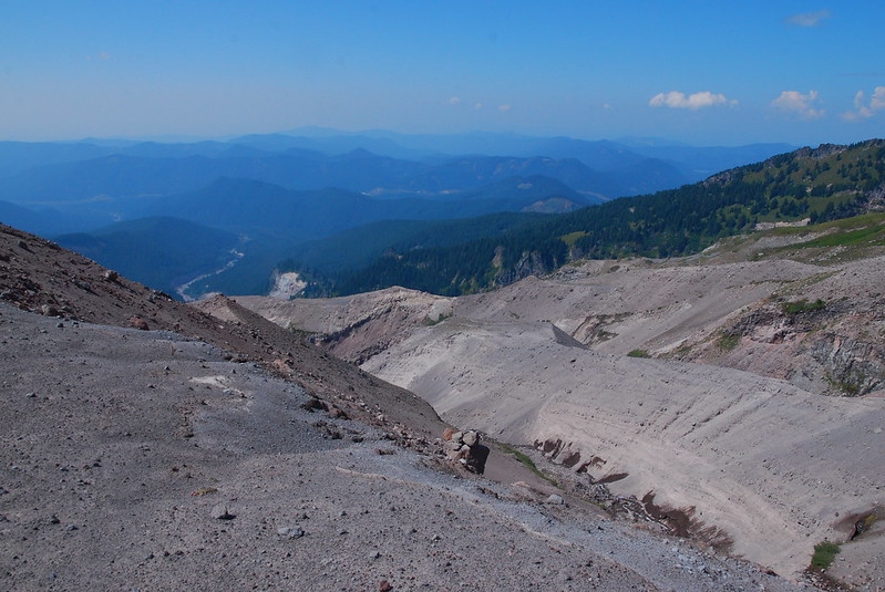
Looking back at the end of the trail, and the beginning of the Sandy River.
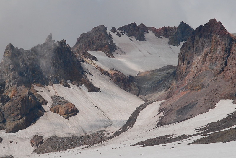
It’s funny: I usually think of mountains as these big, stationary things – paradigms of stability. But Mount Hood is a geologically recent volcano, with geologically recent ash, which is still in the process of clearing off the mountain. The thing is, quite literally, washing away. I guess this is the fate of all volcanoes, sooner or later. Sort of makes it seem all the more precious.

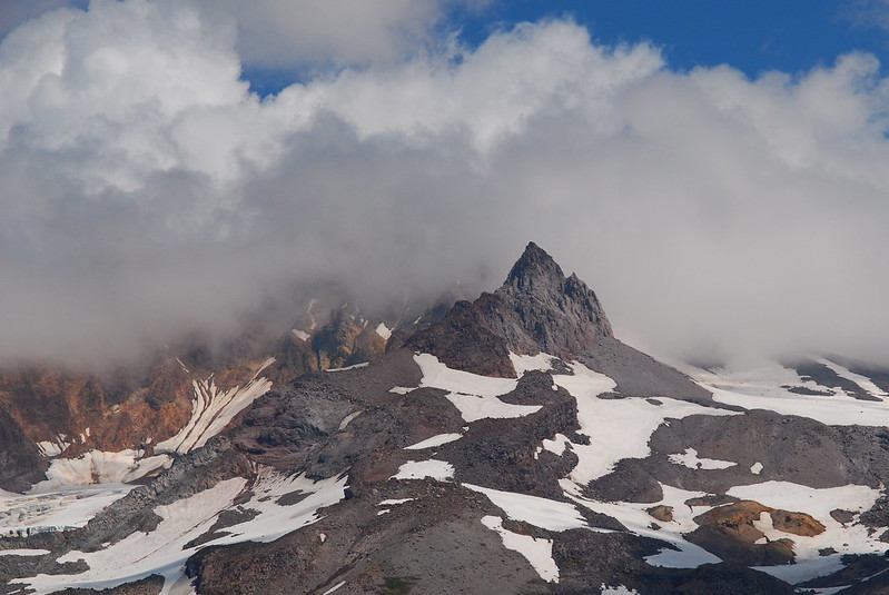
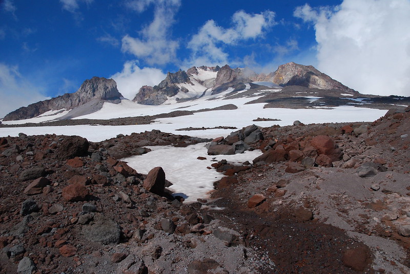
Looking up at Hood’s Summit Castle. Man I love that thing.
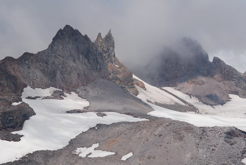
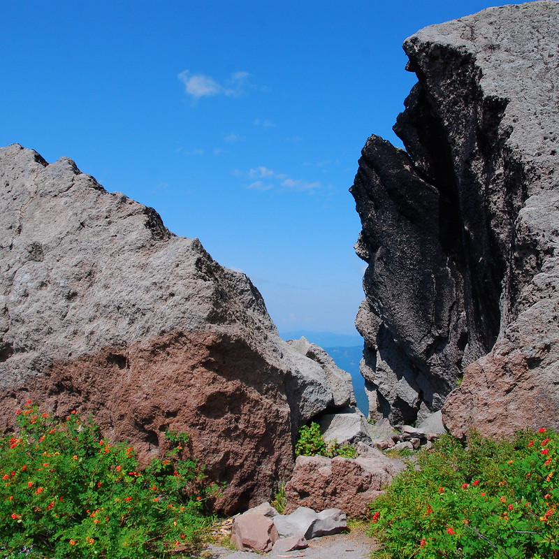
Illumination Rock.
There was really only one sort of sketchy part: a steep-ish snowfield where a fall might have sent us down a few hundred feet. But, with steps kicked into the slushy snow, it wasn’t much of an issue. Next time, I’ll bring traction.
Not as bad as it looks.
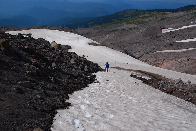
“Easy for you to say!”
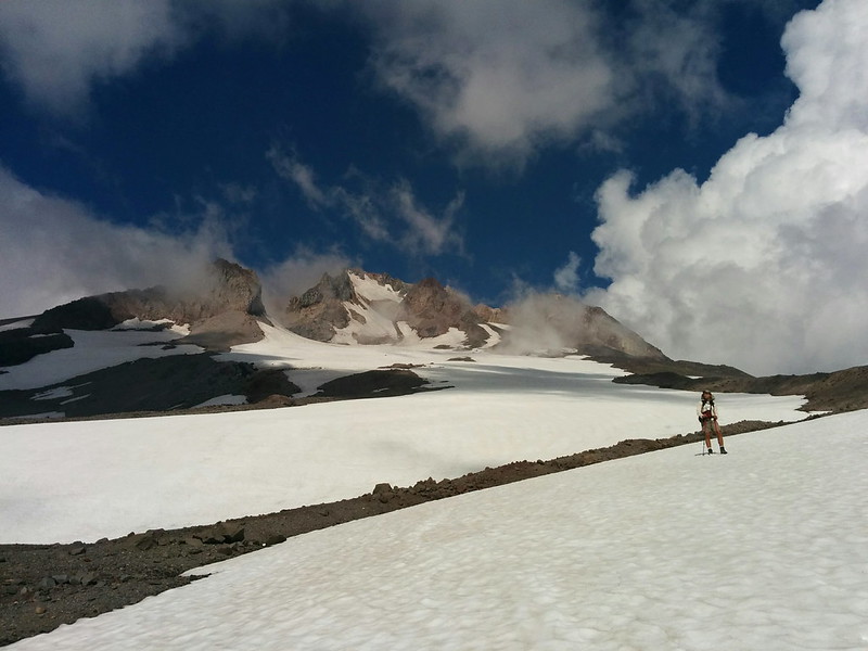
Me (and my silly hat) nearing the top.
Okay, so maybe there were actually two sketchy parts, but the second one was easily avoided. Just as we passed over Zigzag Canyon, we noticed a reasonably large cornice.

Basically, just don’t walk too close to the edge.
Shortly after passing over Zigzag Canyon, the ski lifts came into view. This seemed like a good time for a candy break and a few (dozen) pictures.
Lots of good sitting rocks.
(Yet another) closeup.
After this, it was just an easy 2000′ descent to the lodge. Mostly on our behinds. I’ve never really understood the lure of downhill skiing – and, perhaps more importantly, all the mountaintop litter it necessitates – but glissading is a blast.

Wee!
“Again!”
-RLB
