This was my first time up Mount Defiance. The “classic” way – if there is such a thing – is to do an out and back up the Mount Defiance Trail 413, but the by far better option is to make a loop: from Starvation Creek State Park, go up the Starvation Ridge Cutoff (414B) to Starvation Ridge proper (414) for several grueling miles, scooch over on the gorgeous Mitchell Point Trail (417) past Warren Lake to the Defiance Trail (413), and finally to the summit on the Defiance Cutoff (413C). The Defiance Cutoff’s only three-quarters of a mile or so, but contains at least half of the hike’s good views. Definitely take it. The easiest way down is to stay on 413 the whole way, as it’s slightly less steep than 414, and much nicer on the feet. In any case, be ready to be sore. I’ve done hikes nearly twice as long, and hikes with several thousand feet more cumulative elevation gain, but I was very, very sore the next day.
1.
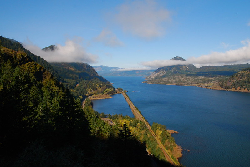
I drop Krista off at work, stop for gas and a banana, and drive straight out to the Gorge. It’s a bright, sunny morning – the hottest day of the year so far – but the trialhead’s empty. A minute after I pull up, while I’m still sitting on the hood of our car looking at a map, a maintenance truck pulls in. A uniformed ranger gets out and cheerfully asks if I’m hiking. I tell him that I am, and he seems disproportionately impressed. Apparently Starvation Creek is more of a picnic spot than anything else. He excuses himself to go clean the restrooms.
Before the proper hike, I jog a mile over to Viento State Park, just to fill in an empty spot in my GPS. If all goes as planned, after today I’ll only have 26 miles to go before I’ve walked on every trail in the Gorge. They’re not contiguous miles, so it’ll be at least three more hikes, but I’m close. It seems like such a silly goal now, but I’ve gone this far, and anyway I’m sort of excited about it. Something about OCD.
On my way back from Viento I run into some guys from the Bonneville Power Administration doing powerline maintenance. I get to talking to some dude with a thick Russian accent, and he tells me about the network of maintenance trails they have for accessing buried powerlines. Just off the road, there’s a small wooden sign, marked 16.2 or something. On my way out, I’d walked right by. But it marks a small path that we walk up together, to a boulder with an orange spray painted “X.” I ask how many trails like that there are, and he shakes his head. Too many to count. There’s always something new.
2.
Just before I get back to the car, I stop briefly at Starvation Falls. I’ve never seen it before – never knew there was something to see here – but it’s gorgeous.
There are two theories about the name “Starvation.” The first is that a group of pioneers nearly died here after running out of food. This is not an implausible story – nearby Dog Creek got its name after some pioneers got so hungry they ate their dogs there – but it seems sort of strange that this, out of all the myriad of places where pioneers nearly starved to death, would be named the Starvation Creek. The other theory is that it got its name after two Union Pacific Railroad trains got stuck here in the mid-1880s, and all the passengers had to be fed with supplies skied in from Hood River. I like that story, but wonder why the passengers wouldn’t have just walked the dozen odd miles back to Hood River.
3.
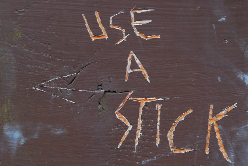
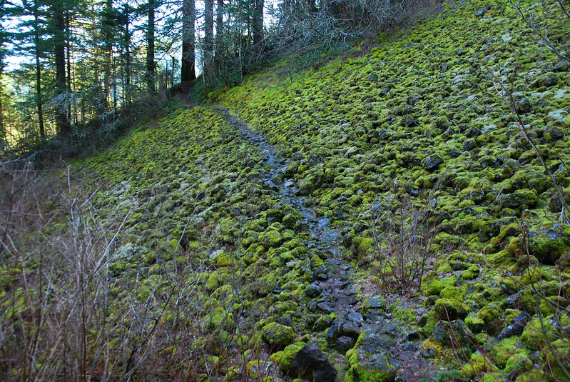
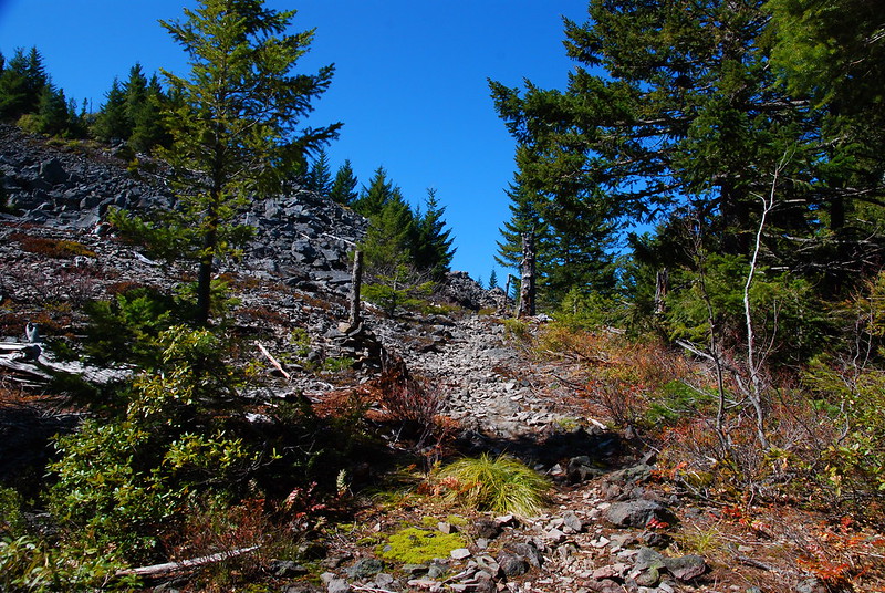
Starvation Ridge starts just west of the State Park, on an unrestored section of the Old Highway that’s now dirt and gravel, more a glorified shoulder of I84 than a real road or trail. But in short order I reach the Starvation Cutoff Trailhead and a hilarious (and completely apt) warning.
Some of the best views come very quickly, at the powerline meadows a few hundred feet up. Nearly every trial in the Gorge at some point passes through a meadow like this – wildflowers and electric buzzing. I stop for first breakfast, just like I have at others a few miles down the way.
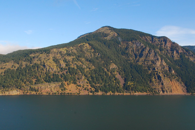
Nice view of Dog Mountain.
4.
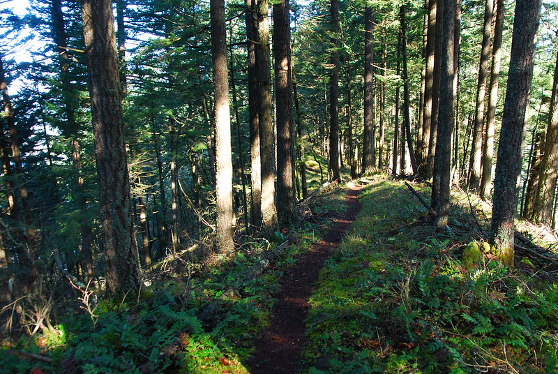
The Starvation Ridge trail pretty much stays on top of the ridge, regardless of terrain, and rarely switches back. A half an hour later I’ve only gone a mile and maybe a thousand feet up. The trail’s in great condition, but it’s steep. More than once I use handholds. I take a bunch of what I tell myself are “picture breaks,” but which are really much needed chances to catch my breath.
4.
Half an hour later still, around 3000′, I hit a couple great talus fields and stop to sit for a little.
It’s already warm, and sweat’s been stinging my eyes, making my lips taste salty. I pour a little water on my head – I can always filter more at Warren Lake – and rub my face with wet hands. For some reason the whole thing makes me laugh, and I think about coaches at the ends of football games getting Gatorade dumped on their heads. Gatorade sounds really good. I continue up, a little slower now, laughing to myself. There’s an ancient clear cut, and, my map says, an ancient road grade, but now it just looks like a game trail.
5.
Just as I see my first bit of snow – maybe 3500′ – there’s a big black shape in front of me, maybe thirty feet ahead, just sitting in the middle of the trail. A black bear! Krista and I saw one in the Wallowas last summer, but it was across a stream, at least two-hundred feet away. This one is close enough that I can see its eyes, its mouth, its hands.
I don’t think to be scared – I’m so in awe that I feel nothing but wonder – and for a brilliant moment I just stare as it goes about its business. I’m so happy it’s still here, so happy that, despite everything we’ve done, it can still make a life up here. We’re not even in the official wilderness. Old roads, now faded to four-by-four tracks, crisscross the area. But still, there’s a bear, absentmindedly digging in the trailside dirt.
I try to be silent, but it sees me after a while, and trundles on up the trail. Not scared, not angry, just after a more secluded spot. I know the feeling. I wonder how it will spend the rest of the day, where it will sleep tonight. Does it have a family there? Do bears even have families? I hope they do, then I hope they don’t, then I just hope that they’ll remain unknowable to me. John Muir said that going to the wilderness is going home, but he was wrong. Going to the wilderness is going to a place that existed before us, and that will, with any luck, exist long after we’re gone. Going to the wilderness is going to a place not made for our comfort. To be here is to be confronted with a world utterly indifferent to us. I can only be a stranger here, a tourist. This is not my home. This is a home for creatures much nobler than me. And I am just lucky, so so lucky, to even see it, and them, for a moment.
6.
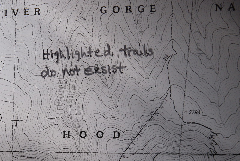
A few minutes later I’m at the Mitchell Point Trail junction, where there’s a nicely forthright map.
The name of the trail here is a little incongruous. Mitchell Point is a thousand foot prominence just off the river, slightly east of the beginning of Starvation Ridge. The Mitchell Point Trail does not go there. It does not go anywhere close to there. Apparently the deal is that there used to be a bunch of logging roads here, one of which was called Mitchell Point Road, and the trail was named after the road, not the actual geographic feature. The road’s gone now, though. This really ought to be called the Warren Lake Trail, as its main purpose is to connect Starvation and Defiance Ridges to Warren Lake. But alas.
7.
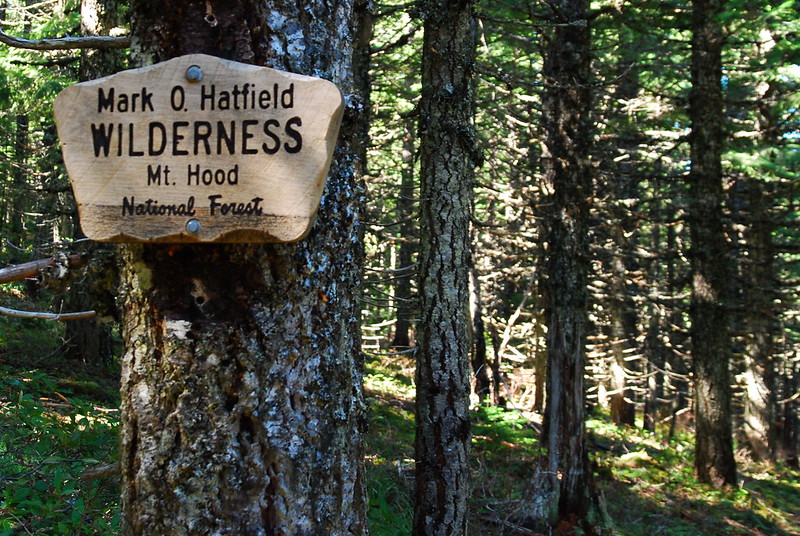
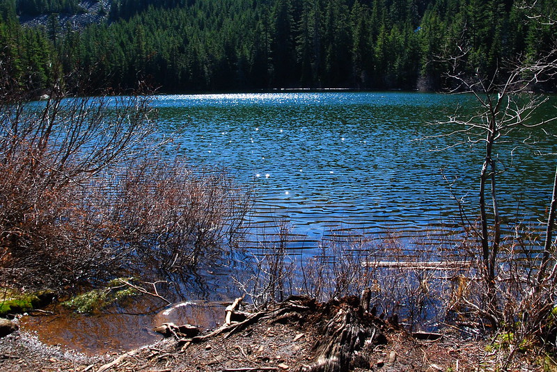
After the junction, the trail quickly enters the Hatfield Wilderness and untouched forest. Maybe a quarter mile later, it hits Warren Lake, looking disconcertingly summery. There should be snow here this time of year.

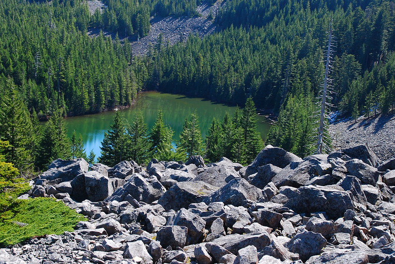
8.
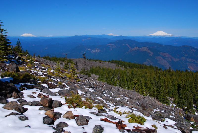
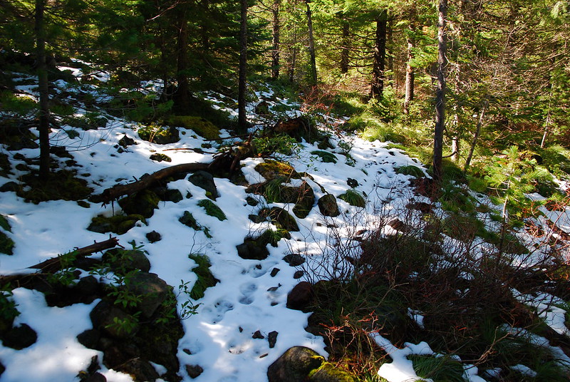
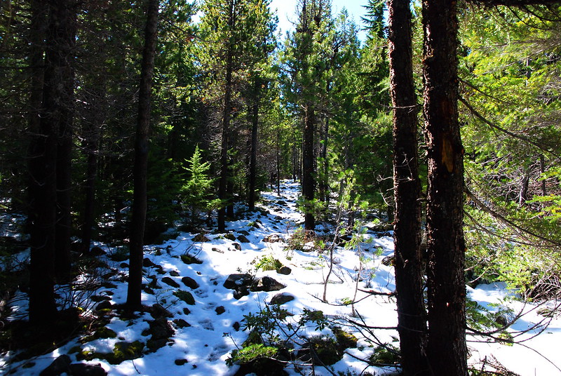
The trail coming up from Warren Lake is really pretty. It reminds me of summer in Sisters. And very quickly there’s snow – at first spots, then an even blanket. It obscures the trail a little, and I’m reminded for a moment of getting lost on the Benson Plateau around this time last year. But I’m more confident now, and when I lose the trail I just follow my compass to the junction with Defiance Ridge. It feels really nice to now how to do this.
Also: mountains!
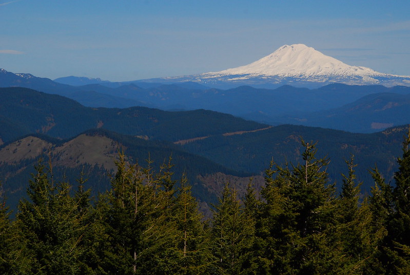
I guess the Mount Margaret Backcountry got some snow too. See you soon!

9.
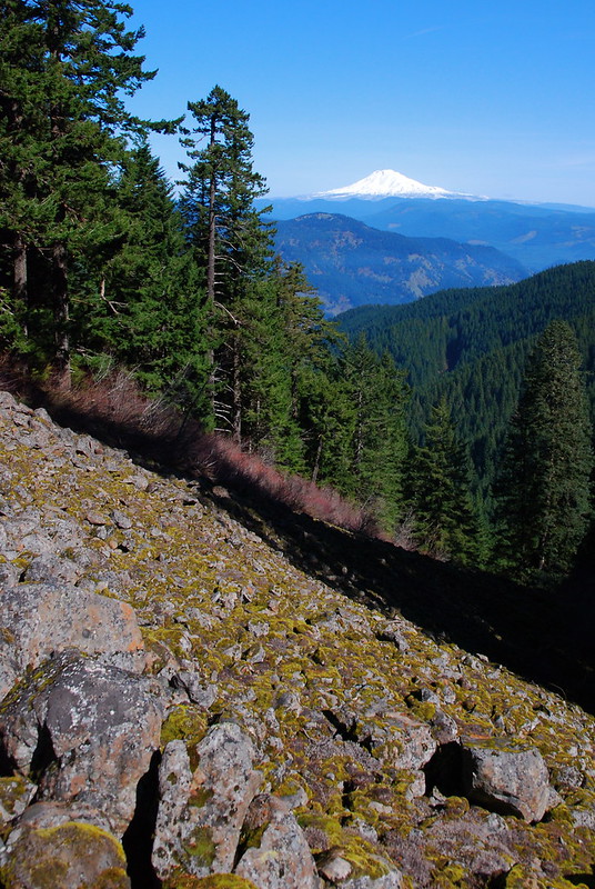
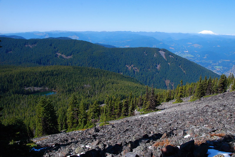
After reaching Defiance Ridge, I walk up for a quarter mile to another junction – with the Defiance Cutoff Trail. Some people complain that this hike has no views, but the views along the Defiance Cutoff are excellent. Here’s Bear Lake and Nick Eaton Ridge:
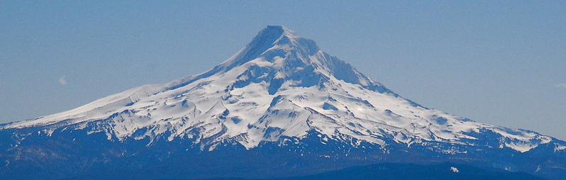
And Mount Hood, from the summit.
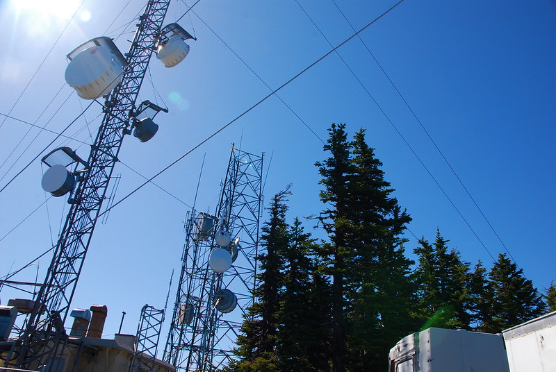
Slightly less beautiful summit view – communication towers:
10.
On top there’s a large, loud group of dudes listening to music and getting stoned, bragging to each other about their heroic ascent. They’ve come from the South Defiance Trailhead, which means their hike in was around a mile and a half. Must have been difficult to lug that stereo, though.
I quickly eat my sandwich, text Krista (the usual: “Gonna be a little later…”), and start to pack up. Just as I’m getting ready to leave, a nice solo hiker – Evan, I think – shows up, and we sit for a while talking about our sore legs. This is his first hike of the season. I wonder whether this really makes sense as a season opener – I mean, what’s his second “training hike” going to be? Mount Hood? – but he good-naturedly laughs it off. Maybe St Helens?
I love talking to the guy, but eventually I head down 413, boot skiing a little down the steep slope. There was a sign at the Defiance / Defiance Cutoff junction warning that the former involves some scrambling, but, at least in the snow, 413 seems by far the easier option. (Defiance Cutoff involves some walking over uneven rocks.) After getting out of the snow around 4000′, I descend down (and down and down) 413, back into the spring.
11.
Around 2000′, I stop at what I hope to be an inauspicious corner to pee, but just as I’m taking off my pack my new friend yells down to me. “Hello, Robin!” He’s very nice about being much faster than me, claiming he left the summit just after I did. I doubt it.
We talk for a little bit – why are we so sore? – and he does some stretches. I’ve never really gotten into the habit of stretching. Or, more honestly: I don’t think I’ve ever stretched once in my life. But I figure why not, and do some with him, probably wrong. It’s like I imagine it would be if I were ever to go to yoga class – me trying and failing to imitate someone who actually knows what they’re doing.
I appreciate the company, but it’s lasting longer and longer, and man I really need to pee. Eventually he does his last stretch – an advanced thing I don’t even attempt to imitate – then heads down at an admirable clip. I duck into the woods, finally.
12.
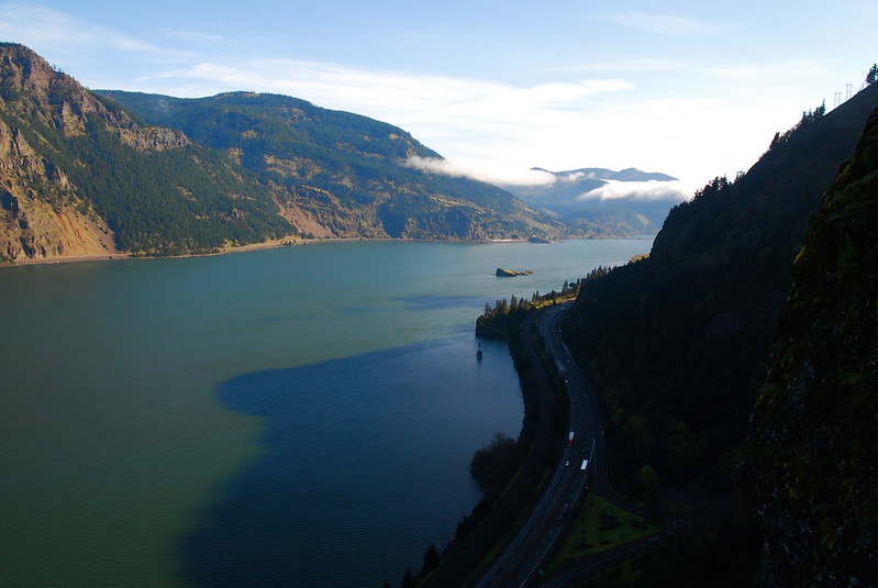
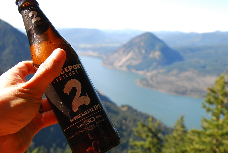
I walk down another half a mile or so, to a nice viewpoint for some “hydration.” I’d planned to have a beer at the summit, but it’s nice to have this spot to myself, giving cheers to Wind Mountain.
As I’m sitting, a backpacking couple in jogging clothes passes, the woman carrying a small dog. They look happy – fresh, dewy, and bright. I’m covered in dried sweat, and pretty sure I’ve somehow got mustard on my forehead.
13.
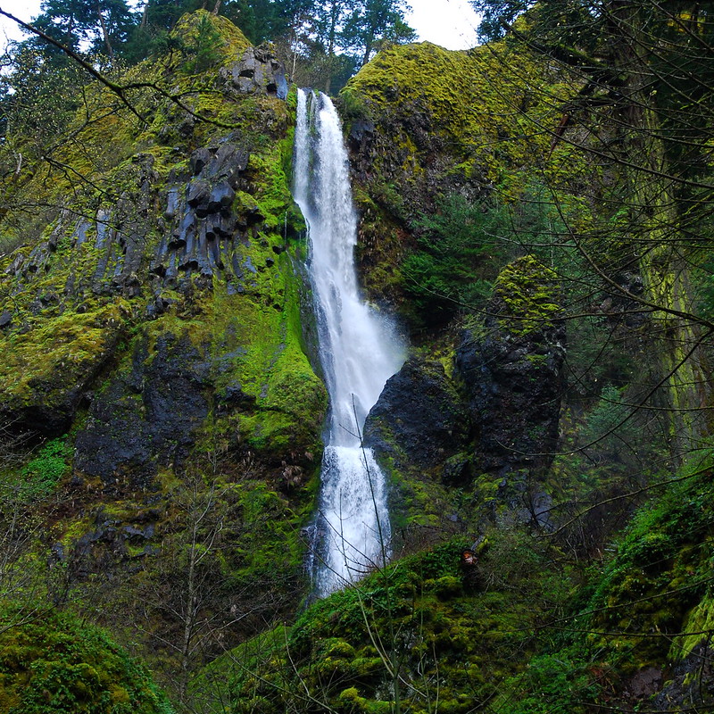
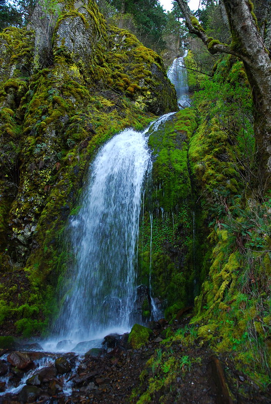
The rest of the hike blurs by, as I cruise down the now well-graded trail. Some of the best scenery is in the last mile: three waterfalls in rapid succession. Here’s Lancaster Falls:
Hole-in-the-Wall Falls:
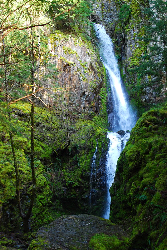
A little more history: Hole-in-the-Wall Falls is completely man-made. In the 1930s, during the construction of the highway, there were repeated problems with Warren Creek flooding the road, so they decided to divert Warren Creek from its original path down Warren Falls through a narrow shoot to a new path here, at Hole-in-the-Wall. The map still labels the new waterfall as Warren Falls, but Warren Falls hasn’t existed for eighty years.
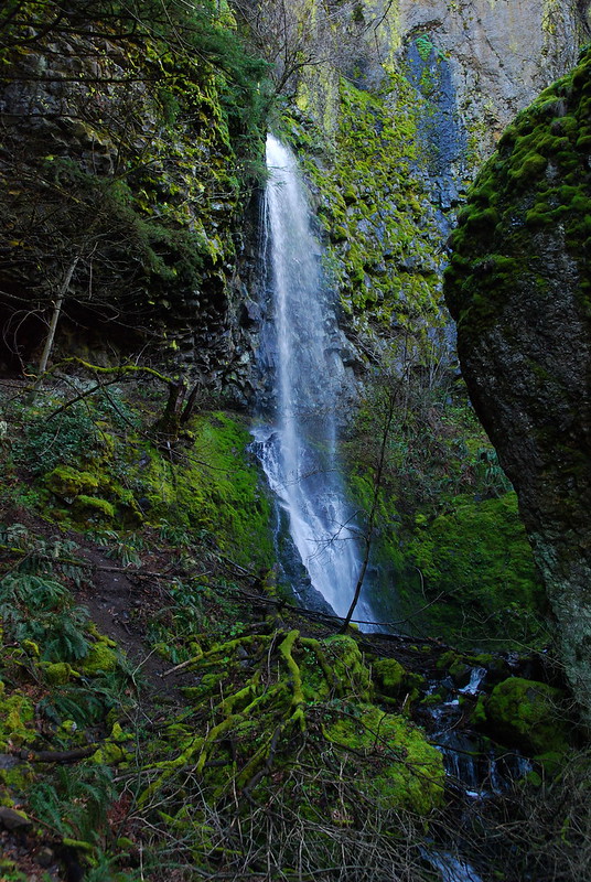
Anyway, one more: here’s Cabin Creek Falls.
14.
The last half mile is pretty much on the shoulder of the freeway, but it passes quickly. I interrupt a couple guys mid-canoodle at the base of Cabin Creek Falls, and they start back furtively toward the trailhead. I wait for a while to give them space, feel sort of bad for messing up their moment.
Back at the parking lot, I call Krista. Let’s get Thai takeout tonight! I mean it to be just a quick check-in, but I can’t help but mention the bear. I wish she’d been there to see it.

Thinking about doing this hike next and lived reading about your adventure! Thanks for sharing your day and the pictures!!
Oh nice, have a great trip!