June 24, 2015
I had to be in Eugene early Wednesday morning, so I decided to take a “nearby” hike up South Sister. The basic idea was to start at Devil’s Lake TH; take the Climber’s Trail to the summit and back down to the bottom of the Lewis Glacier; follow the unofficial route from the foot of the Lewis Glacier to Green Lakes; and finally follow the Green Lakes, Moraine Lake, and Climber’s Trails back to the car. It ended up being a long day – something like 19 miles with around 7500′ elevation gain, and several hours of driving on either side – but it was so, so worth it.
1.
Tuesday night, I stay up late finishing Carrot Quinn’s excellent book, then sleep fitfully until my alarm rings just before six. Ugh. I drag myself to the car, put on an innocuous podcast, and set out on the familiar drive to Eugene, which, these days, seems to pass without me even really knowing it. One moment I’m passing a truck on the Terwilliger Curves, then, the next, I’m exiting I5 at the big University of Oregon sign.
The university seems abandoned when I get there. I park right in front of the library – all the spots are open – then run a few errands, text Krista, and am back on the road fifteen minutes later.
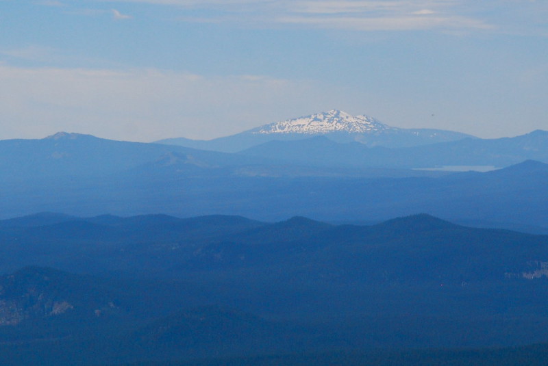
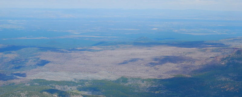
I decide to take Highway 58 east, which jots further south than it needs to, but it’s pretty, and I haven’t seen it for years. It turns out even prettier than I remembered. Diamond Peak and Mount Thielsen tower over the south. Lakes and rivers glimmer through the trees. There are big, beautiful trailhead signs every few miles.
Also: I’m getting tailgated by a massive SUV with a canoe on top and bikes on back. A general theory: the more stuff that people think they need to enjoy the wilderness, the more likely they are to tailgate. I’m not sure what exactly the causal mechanism is here. Probably something to do with both deriving from a background desire to control the world.
There’s construction just west of Willamette Pass with signs about twenty-four hour paving and a long-suffering dude holding a stop sign like a weapon against the dozens of cars. We wait for long enough that I turn off the car, role down the windows, try (and fail) to get a picture of Diamond Peak through the trees. My large-vehicled friend’s just in front of me. Through the window, I can see him anxiously tapping the steering wheel. Must get out to the wilderness to relax! I vaguely hope that the delay takes hours.
But we’re moving again a few minutes later, past signs for Odell Lake. We used to go there when I was younger. The highway afterward seems exotic in its unfamiliarity, and I’m a little unsure at first as, a few miles later, I turn left onto the Cascades Lakes Scenic Byway. The Byway is immediately, and overwhelmingly, beautiful. South Sister’s forty miles away, but it seems like it’s right here. And there are more lakes, closer now, everywhere. Huge jumbled lava flows peek over the trees. The road’s ruler straight and there’s no one else on it. Who am I that I get to be here, seeing this, on a Wednesday morning?
2.
I’m already satisfied with the day when I reach the Devil’s Lake Trailhead around 11:30. The trailhead’s full of campers – there’s a free walk-in campground nearby – in various stages of getting ready to go swimming, I presume, in Devil’s Lake. A woman in her sixties sits just at the edge of the lot in a lawn chair holding a tallboy of Rainier. She’s got sunglass attachments on her glasses, the kind that allow the shades to flip up and down, and a beer cozy that says “On Lake Time,” with a cartoon anchor. I love her immediately, and without reservation. She stays completely still as I get ready. I’m pretty sure she’s asleep. In a lawn chair in a campground parking lot at 11:30 on a Wednesday. And I love her yet more for it.
The first few miles of trail are through anonymous forest. The grade is weirdly uneven: sometimes flat, sometimes very steep. I sometimes jog, sometimes struggle with big steps.
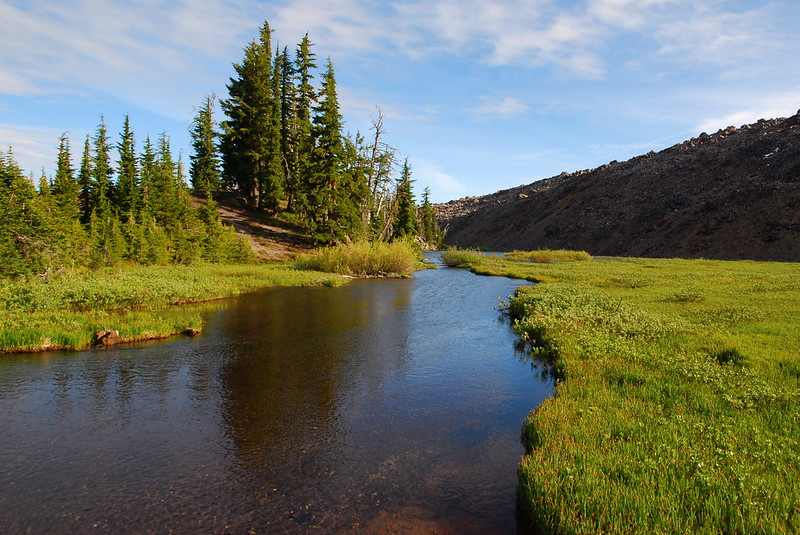
After a half hour and a couple miles, the trail breaks out into open meadows, with good views of Broken Top and South Sister. The trail becomes wide and flat – wider and flatter, in fact, than some Forest Service roads I’ve been on – and I do that weird thing I do, halfway between walking and running.
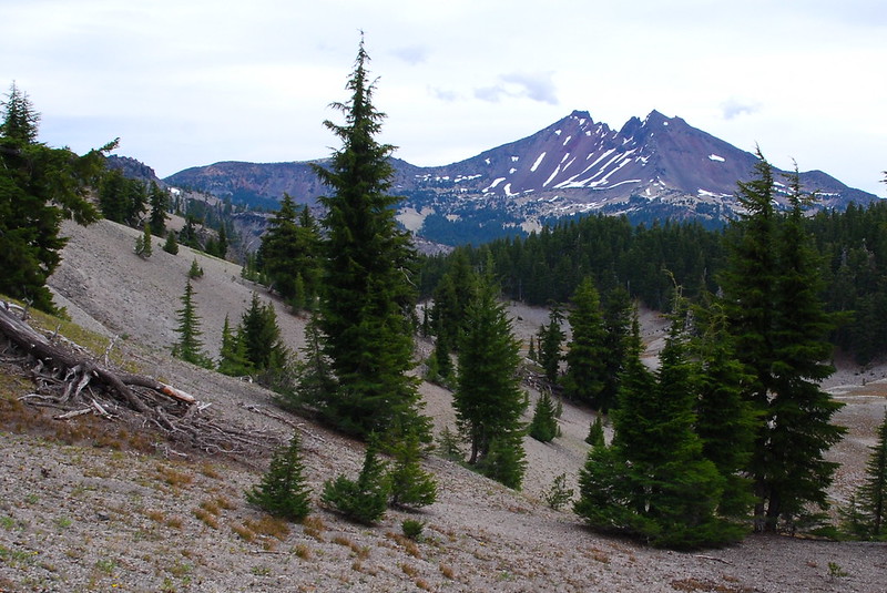
After a couple junctions with trails to Moraine Lake, the views open up to the south too. Mount Bachelor, Moraine Lake, and Devil’s Hill:
3.
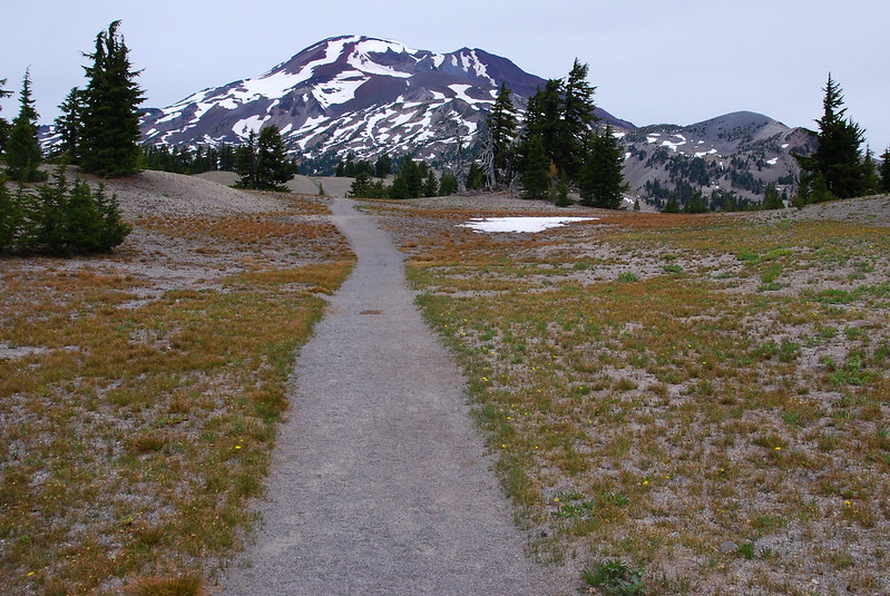
The trail’s basically flat for a while after the lake, but eventually it does start to climb, and to look more like a trail than a broad road. The sky’s been a little overcast, but as I start climbing it obligingly clears off. Wonderful.

As the skies open, so do the views, and I finally get that picture of Diamond Peak:
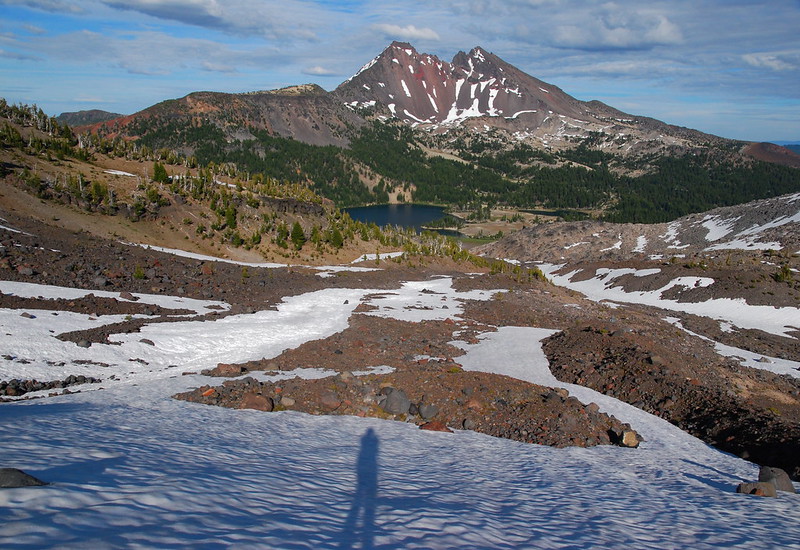
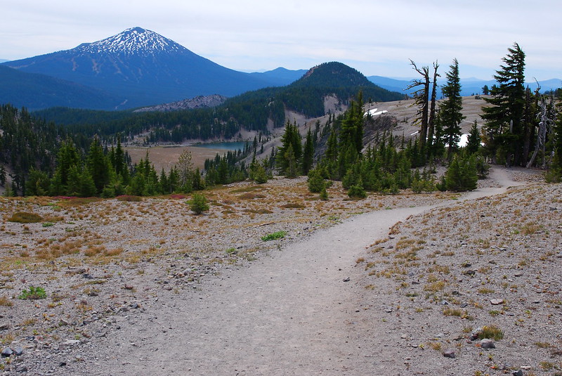
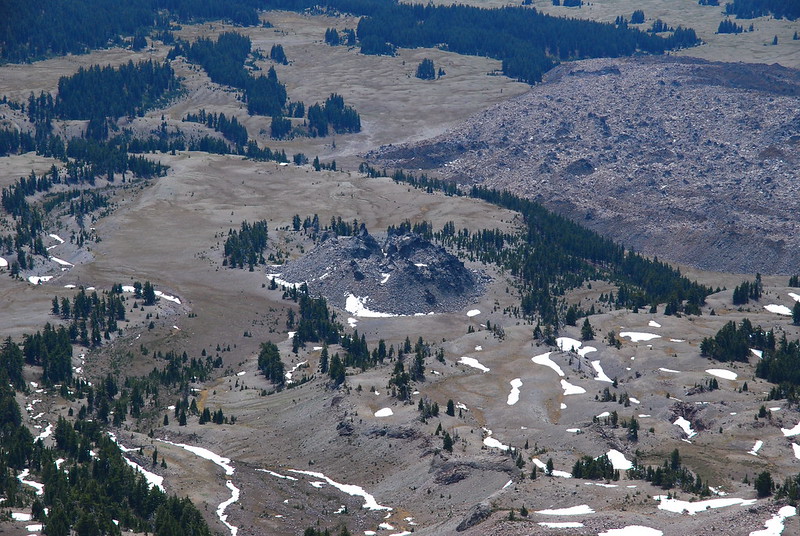
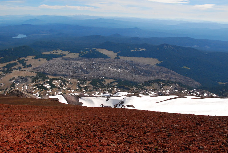
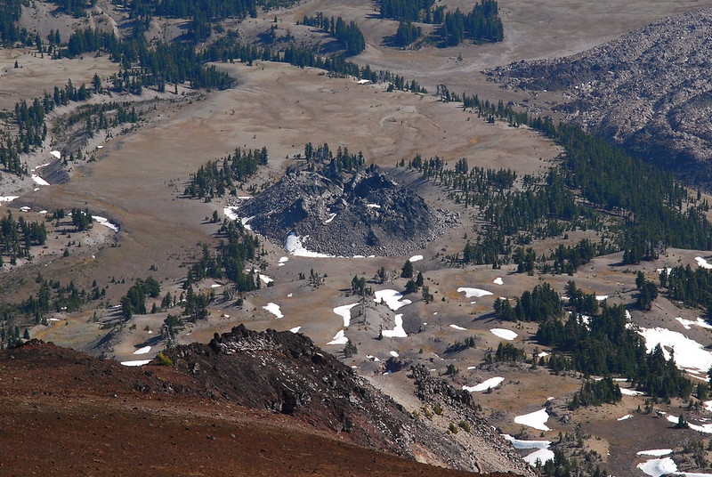
My favorite views are probably just to the west, down at the Wickiup Plain and all of its incredible lava features. I’ve never walked through there, but definitely need to. Here’s Le Conte Crater (center) and the Rock Mesa (upper right):
4.
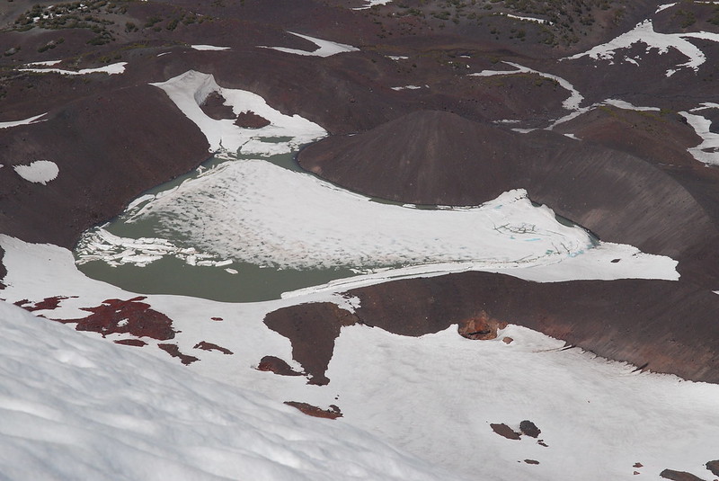
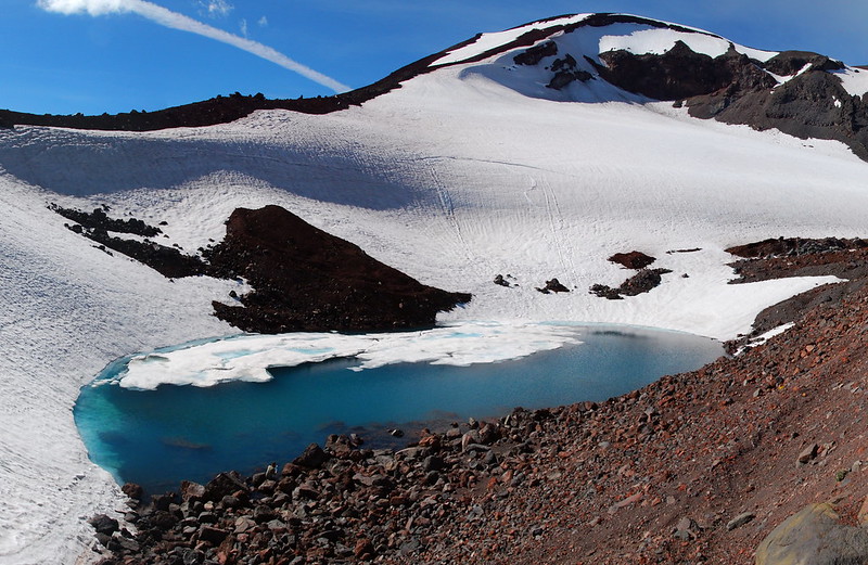
In what seems like no time, I’m at the foot of the Lewis Glacier, with its gorgeous tarn, where I stop for a quick lunch. From here, the summit seems really close.
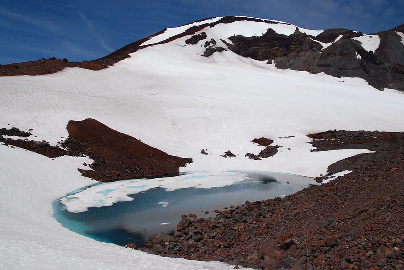
I don’t know what it is – the altitude, the heat, that I’m really hungry, what – but my food tastes so, so good. It’s the same thing I always eat on dayhikes: salami, cheese, and mustard on a tortilla. But oh man. No one, in the vast history of salami, has ever enjoyed it as much as I’m enjoying it right now. I start acting like I’m at a fancy restaurant, taking small bites and pausing to listen carefully to what my date, the mountain, has to say. Rockfalls echo down the glacier.
5.
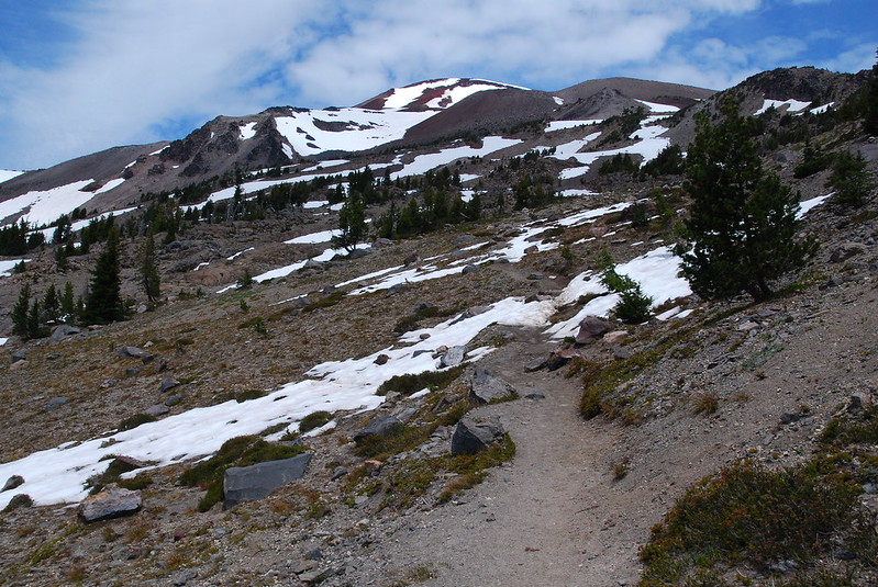
After the tarn, the trail steepens considerably, and gets kinda cruddy. Lots of ash and scree. I find myself wishing there were more snow. I have microspikes in my pack, and I suspect it would be a lot easier to walk on snow than this stuff, which shifts a half step down for every step I take up.
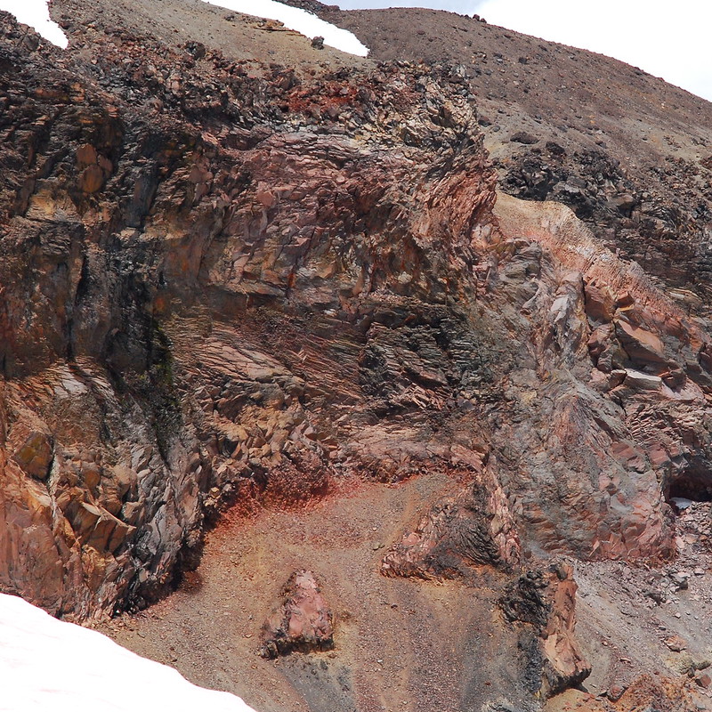
As ever, though, the minor annoyances are more than made up for by the scenery. Just to the east of the trail, there’s the most gorgeous rock formation.
Someday, I’ll have to learn something about geology.
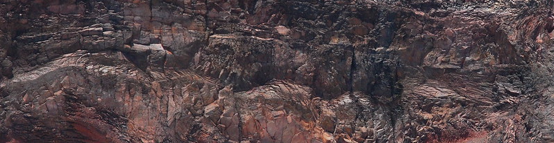
Okay, maybe that should have been rock formations:
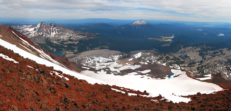
The bigger views are also, of course, increasingly fantastic:
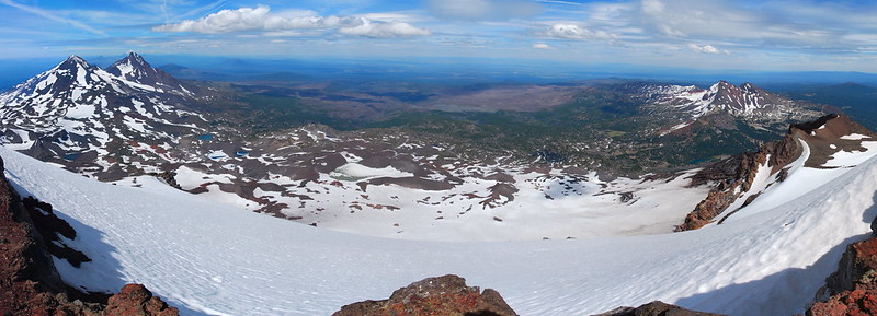
A panorama of the whole business:
6.
As I’m stumbling up the scree, I see a thin black figure confidently bounding up the trail, going twice as fast as I am. Turns out to be a young guy, maybe in his early twenties, in black skinny jeans, a Morrissey t-shirt, and minimalist running shoes. As he passes me, he pulls out an ear bud, yanks it out by the wire. Loud, tinny funk metal splashes out onto the rocks. I’m a little out of breath as I ask him how it’s going. And he answers, not winded at all, in a voice somewhere between Andrew W.K. and Bill and Ted era Keanu Reeves that it’s excellent. Totally excellent. Totally, totally excellent. “Look at this shit!” Who is this guy, and why isn’t everyone out here more like him?
Before the tarn, I passed a few people outfitted in the newest REI gear, tiredly bickering about where to have lunch. And here’s this dude, in what I imagine to be last night’s concert clothes, basically running up. I imagine him waking up this morning in Bend, hungover, and blearily thinking: “Fuck it man, today I’m climbing a mountain.” I can’t stop smiling as he speeds ahead.
It takes me longer than him, but the summit still comes a lot quicker than I expected it to. Although it’s certainly a good workout, I think the walk up’s much easier than, say, Mount Defiance. Though that may also have something to do with what you get to see on your way up.

7.
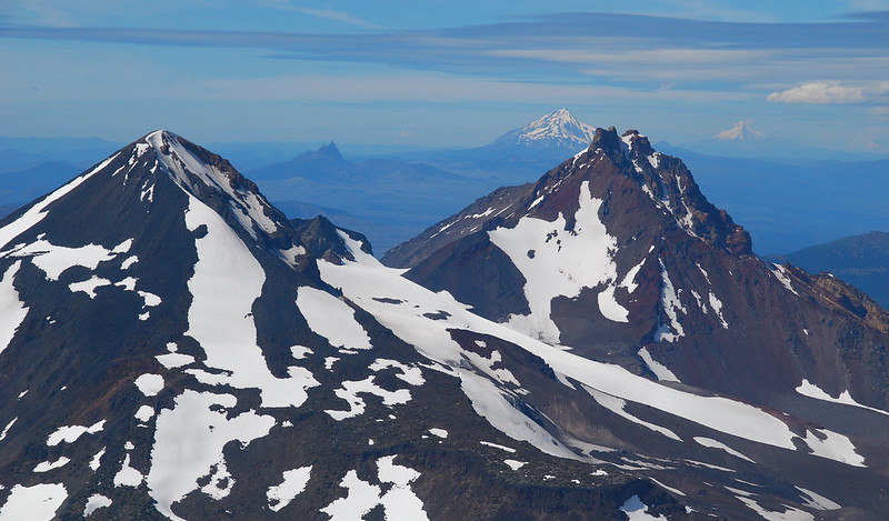
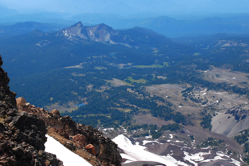
I made pretty good time coming up, so I spend a while walking around the summit crater, taking a whole bunch of pictures. It’s all so big that I find myself mostly taking panoramas, dozens of pictures that, when stitched together, still don’t show the whole thing. Here’s Broken Top, with the Pole Creek Burn:

Middle and North Sister, with (from right to left, for a change) Carver, Camp, and the Chambers Lakes:
From the top, the Cascade line looks more like a squiggle:
8.
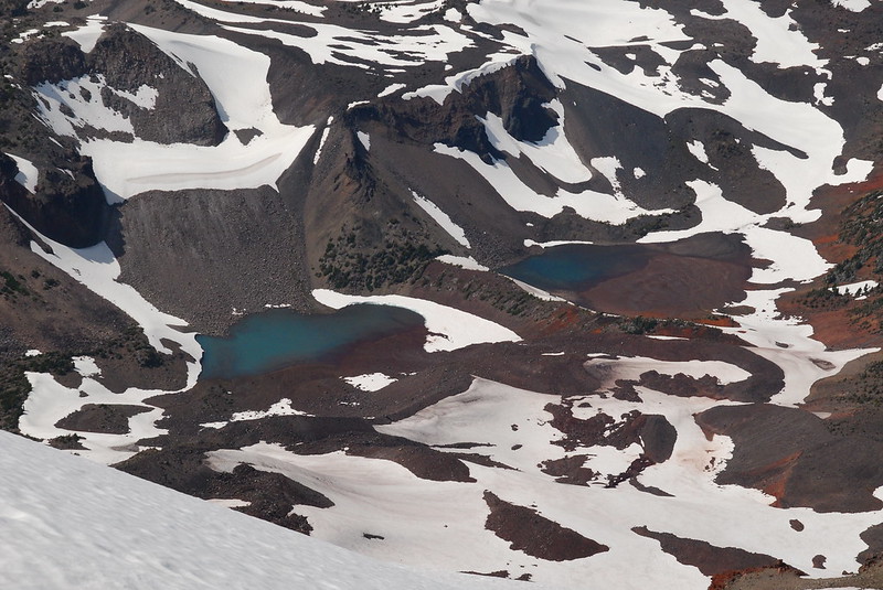
As I walk around the crater, I look down at all the spots we’ve visited over the years. Here’s Golden Lake, which we couldn’t find on our walk around Broken Top:
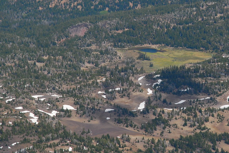
And here’s Carver Lake, where we dayhiked the first time we stayed at Green Lakes, when I was first awkwardly learning to use our GPS:
The Pole Creek Burn, where we wearily camped on the last nigh of our Broken Top loop:
The Chambers Lakes, where we happily camped the last night of our loop around Middle and North Sister, finally drying off from the rain and snow the day before:
The Husband, Linton Meadows, and the Frazier Uplands, which we walked through on the way to Chambers Lakes that same trip, grateful for the clearing skies. I think that’s Reese Lake in the bottom center left, where we had breakfast that morning:
9.
As I reach the northern edge of the rim, I’m suddenly very dizzy, then very sick to my stomach. I sit down on the edge overlooking the Carver Glacier and try to eat a bar. But it just makes me sicker so I drink some water, which seems to help. A full liter, then I’m feeling almost back. I finish the bar.
What was that? Altitude sickness? Heat sickness? Just plain being tired?
I don’t know, but I sit on the edge a little while longer making sure that it’s passed, idly looking down at the Chambers Lakes.
It’s not just Krista and my past down there, it’s my whole life in Oregon. There’s a picture somewhere of me and my mom at one of those lakes. She’s standing behind me with her arms around my shoulders and hands on my chest, in that motherly way that’s only possible before you’re thirteen. And there’s another picture of me a few years later, maybe even at the same lake, with long hair and a tie-dye shirt, no mom in sight, arms outstretched in a V. I think my dad had told me to take that pose. I still do it in photos Krista takes now, and she does it too. We call it “the pose.”
At some point I realize that I’m crying. Or: I realize that I’m tearing up, which somehow makes me cry for real – silent sobs that make me very glad no one’s around.
From up here I can see a lot of my past, and I love it all. Whatever I wish I’d done differently, above all of it there’s this unshakeable affection I have for myself – the self in those pictures, and the self that complained just afterward about having them taken. The self that’s a straight line from there to here. And it’s not just affection for my history. It’s also affection for everyone in it. My mom, my dad, my brother, everyone. The movements that connect them to me and then to now.
I’m crying, I think, because that version of my family isn’t really around anymore. Those trips could never happen again. It’s still me down there. Not past me but present me, or the me that extends from one to the other. I’m still that kid in the picture with my mom, but that picture’s also now impossible. It’s still me, still us, but we’re gone from there now. It’s so strange how time does that.
I try to think about something funny to get myself out of it. I think of Heraclitus’s supposed remark, generally known from Plato’s Cratylus, that “you cannot step twice into the same stream” (402a). Then I think of the supposed reply from Zeno or Parmenides or someone that you can’t step into the same stream once, either. I think I heard that on Car Talk. And it makes me laugh.
10.
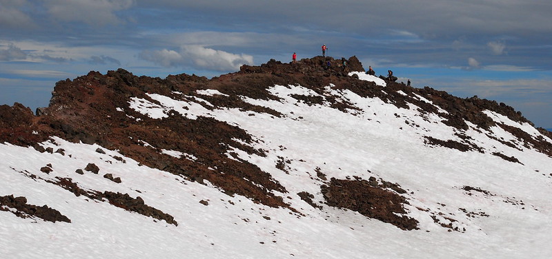
Walking back across the summit crater – straight though this time – I run into my skinny-jeaned friend, who asks if there are any crevasses up here. I tell him no, that we’re not even on a glacier, that the only real crevasses near the Climber’s Trail are on the Lewis Glacier, down lower. He replies, vigorously shaking his head yes: “Oh fuck yea, I thought I might die. Imma walk all over this shit!” Then he walks away, somehow even more jauntily than before.
I want to ask if he wants to be friends.
As I was turned the other direction, something of a summit party developed. Someone shouts “Woo!”
11.
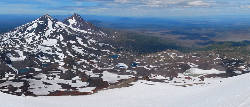
Heading back down, the light’s more forgiving than it was on the way up, so I take many of the same pictures again. I hope you have a really short memory, because you’ve seen this before:

This too:

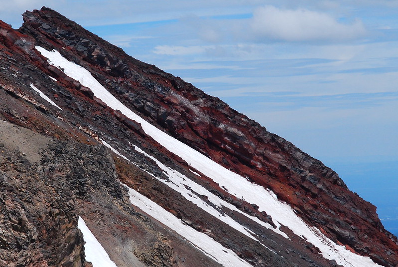
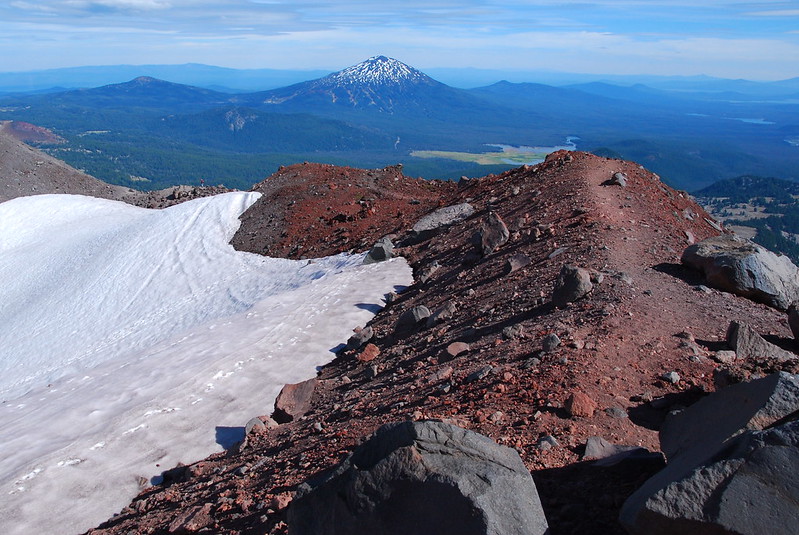
It was sort of hard to get the trail’s redness on the way up. Maybe it’s better now:
With the sun lower in the sky, the shadows are starting to bring out the Rock Mesa’s crazy internal structure. It almost looks like a cow patty…
…if you’re into that sort of thing.
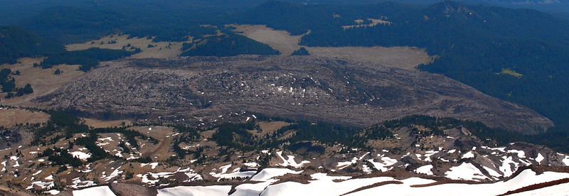
Le Conte Crater’s looking better too:
12.
I get to the Lewis Tarn around five, which is a bit later than I’d planned. Apparently I spent too much time wallowing on the summit. Given that there will be reliable light until at least nine, I figure the plan is still doable, as long as I do a little less dillydallying, so I take one final panorama and set out east-ish toward Green Lakes.
A word of caution here: there’s a pretty good boot path for maybe half of the route between the Lewis Tarn and Green Lakes, but the rest requires reasonable route-finding skills, and the whole way is pretty steep, including some steep snowy sections where a fall would be unpleasant. That said, if you’re up for it, it’s a lot of fun.
Especially the glissading part:

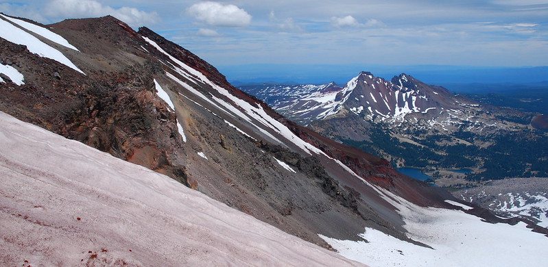
It’s cool too to get different views back up to the summit…

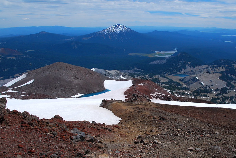
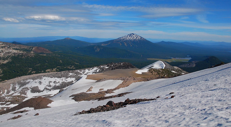
…and south at Mount Bachelor…
…and east at Broken Top.

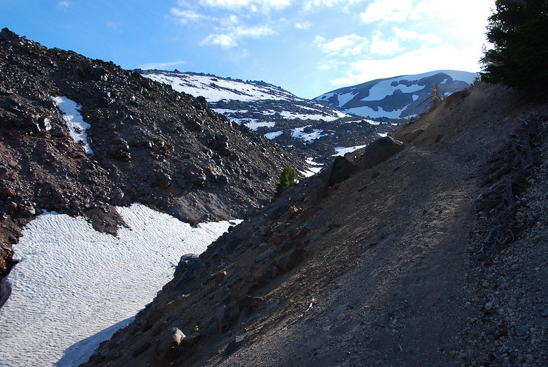
Just before the Green Lakes basin comes the only really sketchy part of the route, as the hill steepens and the drainage narrows. There’s a pretty good boot path on the north side of the drainage, which leads to a pretty good section of switchbacks that descend the last steep slope into the basin. If you go down this way, you should definitely try to find it, as, without the trail, it would be pretty rough.
13.
By the time I get to the bottom it’s nearly seven, so I high-tail it through the Green Lakes. I find myself wishing I could stay for sunset, as the flowers are blooming, the meadows are green, the mosquitoes are not terribly hungry…

The beginning of Fall Creek:

Feeder stream:

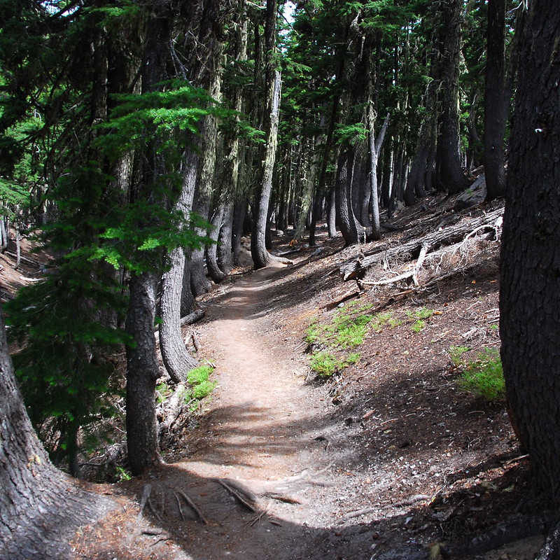
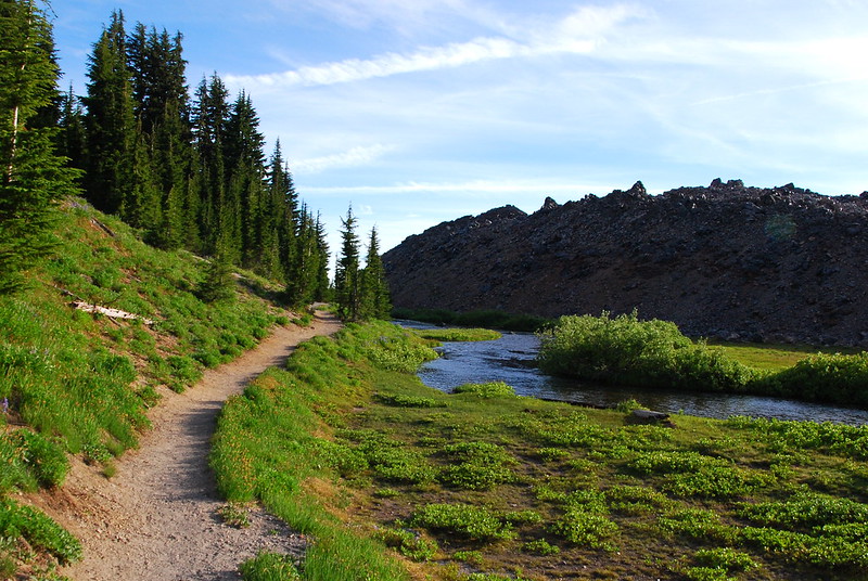
Green Lakes Trail, just as it enters the woods:
14.
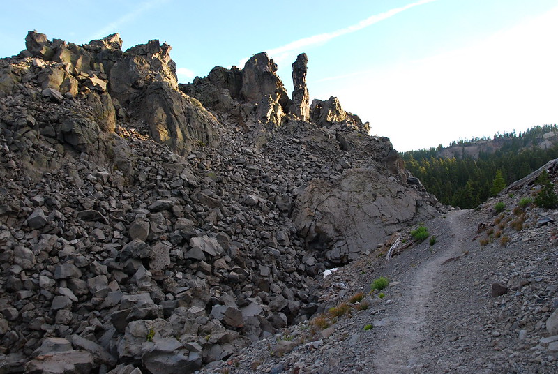
After the basin, I put the jets on, and motor down to the junction with the Moraine Lake Trail. I was anxious to get through here before dark, because I’d never walked this part, and didn’t know what sort of condition it would be in. As it turns out, my fear was for naught, because, like seemingly every trail in the area, the Moraine Lake Trail is incredibly clear and well-maintained. I count three blow downs. Total.
There are some cool rock formations, though:
15.
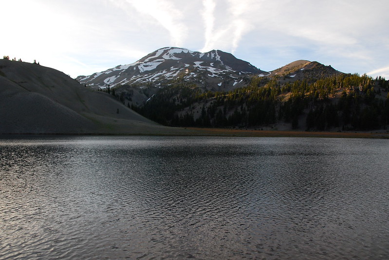
Once at the lake, I take a quick break to filter water (I ran out just after Green Lakes), and get my head lamp ready just in case. It feels really nice to sit.
16.
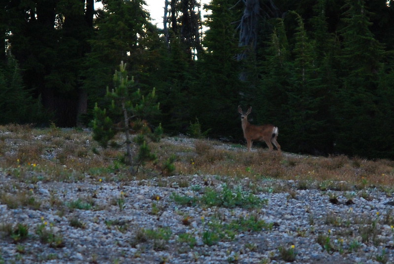
The last few miles out are just as uneventful as they were on the way in, though I do interrupt this fella having dinner:
I get back to the trailhead just as the sun is setting, take off my sweaty shirt, put my stuff in the car, and walk over to a nearby stream to rinse off. There I interrupt a college-aged woman in her underwear, washing off. I guess she had the same idea I did. When she sees me she bursts out laughing and apologizes for hogging the “shower.” I apologize for interrupting her sauna, but she’s just about done anyway, and she limps off toward the campsites. I spend a while in the water, splashing it on my face until it no longer tastes salty. It takes a long time.
I get back to the car around 9:30 and head out. I call Krista from Bend around ten, then drive back through the black dark toward Sisters, then Salem, then home. It turns out being a very long day: after a stop for dinner, it’s almost two when I get home. But as I fall asleep, I’m so, so happy with all the new memories.