June 5-7, 2015
I spent the weekend with a couple friends in the upper basin (“core”) of the Enchantments, in Washington’s Alpine Lakes Wilderness. Due to overcrowding, camping permits in the Enchantments are awarded by lottery June 15 – October 15. I apply every year, and only very, very occasionally (read: never) win. But, given the low snow this year, we decided to give it a go before the lottery season officially starts.
The short story is that Aasgard Pass (the shorter but more difficult route into the upper basin) is mostly snow free and as un-sketchy as it ever gets, but the basin itself is completely snow-covered and the lakes are still largely frozen. It’s still wonderful, but wonderful in a different sort of way than it is in late summer, when it’s all blue-green lakes, polished granite, and changing larches.
Before I start, a quick aside about names: several lakes in the upper basin have two. The original – and, for my money, better – names are, from west to east as one leaves Aasgard Pass: Brynhilde, Freya, Talisman, and Rune. However, many maps have them labeled as (in the same order): Isolation, Tranquil, Inspiration, and Perfection. I think these are also the “official” names. Actually, even Aasgard Pass isn’t officially Aasgard Pass: it’s Colchuck Pass. Here I’ll stick with the originals, though with the interlopers in parentheses to avoid confusion.

Friday
1.
Due to an alarm… “malfunction,” we don’t get out of Portland until around 5:45. After a short stop in Toppenish – which is somehow very, very charming – we make it to the trailhead around eleven. Icicle Creek Road (NF-76) out of Leavenworth is obviously well-traveled and in excellent shape, but NF-7601, though seemingly also well-traveled, is pretty rough. It’s doable in a passenger car, but you’ll have to take it very slow. I’m very glad that I’m not the one driving.
The trailhead is surprisingly empty. But it’s hot and dusty and just generally unpleasant as we set off up the initially flat trail along Mountaineer Creek.

2.
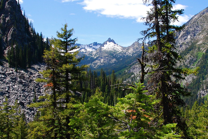
After a few uneventful miles, we turn left at a junction to head up toward Colchuck Lake and our first views. Here’s an unnamed ridge just south of Lake Stuart:
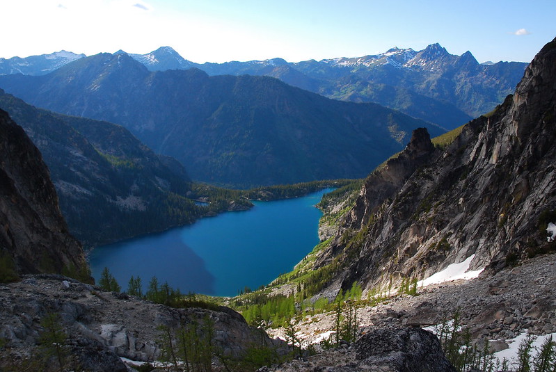
It takes us maybe two hours to get to Colchuck Lake, where we stop to have lunch, filter water, and stare a little dreadfully at Aasgard Pass. Here we also see our first campers. I’ve never stayed at Colchuck, but it looks like a really nice place. It’d be a long drive for such a short hike, but I imagine it being a good way of getting a taste of the Enchantments without having to deal with the steep climb up Aasgard or the long trudge from the Snow Lakes Trailhead.
Here’s the view from lunch: Dragontail Peak over Colchuck Lake.

Same, with Colchuck Peak to the right:

At lunch, we run into a few people who tell us they’re not trying Aasgard because they don’t have ice axes. This is a little foreboding – we don’t have ice axes either – but, as it turns out, they don’t end up being even remotely necessary.
3.
The trail around Colchuck Lake is scenic, but gets a little rough on the south end, below the Colchuck Glacier, where it turns to rock scrambling. The view up the glacier:
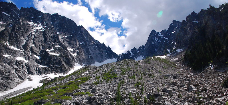
And here’s the “trail,” with Aasgard Pass in the upper left.

Incongruously, after scrambling over boulders for a few hundred feet, the trail – that word feels a little generous here, shall we say “route”? – drops into a gorgeous, almost tropical beach, with excellent views of Cashmere Mountain in the distance.
4.
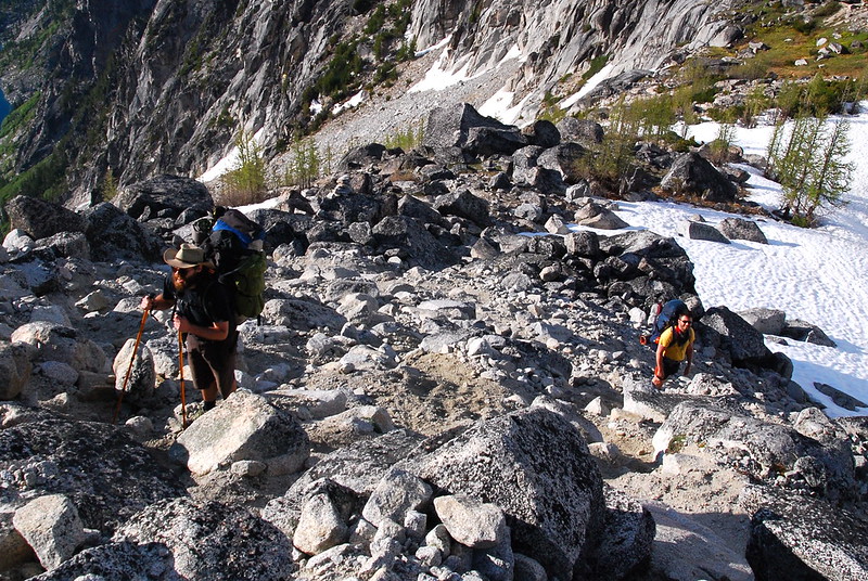
After the lake: the climb. The trail, now entirely having given up on any pretense of being a trail and subsisting largely on cairns and faith, gains something like 2200′ in 0.8 miles. It’s the hardest hiking I’ve ever done. The gain isn’t all that dissimilar to the last couple miles on St. Helens, but, for whatever reason (possibly packs full of two nights worth of stuff), it hits us all a lot harder.
Still, it’s also never that bad. You have to watch your footing the whole way, and there are spots where a slip would be pretty costly, but it’s nothing like the Terror Fest some people make it out to be.
On the Terror Fest thing, here’s one of the worst offenders, from Harvey Manning and Ira Spring’s 100 Hikes in the Alpines Lakes (Mountaineers: 1985), p. 77:
It’s not easy; actually it’s a very steep climbers’ route, gaining 2200 feet in 3/4 mile, which may require an ice ax, sometimes rope and crampons, and in early summer the ability to recognize avalanche instability. It’s dangerous, not only from falling off cliffs or slippery boulders or snowfields or from being fallen upon by snow or rock, but also from summer storms that at these elevations can be distinctly hypothermic and from summer snowfalls that can make the already difficult descent of boulder fields a very long nightmare.
Also, they claim it will take your first born child.
5.
The pass doesn’t take our kids, but we do stop to take a whole lot of “picture breaks.” Maybe a quarter of the way up, and already tired:
Dragontail Peak:

Trail Friend, enjoying the view:

Now halfway up. Just a thousand feet to go!
“A thousand feet!?”
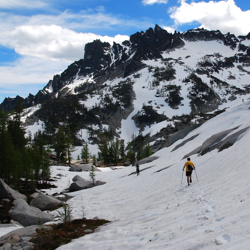
6.
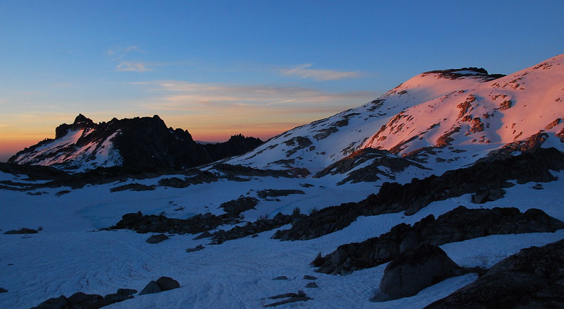
Around 7000′, we start hitting our first significant snow. It’s never a huge problem, but it becomes increasingly consistent. When we hit the pass, at 7800′, it’s everywhere. But man, it’s also so beautiful.
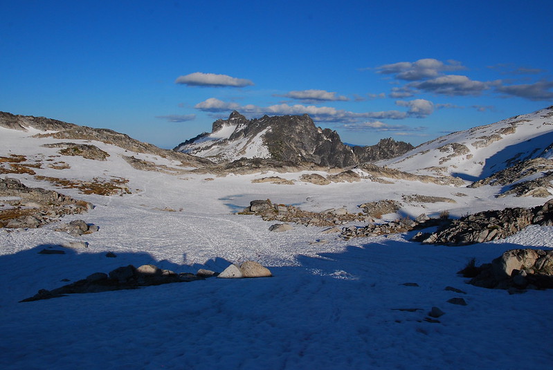
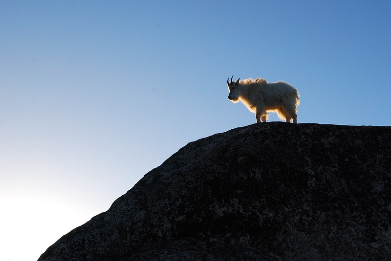
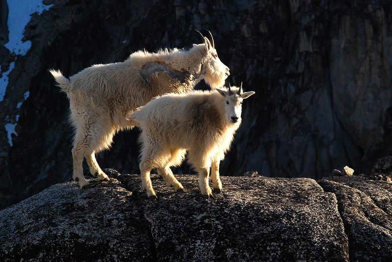
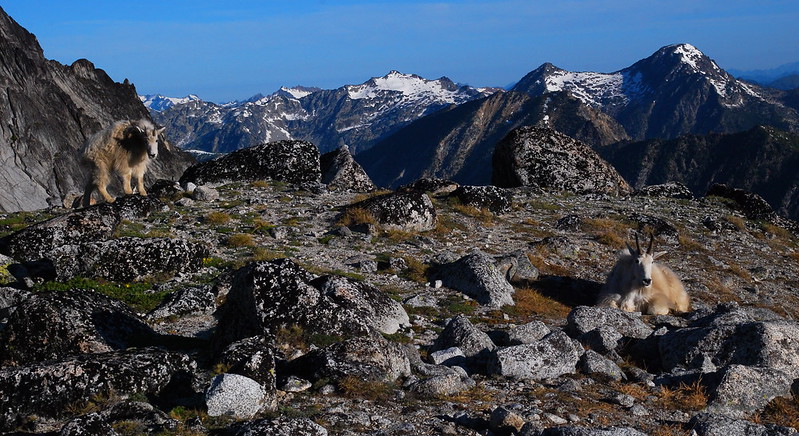
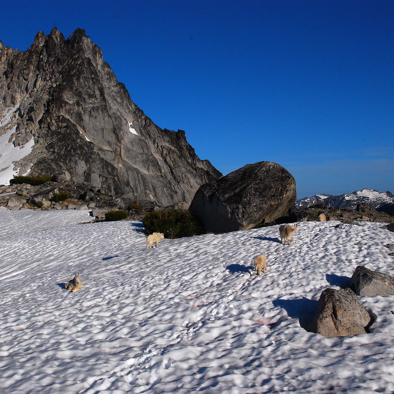
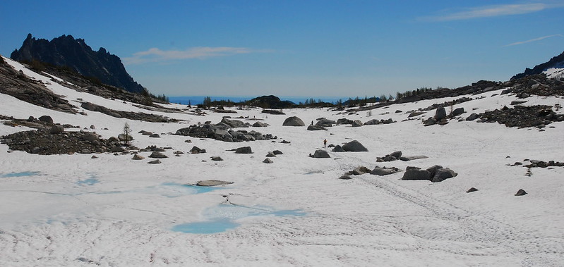
By the time we make it up to the upper basin, there’s not a lot to do beyond finding a campsite, setting up our tents, filtering some water, and making a little dinner. Our welcoming committee:
Freya (Tranquil) Lake, our water source for the weekend:
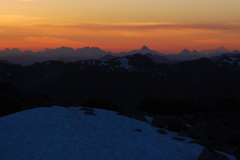
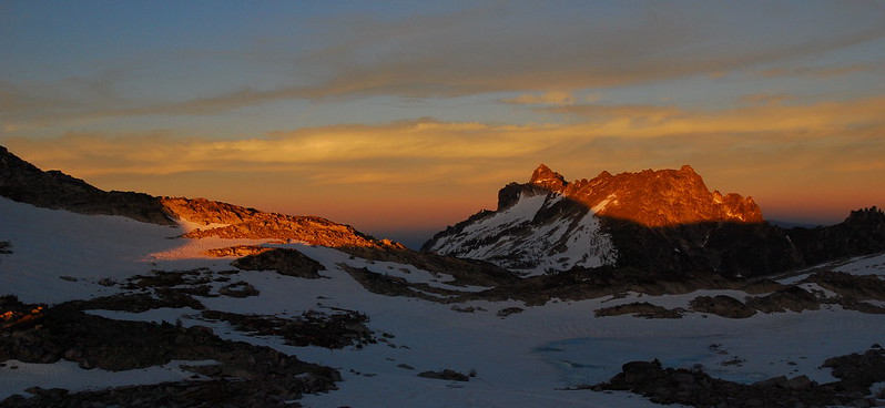
Sunset over the North Cascades:
Saturday
7.
The night is apparently cold – the melted parts of lakes partially refreeze – but, when I wake up around five-thirty, it’s already quickly warming up. While my buddies sleep, I walk around a little, taking pictures of the dozen or so mountain goats roaming nearby.
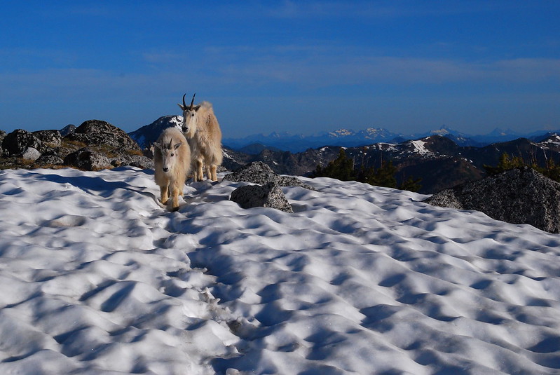
Have you ever heard the sort of high-pitched mewing sound young goats make? It’s got to be one of the most adorable things I’ve ever heard. I’m sitting on a rock above camp happily listening when I hear a slightly different sound – not so much mewing as whining – and realize that it’s my buddy, now awake, stretching his sore legs.

8.
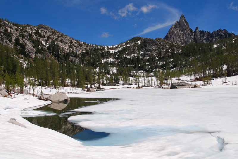
After some deliberation (mostly strategic, mostly involving the locations of nearby toilets), we decide to start our dayhike early, and have breakfast somewhere down the way. Freya (Tranquil) Lake again:
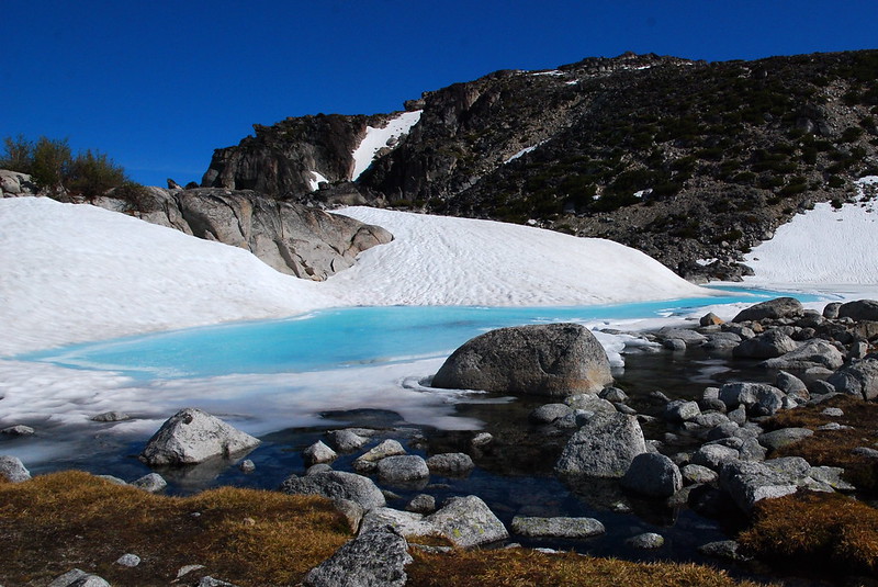
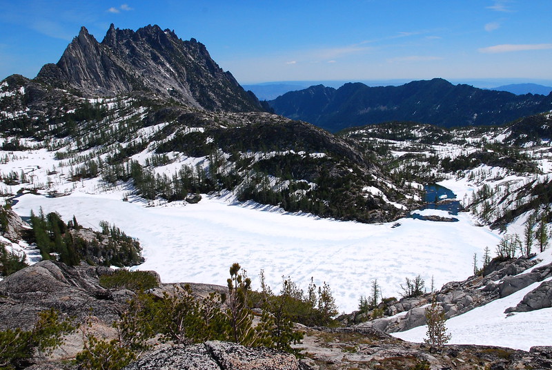
Heading into the basin, past some unnamed, iced-over tarns. That’s McClellan Peak in the background:
Same, with Prusik Peak in the upper left:
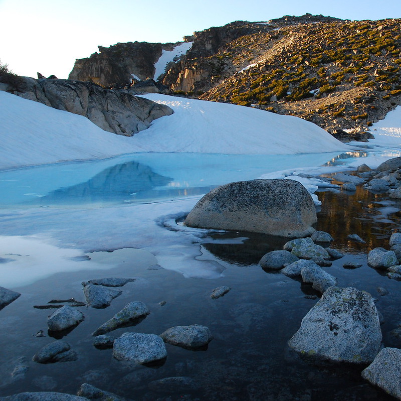
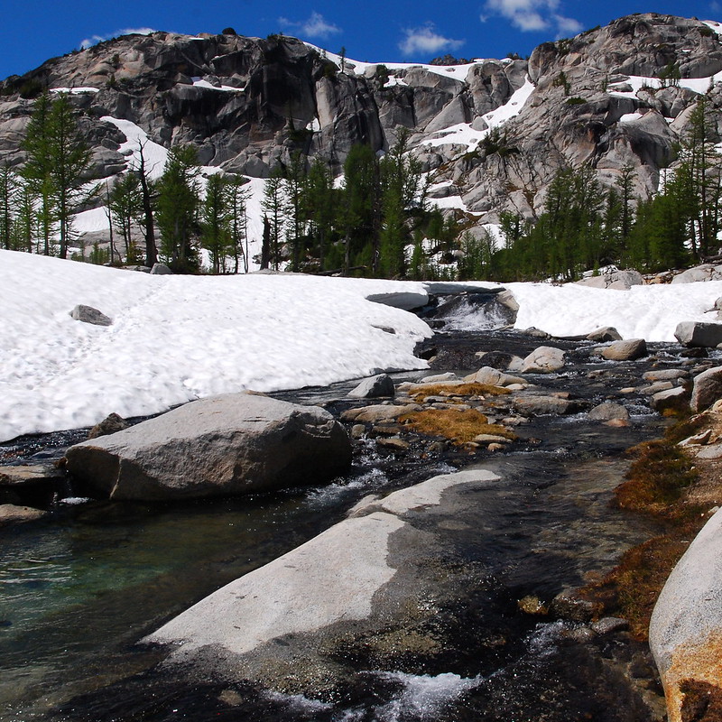
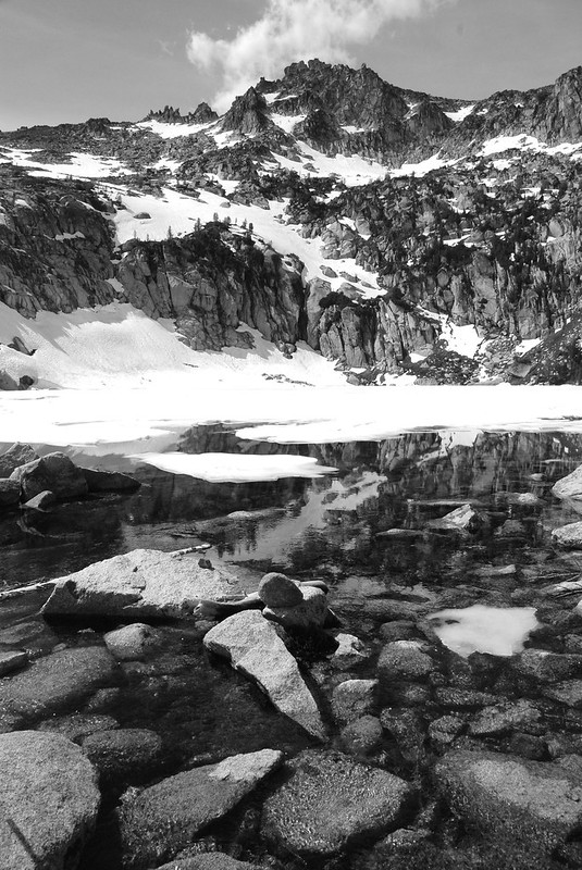
Even with the water frozen and covered by snow, it’s still amazing up in the basin:

9.
A word here on the toilet situation: you really should use them, as it’s so barren up there that catholes aren’t always a possibility, and anyway for the time being you’d have to get through several feet of snow first anyway. (I guess you could use a wag bag, but that might be even worse.) However, at the moment, the toilets are very unpleasant affairs. Without going into too much detail, you’ll probably meet a larger number of flies than you’ve ever wanted to, and they’ll probably take energetic, unwelcome interest in parts of you unfit for such public consumption. The toilets are also quite exposed, which means it’s probably best to have a friend – hopefully an understanding, sympathetic friend – stand guard.
So… yea. That.
10.
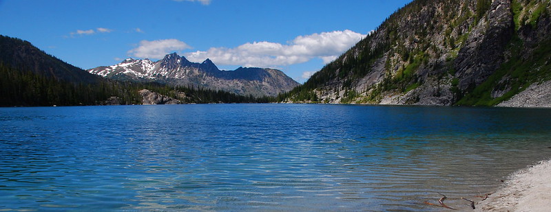
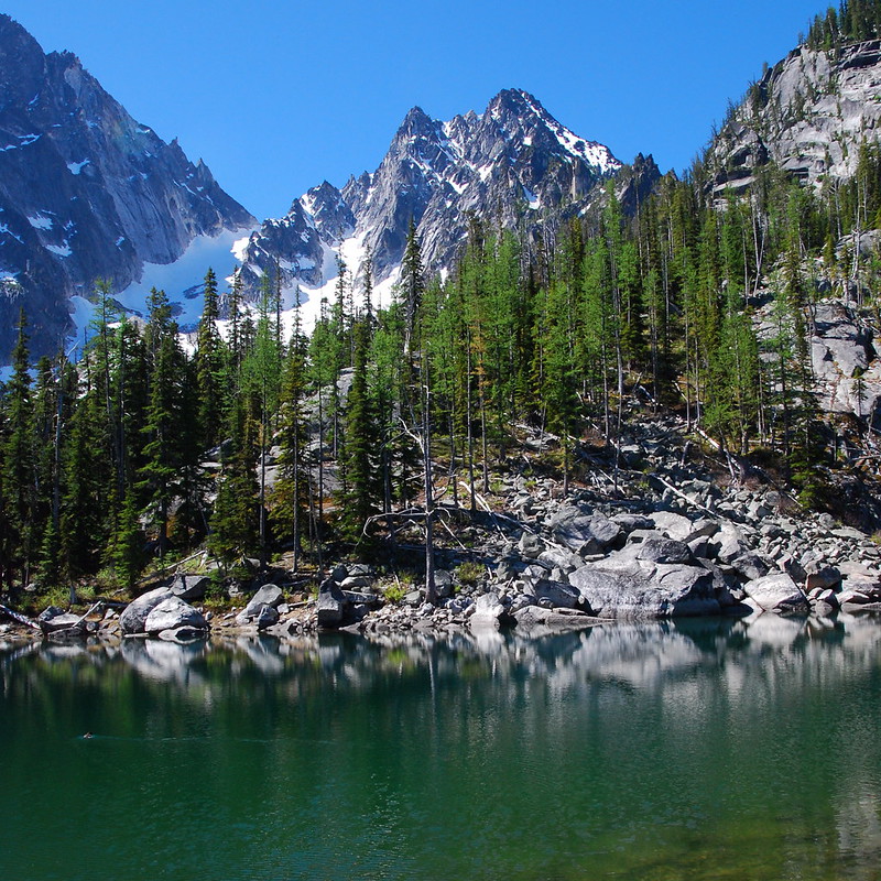
Anyway, we stop for breakfast at a small clearing under some trees, melting water for coffee and oatmeal. Then it’s on to a gorgeous overlook of Rune (Perfection) Lake, with Prusik Peak again in the upper left:
And down to the lake itself:
11.
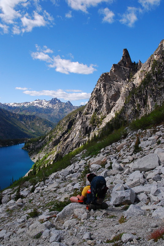
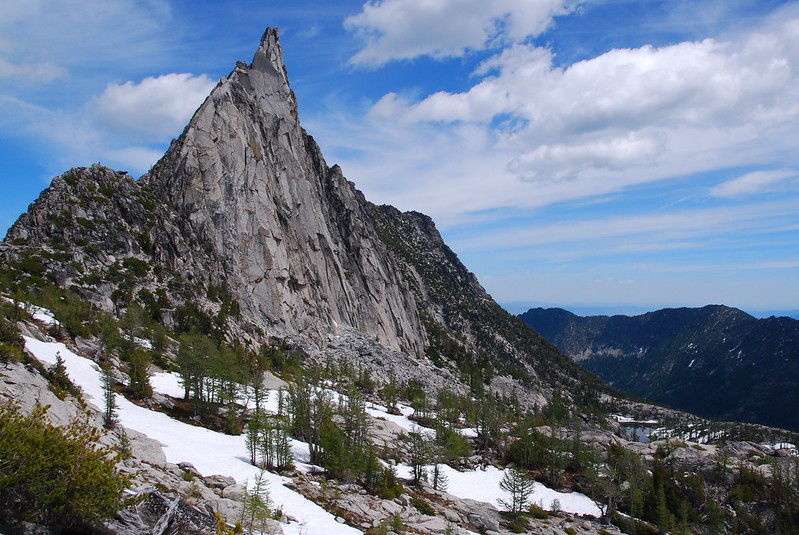
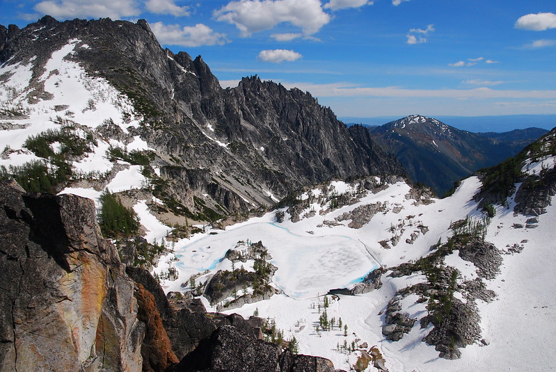
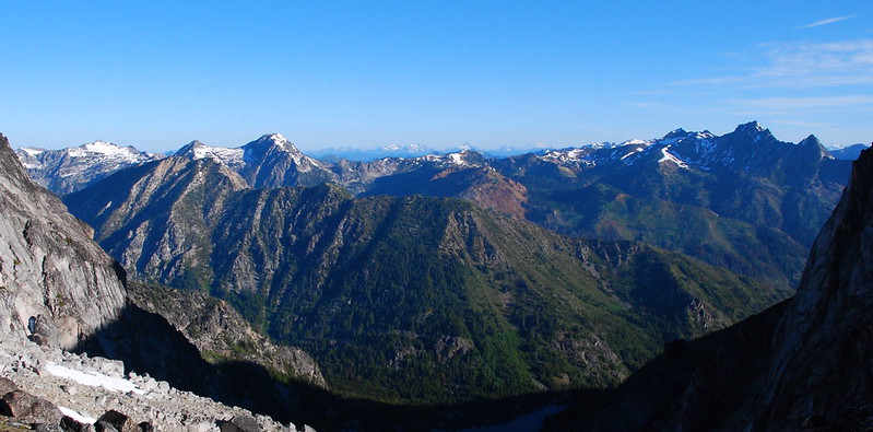
We wander around a little, considering the possibilities, and decide to walk up to Prusik Pass to get a better view of the basin. On the way up we meet a couple of very friendly climbers on their way to climb the peak. They’re made of much hardier stuff than I am. Here’s their goal, with Temple Lake in the bottom right:
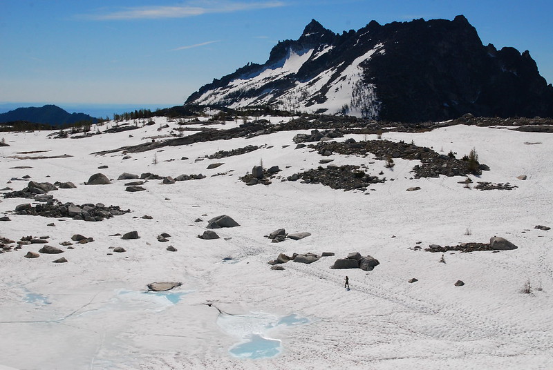
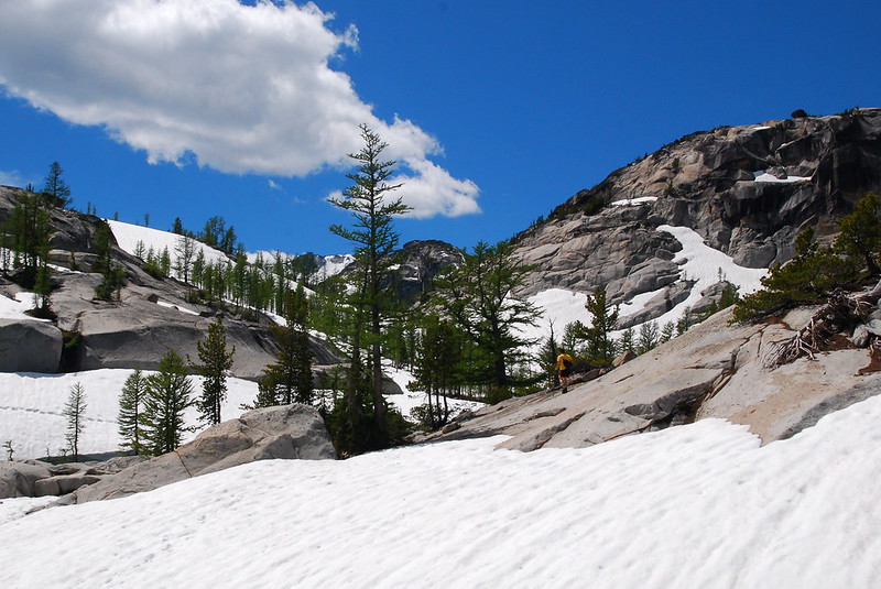
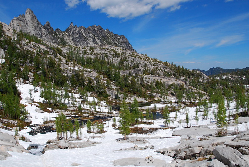
We have a quick lunch near the pass, where our phones start to ding – apparently there’s cell service up here. Weird. Then it’s a pretty traverse along the first significant exposed granite we’ve seen all day, south to near Leprechaun Lake. In a month or two, it will all look like this:

12.
The area just above Leprechaun Lake, near the stream that becomes Snow Creek, is probably my favorite of the trip. I take at least six versions of every picture, just to be sure.

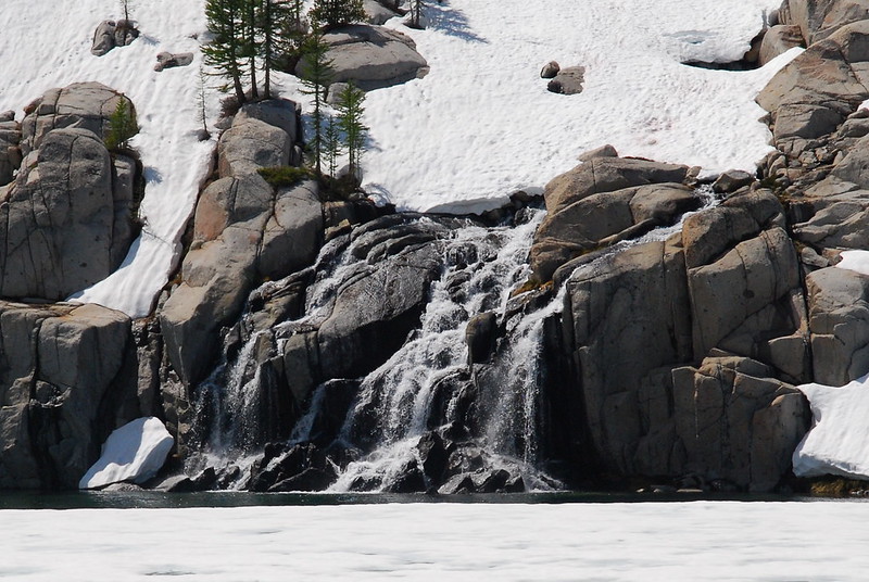
13.
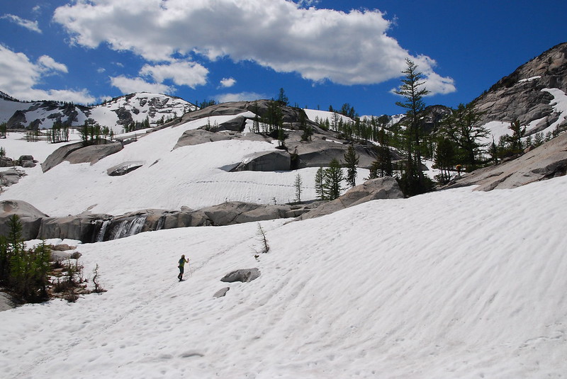
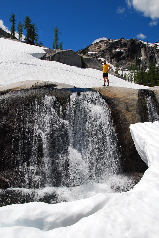
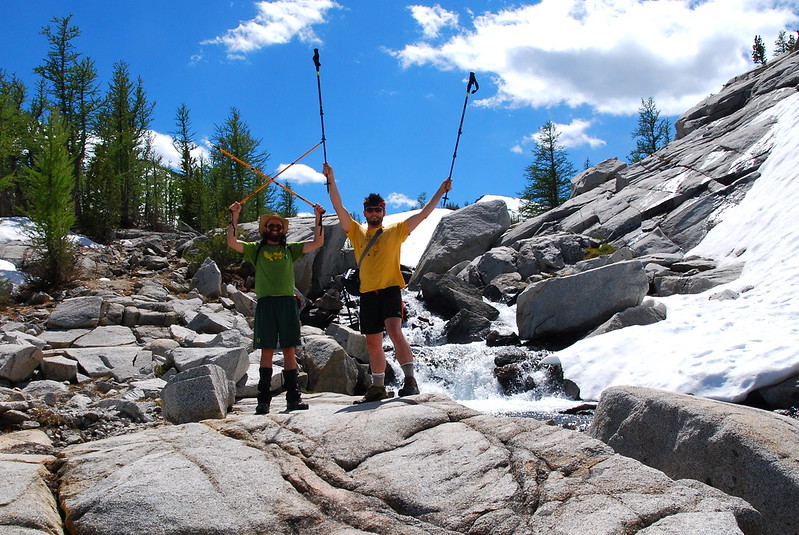
We stop again near a broad waterfall just above Leprechaun Lake to filter some water and hang out taking pictures. If – or, really: when – I go again, I’m going to try to camp around here.
14.
It’s markedly more crowded in the basin proper than up by the pass where we’re camped. Walking back, we run into at least five groups – one of close to double the eight person limit. Most seem to be in “Head Down Hiking” mode, presumably because they’re tired from going over Aasgard. Having recovered overnight, we’re just stoked. I’m sure it’s annoying.
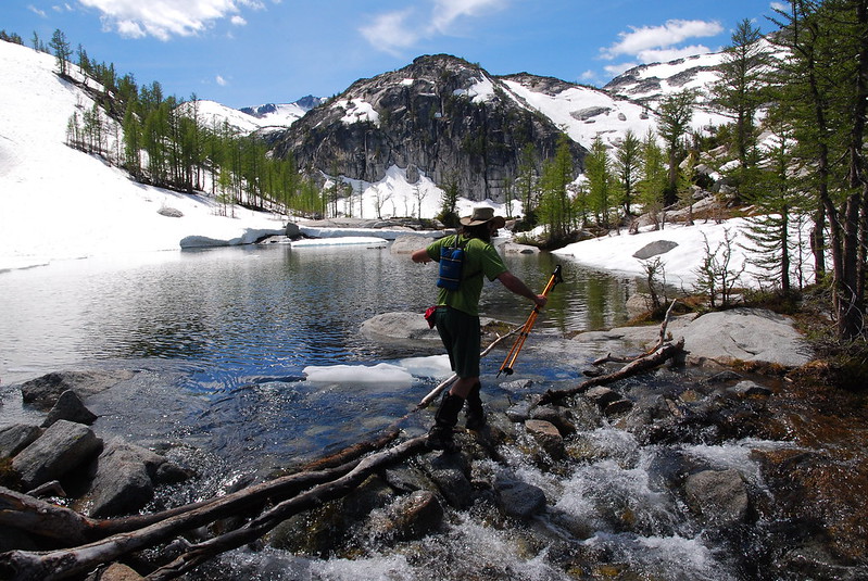
Crossing Sprite Lake’s outlet stream:
Another waterfall, this one flowing into Rune (Perfection) Lake:
Talisman (Inspiration) Lake:
Above Talisman, there’s a very glissadeable slope. Although we’re headed the other direction, it’s hard to let something like that go. So we don’t.

15.
On the way back we stop at a nice overview of Crystal Lake and the Crystal Creek drainage. There’s no trail that goes down there, but it sure would be fun to try.
We get back to camp with a lot of daylight left, but while it away just sitting around, having an extravagant cocktail hour. It’s wonderful. While we lazily lie on the rocks, half a dozen parties pass our camp looking for places to set up. Several just plop down in the snow.
16.
Eventually: sunset. It’s just amazing.

Sunday
17.
I wake up earlier than my friends again, but we’ve all agreed to head out at six to beat the heat, so I only have a little while to take in the sunrise solitude.
When alarms blare, we quickly pack up, apologize to our knees, and begin the grind down Aasgard toward Colchuck Lake. I’d mentally prepared for it to be pretty tough, but it’s actually not so bad, despite the heavy protest my legs are waging by the end.
18.
It takes us almost as long going down as it did going up, though this is admittedly due largely to me lollygagging. And it’s already getting hot when we make it down to Colchuck, where we stop for breakfast, coffee, and to filter a little last water to get us down the trail.
Here are Colchuck Peak and Glacier, from a small pond just west of Colchuck Lake. Anywhere else, this would be the highlight of the trip:
It gets hotter and hotter as we motor our way down toward the car – it’s around a hundred by the time we make it back. Once at the trailhead, we pile in, stop briefly in Leavenworth for cold drinks, and drive the five or so hours back to Portland on baking highways, happy to be in a place with air conditioning.

One thought on “R Solo: Enchantments Upper Basin via Aasgard Pass”