June 15, 2015
I had to be in Eugene Monday morning for school junk, and figured I’d go for a quick dayhike afterward to make the drive worthwhile. Happily, McKenzie Highway was also scheduled to open Monday, so I planned to head up with the vague idea of rambling around Collier Cone, which we’d walked by last year in a storm, but which I’d otherwise never really seen. There were still plenty of permits available for the Obsidian Limited Entry Area Sunday night, so I reserved one, thinking it might be nice to make a loop up the Scott Trail, south on the PCT, and down Obsidian. I’m so glad I did.
1.
I finish in Eugene around eleven, walk back to the car through graduation day crowds, and head out through Springfield. The town fades into farms and then into trees, white mountains towering above the McKenzie River.
I wind my way through farms advertising fresh berries, small towns and creeks that are gone as soon as I notice them, boarded up country stores with old rusted Pepsi signs out front. I’m listening to Band of Horses, singing along. The towns out here seem to have peaked at some indeterminate point in the past, then spent the last several decades receding. Did they follow the boom and bust of timber? It all makes me feel like a guest from the future, and I think about history, older history, wonder who lived here a hundred years ago, before the old stores were built and abandoned.
The road winds up several thousand feet in just a few miles. Early builders called the steepest section, near Alder Springs, “Deadhorse Grade,” for obvious, unpleasant reasons. I don’t know if it makes sense to call curves in a road switchbacks, but the curves here feel distinctly like switchbacks.
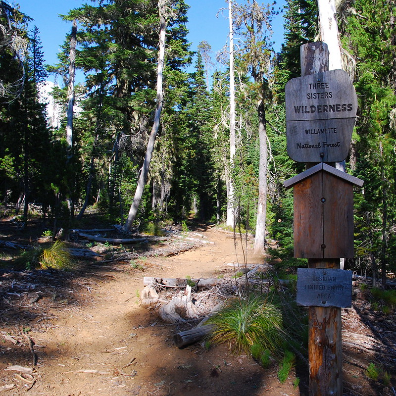
Things eventually straighten out and a couple minutes later I’m at the Scott Trailhead, dodging mosquitoes and changing into my running shorts, half naked in the middle of an empty parking lot, running back and forth to avoid the bugs. I must look so ridiculous. I imagine a ranger pulling in and laughing too hard to make a fuss.
2.
A little history. The Scott Trail used to be a road. It was actually the first major east-west route in Central Oregon, built a decade before McKenzie Pass, where the road is now. In 1862 Felix Scott, the son of one of the first white settlers of Lane County, brought fifty men up to build the thing as a business venture. Gold had been discovered in Eastern Oregon in the 1850s, causing a miniature version of the rush that was happening in California around the same time, and Scott wanted to capitalize by selling cattle and other goods to the newly rich miners. Before that, though, he had to get over the Cascades. He and his men started near the McKenzie River and, in a single season, cut a route through the woods and rocks to that flat plains of eastern Oregon. Much of his route is still preserved as the McKenzie Highway. But Scott’s path detours from the present-day highway in one important respect. Whereas the highway pushes straight though the lava flows around McKenzie Pass, when Scott reached the lava he jotted south to avoid it, passing between the lava fields and mountains to what’s now called Scott Pass. If you look at Satellite images, it actually makes more sense: the highway unnecessary runs through a lava flow that it could easily avoid, whereas Scott’s route takes the path of least resistance. For a while, Scott’s pass was the pass.
Things changed in 1872, when John Templeton Craig, who had actually worked for Scott on the original expedition, cut a new route, a toll road, directly through the lava, saving travelers a few miles and a thousand feet of elevation. Craig’s route became the default, and Scott’s fell into disuse until it was re-purposed as a trail many years later.
Craig, incidentally, was a strange dude. Despite deep, often-impassable snow drifts in winter, he insisted that his route should be kept open year-round. To prove the point, he would carry mail over the pass in the dead of winter. Around Christmas of 1877, Craig left on skis with a bag full of letters bound for Sisters – then a small military outpost called Camp Polk. He didn’t ever come down. A few months later, they found his frozen body in a cabin he’d built at the edge of the lava near McKenzie Pass. The best guess is that he couldn’t find wood to start a fire.
When you see Craig commemorated now, it’s almost always as a lowly letter carrier who died in the line of duty. In 1930, the Oregon Rural Letter Carrier’s Association built a grave where he died with a plaque to that effect. But that’s not exactly right. He died on his road.
In 1898, Craig’s road was made public and renamed the McKenzie and Eastern Oregon Road. It was still dirt and rock when the first automobile passed over it in 1910. In 1925, the state of Oregon designated it as State Highway 126, then, in 1926, the federal government designated it part of U.S. Route 28. With the federal designation brought an influx of cash for improvements, especially in the upper sections, which were then still largely unpaved. Thus improved, the route remained the major east-west passage in central Oregon until 1940, when U.S. Route 20, which had previously only extended as far west as Yellowstone, was extended to Albany, passing through the Cascades at Santiam pass, just north of McKenzie. The two routes coexisted for a while, but, in 1952, Route 28 was decommissioned, and, in 1964, Highway 126 rerouted away from the pass on the Clear Lake Cuttoff to join Highway 20 near Lava Lake. The old McKenzie Pass Highway became Oregon Route 242, a primarily scenic drive.
3.
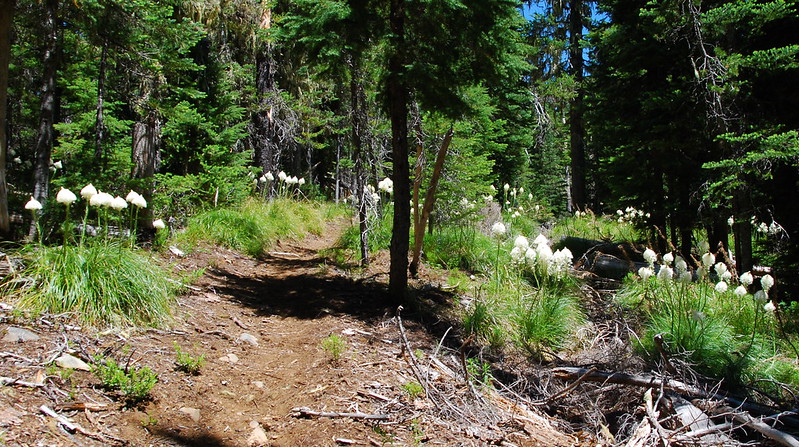
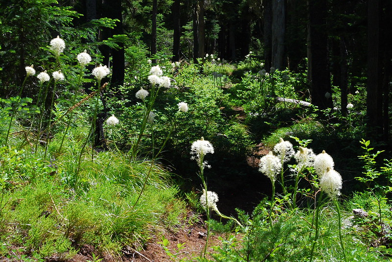
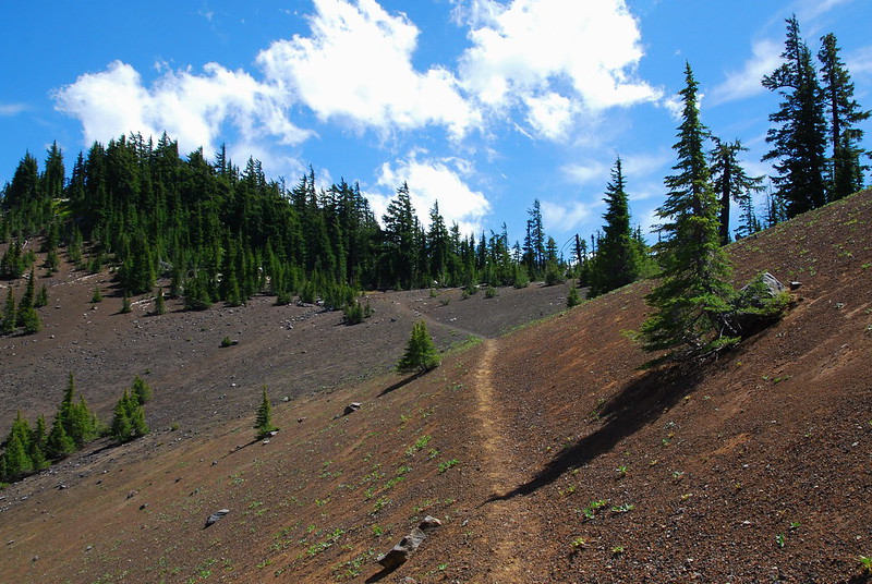
It’s easy to see why Scott preferred this route to the lava fields further north. The first few miles run through pretty, open, unexceptional forest. There are some nice beargrass blooms, though, to add punctuation.

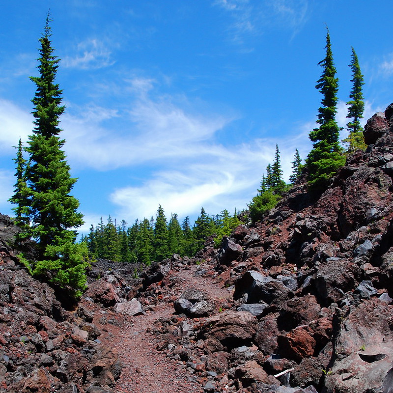
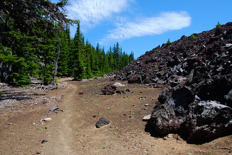
After a few easy miles, the trail emerges into more open terrain, as it runs at the edge of the lava.
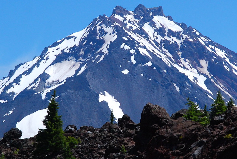
North Sister:
4.
There’s a lava pass of sorts, as the trail skirts a thin strip of forest between lava flows from the Four in One and Collier Cones. Then things open still more, as the jumbled rocks dwindle down from tennis balls to peas and thin sand.

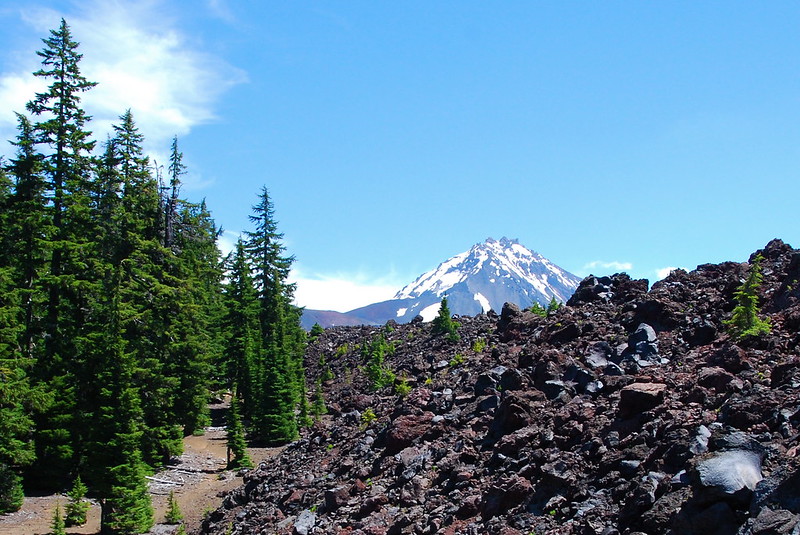
Around Four in One Cone come the first views north, toward Jefferson (and a very faint Mt. Hood):

5.
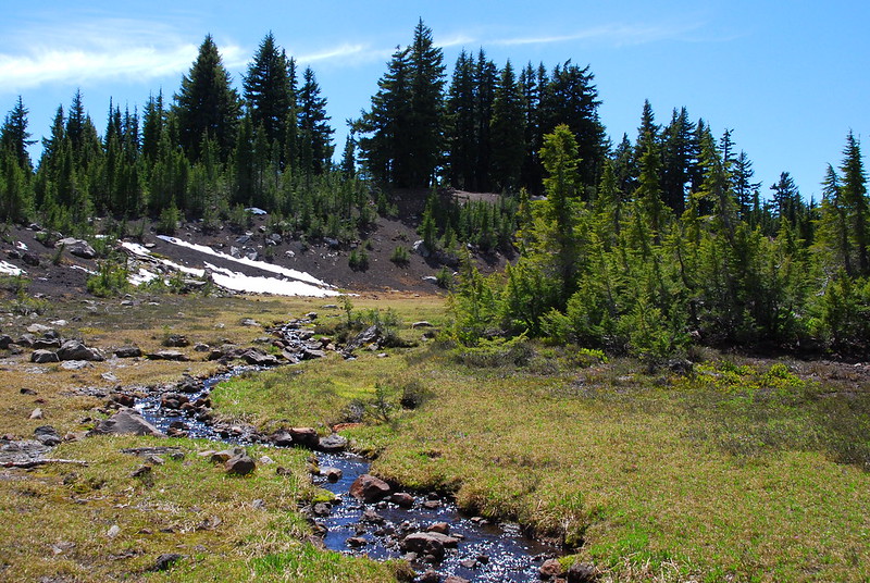
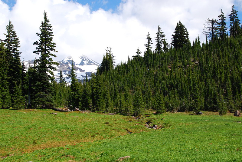
Around Four in One Cone I run into the first people I’ve seen all day, a jolly couple doing an out-and-back. They tell me I’m in for a treat at the meadow just west of the Ahalapam Cinder Field where the Scott Trail ends and the PCT begins. When I get there a few minutes later, it’s beautiful.
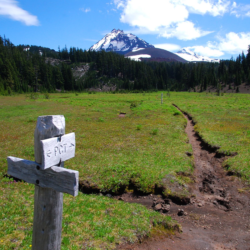
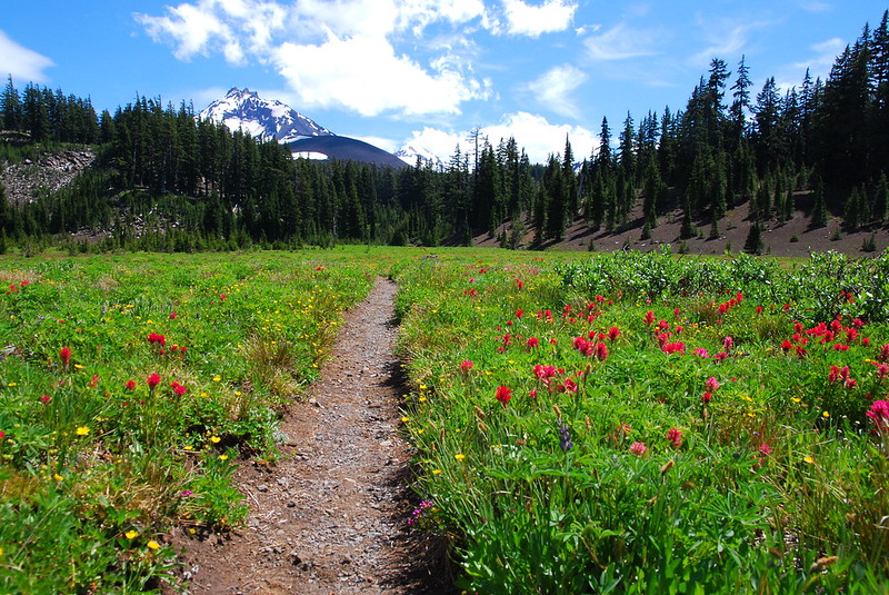
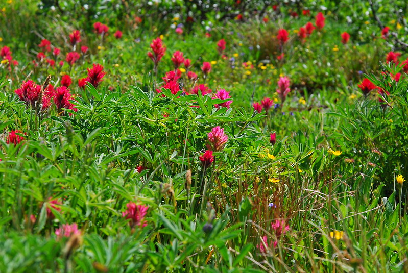
I love seeing the meadow in full summer mode, even if summer mode’s coming a couple months too early this year. The last time we were here, things were… different:
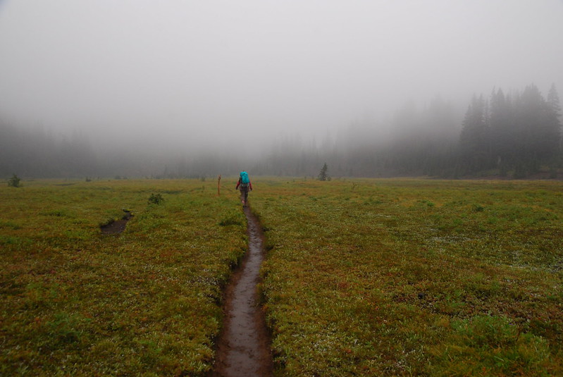
6.
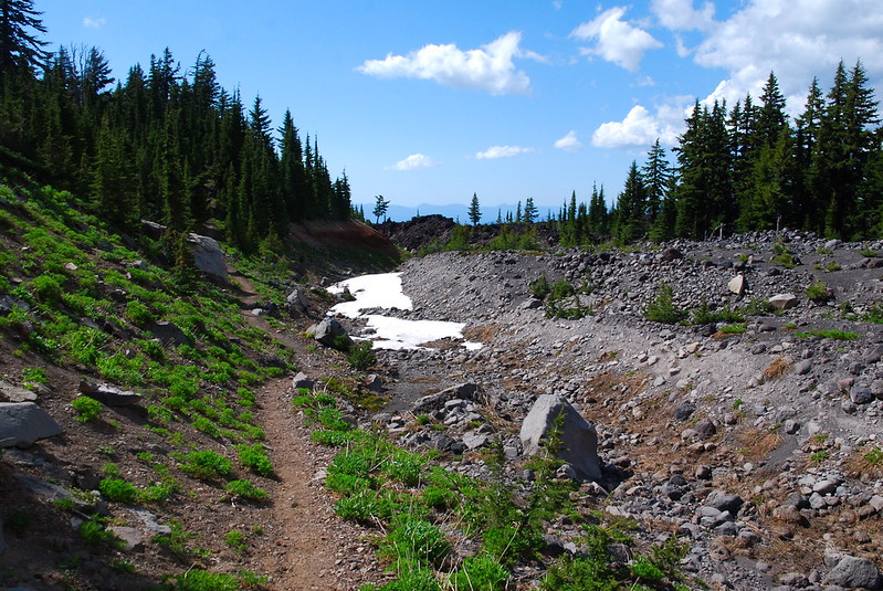
Scott’s original route follows the PCT north, but after the meadow I go south and follow the trail up a few pleasant hills to Minnie Scott Springs. I’ve been expecting snow – mentally preparing to get turned around by it – but there’s absolutely nothing.
At least the spring is still running. The thing’s usually year-round, but this year I don’t know.
Scary.
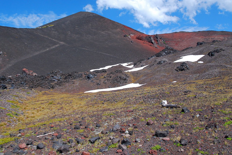
7.
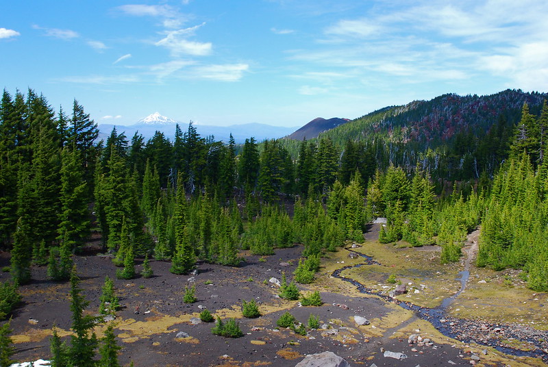
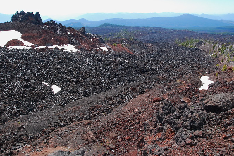
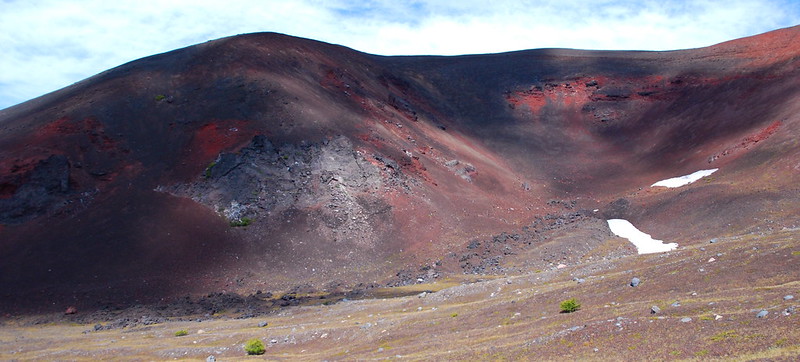
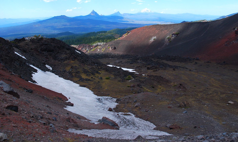
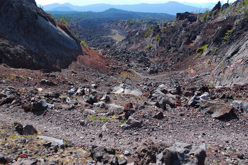
I stop at the springs to splash water on my arms and face, play around like a kid until the mosquitoes find me. Then it’s on to more lava flows and Opie Dildock Pass. The pass is at the west side of the Collier Cone, which, 1500 years ago, sent lava miles and miles down toward the McKenzie. If you look west from the pass, jagged red fields still stretch to the horizon. Intrepid trees grow on the edges, but in the center it’s still all sharp shrapnel in the baking sun. One gets the impression that here the earth’s not quite finished being built. It’s otherworldly, and totally, totally beautiful. I just bliss out for a while, taking pictures of everything.
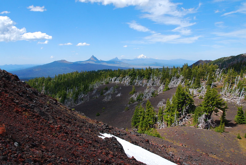
From left to right: Mt. Washington, Three Fingered jack, Jefferson, and Hood:
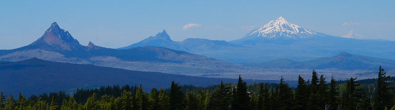
If you look carefully, you can see the flow:
8.
From inside the Collier Cone, the mountains are a convoluted mess of rock and snow. I spend a while trying to suss out where one ridge ends and the next begins but fail miserably.
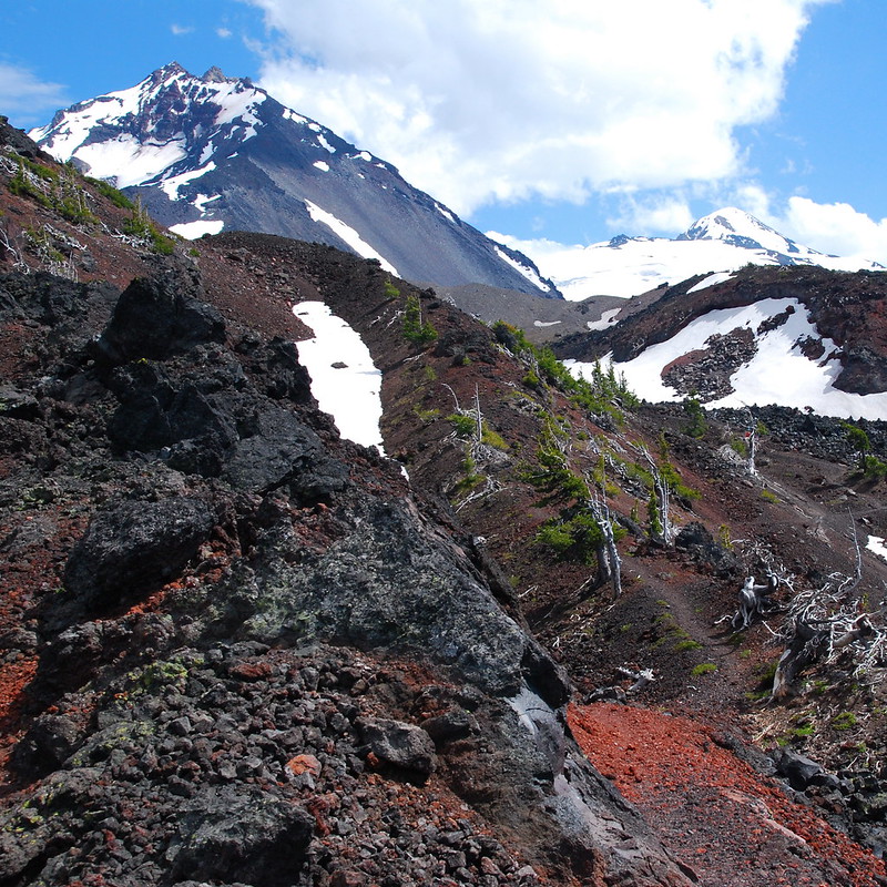
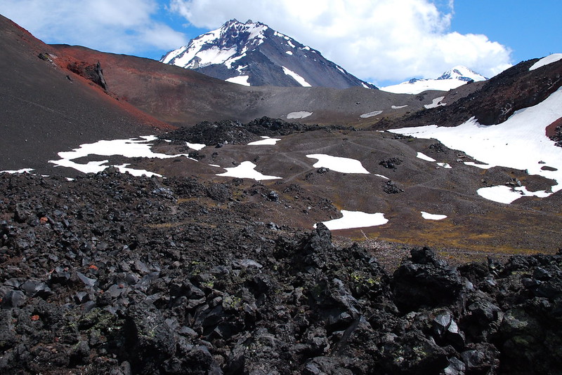
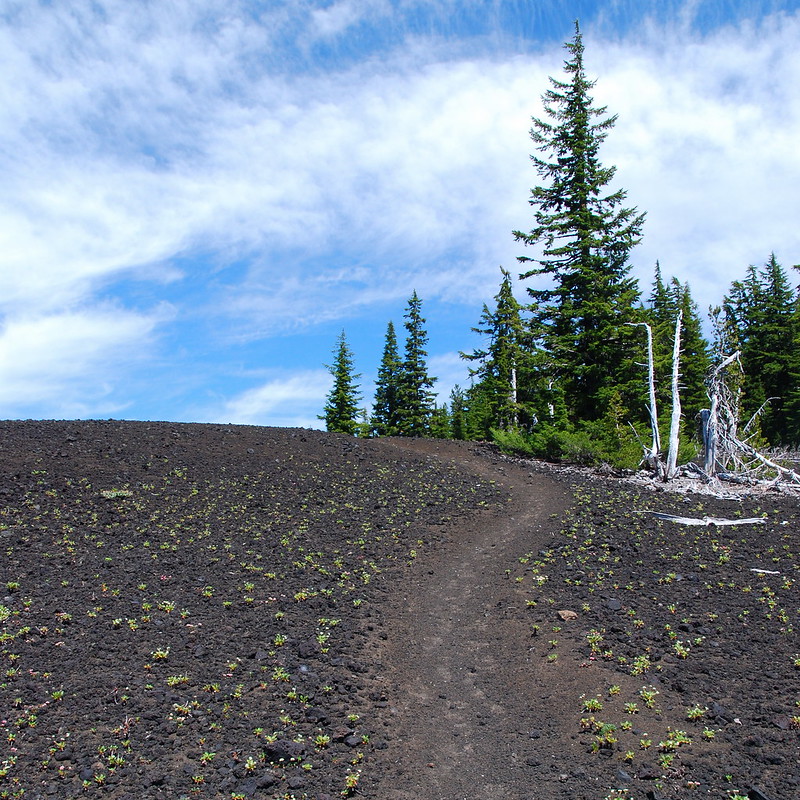
I’m doing pretty good on time – apparently, even with breaks, I walk three miles an hour uphill now, which is sort of nice – so I decide to take the well-worn, if braided, trail up to the top of the Collier Cone for lunch. Pick a path!
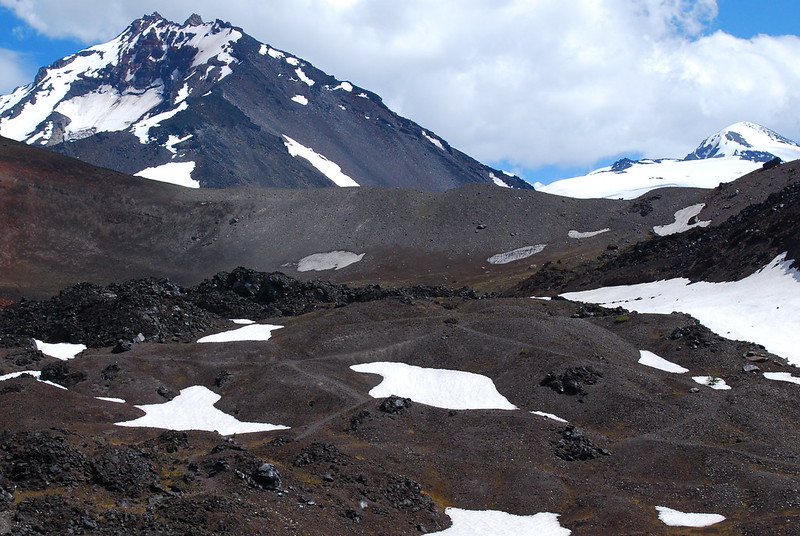
The inside of the cone looks like Mars.
9.
The view from the top of the Collier Cone is just amazing. It’s probably my favorite place in the Sisters. The boot path to the top is on a lot of maps – “Collier Glacier View Trail” or something like that – but it still somehow feels like a secret. No one’s here. Why is no one here? Driving along the McKenzie this morning, I passed overflowing parking lots, full of boats and coolers and shirtless dudes in baseball caps. But this place is empty. I’m grateful, but I don’t understand.
As I’m walking around taking pictures, a few backpackers pass below on the PCT, a set of slow, tiny dots. I almost yell down that they should come see this.

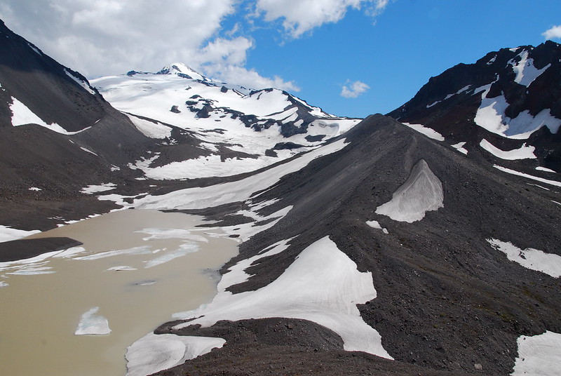
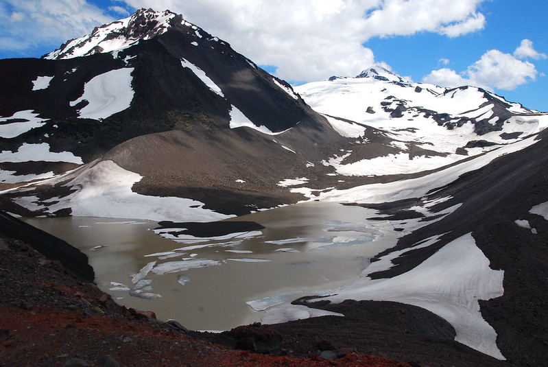
10.
A century ago, the Collier Glacier extended all the way down to the base of the cone, where the silty lake now sits. According to Portland State’s excellent Glacier’s of the American West:
Until 1924, Collier Glacier extended from the saddle between North and Middle Sister to the base of Collier Cone. Between 1924 and the early 1950s, however, Collier underwent a drastic retreat of about half its 1910 length. Since then it has continued to decrease in area, but at a much slower rate.
Huh.
Here’s what the glacier looked like in 1936, before its major retreat:

11.
I spend an hour eating, taking pictures, and generally trying to avoid leaving. But eventually I have to pack up, head back down to the PCT, and continue south.
Just after rejoining the trail I run into the backpackers – three big dudes with bigger packs – taking a long break, sitting on sharp rocks looking grave. One’s got a first aid kit cabled to the outside of his pack. It’s very nearly the size of my entire daypack. Another’s got an ice axe. They’re all wearing shiny leather boots.
I’ve been told that I have a tendency to get a little too jaunty in the mountains, so I try to tone things down a little when I talk to them, and solemnly ask how it’s going. The youngest of the three, a guy probably not much older than me, answers in a voice that more than matches my solemnity. He tells me it’s brutal up here. Brutal? What? It’s sunny and mild with a gentle breeze. I ask where they’re coming from and, with a weird breath of hesitation, the younger one tells me Matthieu Lake, a pleasant pond a few miles north of where we are. I smile and try to sound bright, say that it’s beautiful up there. It is. But the guys are all stone faced. I’ve seen happier people at funerals.
Clearly getting nowhere, I make one last go of it, asking where they’re headed. Apparently they’re going to try to “trek” “all the way” to Linton Meadows, a gorgeous grassland a little south of Obsidian Falls. Without thinking, I say that the flowers there are probably amazing right now. This is apparently a wrong turn, and they all frown in unison. These are Serious Men on a Seriously Manly Trek. They’ve got Serious Gear for the Seriously Brutal Conditions. They do not like flowers. I get the impression that they are vaguely offended by the existence of flowers at all, as they add an unwelcome air of femininity to the otherwise masculine mountains.
Their attitude’s familiar, but I don’t understand it. These guys are treating hiking like it’s some sort of epic quest. And sure, things are sometimes difficult – people fall, muscles get sore, gear breaks, it gets cold, rains or snows, trails wash out. But ultimately the only reason to be out here is because you love it. People forget that, treat it as though it’s an almost moral journey, a conquest of nature for the good of mankind. That’s bullshit. There’s nothing noble about hiking, nothing heroic. It’s a privilege, something we’re lucky to get to do for ourselves.
Anyway, it’s time to go.
I say my goodbyes to silent, sullen faces and continue down the pass, trying vaguely to sashay. I’m not actually all that sure what sashaying is, but I think it’s got something to do with swinging my hips, which I do. Vehemently. Would it be too much to skip?
12.
A quick aside about the name “Opie Dilldock.” Although people sometimes assume that the pass was named for someone involved in trail construction, it’s actually named for an early twentieth century comic book character, “Old Opie Dilldock,” famous for telling tall tails about getting out of tough situations:
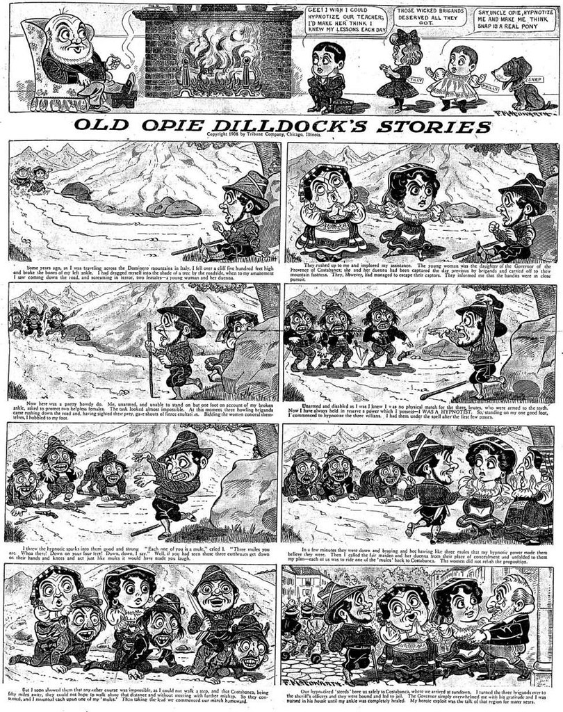
(You can read more of the comics for free here.)
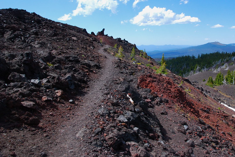
Despite the sharp, uneven terrain, the trail itself is luxuriantly smooth, and suddenly the name makes total sense. You could easily skip down the thing.
13.
South of the pass, the trail again heads into the woods for a while, before emerging at Sunshine Meadow in the Obsidian Limited Entry Area. Into the trees:
And out of them. Glacier Creek and Sunshine Meadow:
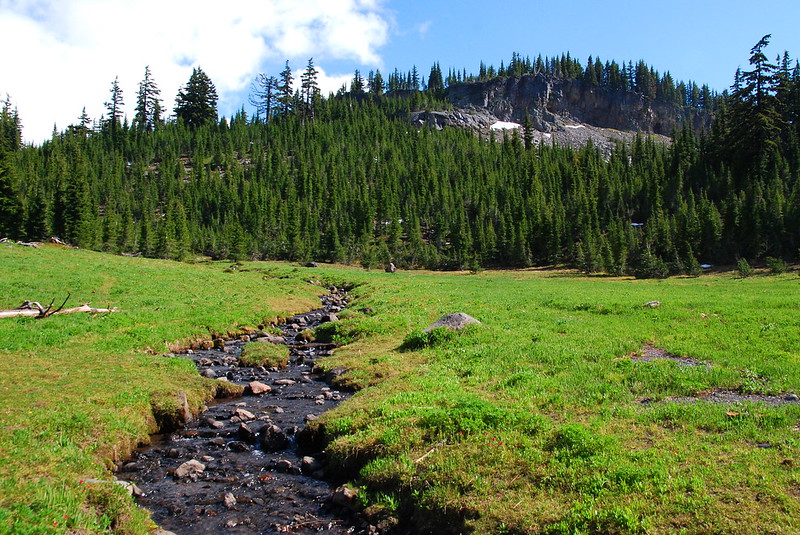
Clouds descending over Middle Sister:
14.
I’m still doing okay on time, but not so okay that I have time to lollygag, so I put the camera away for a while as I walk through Obsidian and back into the forest on the way to the car. From the meadow onward the mosquitoes are very excited to see me. As usual, walking fast seemed to be the best defense.
I make it to the bottom of the Obsidian Trail around six-thirty, and back to the Scott TH shortly thereafter.
Crowded!

I like walking through Obsidian again. Krista and I backpacked here a couple years ago, when we were first getting into this stuff. I remember our hike out then being exhausting. But this time it was over before I even really noticed that it had begun. I love that.

2 thoughts on “R Solo: Scott Trail / Obsidian Loop (Three Sisters)”