So. This hike’s from two months (!) ago, but I’m somehow just getting around to posting about it now. Something about the holidays and school and and and… I actually started to write it once, but it didn’t seem to fit here, so it became the first post on my new blog, which is also about hiking, but is more… personal?
Anyway, my last hike of the year last year was with my dad to the north end of Olympic National Park. It was sort of a nice book end: KRock and my first trip of the year was in the Olympics, up near Buckhorn Mountain.
It was my dad’s birthday, and, miraculously, it corresponded with a window of sun. The plan was to start from the Upper Dungeness Trailhead, take the Upper Dungeness Trail to the Home Lake Trail, follow the Home Lake Trail to the National Park boundary where it becomes the Constance Pass Trail, and finally take that past Home Lake and Constance Pass to its high point on Del Monte Ridge. (I’m making it sound more complicated than it is.)
Friday
We left Portland at 4:30. My pops was kind enough to drive, so I slept until we got to the peninsula, and even then I was only vaguely awake until we made it to the bumpy Forest Service road out of Sequim. We got to the trailhead a little before ten. It was cold.
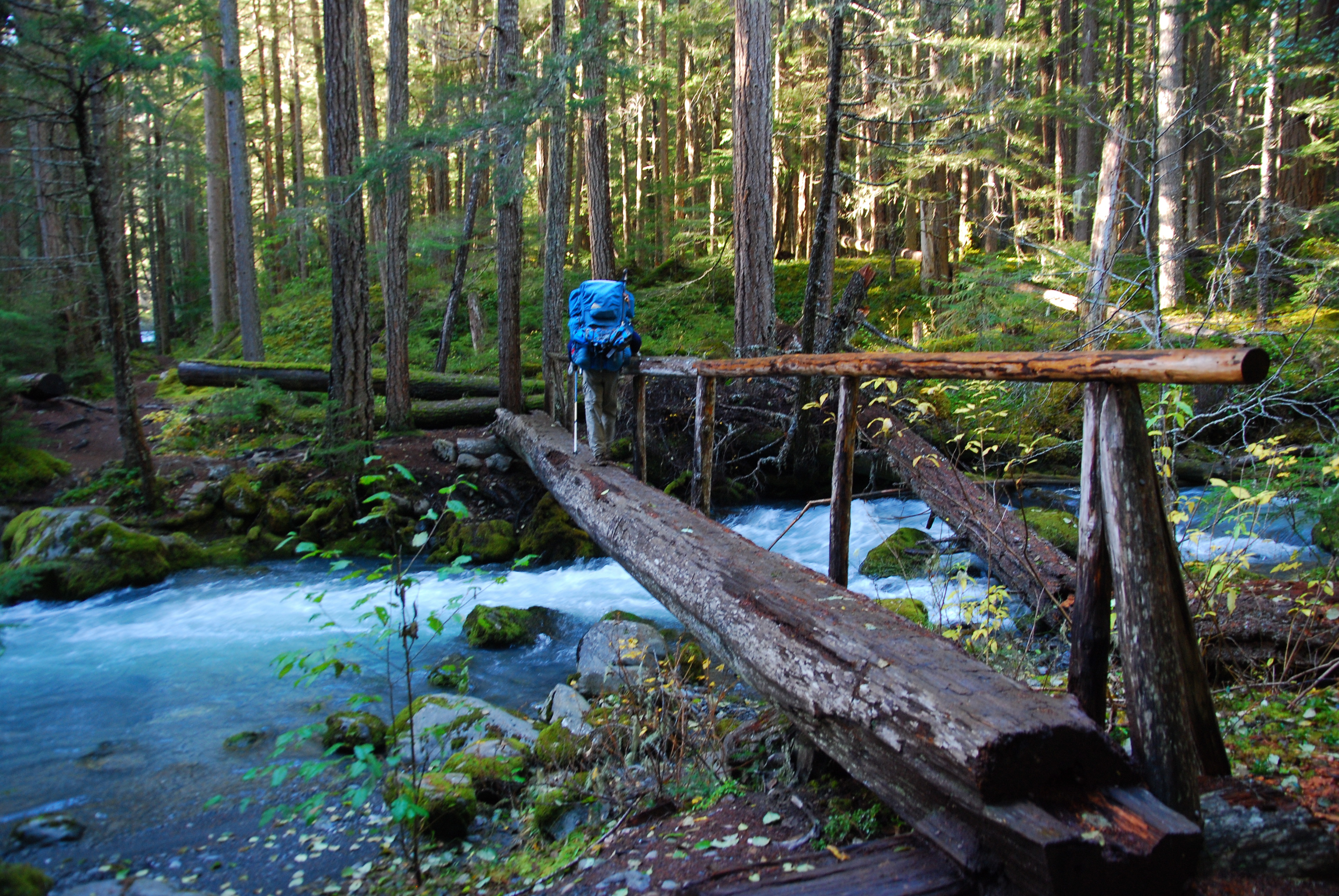
The Upper Dungeness Trail follows the Dungeness River for the first few miles until it reaches a very nice shelter at Camp Handy.
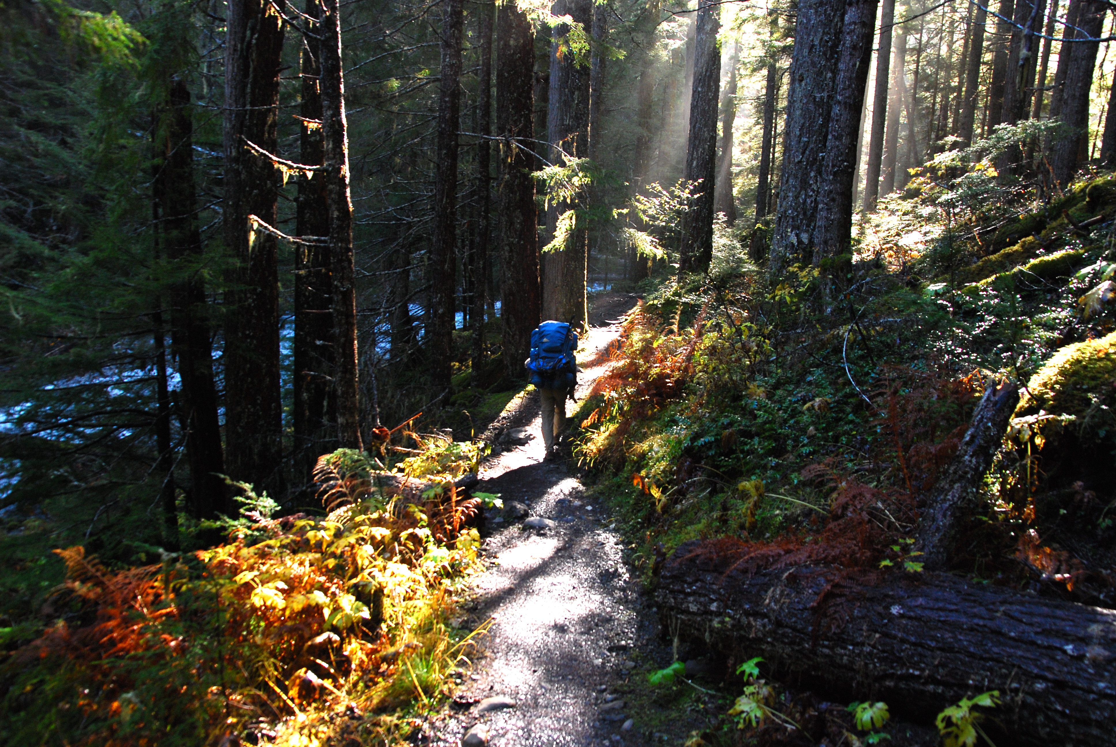
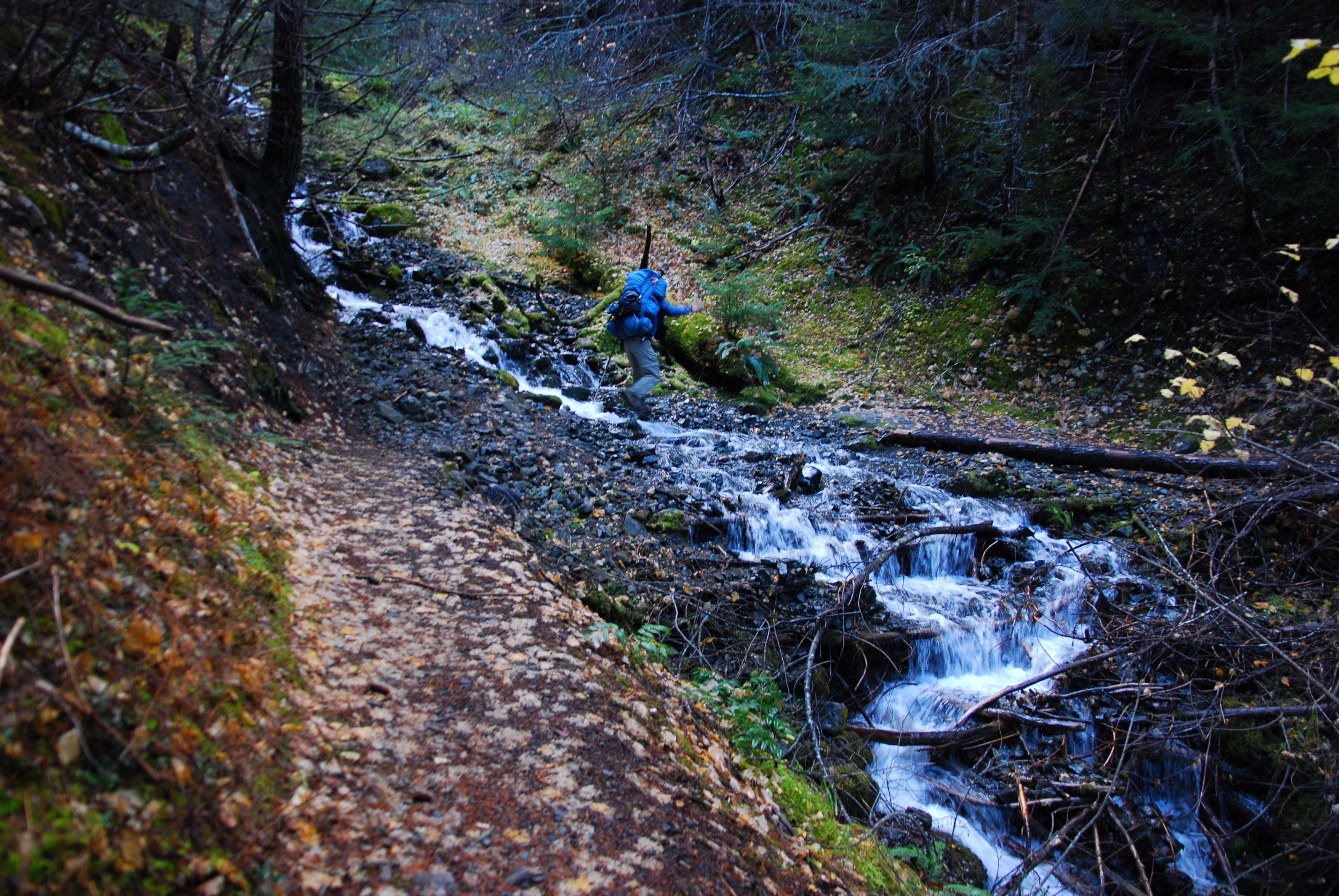
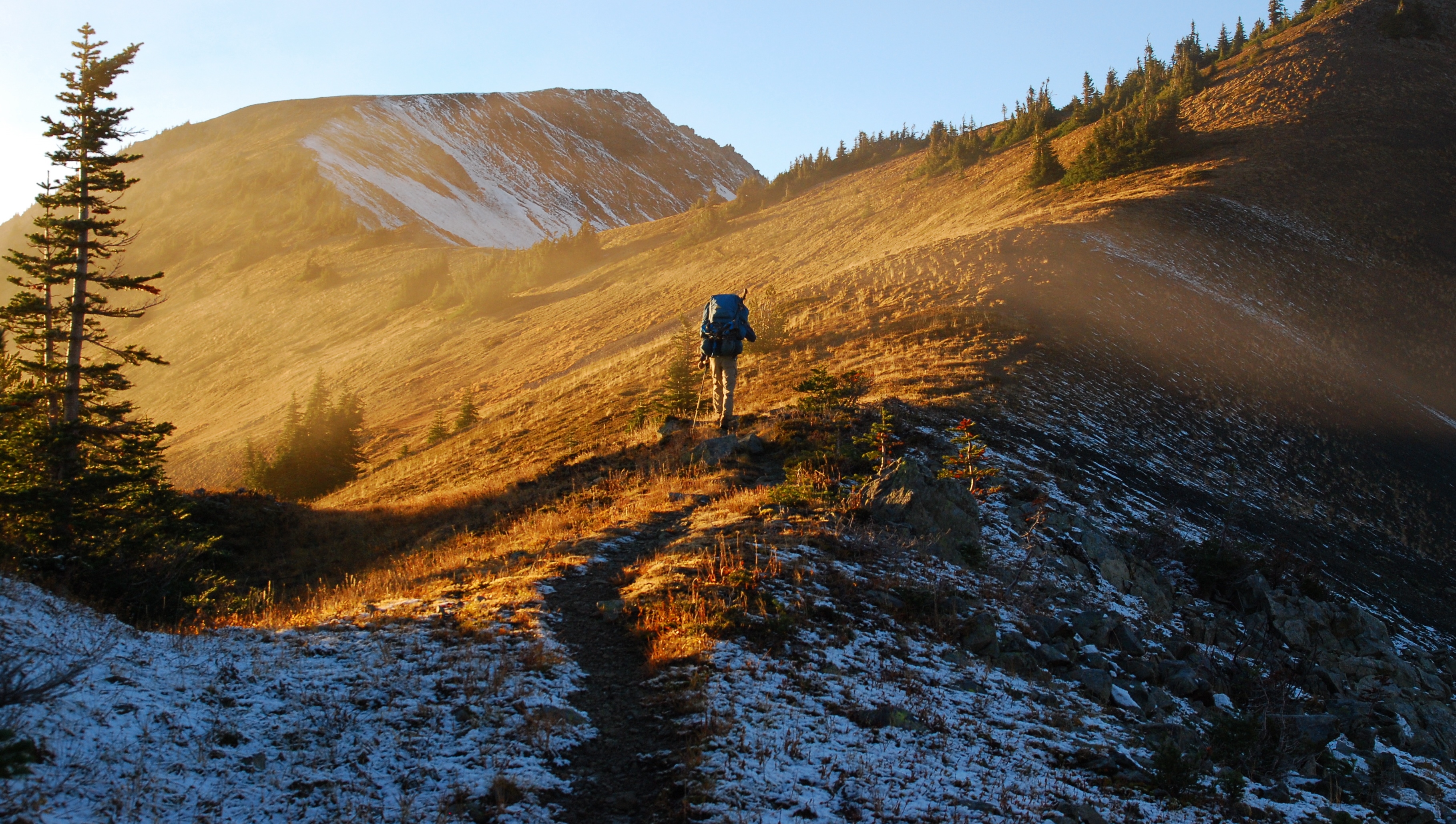
After Camp Handy, the trail forks, with one side continuing along the Dungeness toward Heather Creek and Basin, and the other heading uphill, away from river. We took the latter. At this point, we’d walked maybe three miles and only gained 600′. We owed the trail some elevation. There were a bunch of lovely side creeks, though. It felt a lot like walking up Herman Creek.
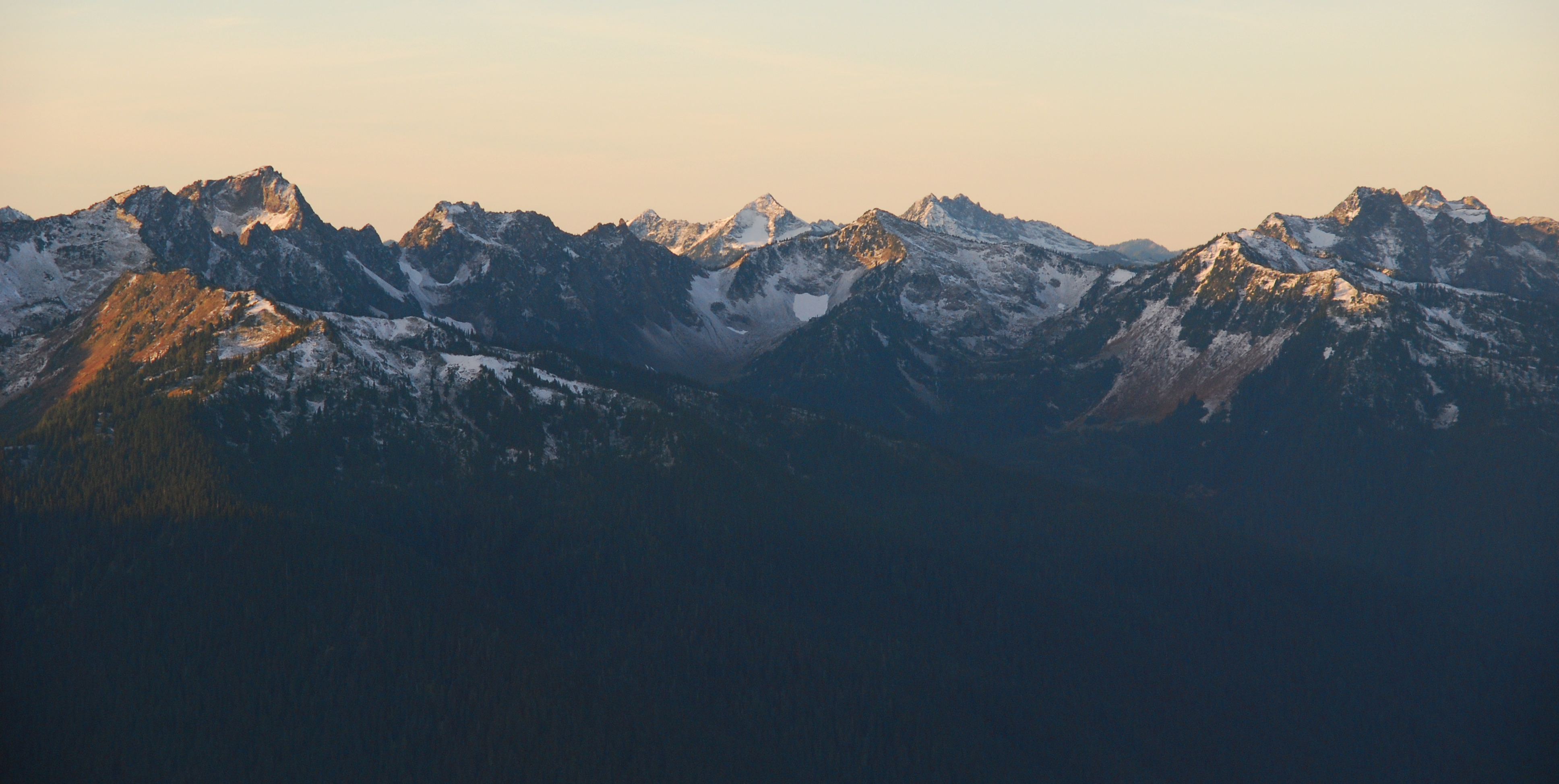
As we ascended, the views opened up more and more, and we could finally see the surrounding mountains.

After a bit of a climb, we hit the Boulder Shelter, and the junction with the Home Lake Trail. This would be a great place to set up camp, especially in foul weather, as the three-sided shelter is big and seemingly pretty well protected. There’s water nearby, and, in addition to the the trail to Home Lake, dayhike options to Charlia Lakes and Marmot Pass. A good reason to come back…
This time we just fooled around for a little while and had some lunch. I’d made some, uh, unwise dining choices the night before (“I bet I can eat half of the salsa in this bottle!”), and, just after lunch, my stomach started to complain a little. Funny how something that small can affect things so much, but I slowed way, way down. My dad’s way faster than me on a good day, and now he was running way ahead. Still, the scenery was a nice consolation. Continuing on the Home Lake trail from the shelter we almost immediately entered the National Park, and the views almost immediately opened up a bit more.

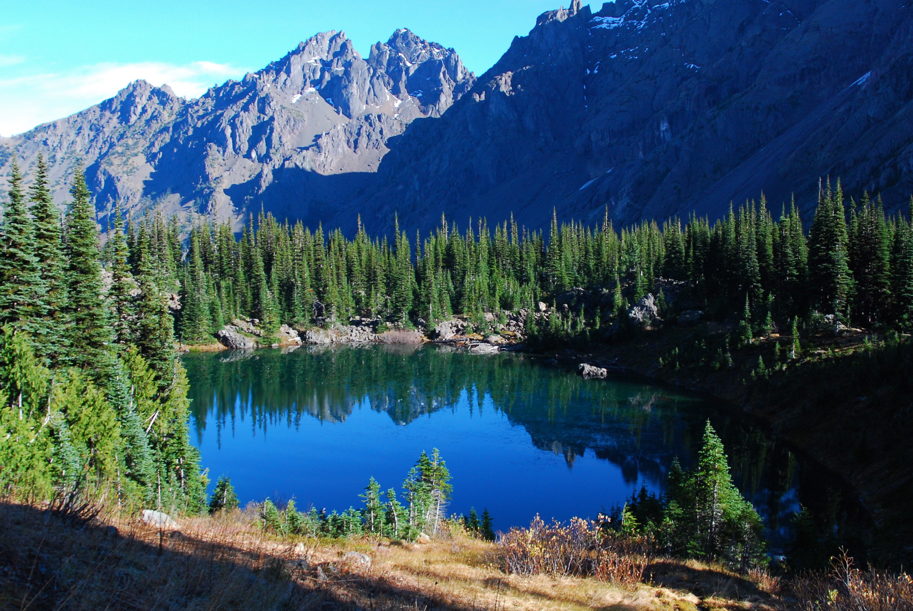
It took us longer that we’d hoped to get to Home Lake, so we just stopped there long enough to get some water for the night.

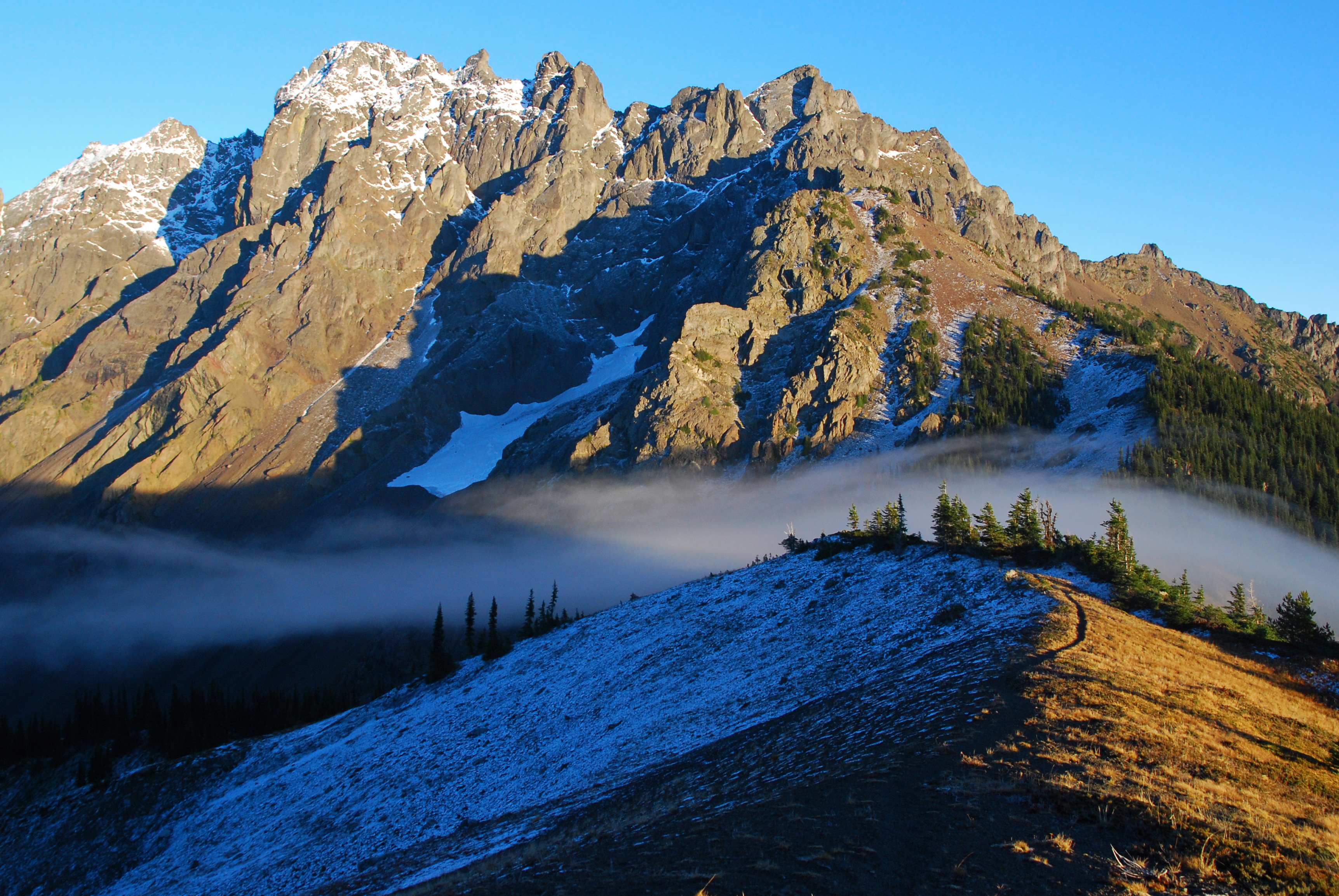
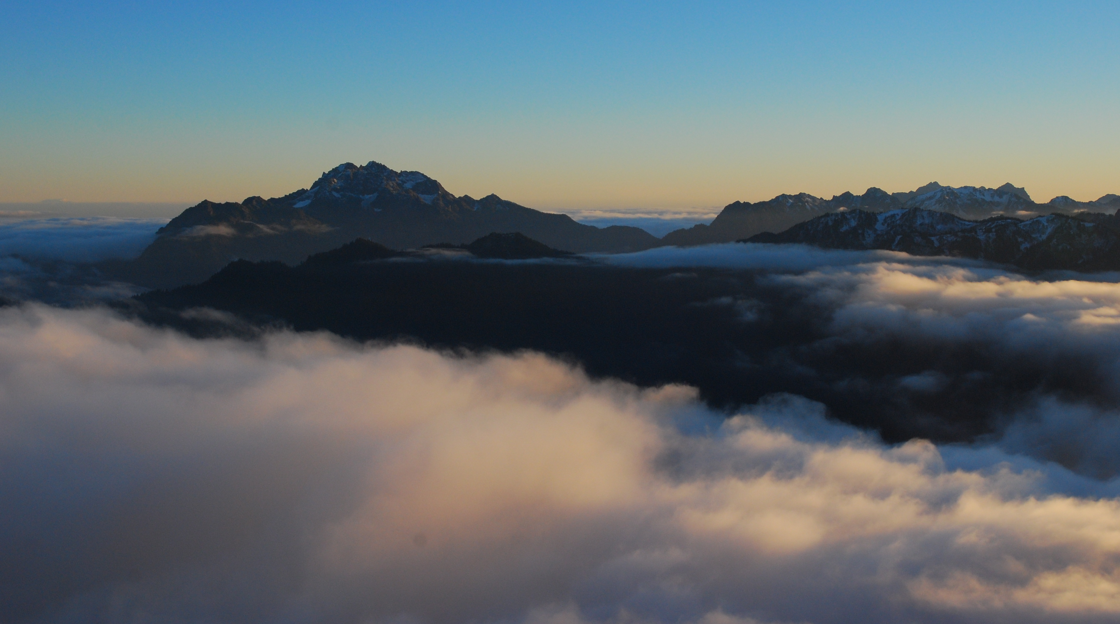
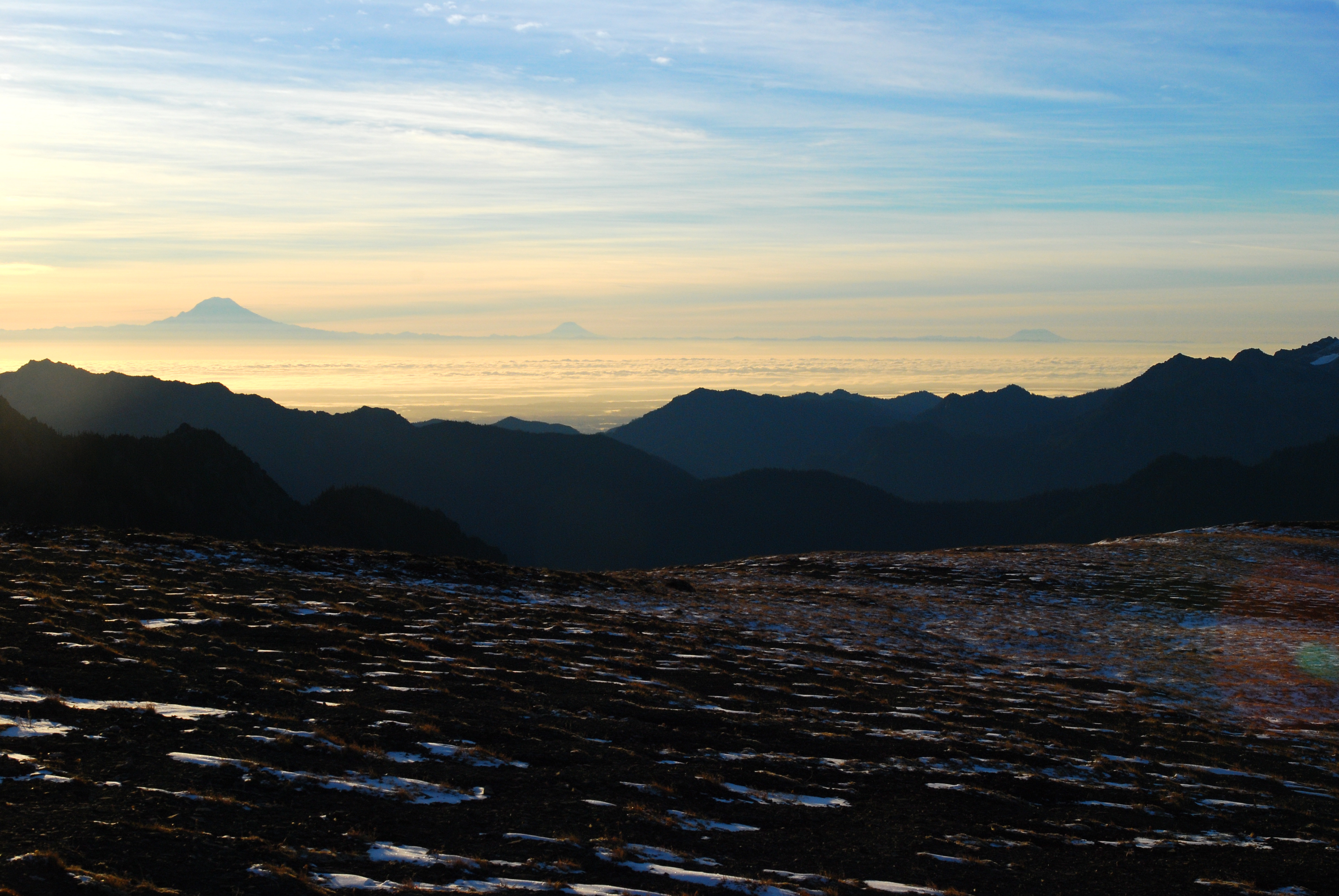
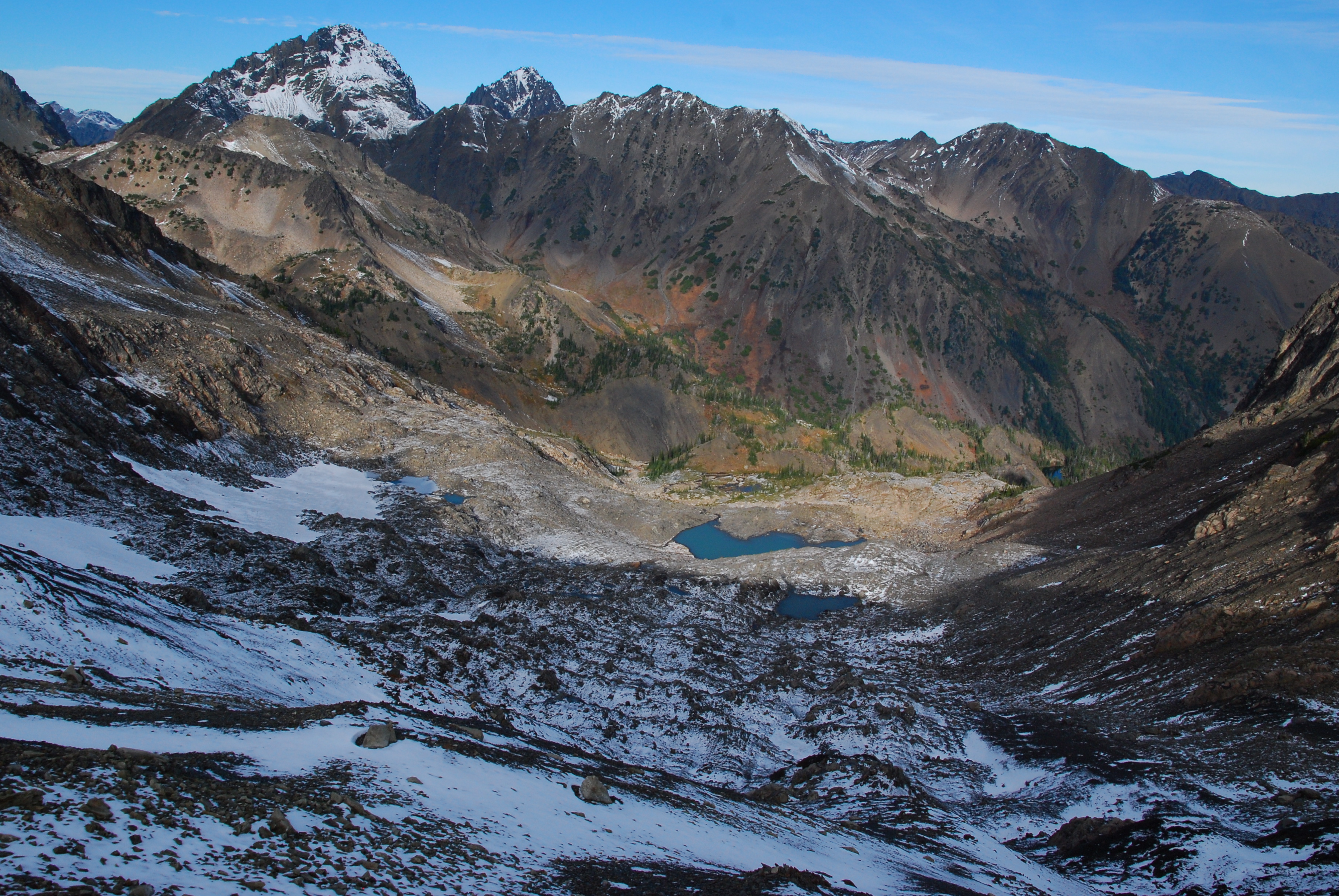
From the lake, it’s only a few hundred feet and maybe half a mile up to Constance Pass, where the views open up to the south over the Dosewallips drainage, to the west deep into the National Park, and east across the Hood Canal all the way to the Washington volcanoes. It was just incredible. We followed the trail as it continued up another 700′ or so to Del Monte Ridge, and just as we got to camp at the ridge’s high point, the sun began to set and all the mountains turned red.

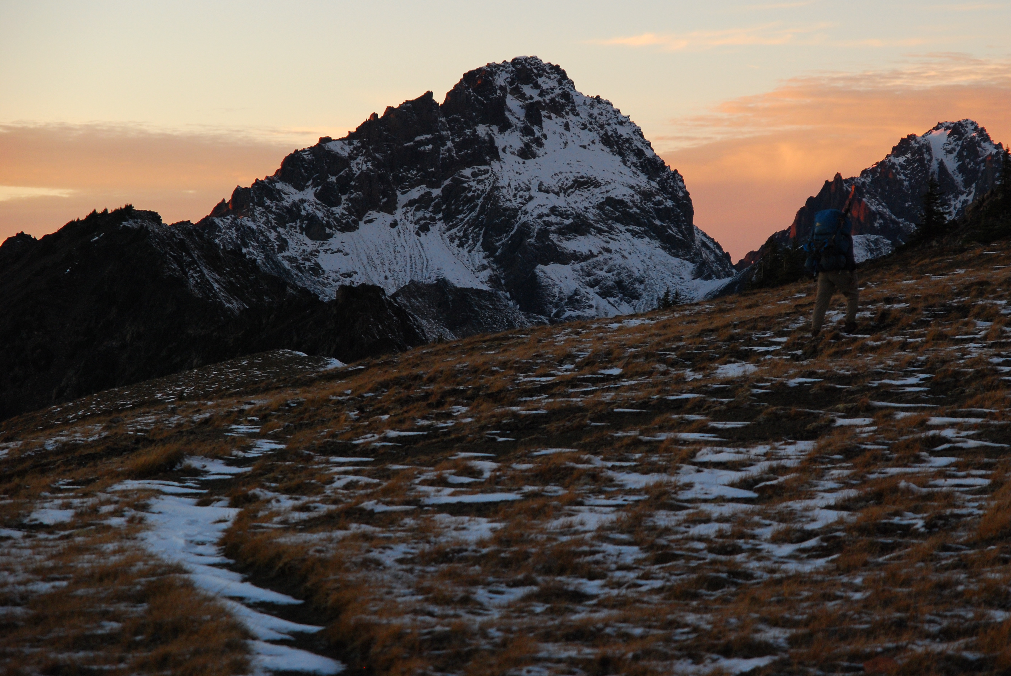

We got the tent and everything set up just before dark, then settled in for a cold, cold night. Night time in the mountains is one of my favorite things about backpacking. I think we drank at least a pint of brandy between the two of us, just sitting out on the frozen ground. I’m glad I got to be with my dad for his birthday.
Saturday
The night was cold – I went to sleep wearing nearly all of my clothes – but we woke up to a clear sunrise over the Washington volcanoes. Before breakfast, I ran around for a while taking pictures of all the things I’d only sort of noticed on the way in, mostly the ranges and ranges of peaks looking south into the Park.
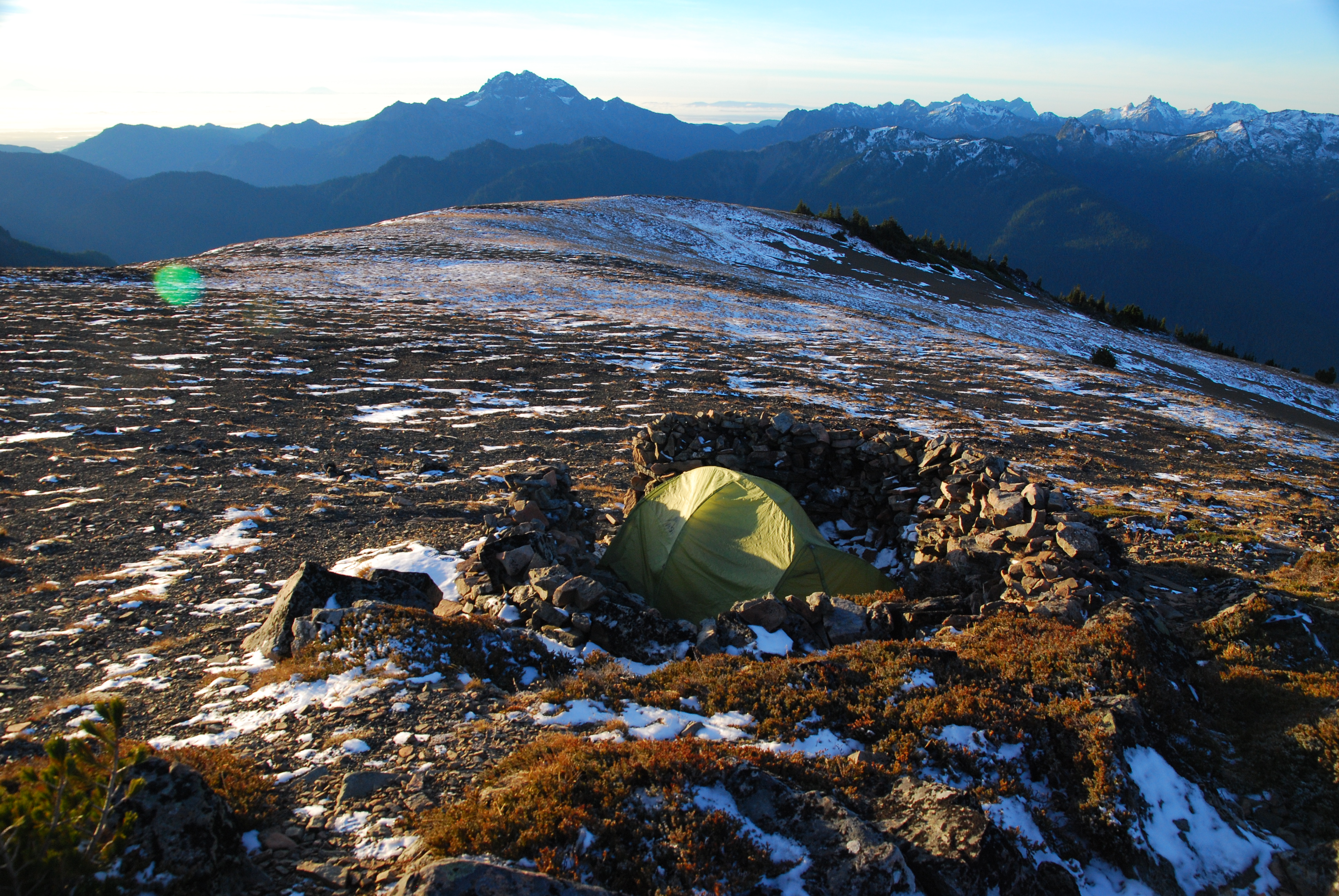
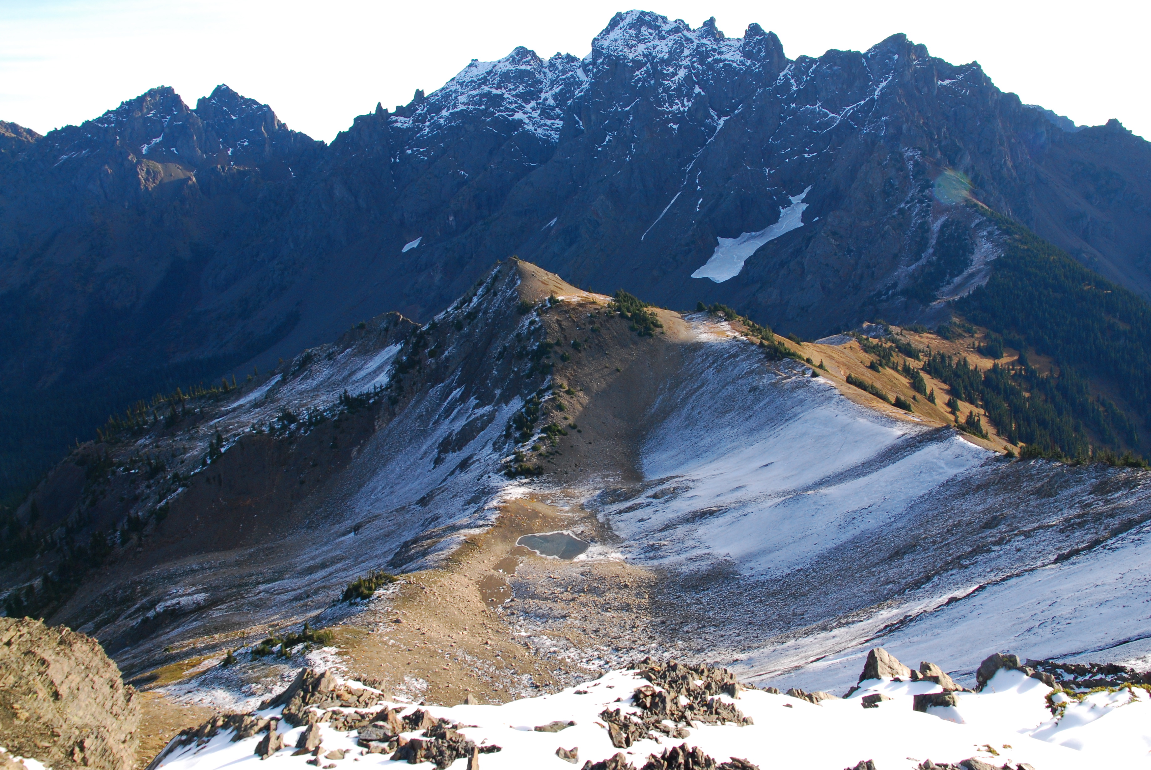

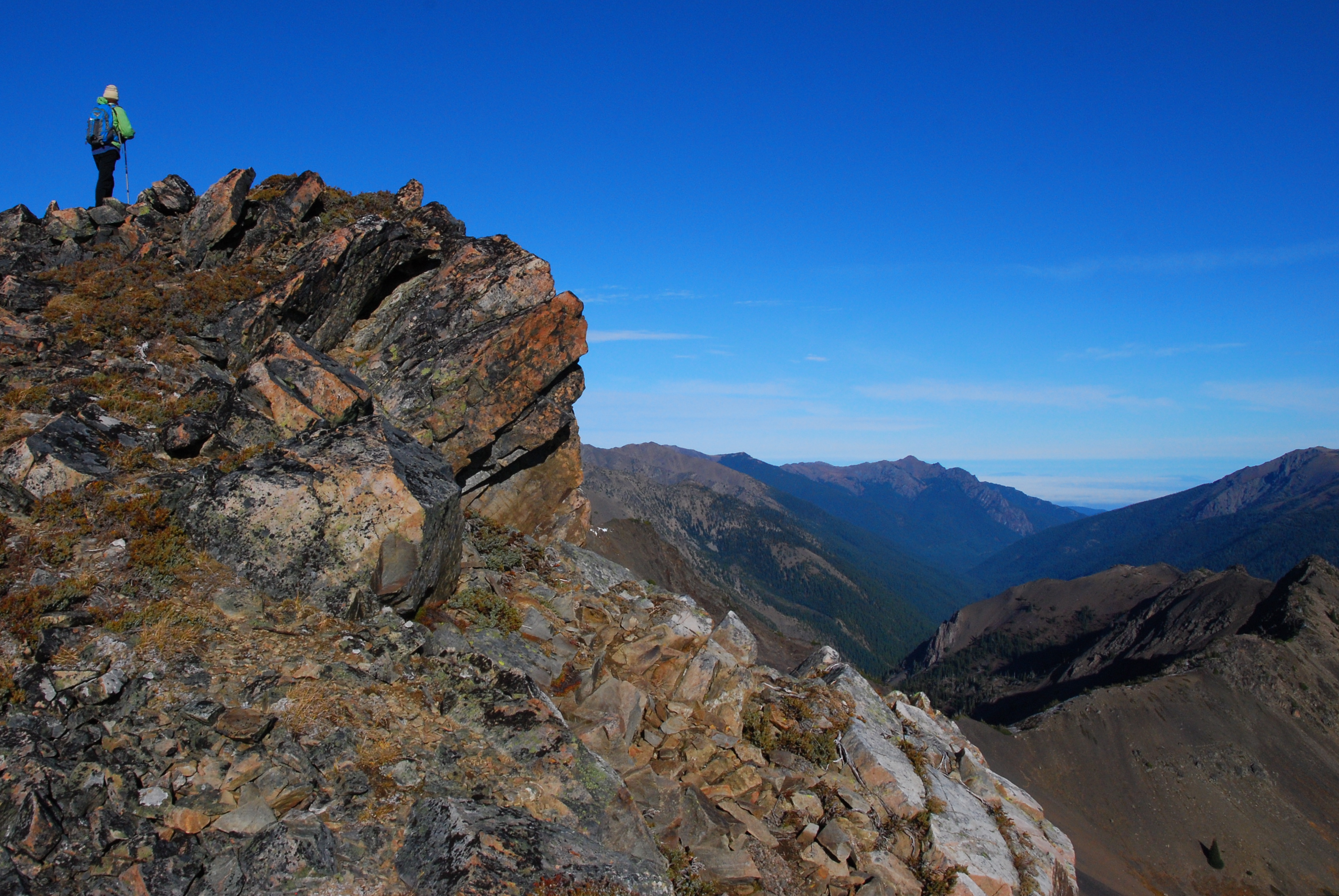
The thing about having something very close to 360° views is that you tend to forget about little things like eating and drinking. But, eventually, we remembered the existence of basic human needs, and had a leisurely breakfast. But we weren’t ready to give up the gawking just yet, so we decided to take a quick jaunt along the remainder of the ridge before heading out. We packed up our stuff then picked our way along the off trail but very easy route. The views changed pretty much every step. At the end of the ridge – or, at least, as far as you could go without some scrambling – there are gorgeous views down into Heather Basin and further still into the Olympic range.
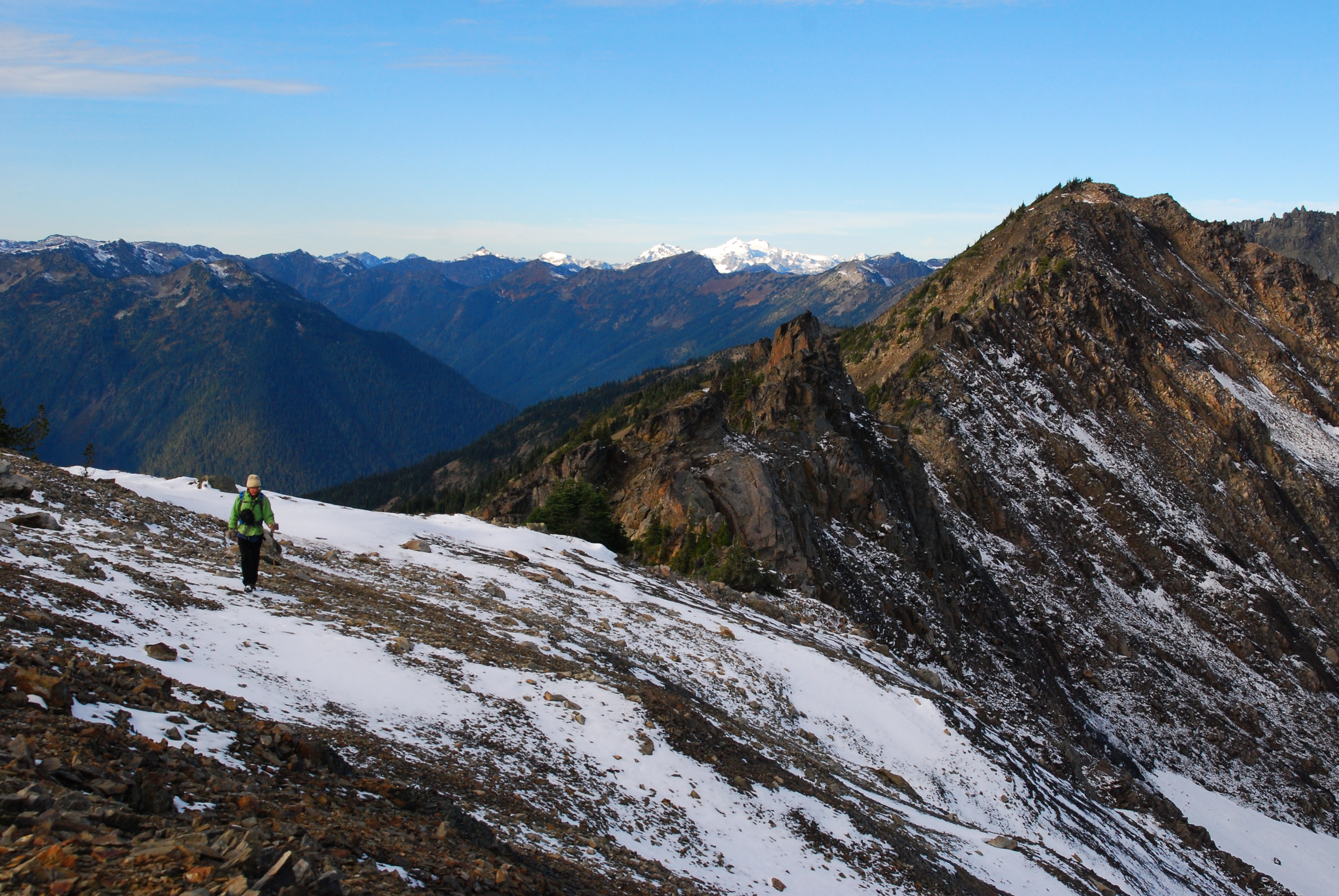

We eventually headed back to camp, picked up our bags, and headed back down to Constance Pass and Home Lake, this time hanging out for a little to take some pictures. Then it was just the usual hike in reverse, back along Warrior Peak, down through the forest to the river, and across a couple bridges.


One thought on “R Solo: Dungeness River to Constance Pass (Olympic NP), Nov. 7-8”