October 26-29, 2017
Every year, my dad and I celebrate his birthday, and also sort of cap off the summer backpacking season, with a hike: last year was Enchanted Valley, the year before that Three Sisters, the year before that the Dungeness River and Constance Pass… It’s always a little bit of a gamble with weather, but we absolutely lucked out this year, for four days and three nights in the heart of Olympic National Park, at the headwaters of the main for Dosewallips, with side trips up several of the surrounding passes.
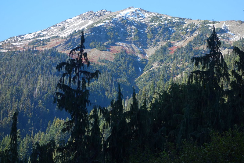
I really love hiking in the autumn: everything feels particularly precious, with the onset of winter, as it happened, less than a week away.
Thursday, October 26
1.
The sun’s just rising over the Hood Canal as our road winds car sick around the water’s curves. Grey sky reflects in grey water in an expanse broken only by a thin black line of land on the opposite shore.
I’m just waking up. My dad’s been driving for hours, since four, but I’ve been snoring with my forehead pressed up against the passenger-side window.
“When you get a chance,” he pauses to take a corner, “would you mind pouring me some coffee?”
I know this routine well, and this road. I think of being a kid, on this same drive, with this same dad.
2.
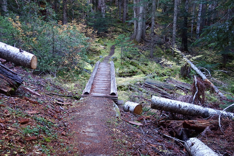
Maybe half an hour later, we’re pulling into the small, makeshift parking lot where the Dosewallips Road now ends. It’s sort of the story of this park: the road used to stretch seven miles further, but it washed out—first in 2002, then again more recently—and it’s now on its way back to a trail.
We ride out bikes up the old road, walking here and there when it’s too steep.
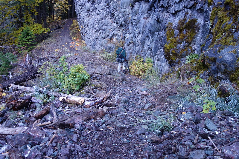
An hour and change later we’re coasting into the old campground. There are still tire tracks here and there, but they’ve faded across the decades. More often, the road’s just a single track now. And the picnic tables look more and more like moldering forest wood.
3.
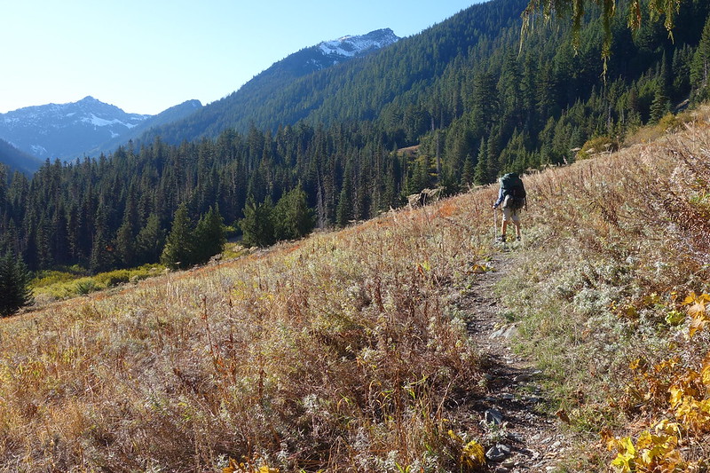
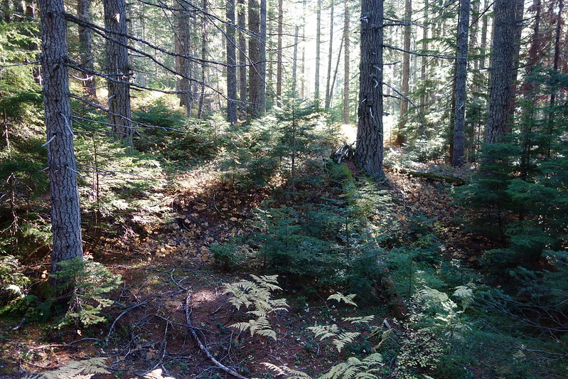
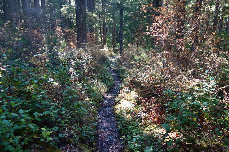
It’s eleven miles from the old campground to Bear Camp, where we’ve planned to spend the weekend, all through mellow, pleasant forest on flat, easy trail. The last time I was here, I was just trying to make miles. And it was hot. It’s easier now, in the fall forest and autumn air.
4.
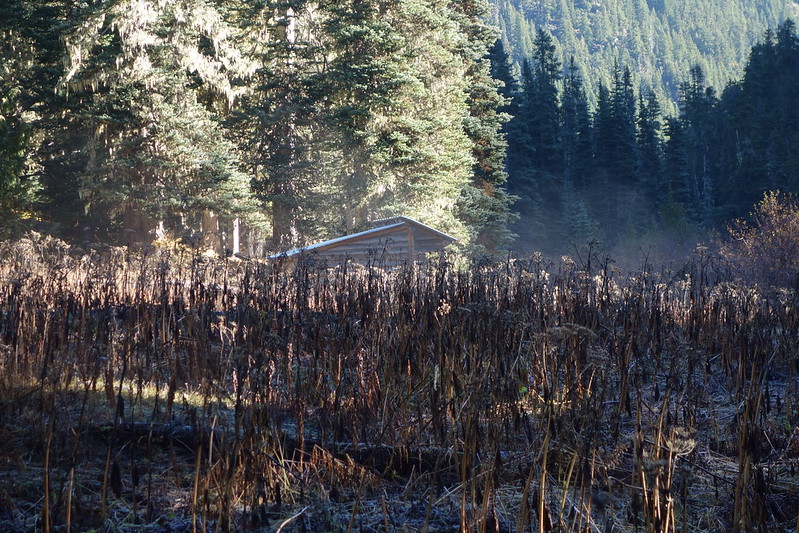
We reach the (posh!) Bear Camp Shelter just after a late lunch, and setup for the weekend. There are three bunks still intact under the roof, with room for a couple more on the floor if need be. There are also of course very nice tent spots nearby. But we setup inside, then start in on a long evening of eating and drinking and cribbage.
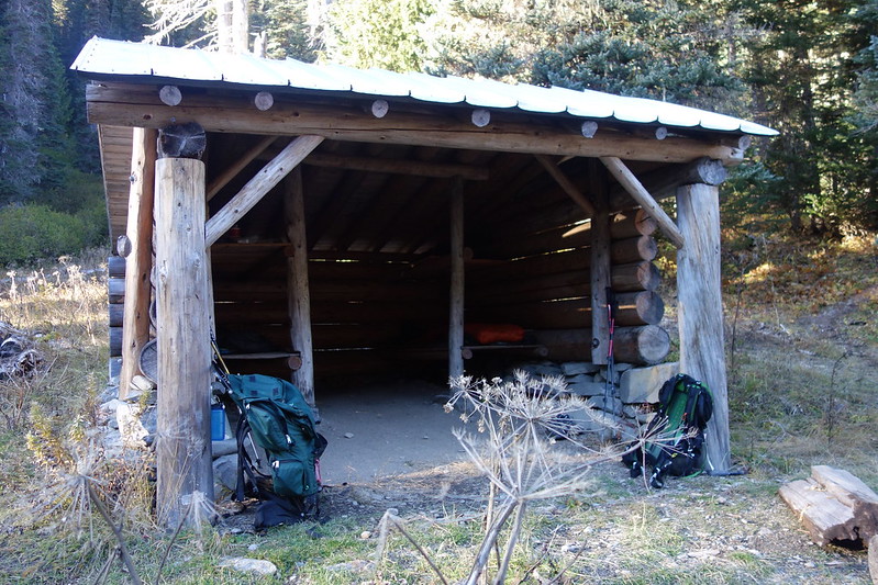
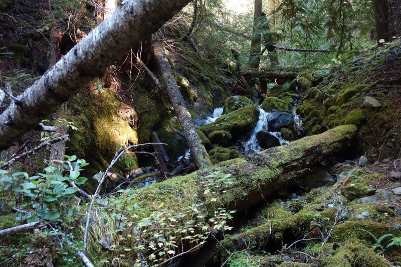
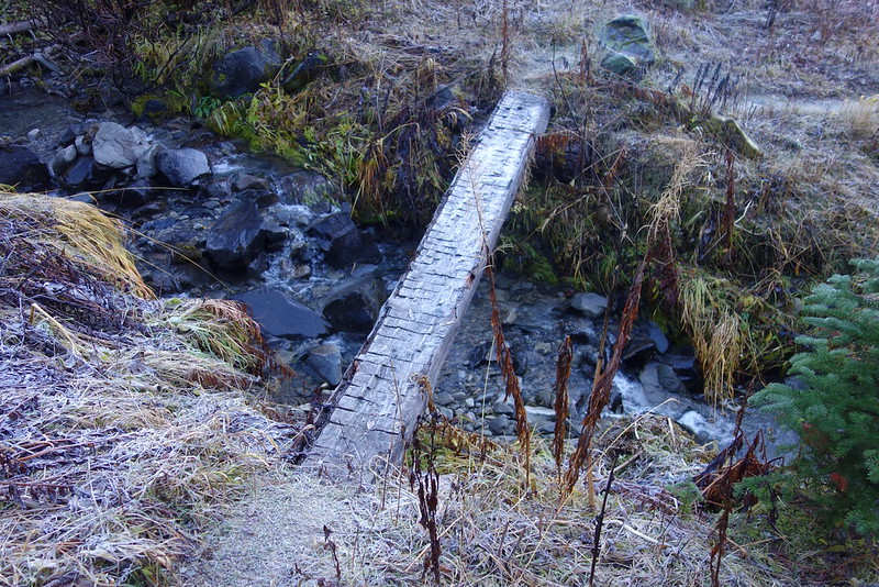
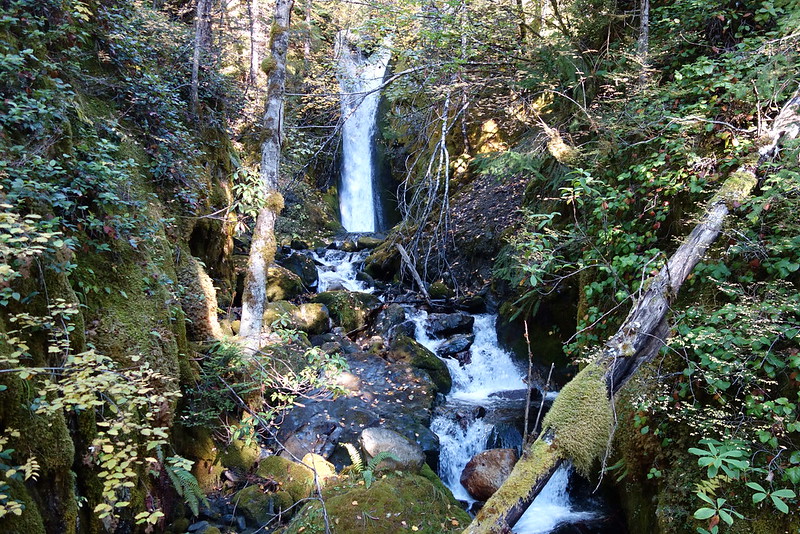
My last time here, it was for a rushed breakfast before climbing Lost Pass. Now I’m falling asleep to Butler Creek’s quiet winter rush.
Friday, October 27
5.
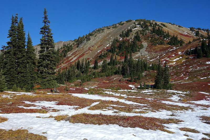
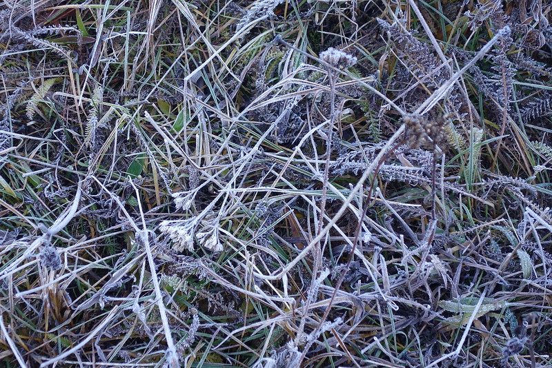
The night is cold, and we wake up to a thick frost. But as soon as the sun hits, things melt, and the morning transforms into something almost like summer.
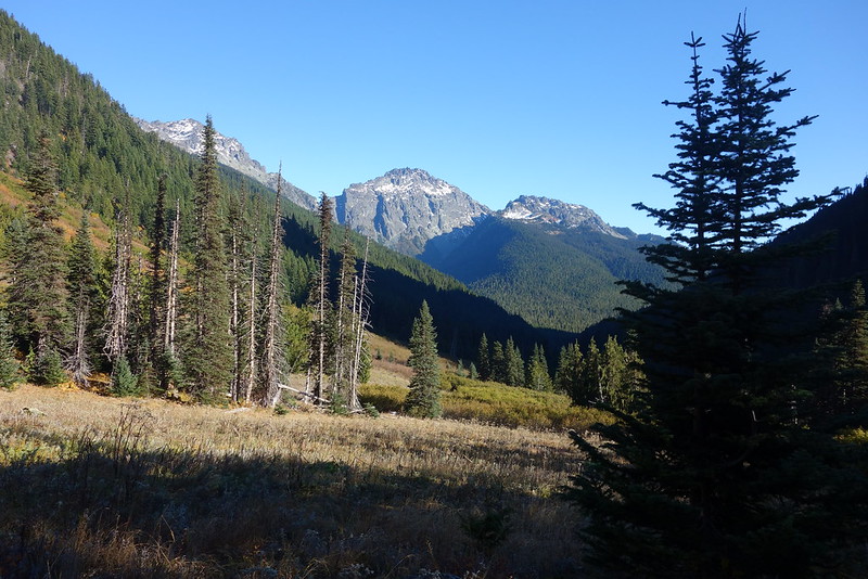
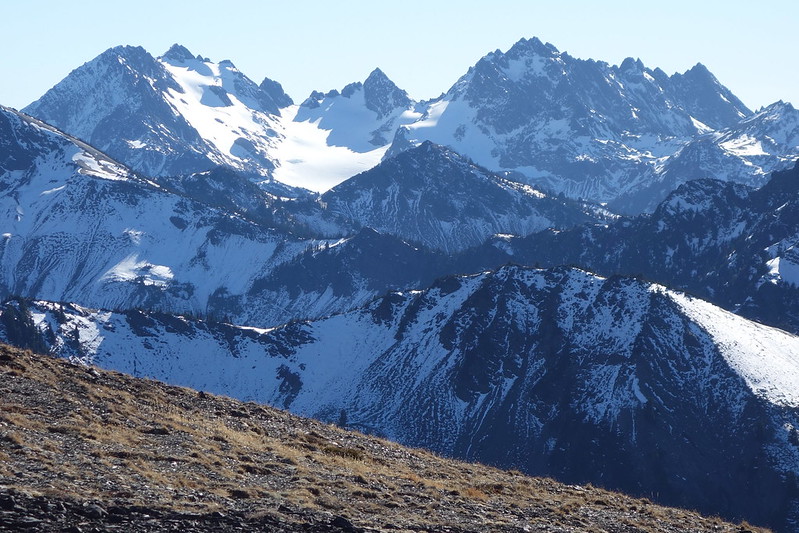
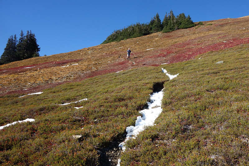
There are several obvious dayhikes from Bear Camp: up Hayden Pass, or Lost and Cameron, or back a bit to Grey Wolf. We decide on the latter two, largely because the slopes we’ll be climbing are mostly south-facing, and so have the best possibility of being snow free.
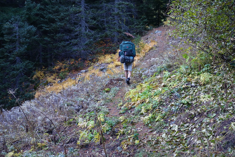
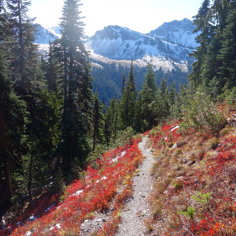
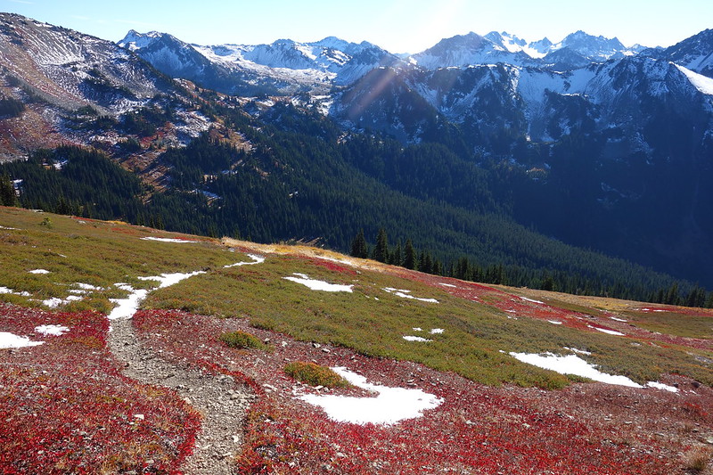
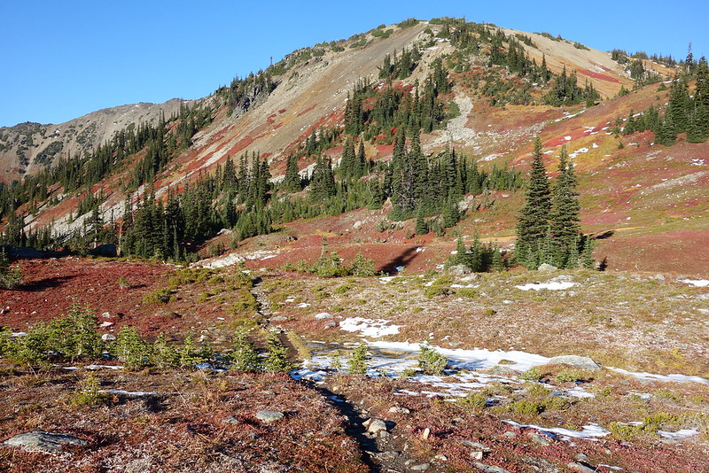
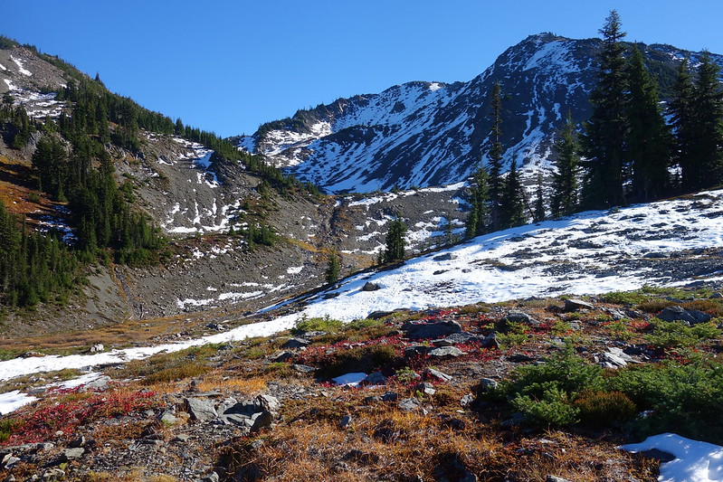
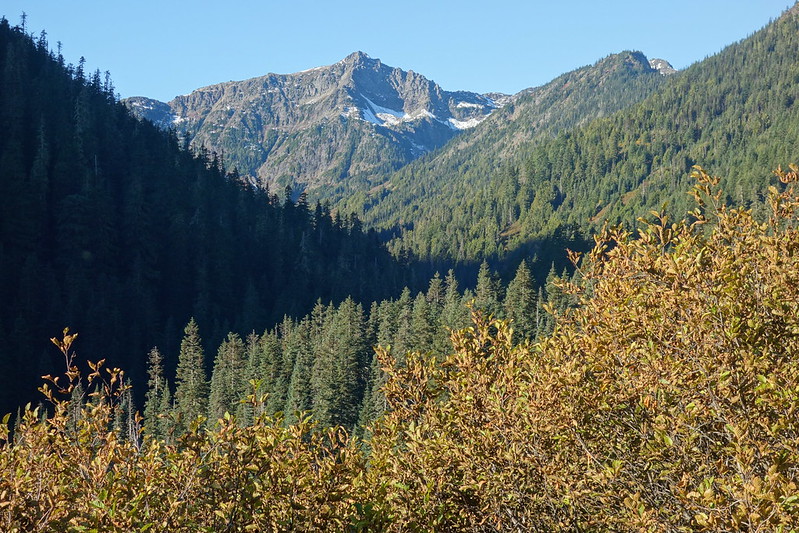
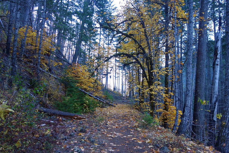
First, Lost and Cameron. From camp, we walk up a couple miles to Dose Meadows, then cut north on the “Primitive Trail” up to Lost Pass. The thing is steep—around 1000’ in a mile—but easy to follow, and surprisingly pleasant. It’s totally different than this summer: blue lupine replaced by bright red leaves, biting flies replaced by peace.
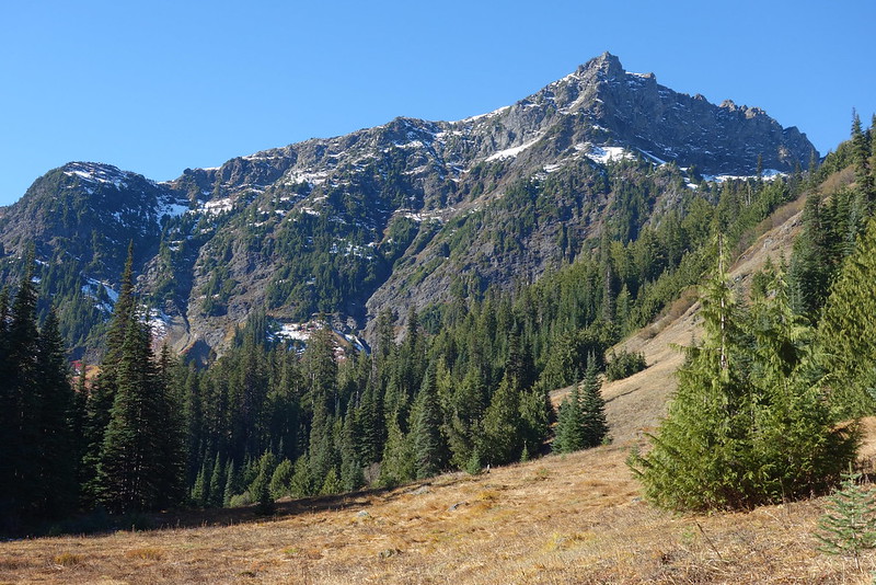
From the pass, the trail continues north, under Lost Peak, and across the headwaters of the Lost River. I really love it up here.
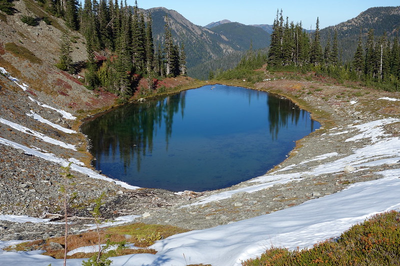
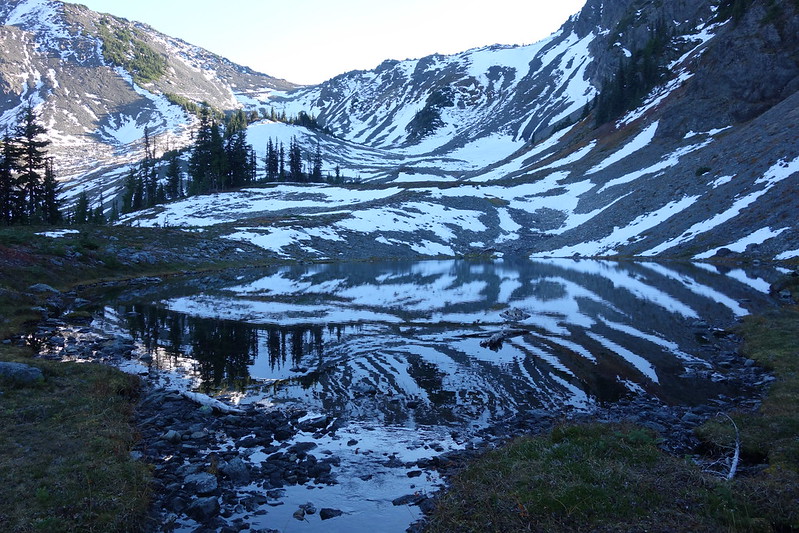
I guess there are lakes in the upper basin here. A trip for another day…
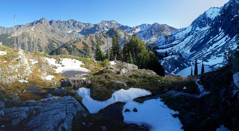
6.
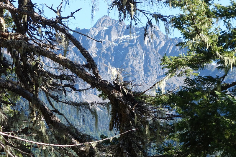
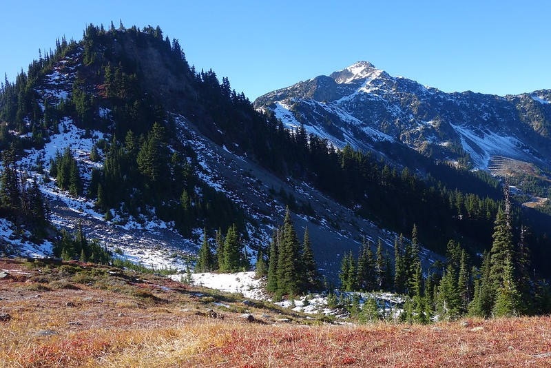
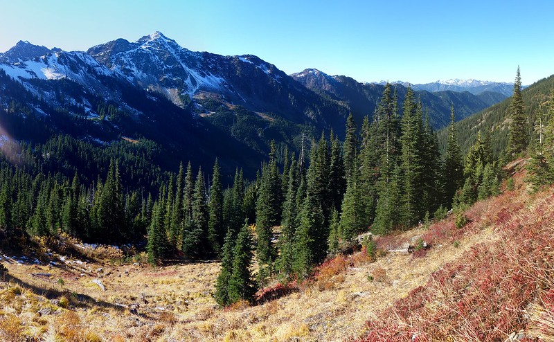
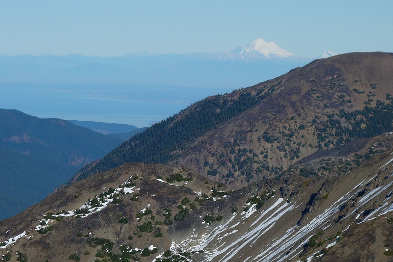
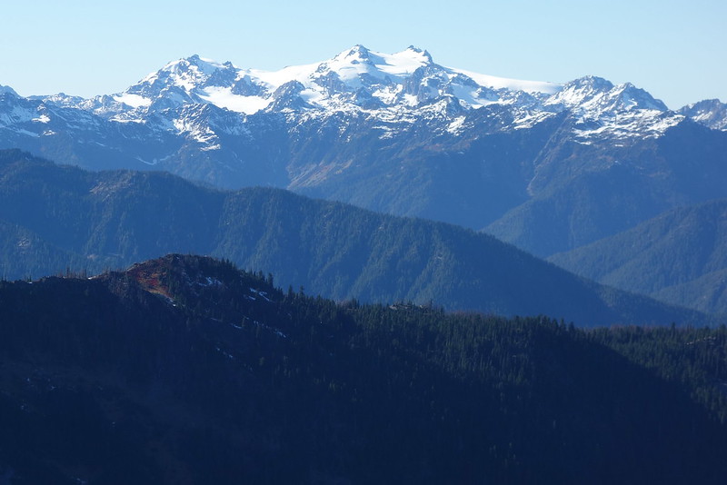
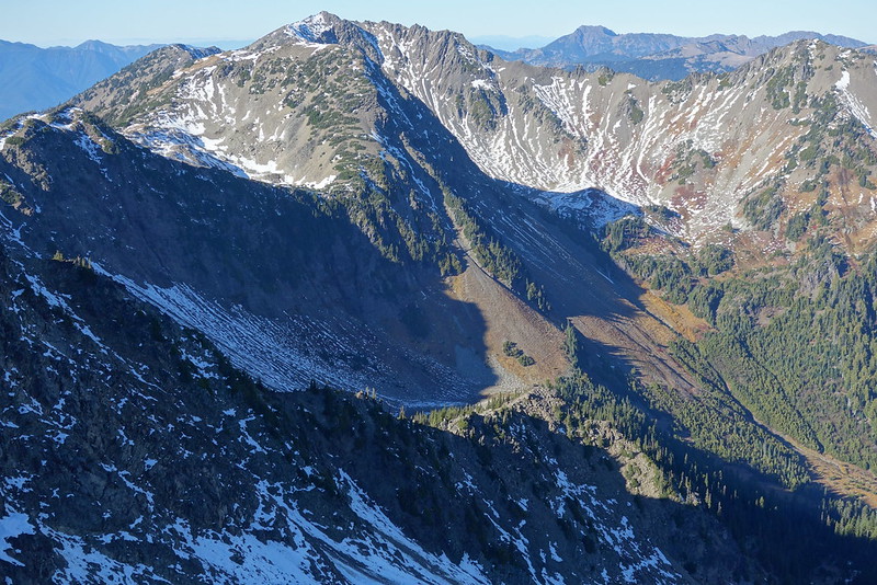
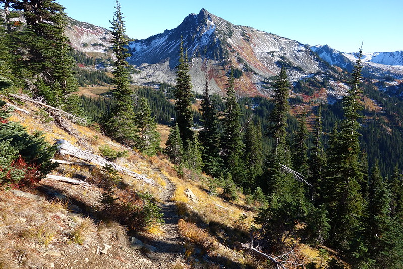
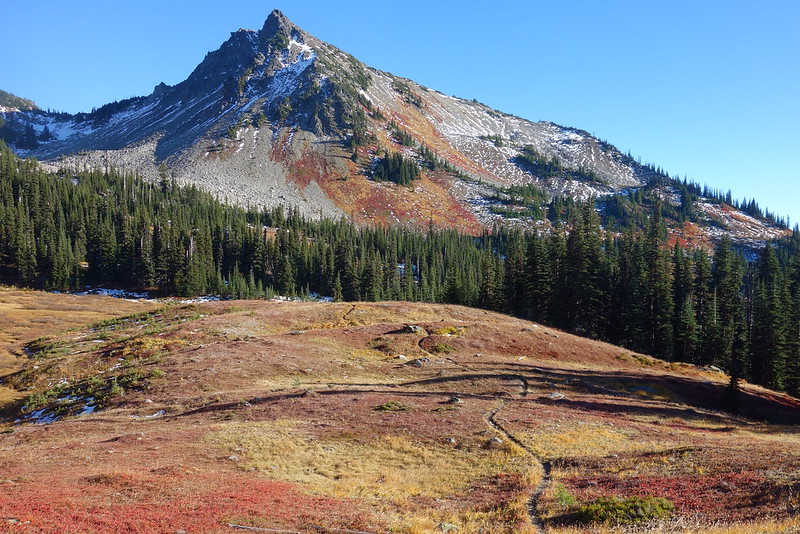
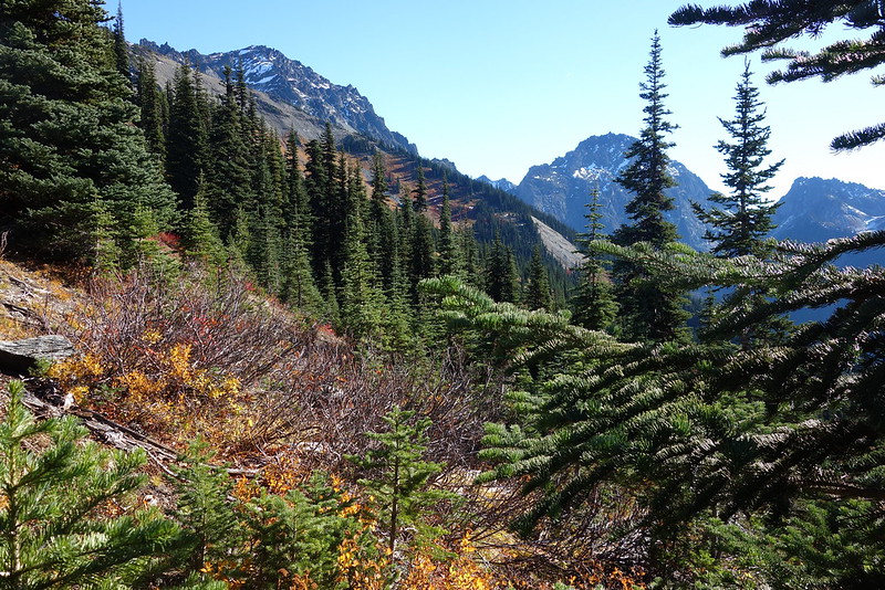
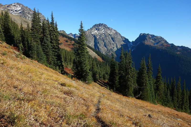
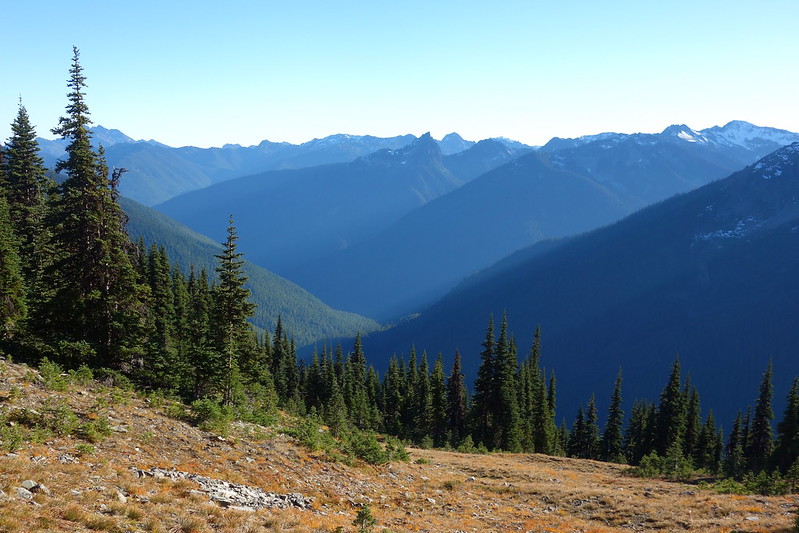
The climb out of the basin, to Cameron Pass, is steeper than I remembered—nearly as steep as the one up Lost—but it goes quickly too, and soon we’re staring at views all around: down Cameron Creek and over the Strait at Baker; west, over the Elwha to Olympus; south over the Sentinels to Mt. Anderson; and east to Rainier.
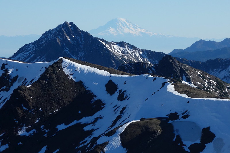
We climb a small prominence to the west, and have lunch near the top, shifting every few minutes for new views.


7.
The descent back to camp is quick, easy, and beautiful, though perhaps a bit too fast: I would have gladly spent the whole trip up there, just exploring.

Saturday, October 28
8.
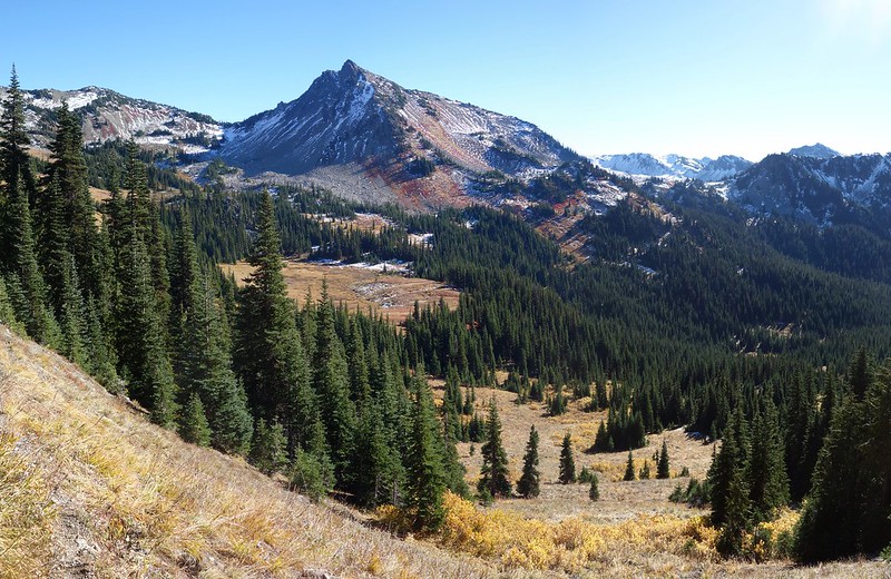
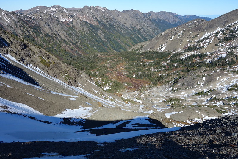
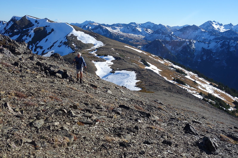
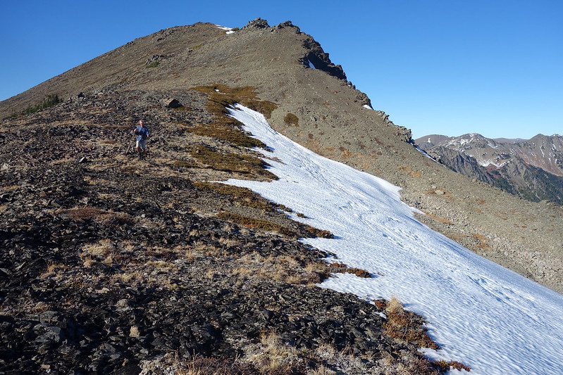
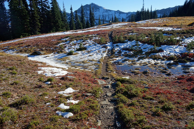
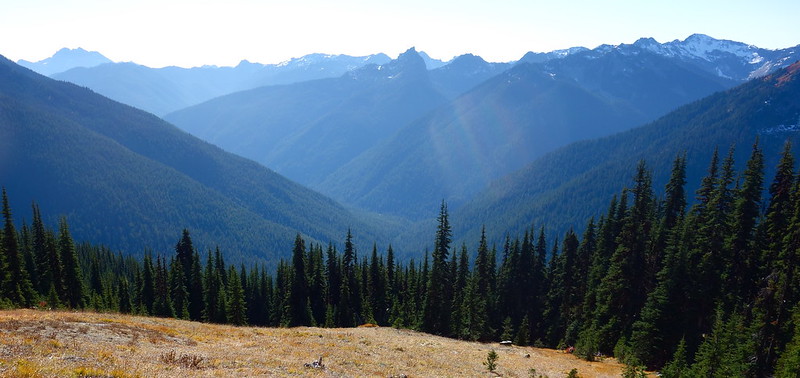
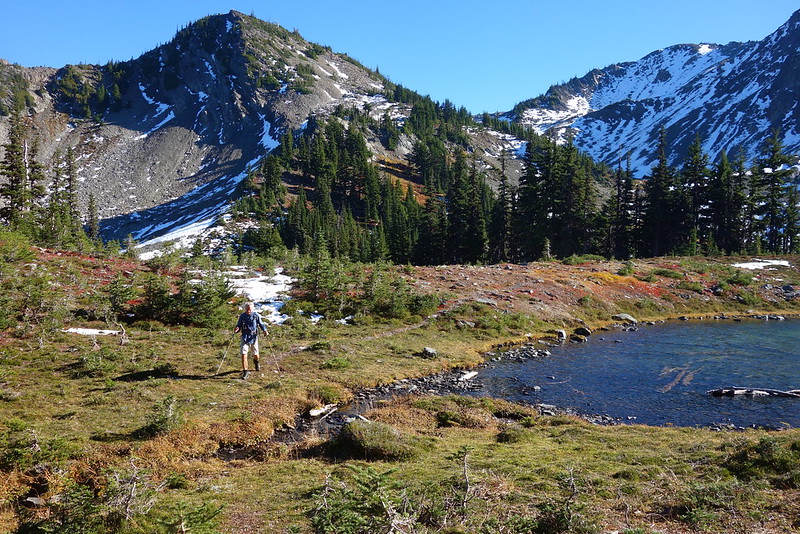
The next morning, we backtrack a couple miles to the Grey Wold Trail, then follow that a few more miles up to Grey Wolf Pass. Compared to Lost and Cameron, the south side of Grey Wolf is exceedingly gentle, with interestingly varied views back down to the Dosewallips’ grand valley, and up toward Hayden Pass.
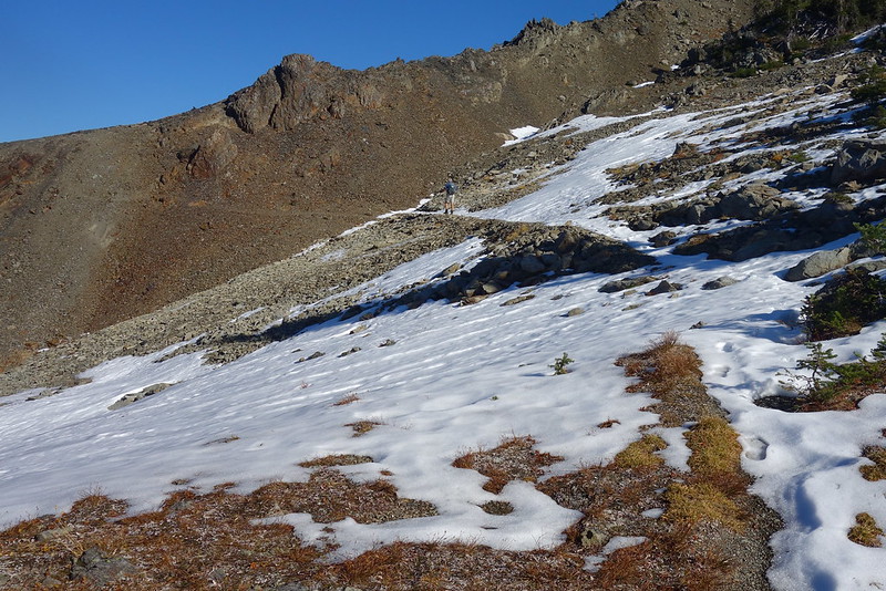
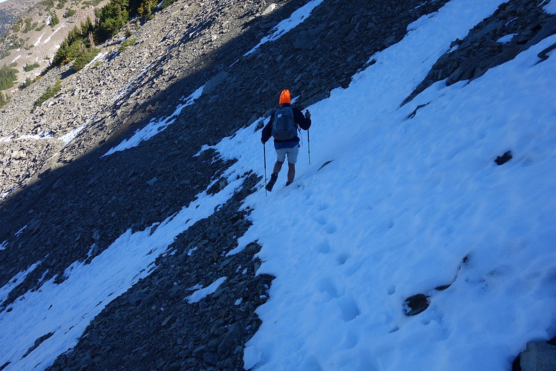
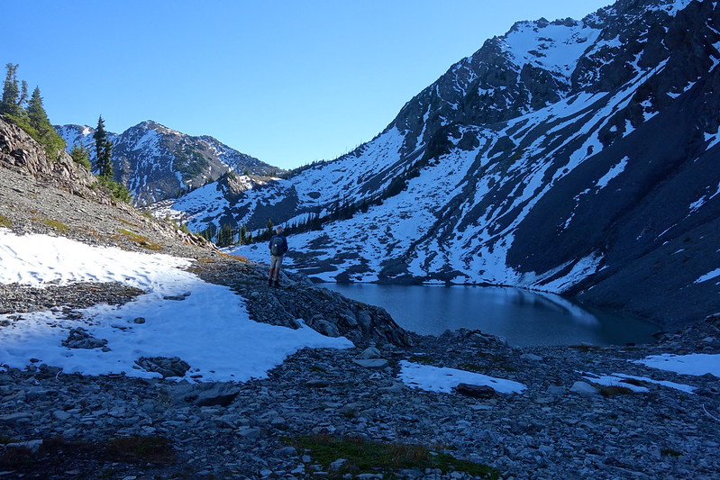
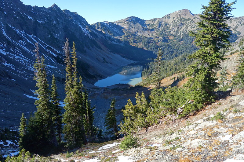
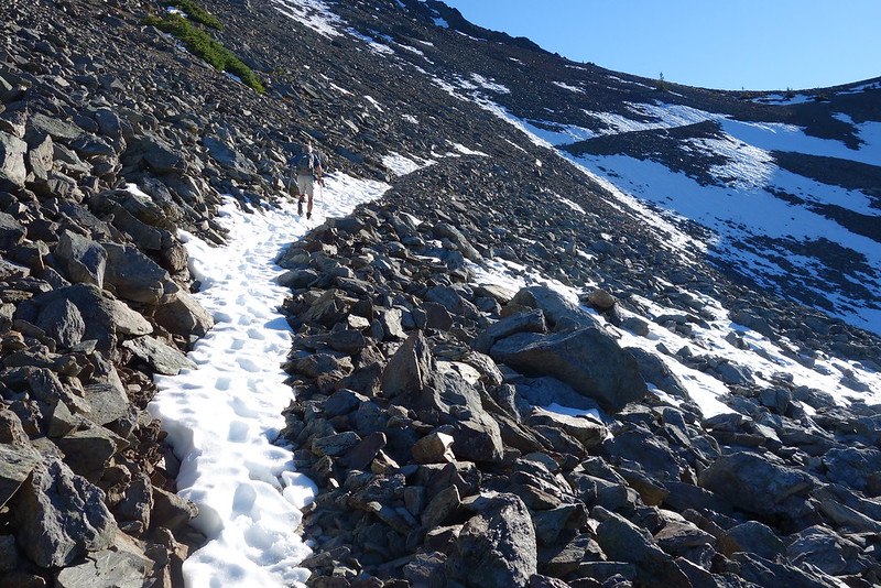
There’s a little steep snow on the north side of Grey Wolf Pass, but nothing all that bad, and we continue on down into Upper Grey Wolf Basin, with a vague idea of heading off trail to Cedar Pass, to look down at Cedar Lake, which neither of us have ever seen before.
9.
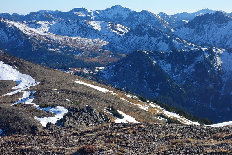
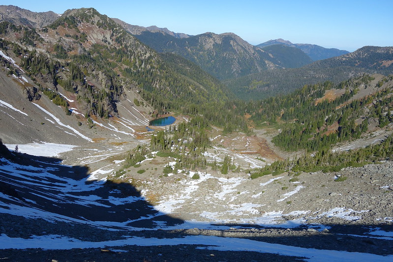
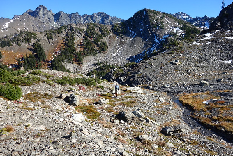
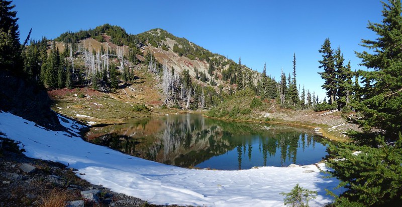
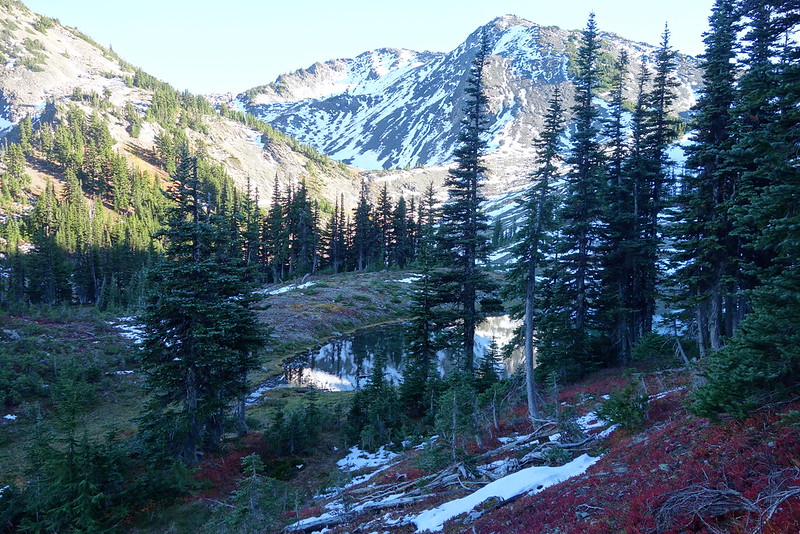
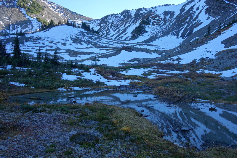
We were both a little unsure about how to get up to the Pass, but the way ends up being easy: once you reach the upper basin, veer east, along the obvious headwall, and eventually you’ll come to a small lake, surrounded by trails and a couple campsites. From there, an unofficial bootpath leaves the north side, sidehilling up to the pass.
The boot trail passes through several small basins and a few unexpected lakes. It’s unexpectedly, overwhelmingly beautiful.
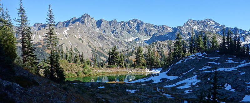
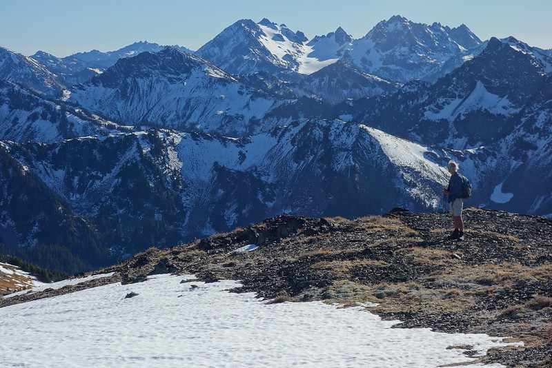
10.
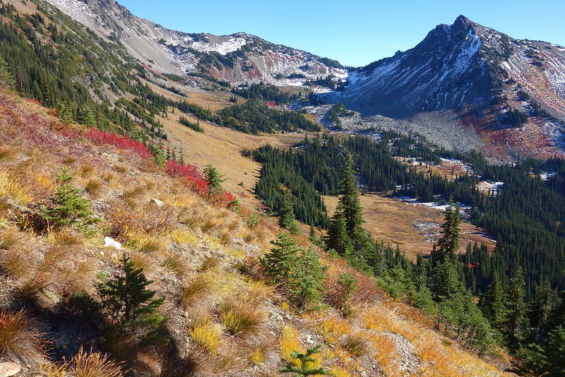
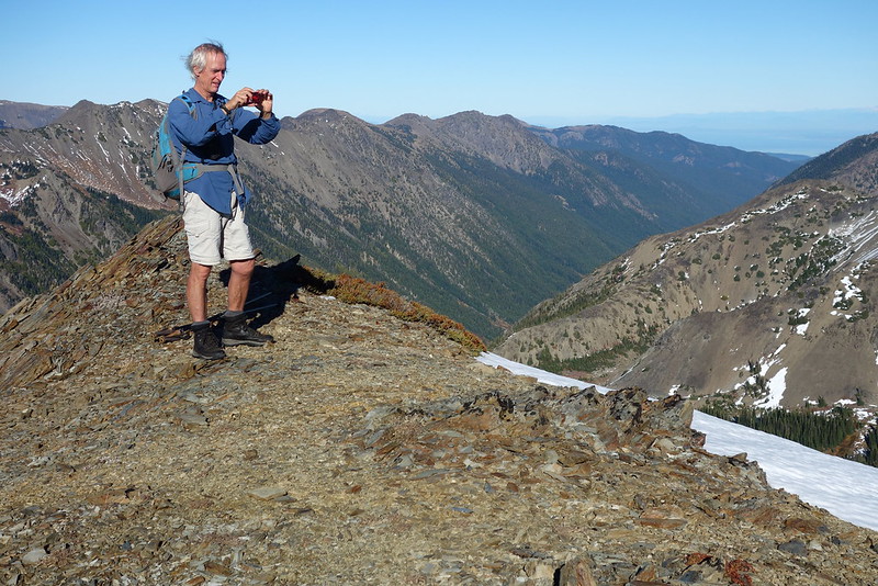
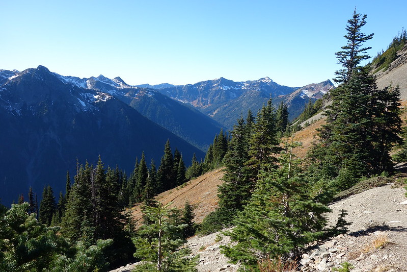
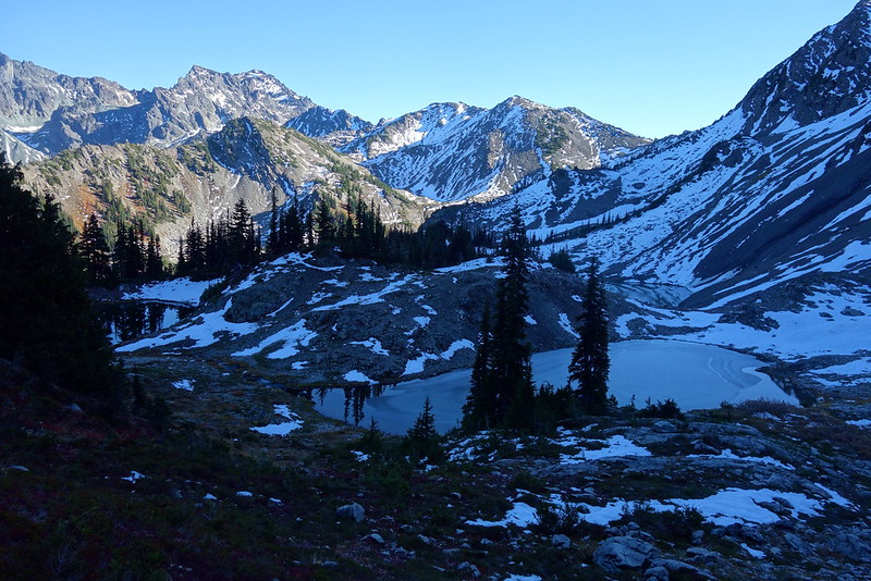
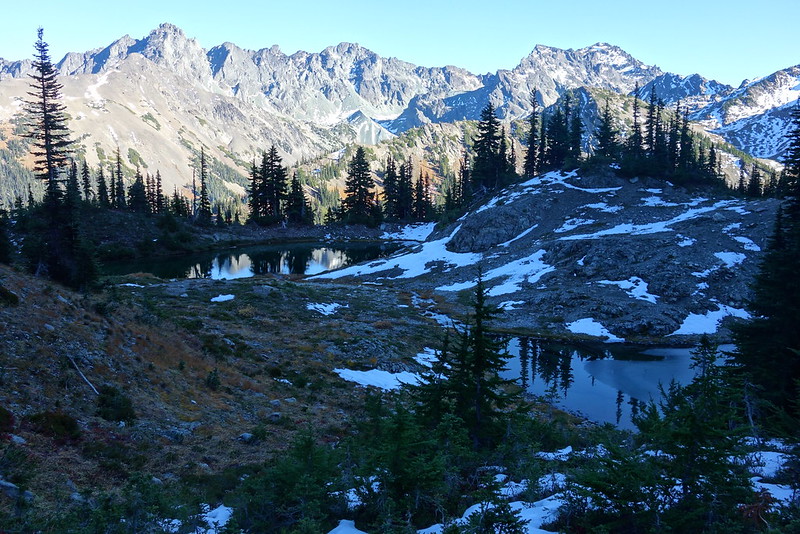
Climbing up toward the pass, the views just keep getting grander. It’s difficult not to take the same picture a thousand times. So, well… I take the same picture a thousand times.

Cedar Pass itself is a tiny notch in a ridge that runs north from Grey Wolf, with barely enough space to bivy. But man, it’s gorgeous up here, with views west over the Grey Wolf to The Needles, and east to Cedar Lake.
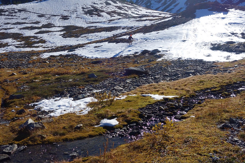
We take a short Snickers break, then head back down, through the lakes and meadows and snow.
11.
Heading down the south side of Grey Wolf Pass, the light starts its descent to golden hour, and the peaks to the east—Deception, Mystery, Little Mystery, maybe even Hal Foss—light up.
Sunday, October 29
12.
The night is cold again—maybe the coldest we’ve had—particularly as we’ve agreed to wake up early, to get a jump on the hike / bike / drive out. Getting out of my quilt is rough. But soon enough we’re walking in the morning sun, and even my light coat’s a bit too much.
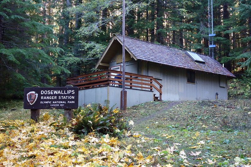
13.
We make it to the old ranger station just in time for lunch, then coast down the old road, toward home.
For the last few miles, the road is full of families, out to see the fall color in the trees. An older father asks me how far up the trail goes, and I think of this summer. “If you wanted, you could walk for weeks.”

14.
As we drive out along the Canal, the light turns red, red against the blue water. We stop in Hoodsport at the most wonderfully improbable burger / teriyaki restaurant, then continue south as the sky turns dark.
When I was growing up, my dad had an ancient box of cassettes to play in the car: The Beatles, Leo Kottke, a B-52’s album I’m pretty sure was just there because of me. There’s a box here too, though it’s full of CDs, and he asks me to put one in.
I pick Revolver.

Dang good stuff!