October 8-10, 2015
For the last couple years, my dad and I have taken a few shoulder season trips in October and November, after both of our regular hiking partners have packed it in for the winter. This past fall, we started in mid-October with a weekend ramble around the Wallowas. From the Two Pan Trailhead just out of Lostine, we walked up the East Fork Lostine Trail to the Lakes Basin, camped at Glacier Lake, and took a dayhike up Eagle Cap and around the (gorgeous!) slopes and streams between Glacier Peak and Glacier Lake.
Thursday, October 8
1.
We wake up around four, and for some reason I’m just not having it. Something about staying up until one the night before reading cookbooks. The nice thing – or: one of the nice things – about going out with my dad is that, probably out of force of habit stretching back to when I was a kid, he always drives.
While he suffers through the pre-dawn dark, I sleep. And sleep. Until we’re, like, halfway there. It’s marvelous.
2.
I’ve been to the Wallowas twice before, both times with Krista: once to Ice Lake and the Matterhorn, and once on a loop around the East and West forks of the Wallowa River. But I’ve never been in through Lostine.
I like heading in this way. There’s less tourist stuff to drive through than with Wallowa Lake, and the scenery on the way up might be a bit nicer. Plus, it starts a thousand feet higher.
3.
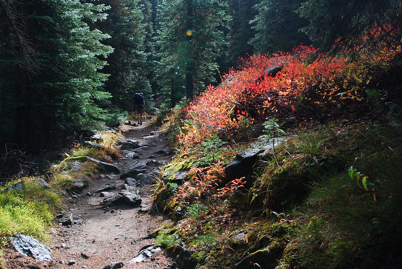
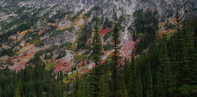
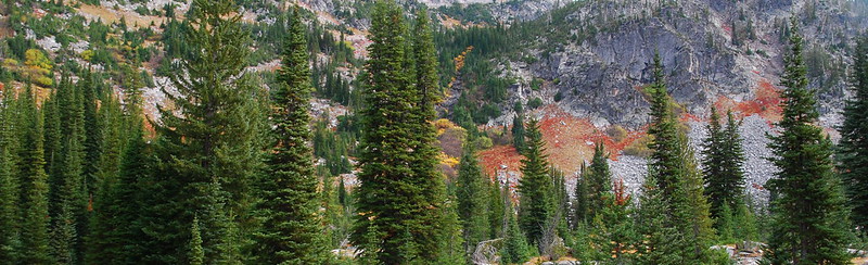
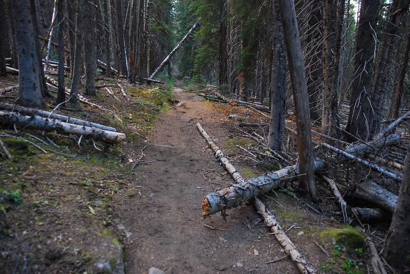
The first few miles are through pretty, if nondescript, forest, with occasional views up the rocky slopes of the Hurricane Divide.
4.
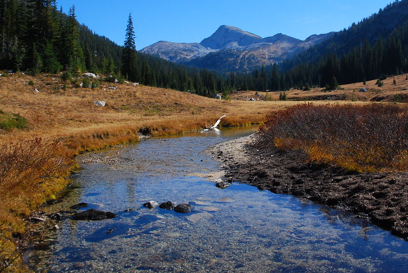
After a few miles and a few switchbacks, the trail emerges into a beautiful, long, open meadow, and the first views of Eagle Cap.
This whole area was apparently once filled with a massive glacier, and it’s still dotted with small lakes from when the thing receded. I try to imagine where I’m standing covered with a mile of ice.
5.
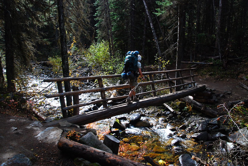
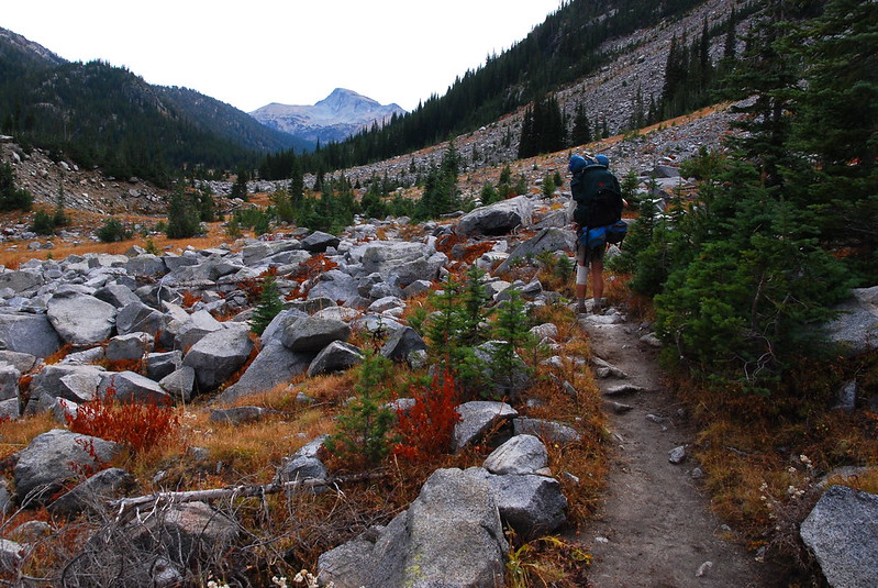
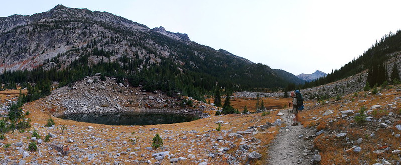
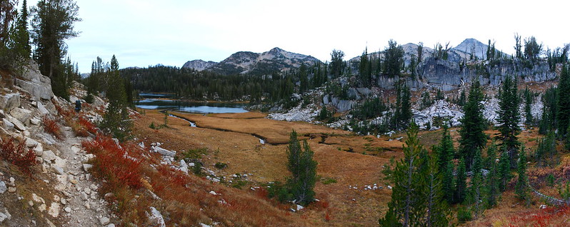
Toward the end of the meadow, there’s a broad bridge across the East Fork Lostine, and the trail veers east into some trees on the way to Mirror Lake.
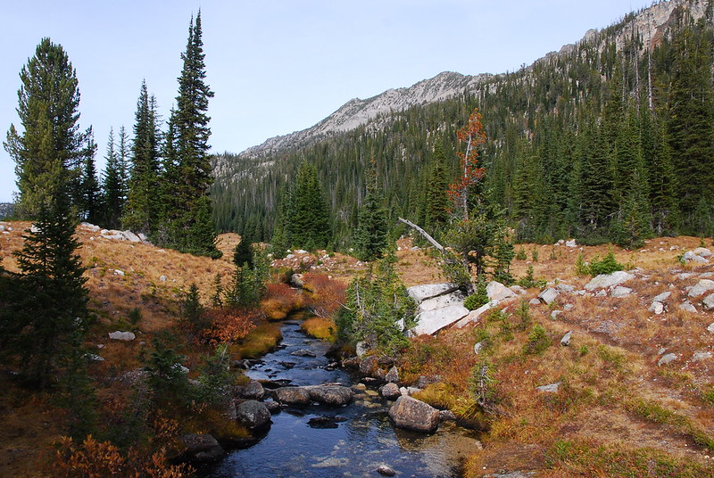
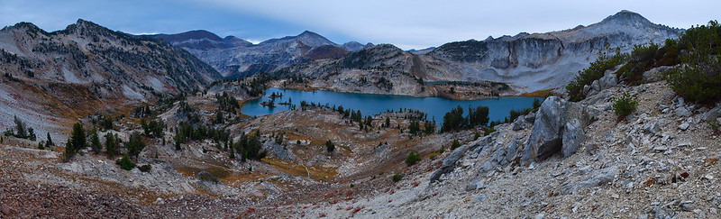
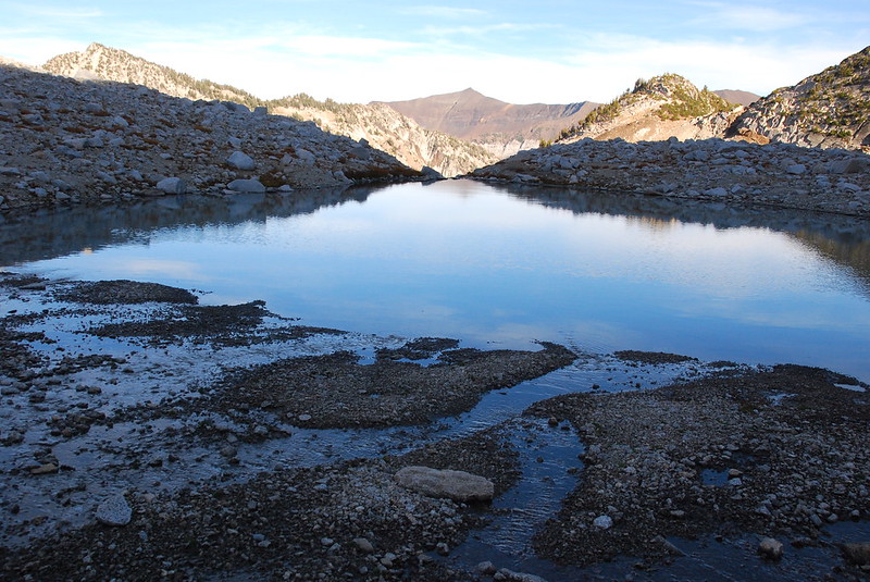
After entering the Lakes Basin Management Area, the views open up in every direction. West, toward Upper Lake:
East, toward Glacier Pass:
6.
I don’t know why, but I always just end up passing through Mirror Lake. Maybe something to do with the crowds. There are only a few people, and it is getting on toward lunch time, but we decide to keep going and maybe stop at Moccasin.
Mirror:
Moccasin:
We eat lunch on the shore of Moccasin Lake just as a few afternoon clouds came by to say hello. Then it’s up the sometimes steep trail to Glacier Pass.
7.
From the pass, the views are fantastic. Back south, toward the Hurricane Creek…
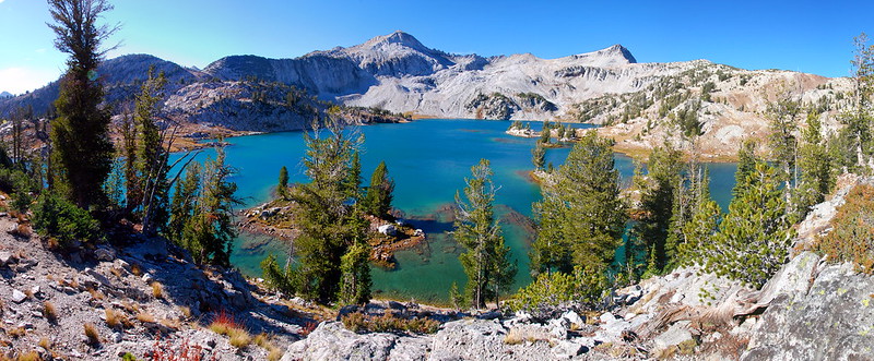
…and north, toward Glacier Lake and the West Fork Wallowa River.
I really love the colors, looking down at the West Fork as it passes from Glacier to Frazier Lake.
8.
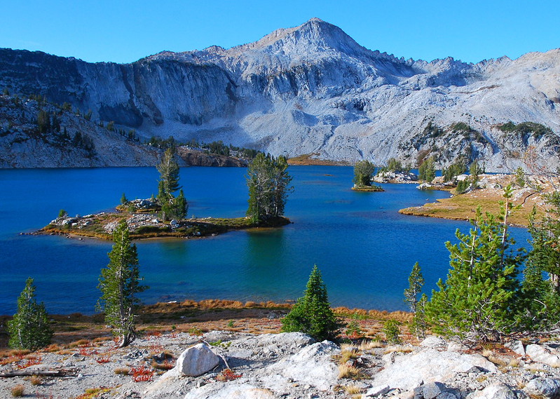
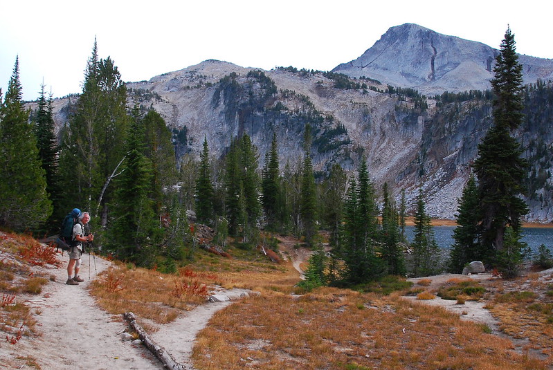
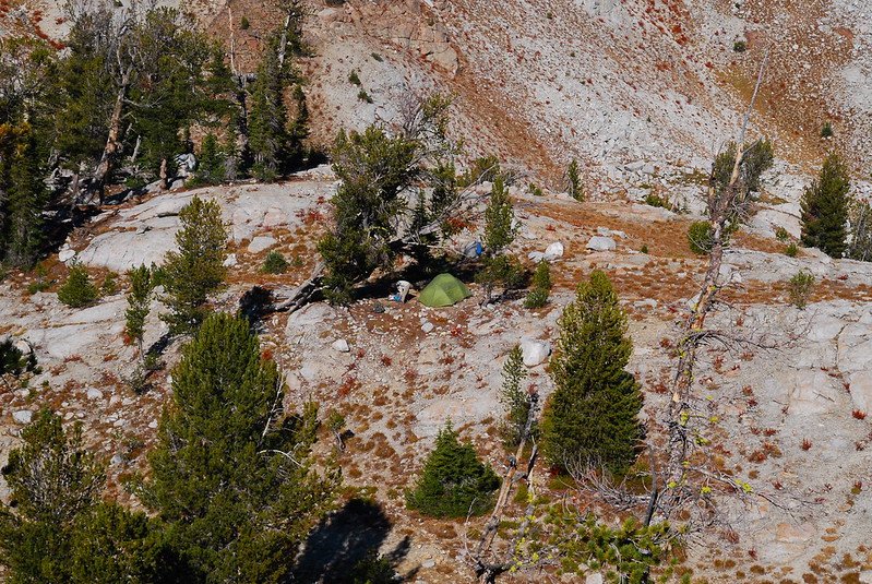
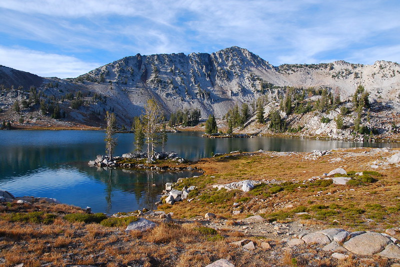
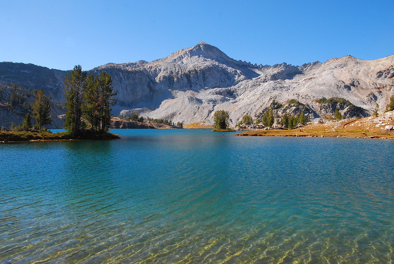
We hang out at the pass for a while, taking pictures and scoping a possible route up Eagle Cap for tomorrow. Then we descend to Glacier Lake, where we find a fantastic campsite near the eastern shore, up a small hill.
I’m weirdly tired – maybe the cookbook’s revenge again – but we have a pleasant night eating Indian food and drinking Hiking Cocktails (brandy or rum, lemonade power, lime, and soda [!] that my dad’s carried up).
Posh.
Friday, October 9
9.
The night’s warm but crazy windy. At one point the front of the tent comes unmoored from the ground and flaps a foot in the air. It’s… startling. But the morning is sunny and, eventually, calm.
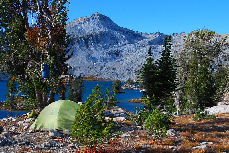
Before heading out for real, I take a quick stroll up a hill just south of us, which affords nice views of our site…
…and, of course, the lake. Man the color’s pretty.
10.
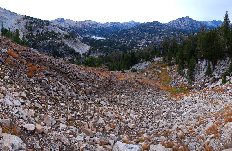
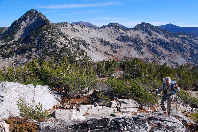
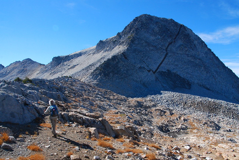
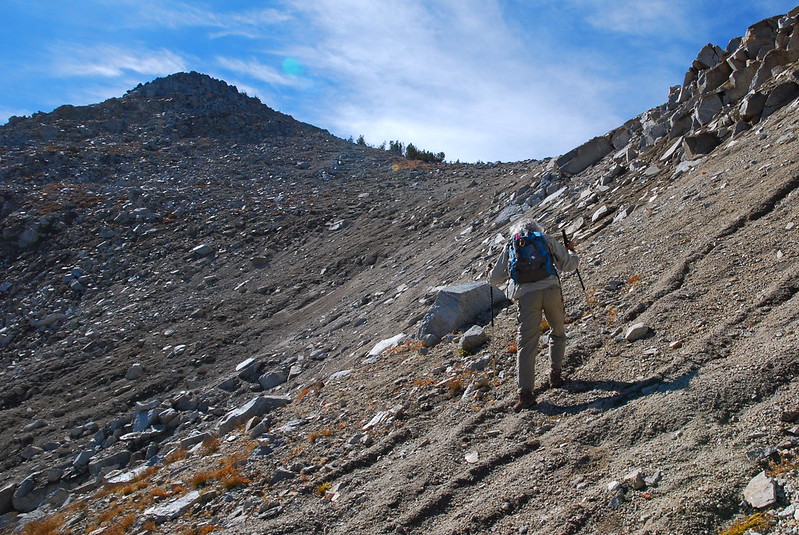
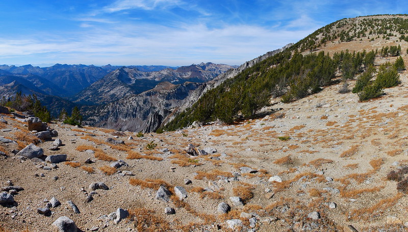
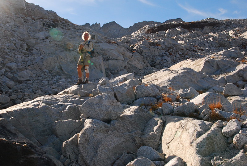
There’s a trail up to Eagle Cap, but, being us, we decide not to take it. Instead, we backtrack to Glacier Pass, and veer left, off trail, in the general direction of Eagle Cap. After reaching a high point of around 9000’, we turn left (south), and follow a broad, grassy shelf under Eagle cap toward an obvious saddle on the ridge between Eagle Cap and Glacier Peak. (There things always sound more complicated than they are. For a map, go here.)
Heading up from Glacier Pass, in the wind:
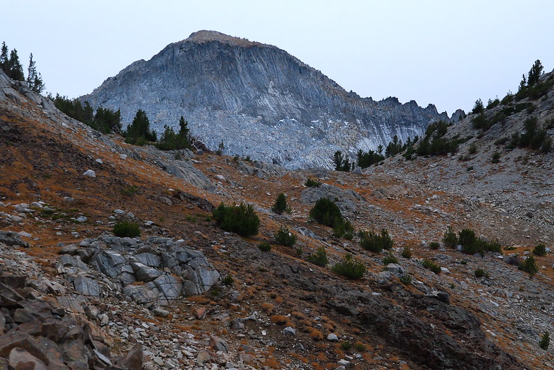
Looking up at Eagle Cap from the ridge:
Veering south:
11.
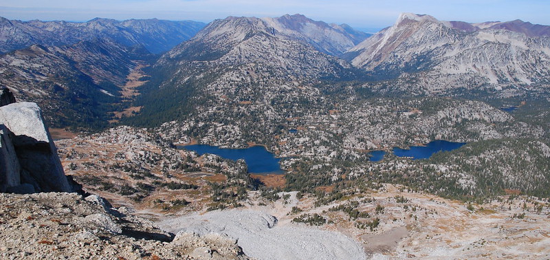
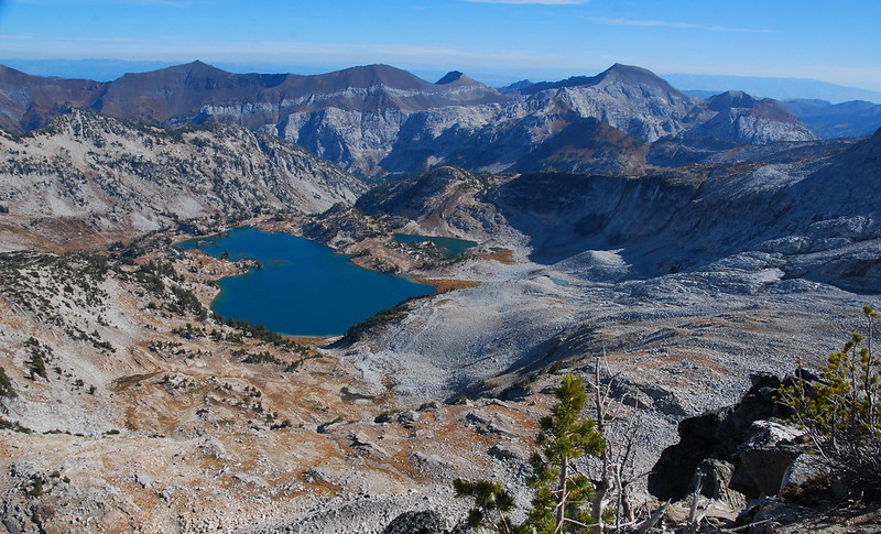
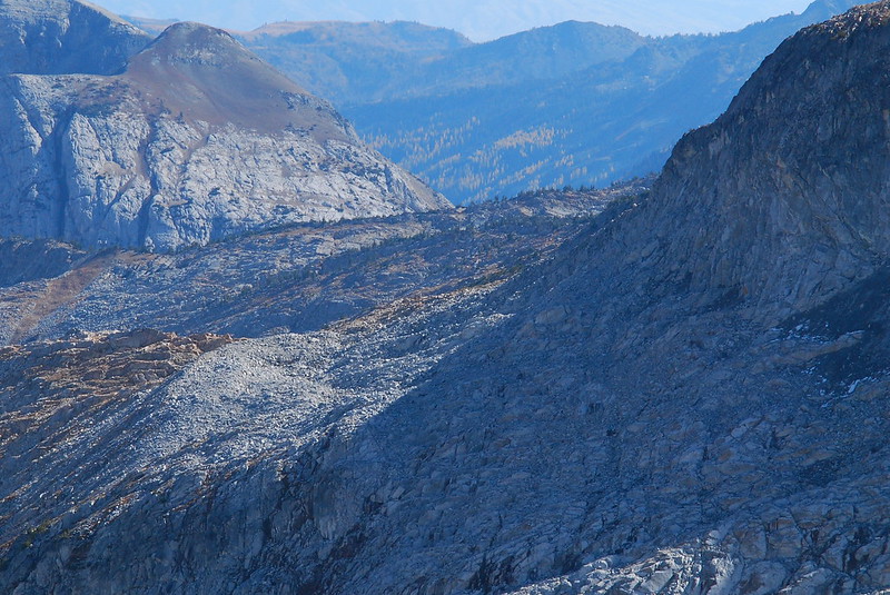
As we pass under Eagle Cap, there’s a fantastic view to the north of a few glacial tarns, Mirror and Moccasin Lakes, the East Fork Lostine, Hurricane Divide, Hurricane Creek, Hurwal Divide, the Matterhorn… everything.
12.
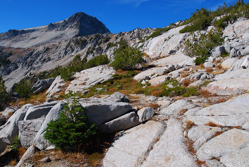
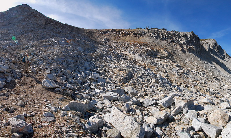
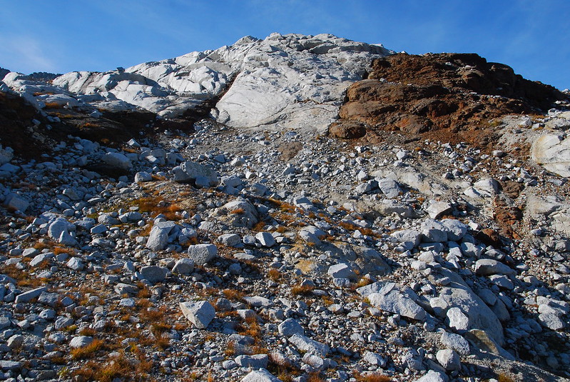
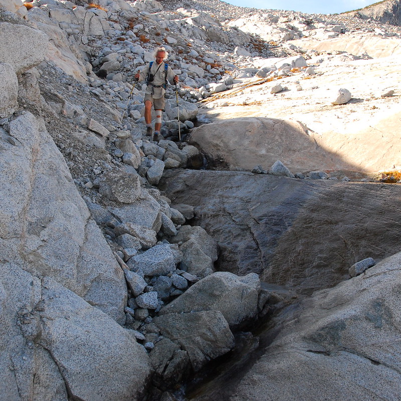
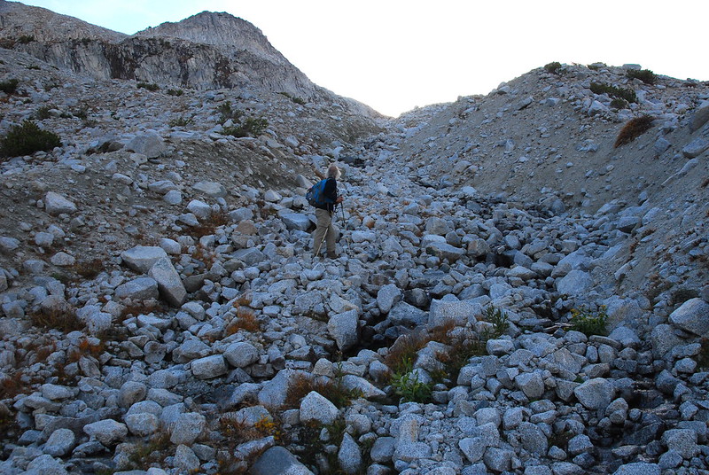
Eventually the shelf shifts from grass to big rocks, and the going gets momentarily more rough.
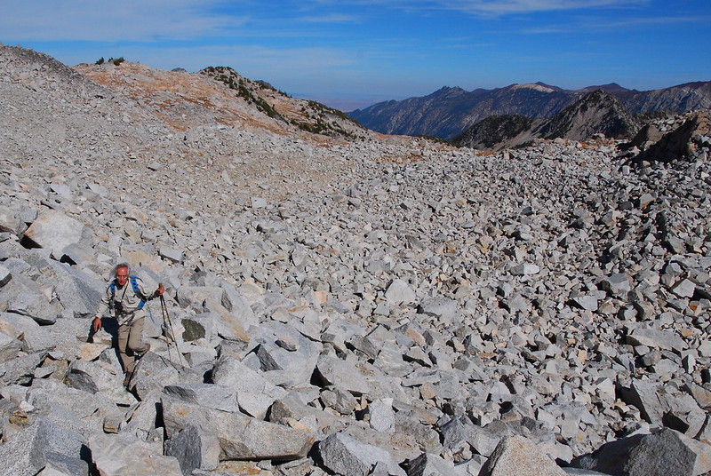
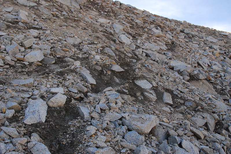
Even this isn’t so bad, though. The only real trouble we have is on a scree slope just below the saddle, which just sucks.
Going up the nearer (north) side of the slope involves maybe twenty feet of pretty steep scree, with occasional large rocks that seem more than ready to dislodge if given the slightest encouragement. It’s never really technical, and definitely not all that dangerous, but it’s still no fun. Maybe Type II?
We end up going up the sunny section of this slope:

But here’s the thing: on the further (south) side of the slope, we later realize that there’s a pretty good use trail, that switchbacks through some bigger, more stable rocks. If you go, definitely go this way.
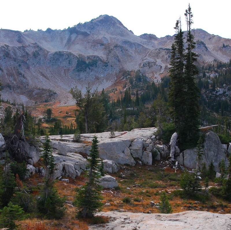
13.
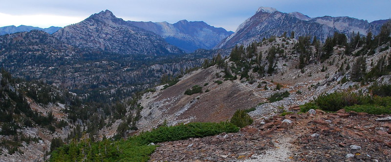
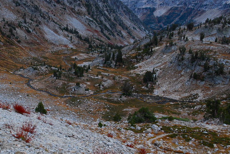
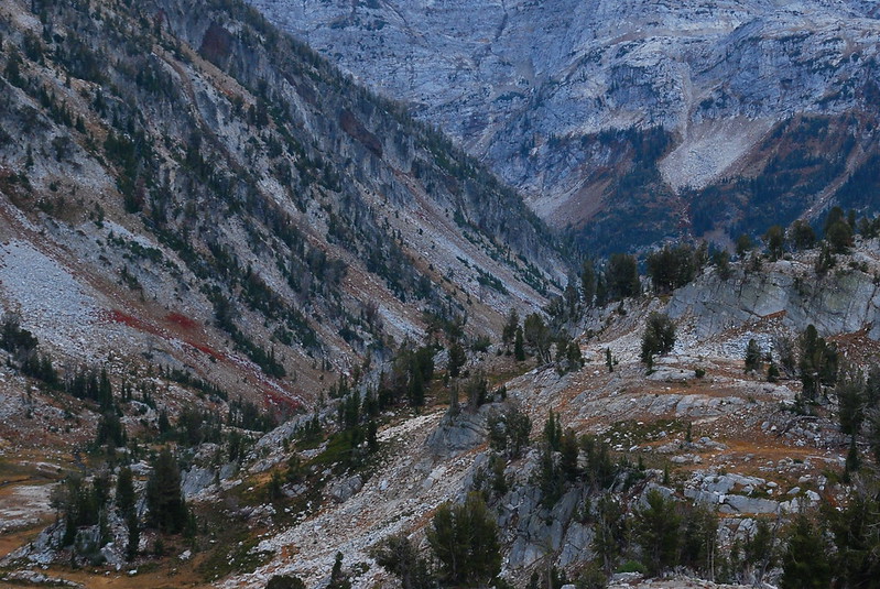
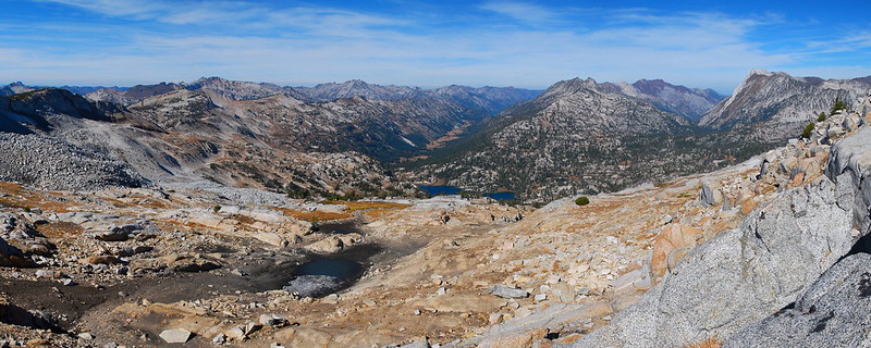
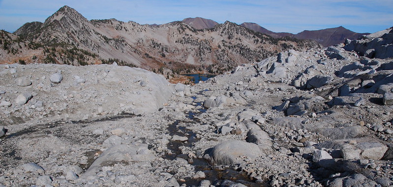
Anyway, we eventually get up to the saddle, where there are fantastic views west, over a precipitous drop down to the East Fork of Eagle Creek.
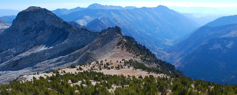
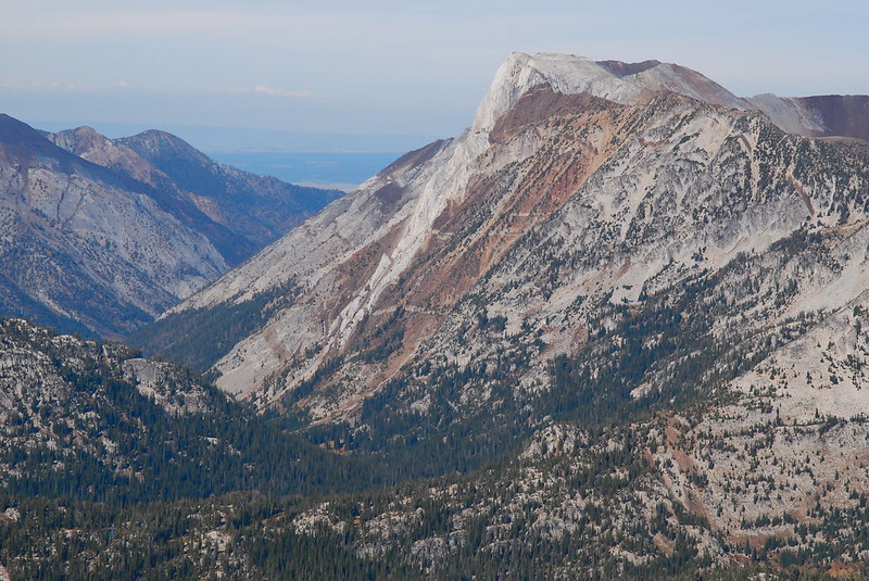
From the saddle, it’s just an easy stroll up Eagle Cap’s lightly wooded southern slope. The views continue to be incredible. Here’s Glacier Peak and East Fork Eagle Creek:
When we get to the top, I’m astounded to have the place entirely to ourselves. We have lunch (and I have some gummy bears) and are just packing up when a trail runner comes ambling up. He proceeds to fiddle with his GPS for a while, then with a tripod for some Summit Selfies. We talk for a while before learning that he’s out making tracks for Green Trails, who are apparently planning to release a new map for the area next year. (Yay! The only widely available one now, from GeoGraphics, is just awful.) We talk for a little longer, and it turns out he’s Craig Romano – that Craig Romano. What a nice guy!
The views aren’t bad either.
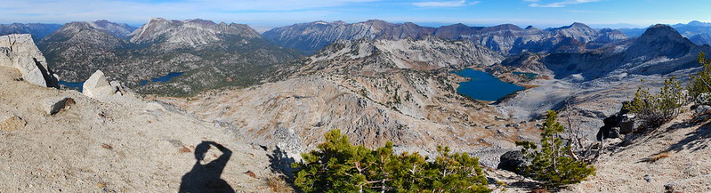
From the top, we can also see a few areas of larches, hiding down around 6000′. One’s near where Lake Creek drains into the West Fork Wallowa:
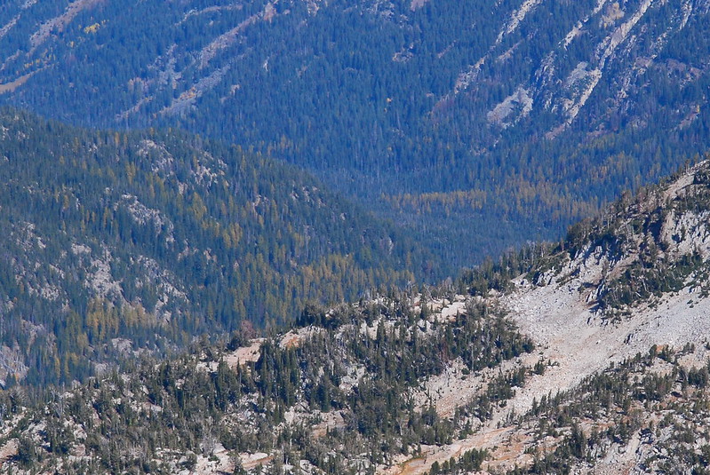
And the other, bigger one’s further away, in the South Fork Imnaha. Something for next year…
14.
I’ve brought a couple surprise beers, but I’m a little worried about the scramble back down from the saddle, so I decide to save them for a little later. As it turns out, I needn’t have worried: after we find the trail down the scree slope, it’s just smooth sailing.
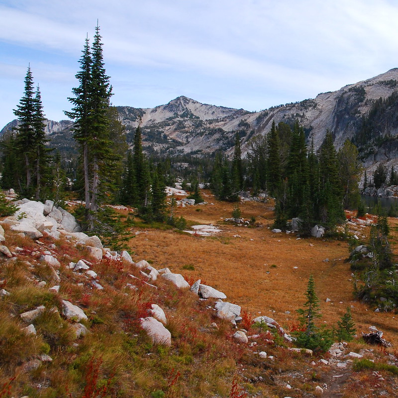
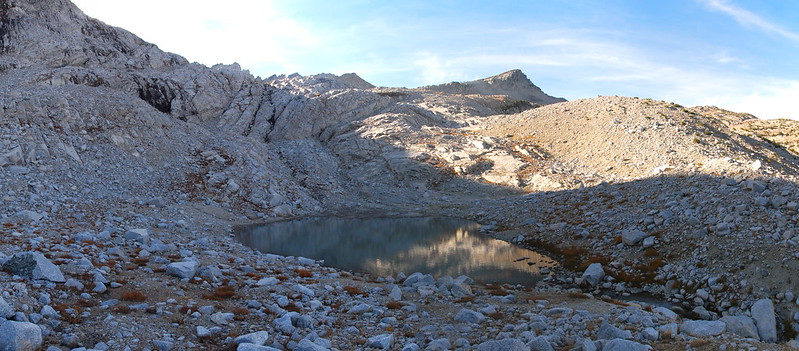
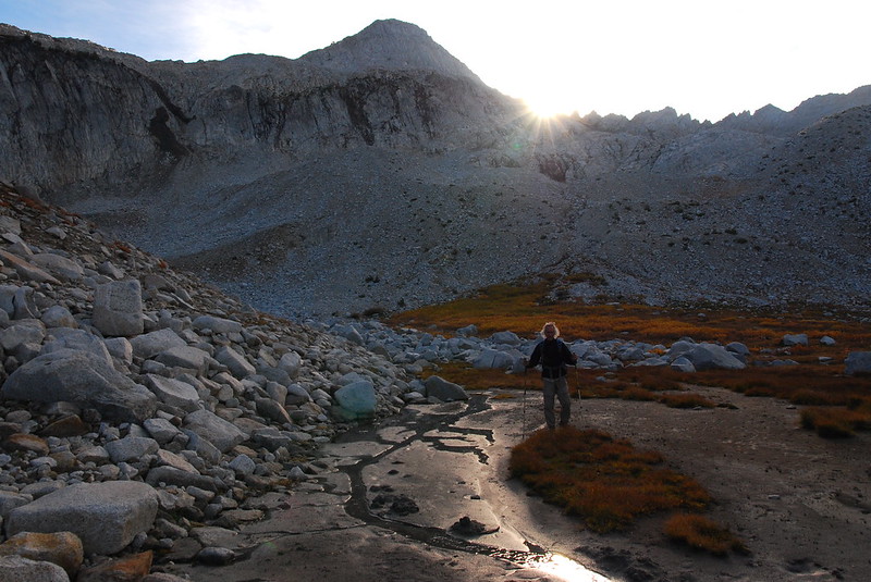
Rather than going back the way we came, we decide to head south toward Prospect Lake, following a couple streams as they drain into a glacial tarn and eventually into the small lake just south of Glacier.
15.
We stop at the tarn, just a couple hundred feet above Glacier Lake, to rest our legs and finally drink those beers. I ramble around taking pictures.
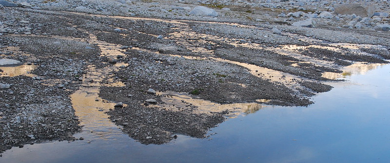
Then it’s just down one last little stream to the lake, and around the lake’s southern and eastern shores back to camp.
16.
We arrive back at camp with ample time to amble around, filtering water and washing off our legs and being pleasantly inefficient. Sunset starts earlier than I think it should, and our hill – all the hills – turn orange and purple and red.
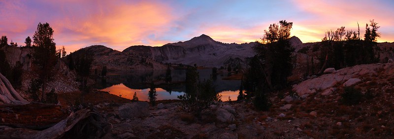
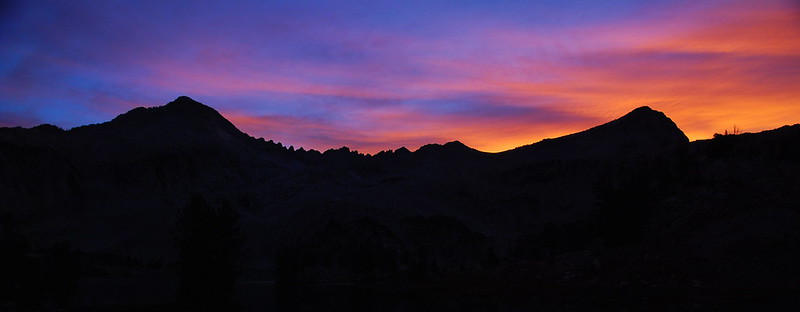
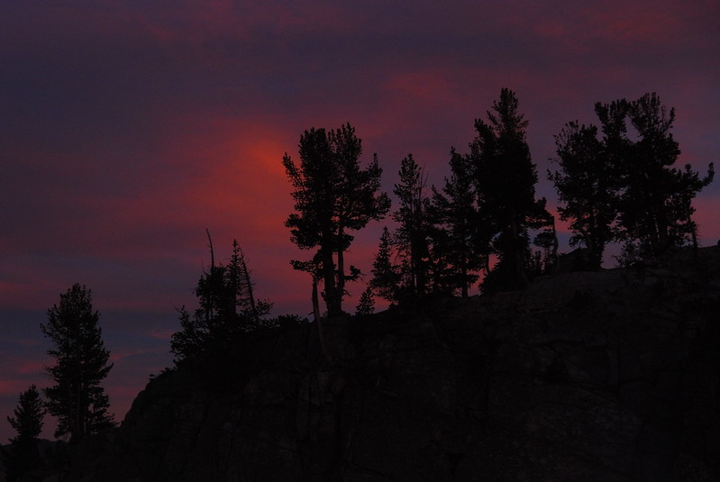
As soon as the sun finishes its show, the stars came out – a million of them, filling the most improbable corners of the sky. Someday I’ll have to learn how to take pictures of that, too.
Saturday, October 10
17.
I’m usually sort of anxious to get moving on the last days of trips – something about the lure of warm cars and big burgers and bitter beers. But at the end of the year leaving becomes a little more complicated. I’m never sure how much longer the weather will hold. And so I drag my feet, trying to soak in every last bit.
Eventually, we do have to get moving, so I say goodbye to the lake…
…and the meadow…
…and the woods.
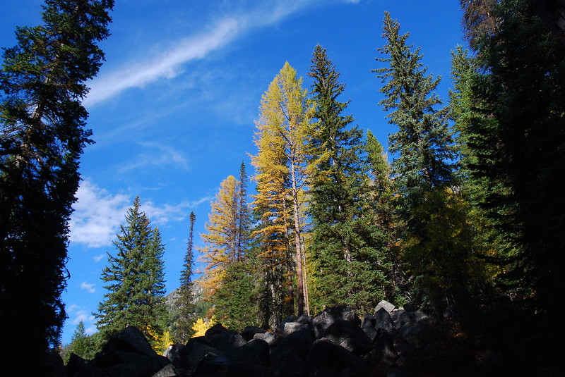
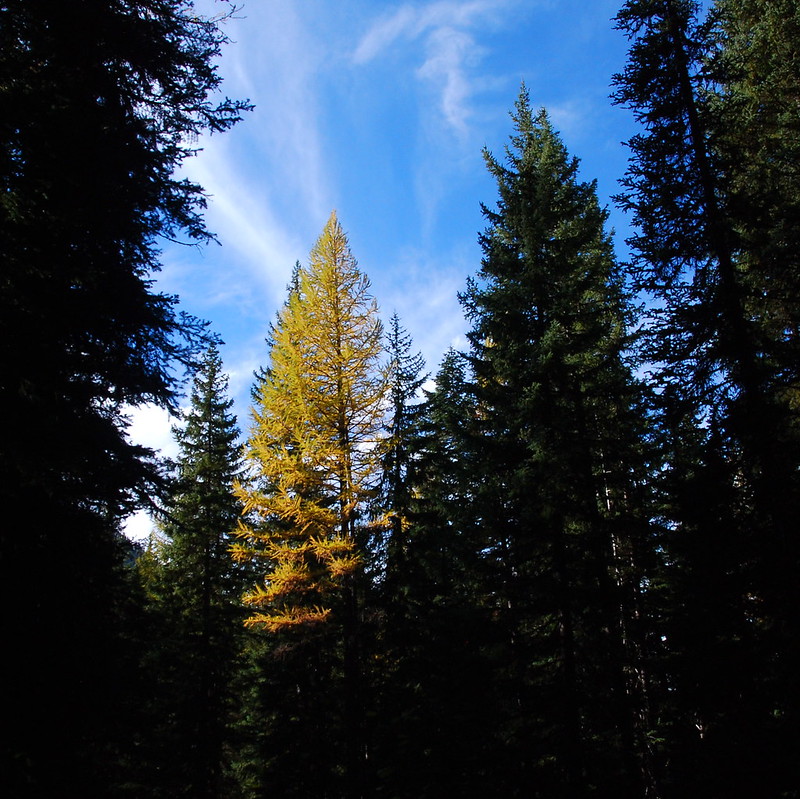
18.
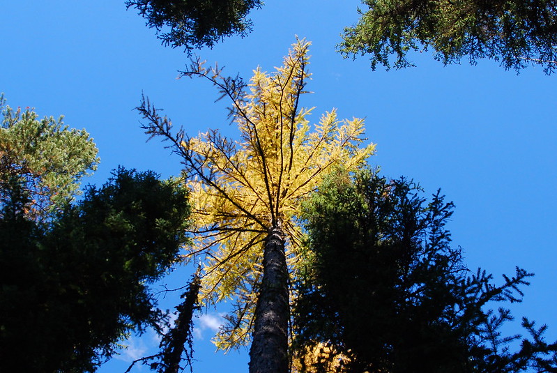
As we near the car, a few dozen larches – which the light, or my tiredness, had hidden on the way in – appear in the canopy. A nice treat on the way out.

19.
The drive out’s mostly uneventful. The sun sets as we ascended toward the Blue Mountains, and torrents of rain come as we descend to Pendleton. We stop for dinner and beer at Prodigal Sun, which is just fantastic, and make it home late, me half asleep in the passenger seat, but my dad still somehow wide awake.
One of these days, I’ll really have to offer to drive.
Maybe.
