October 22, 2015
I spent most of the fall running around like a chicken with its head cutoff about dissertation stuff, but I ended up with a free few days in late October, and the forecast for Mt. Hood called for clear skies – surrounded, on either side, by clouds and drizzle – so I headed up to Timberline with the idea of doing what seems to be quickly becoming a standard loop to Paradise Park and over Mississippi Head. As it turned out, I was probably the last person to make it over this year, as a snow storm hit the next day, and covered everything by several feet.
Krista and I did this hike last August, but it was like another world up there this time: absolutely no snow anywhere on the main route, and very little snow up higher. We had a better winter this year than last, but right now it’s all melting very, very fast.
I should say before starting that, although there’s nothing really technical on this hike, there are a few sections in the off trail portion above Mississippi Head where a fall would be very bad business. When there’s snow, it it’s relatively easy to kick in steps, but without it things are rough. And “without it” seems largely like how it’ll be in the future.
1.
I leave home around seven, stop for a few gallons of coffee, and drive up through Sandy into a thick bank of clouds. Huh. But then as I take the steep turnoff for Timberline, the clouds suddenly stop. By the time I hit the parking lot, I’m above them.
There’s new construction or something on the Lodge – I think they’re putting things up for the winter – so I end up wandering around for a while looking for a bathroom. The Lodge is sort of a mystery to me. Like, I know there are restaurants and rooms that you can theoretically rent if you theoretically have a million dollars, but I don’t, and so, for me, it’s basically a bathroom with a lot of history.
2.
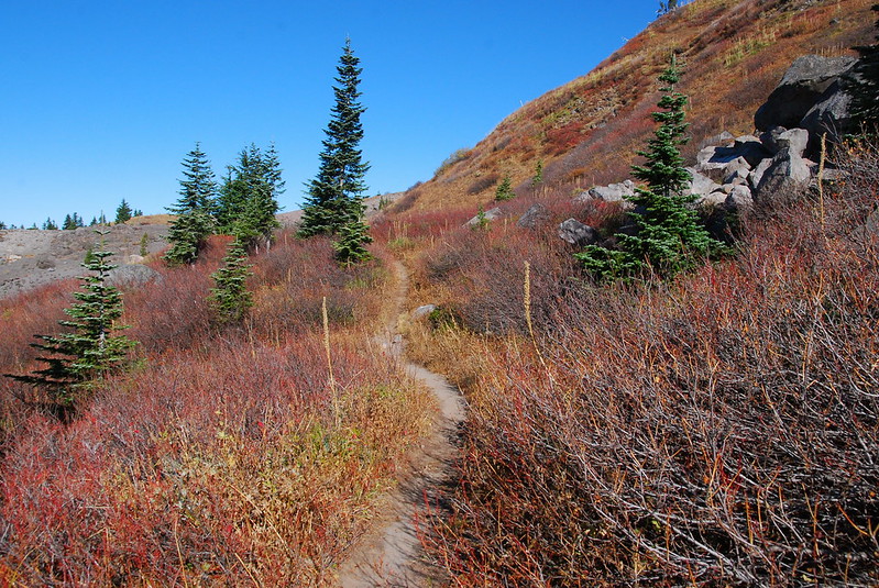
I mostly motor through the first few miles on the PCT, stopping just a couple times to take pictures. Little Zigzag:
Big Zigzag:
Wet Zigzag:
3.
As I’m rounding a corner, wondering whether it’s too early to eat a Snickers (spoiler: it’s never too early to eat a Snickers), I very nearly run into an old student, who’s halfway through trying to run around the Timberline Trail in a day. He’s hilariously shocked to see me.
“Like, you… uh, go outside?”
I tell him, a little sheepishly, that I do. “Like, frequently?” Kinda. “Damn dude.” His world is turned upside down. “I guess I didn’t think you went outside.” There’s a long pause. He’s processing. “Does this mean you actually do watch football?
It doesn’t, but he runs off perplexed all the same. I stay for a while, eating that Snickers. Maybe I should start trying harder to convince my students that I’m a human?
4.
There are a few ways to get up to Mississippi Head from Paradise. I decide on the furthest one, starting from near Split Rock, as I’ve never seen Paradise Park in the fall, and want to look for color.

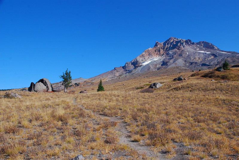
As I walk, I watch the clouds ebb and flow up the mountain. It feels so miraculous, like such a treat, to be above it all.
5.
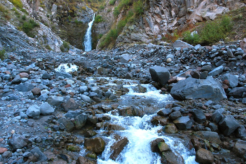
From Split Rock, I continue north a short ways to the edge of the Sandy drainage, looking to see if there’s an obvious way down. There isn’t. But there is a fantastic system of short ridges on the cusp of the canyon, which I follow east toward Mississippi Head.
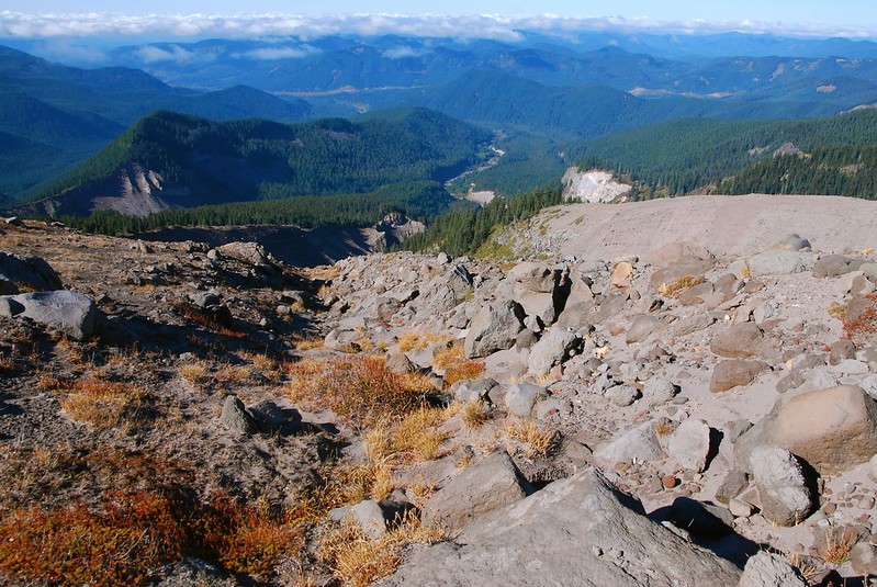

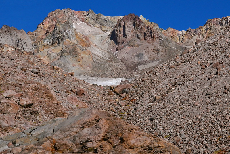
The ridges lead to a viewpoint, where the grasses of Paradise Park finally give in to the mountain’s Martian dust.


6.
I follow a set of ridges south, to a small spine that separates one of the forks of the Sandy River – here just an icy trickle – from the Zigzag drainage. It leads to a steep, dry ravine.
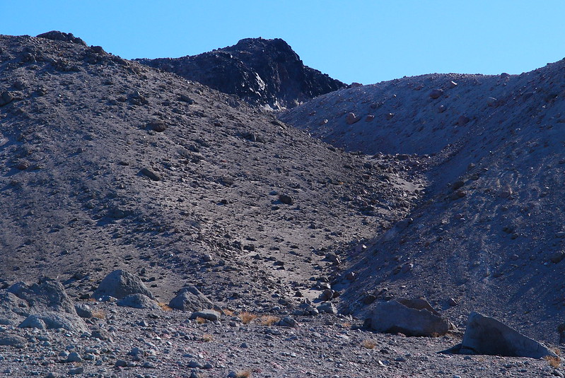
The last time Krista and I were here, it was all snow, and we followed the ravine, the route of least resistance, up. But today, as I’m looking up planning, a relatively large rock comes loose with seemingly no more encouragement than a little wind, and rolls down our old path up the ravine. Hmm. I decide to stay on the steeper ridge to the left.
Instead of snow, the ridge is all frozen scree, which breaks like movie glass or rock candy as I walk. It’s a lot steeper than it looked from below, and a few times I have to kneel to avoid falling. I do, though, eventually make it up, and stop on top to look back down.

7.
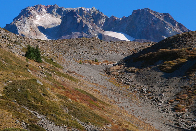
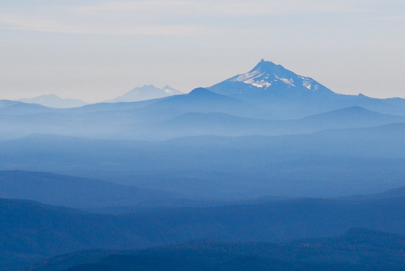
There’s a sort of small plateau on top, which affords fantastic views north, toward Yocum Ridge and St. Helens…
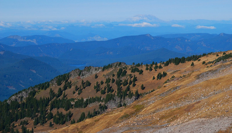
…and west to Paradise Park…
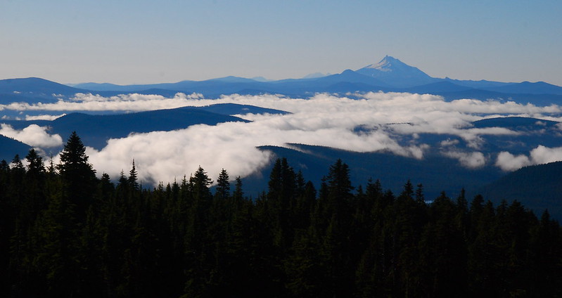
…and south to Mt. Jefferson.
8.
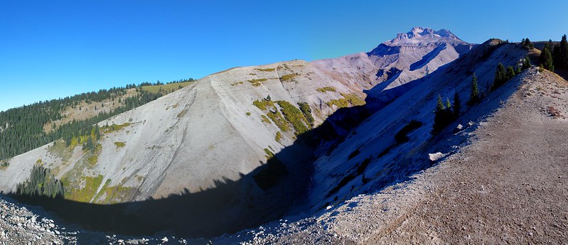
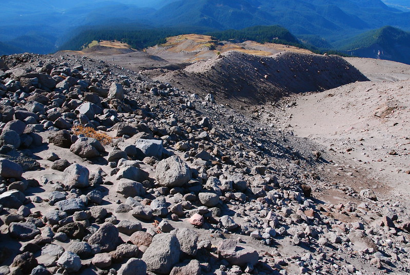
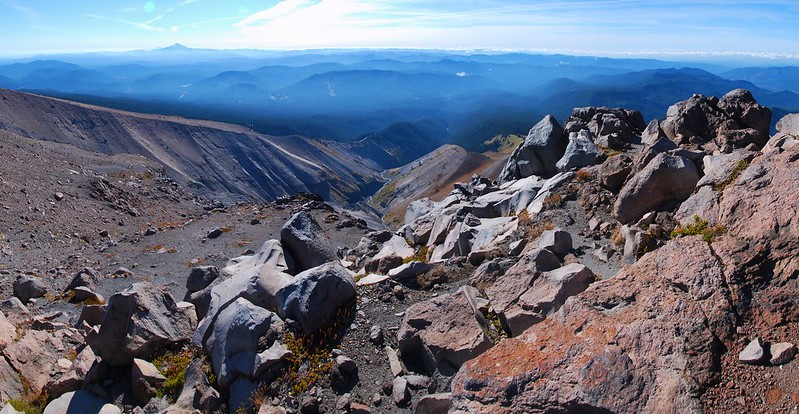
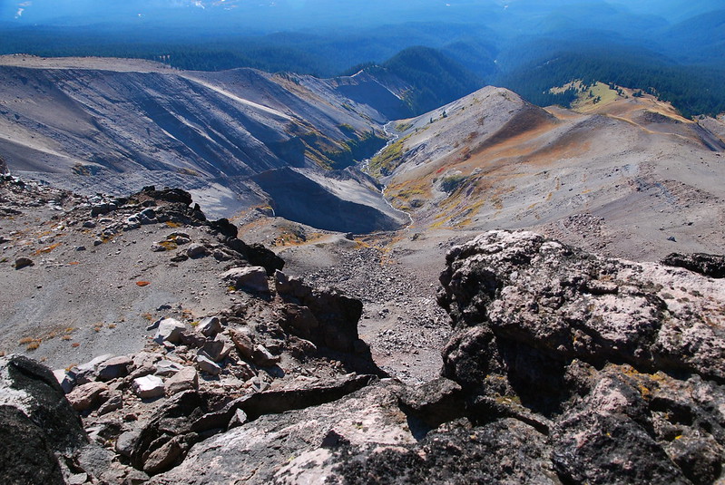
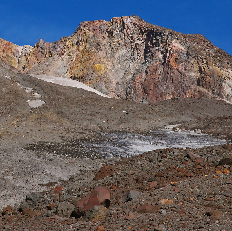
From the plateau, it’s a pretty straightforward walk up to Mississippi Head. I end up cutting slightly further east than I need to, because I want to avoid a steep icy slope that, to repeat a refrain, was covered in snow last year. But it’s easy to jot back west, and soon I’m on the high point of Mississippi Head, looking down into Zigzag Canyon.
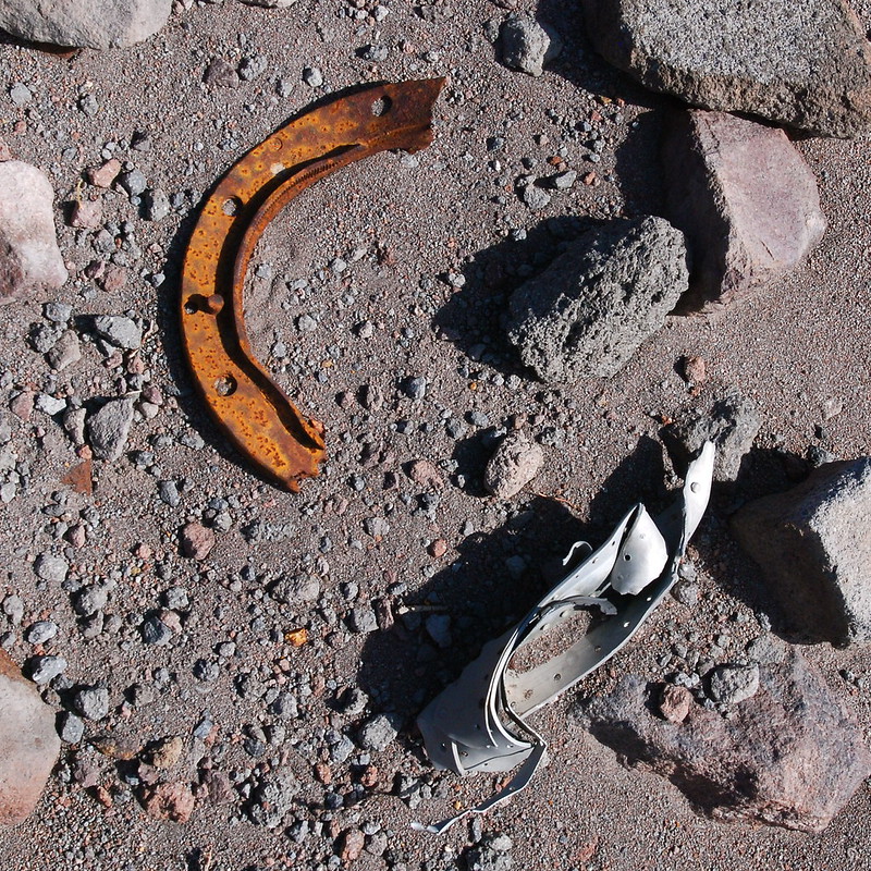
Once at the high point, I follow the cliff edge south-ish down a hundred or so feet to the site of an old 1949 B-26 Bomber crash (read much more about it in here).
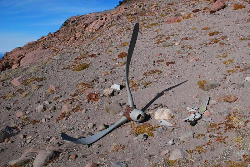
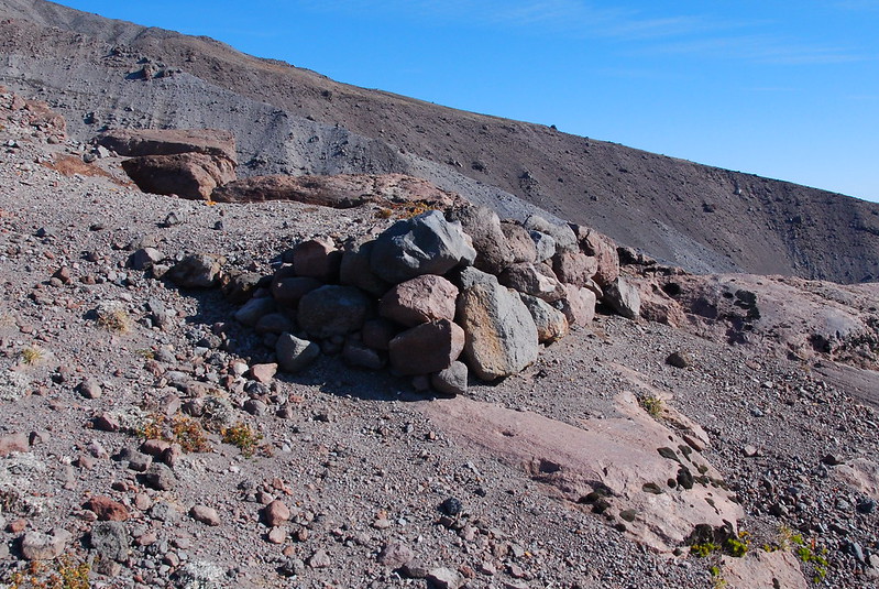
Near the wreckage, there’s also a ski jump (!), presumably from this nutcase.
9.
I have lunch sitting on the jump, enjoying the view, then set back off uphill. The secret to this route, if there is one, is to ascend to at least 8000′ before cutting right over Zigzag Canyon. Otherwise, you fall of a cliff.
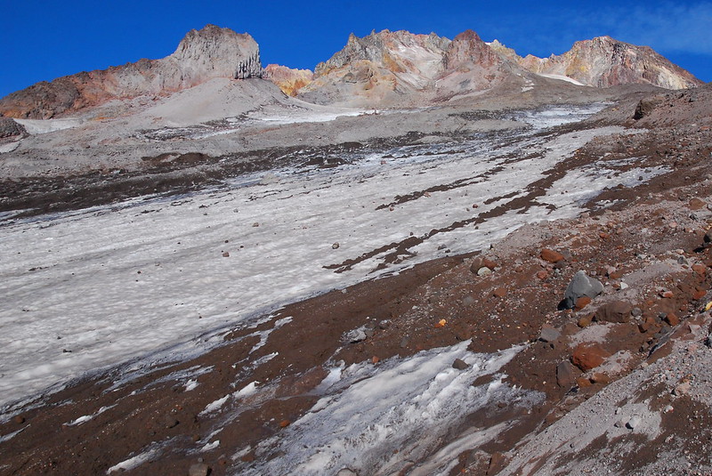
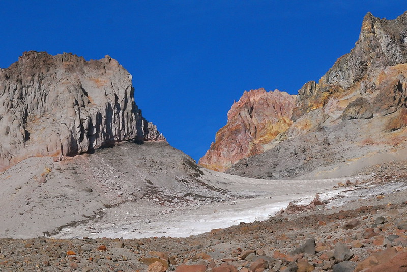
The ascent’s rougher than I remember, largely, I suspect, due to the ice and lack of snow. But there are compensating views of the “summit castle.”
Looking back the way I came:
10.
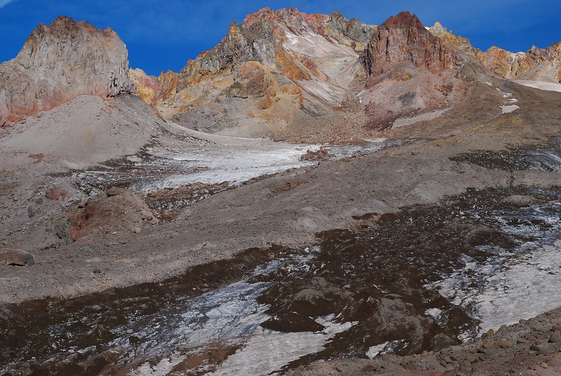
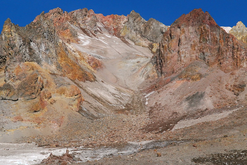
I’m making good time, so I go a little higher than I need to – up an extra 1500′ or so, to near Illumination Rock and the top of the Zigzag Glacier. To where it begins to smell like sulphur.
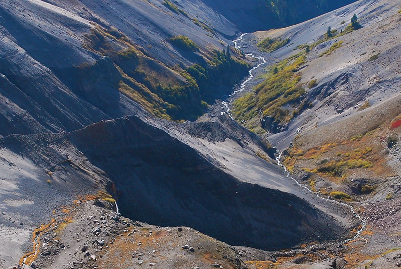
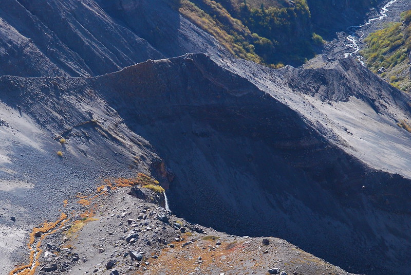
I always have this feeling up high on Hood: it looks so monumental from far away, so permanent, but up close the mountain is falling apart. It’s just a jumble of broken rocks, loosely held together by melting ice and snow.
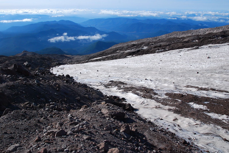
Even near the top of the glacier, there are meltwater streams everywhere, pouring silt and sediment over a thin layer of ice. The ice used to be hundreds of feet deep here, but now it’s a few inches. Beneath, it’s just rock, readying to fall – this year or next, maybe in a few if winter comes back – into the Sandy River. The rocks will emerge as pebbles years later, among swimming tourists near the Sandy Delta. Then to the Columbia, then maybe out to sea.
I stop at my high point, and listen to the near constant sound of rocks falling above. It sounds like cannon fire in a distant war.
11.
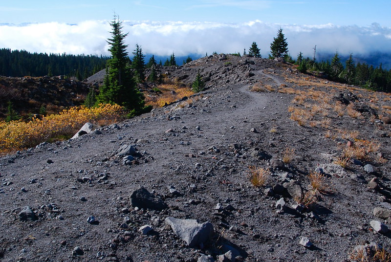
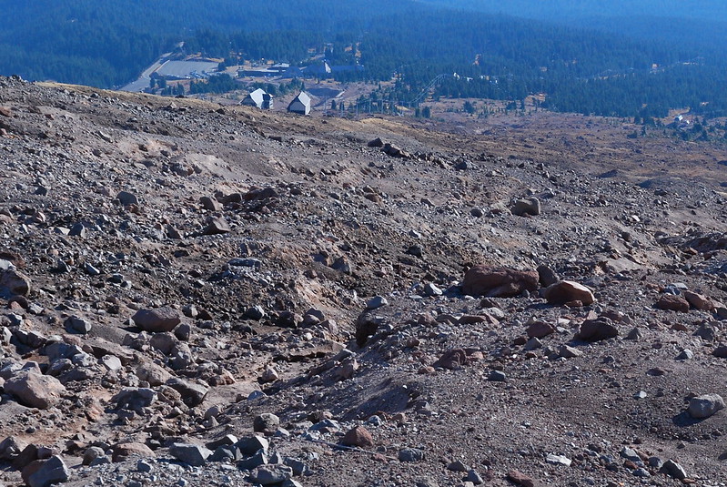
As the sun starts to set, I cut south over Zigzag, and to the top of the Palmer Lifts, with their distant views of the Lodge. All of this infrastructure for skiers. I wonder how much longer it will make financial sense to have it here. And when it no longer does – when the winter snow stops coming for good – what then? I imagine the Lodge joining the rocks, breaking into boards as it flows down the Sandy River.
But for now, my car’s down there. I drive down through the gathering dark, and stop for gas in Sandy. Looking back, the mountain’s brown slopes look blue, and are dotted with small white flecks. It looks so secure up there.

Good post. I was at Paradise Park a week later, https://higheredtechtalk.org/2015/10/28/a-night-in-paradise-park/ but I think I will return many more times. The JMT is on my bucket list so I will take interest in your JMT posts.
Thanks a lot! And cool to see that you made it up there the next week: I guess I was wrong about the snow closing everything.
The JMT was probably one of the coolest things I’ve ever experienced. If you have any inclination at all, I would try hard to make it happen. Even if it takes relatively major adjustments, it’s worth it.