February 24, 2020
1.
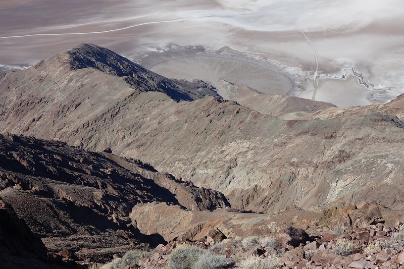
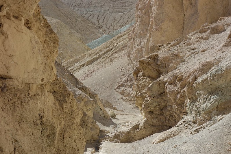
We start the day at sunrise, heading south to Dante’s View. The parking lot’s already amazing—views six thousand feet down to Badwater—but things get still better as we follow a way trail north through the foot of the Black Mountains toward Mt. Perry.


2.
The trail traipses in and out of existence—sometimes clear as the PCT, sometimes little more than a light line through sharp, crumbling rock.
I love every foot.
To the east is the edge of the Park, and some sort of mine just past the boundary. The entire side of a hillside’s gone. But in every other direction, it’s perfect: wilderness; the world as it was; the world as it’s always been.


3.
The last mile to Mt. Perry’s a little scrambly, and Krista just feels like sitting to absorb the place, so I go up alone.
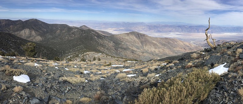
The trail disappears at a steep sidehill, then reappears improbably twenty feet above.
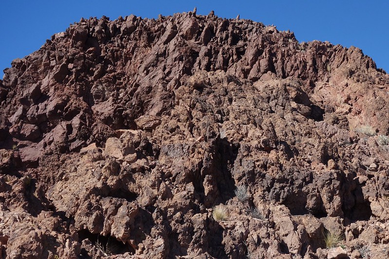


The top is just a minor high point in the ridge. I run down laughing at the ridiculous idea of a summit.


4.
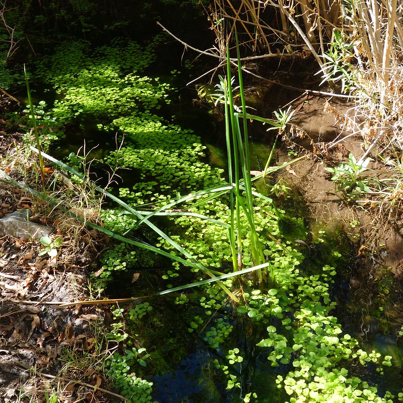
At sunset we’re back down in the valley, following Salt Creek to an oasis full of pupfish and singing birds.
There’s a boardwalk at first, then a trail, then a vast expanse of deep blue pools and blooming pickleweed.


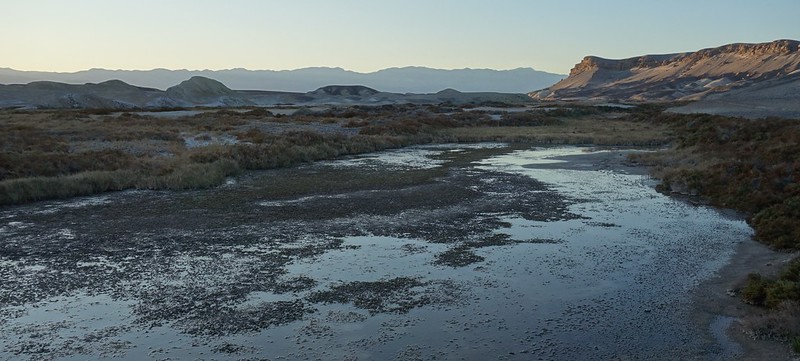
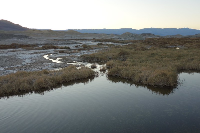
Pickleweed, it transpires, is a miraculous plant. It’s adapted to living in saltwater marshes by building special storage chambers, segregated from the rest of its biology. It filters pure water for its plant-y purposes, then stores the salty waste it can’t filter in its chambers. When too much salt builds up in a chamber, the pickleweed simply drops the chamber into the marsh and grows a new one.
We’ll remember that well in the coming months.
February 25, 2020
5.
We drive south and stop, by chance, at a rough, empty parking lot, big enough to hold a hundred cars. Bulldozers have pushed the larger of the rocks up into piles on the periphery, but just beyond there’s an acre-wide floodplain—an alluvial fan stretching from here for miles into the valley.
From the lot, a trail leads up a narrowing wash—Desolation Canyon—and we follow it for miles, up a couple slick vertical sections to a rainbow world of iron ores and oxides. A muscular man who looks exactly like Ronnie from Jersey Shore tells us about the different minerals: yellow is limonite; orange, red, and purple are hematite; blue and green and chlorite and nontronite.
He’s delighted by the whole thing. We’re delighted by him.

The canyon ends at an endless upland leading to Artist Palette Peak. We spend half an hour taking pictures of each other, running around the ridge.

6.
A day of meandering later we find ourselves in the center of Mesquite Flat’s maze of sand dunes. Someone’s taking a picture of the sky, and someone else is taking a picture of that someone. I form a third layer on top of it all.
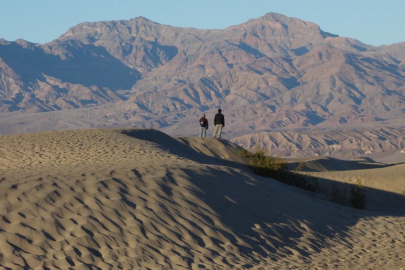


I run up and down the steep sand walls like a kid at the beach. It feels like variations on a theme.
February 26, 2020
7.
The next day we’re pulled, almost inevitably, a hundred miles west to the foot of the Sierra.
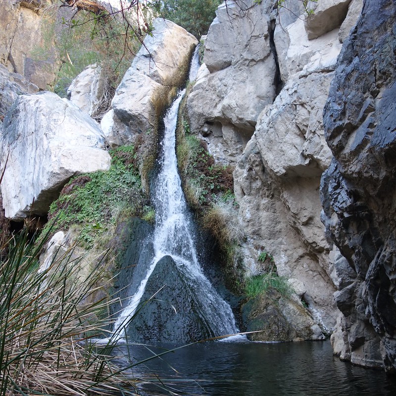
On the way, we stop just outside of the old community of Panamint Springs to follow an even older toll road up Darwin Creek to Darwin Falls, the first thing I ever saw here, that magical first trip.
8.
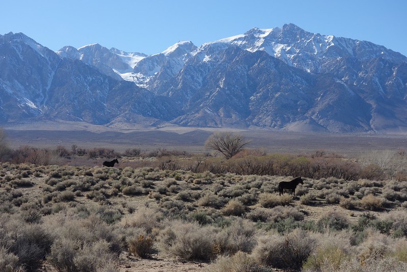
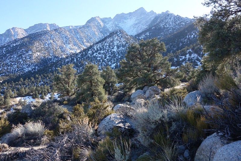
Then over the Inyos and into the Owens Valley. We pass through Lone Pine and up into the Alabama Hills. A small herd of wild horses run north, parallel to the crest.

We follow Whitney Portal Road to its gate at 6500’, then wander down an ancient road to Lone Pine Creek. This is about the elevation where we started last summer, and it feels good—I feel full in a way I can’t completely explain—seeing it again. I think, as I often do seeing the Sierra, about the wonder of a world where even distant mountains can feel like home.


February 27, 2020
9.
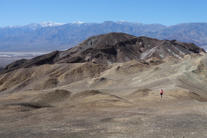
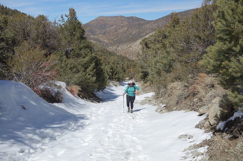
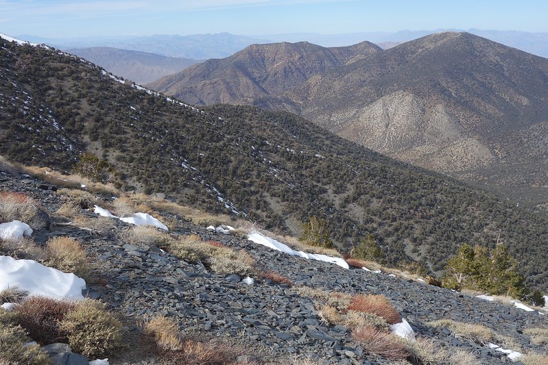
Another familiar range: the Panamints, which overlook Badwater and form the formidable divide between it and Panamint Valley.
We drive up through Emigrant Canyon and park in the snow at 7000’, then posthole up another thousand feet to the main divide.

10.
The view’s so good from the divide that, like at Mt. Perry, Krista decides to just stay and soak in it. I’ve never been good at saying still, so I cut south up the surprisingly sketchy ridge to Roger’s Peak, promising to be back in a couple hours.


As always, the way back down’s scarier than the way up, but I pick my way down, and end up getting back in precisely two hours… and ten minutes.
Krista laughs.

What an adventure.