1.
So the blog has gotten a little bit away from us.
When we started it, almost a decade ago now, we were new to backpacking. New to days and nights and weeks in the woods. New to the milky way untouched by city lights, or the sound of rain in the trees.
Everything felt important, everything felt big. And everything needed to be said.
But in the intervening years, the world out there has become more like home. We’re no longer strangers to the rocks and ridges and rivers. The milky way’s an old friend.
As that world’s become more familiar, its texture has changed: no longer a series of exclamation marks, each in need of explanation, but a quiet forest full of dappled sun or pattering rain.
And as that texture’s changed, our old way of talking about it has started to feel wrong. Writing these last several daily entries about the Alpine Lakes has felt stilted in a way it doesn’t usually, almost tedious. I think it’s felt that way because breaking the experience up into days has felt wrong.
2.
There’s an old distinction in anthropology between two senses of time, what we might think of as clock and baseball time. Clock time’s the time of trains and transits, of business and capital. It’s the time that always passes evenly, untouched by what it contains. In contrast, baseball time is shaped by what it contains. It’s made not of minutes but innings. The game takes what it takes, the clock watching idly from the stands.
Our early outings were shaped by the clock, by minutes and hours and days. And so were the early entries on this blogs. I wanted to catalog every experience, to separate it out and put it all in time—under a microscope, photos filed in our daily ledgers. But that no longer feels right. We play now in innings.
3.
And so the last two entries about the trip will be a little different: a record not of days but of what days contain. It’ll be a record not fit for trains, but fit for trees and trails and rain.
August 16: Necklace Valley to Deception Creek via East Fork Foss River and Tonga Ridge
4.
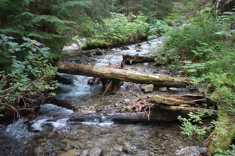
At sunrise I pick my way through talus and tree roots down a steep slope to the East Fork Foss River, then cross the water on an old fallen tree, moldering and mossy, the river running through holes in the wood.
Breakfast on the other side, oatmeal and coffee in an ancient camp, on another old log overlooking the river. Tiny trout break water through the rapids.
5.
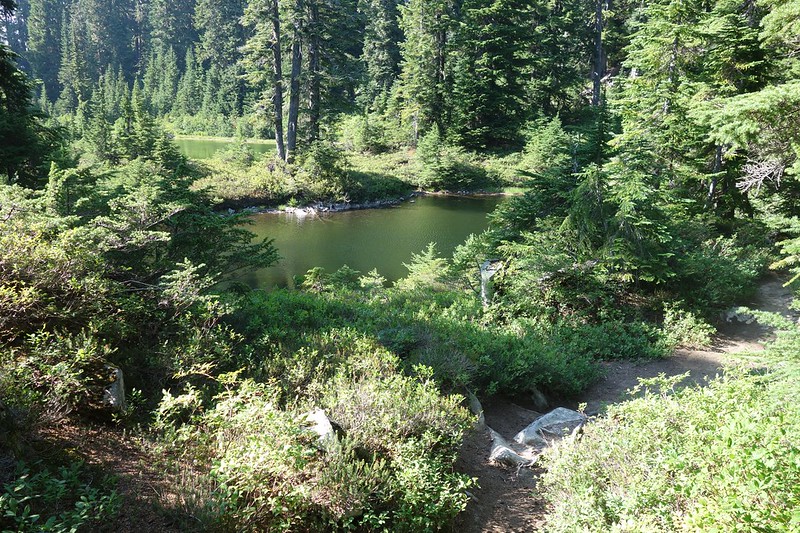
After breakfast, I follow the path across a few more forks of the Foss, then through stately stands of old growth, through trees ten feet thick and hundreds tall, a rich green carpet of fern and moss and vanilla. An owl echoes down the valley. Deep still ponds have settled improbably in small nooks along the way. Tree roots wave up from the bottoms, through pools of crystalline green water the same height and width as me.


Six miles go quickly, and soon I’m sitting in the trailhead restroom. It’s warm and smells of the fake pine air freshener someone’s hung from the yellow bee catcher in the plastic window.
6.
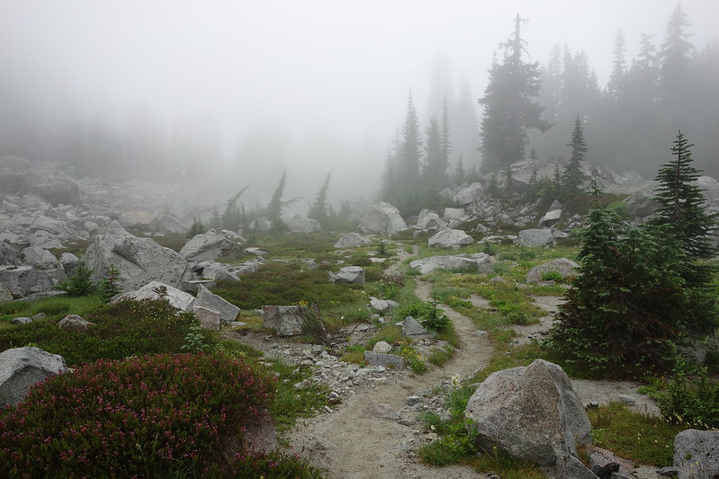
Then a long walk on roads: flat along the river, then climbing up rocky switchbacked tread, past boondocked and broken-down RVs, the remnants of quarries, boulders built up to block the decommissioned roads.
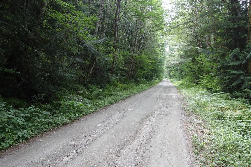
The day gets cold, and clouds thicken as I climb. I stop at a switchback, sit on a stack of boulders, and eat my little lunch: an ounce or two of peanut butter on a tortilla, a couple Sour Patch Kids.
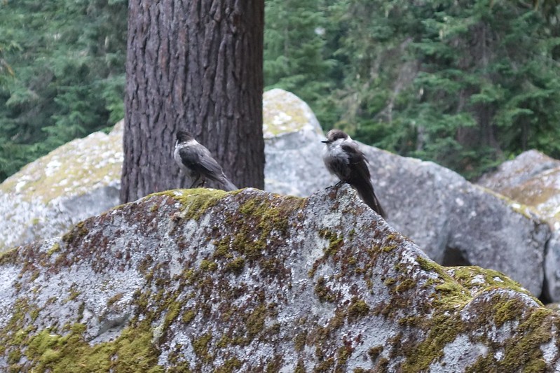
A couple cars pass, but I don’t think they see me hidden in the rocks. I feel like part of the landscape—a pika or marmot, maybe a bear. Maybe a pool of water, gathered from rains on the roots of an ancient cedar.
I love road-walking in exactly the same way that I love walking off trail. Single-track tread feels built for me. It is built for me. But here on the road I’m an outsider. This path is built for things with four wheels, not little legs. To walk on it is to feel the majesty of moving through a world where I’m a stranger.
7.
The clouds have changed to gentle rain by the time I meet the Tonga Ridge Trail at the top of my climb. Senior citizens in adventure hats and matching brown khaki tilt their heads as they pass the other way, wondering, I guess, how someone this close to civilization could smell so bad. Lightning lights the top of Mt. Daniel, just barely visible through thin second-growth pine.


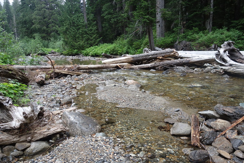
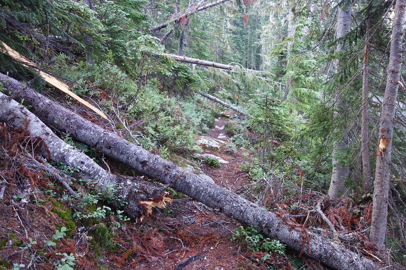
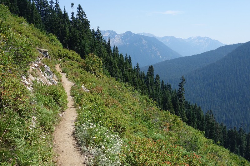
Past the turnoffs for Mt. Sawyer and Fisher Lake, the trail degrades markedly, making its way through fields of blowdown as much by faith as maintenance. It crosses a small rough road—the upper reaches of FSR 6830—then drops steeply on roots and rocks to the confluence of Fisher and Deception Creeks.
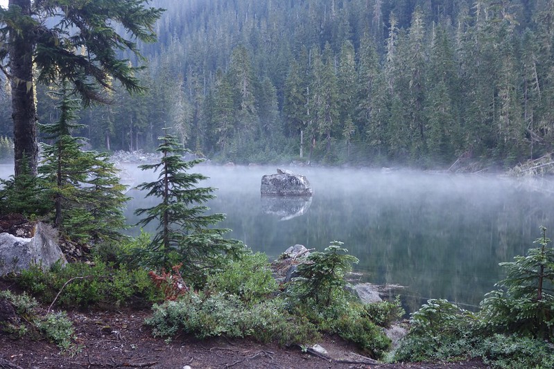
There’s a cluster of camps here, and I rush to get up my tent before the trickling rain turns to more. But the onslaught never comes, and I spend the evening sitting at the confluence, watching the water as the sky goes dark.

August 17: Deception Creek to Surprise Lake via Deception Pass and the PCT
8.
I wake to heavy rain and the sound of hooves hitting wet ground, and make the easy decision to sleep a few more hours.
When I wake again the rain’s picked up. And maybe that’s thunder? I make the still-easy decision to sleep for still a few more.
When I finally wake for good, the rain’s about where it’s been. But I can’t stall forever. I eat a hurried breakfast at the confluence, pack up in a soggy rush, and start up the trail.
9.
The day starts with a ford across Deception Creek, here flowing deep with muddy rain. It’s only thigh deep, but, between that and the dew-soaked brush, I’m wet from head to toe by the time I start climbing up toward Deception Pass.
The trail here’s all mud and mossy wood, ancient bridges and puncheons now part of the wild, old rusty nails like quiet satellites from a distant world.

10.
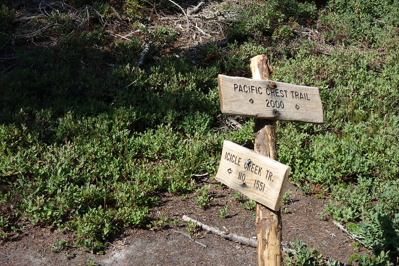
The Deception Pass trail ends unceremoniously at an unassuming curve in the PCT, just below the Deception Lakes. No sign, just a faint bit of tread leading down the way I came.


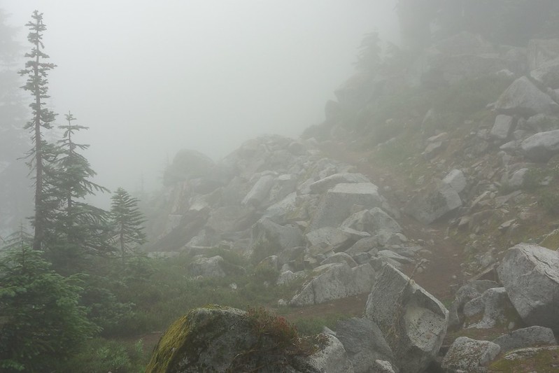
I join the PCT and climb due north below Surprise Mountain, sidehilling in heavy rain up into a deep cloud. The world goes quiet and white, white sky and red ground and small blue lupine dripping with cold dense rain.


11.
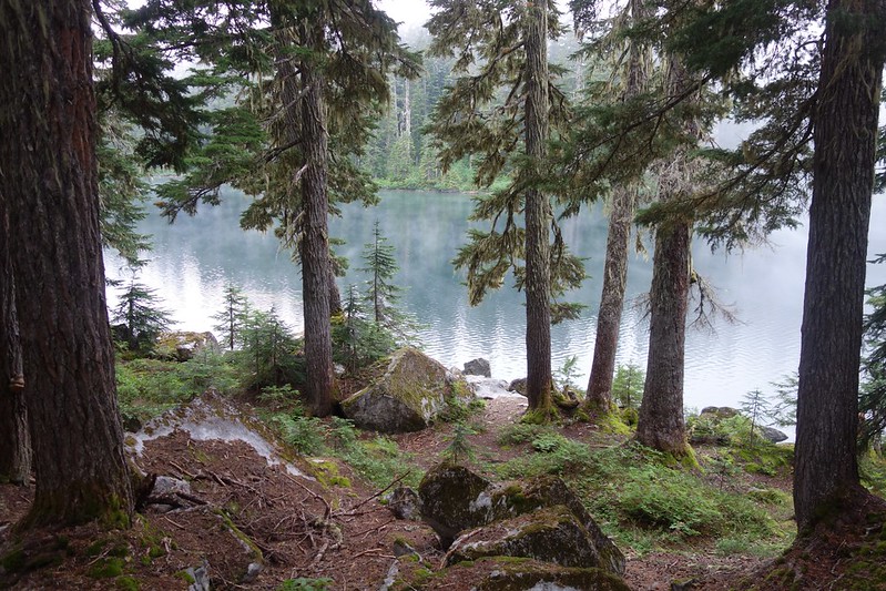
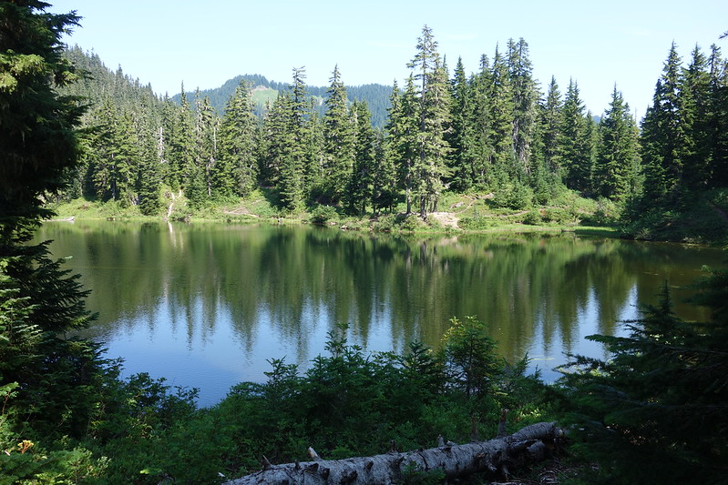
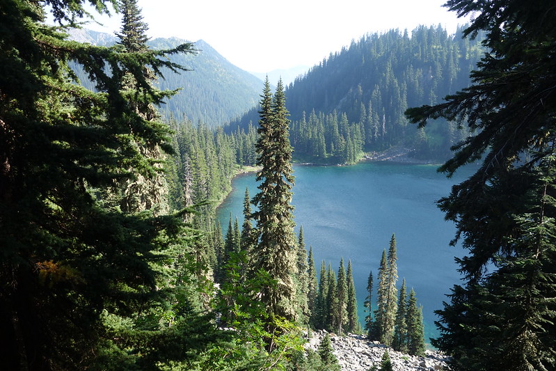
The trail tops out at a narrow pass nestled between Surprise and Spark Plug Mountains, then switchbacks steeply down through talus and thin forest to Glacier and Surprise Lakes. I leave the PCT and find a tiny spot on Surprise Lake’s eastern shore to ride out the rest of the storm. My tent is soaking wet, but my bag and book are dry, and I spend a surprisingly nice afternoon swaddled in bed, listening to the rain and reading about the Himalaya.

12.
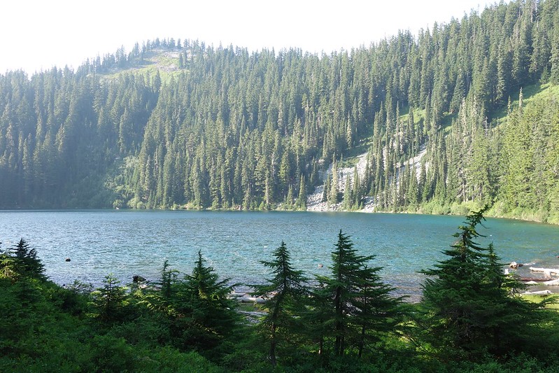
At sunset the storm slows down, and I wander out through dripping trees and singing birds to a clearing along the lake for dinner. The clouds rise from the water to the ridges and into the sky, little bits of blue and purple and red at the edges.

August 18: Surprise Lake to Lake Josephine via the PCT
13.
The day breaks clear, the last bits of yesterday’s rain rising in steam from the bushes and branches and flowers. Bees and birds rush between bright blooms, buzzing with refreshed force.
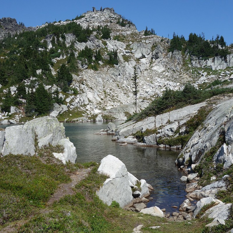
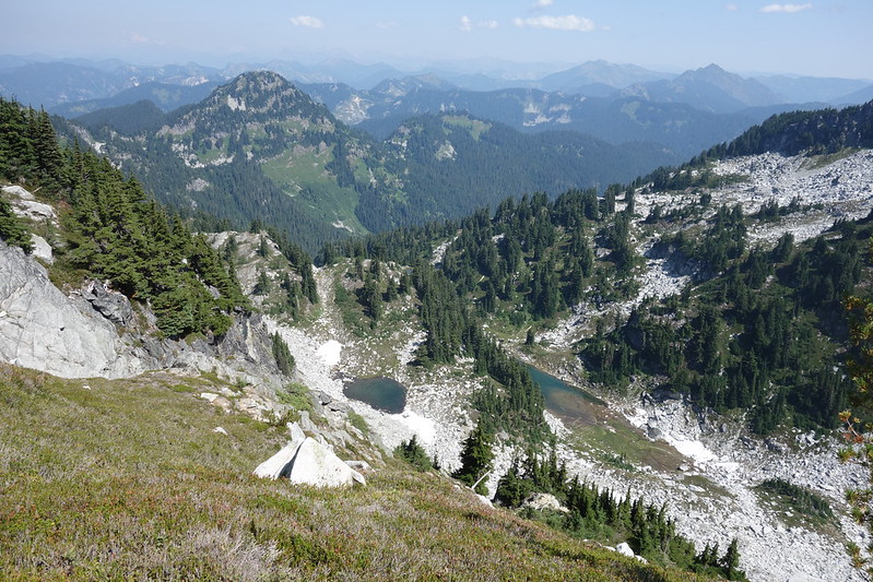
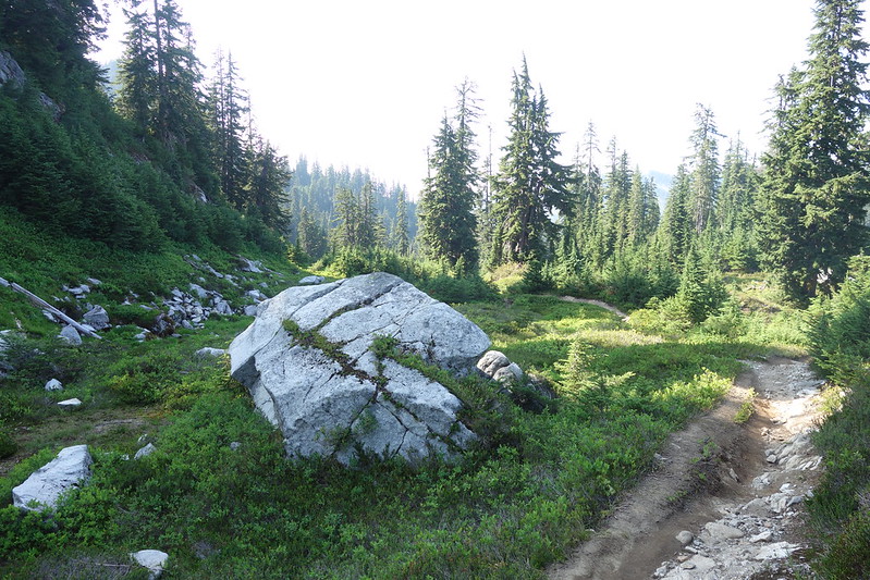
I climb a steep mile 1300’ up to Trap Pass, then cut south on a way trail toward the Thunder Mountain Lakes, a series of blue and green tarns set improbably into the white granite of Thunder Mountain’s northern flank. I feel refreshed to, and stop for a long lunch on a warm dry slab overlooking Trapper Creek—a minor fork of what will become Icicle Creek, where I’m set to finish in a few days.


14.
Back on the PCT, crowds are out in the summer sun, dayhikers and thru hikers and everything in between.
I follow the easy tread along the cascade line, passing from one side to the other, through minor drainages—Trapper, Basin, Tunnel—all on their ways to becoming major rivers.
Above Swimming Bear Lake, I meet a couple of older guys, yoga mats strapped to their external frame packs, just setting out for a section hike from Stevens to Snoqualmie. They ask if I’ve been here before, and out of nowhere I almost tear up. I realize they’re the first people I’ve talked to since Snoqualmie, and for some reason I just want to tell them everything, want to talk their ears off about everything I’ve seen in the last sixty miles. After too long, I tell them that I have, and that they have a wonderful trip ahead. “We’ve been looking forward to this for years.”
15.
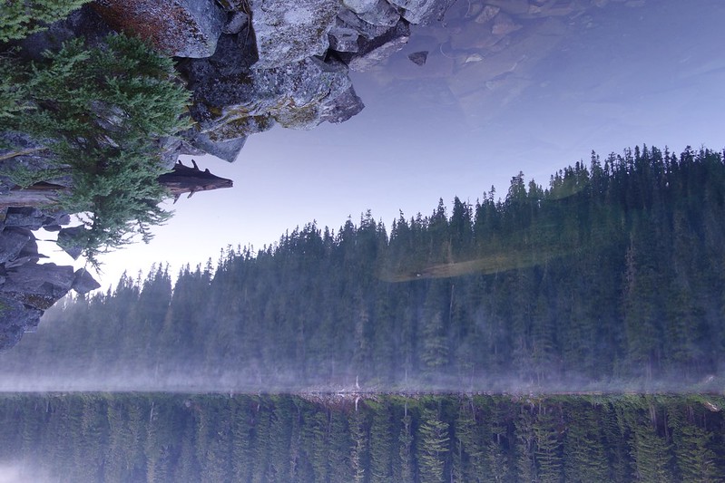
I turn off the PCT at Josephine Lake, and drop down to a cluster of clearings on the eastern shore. There are already several folks here—we’re just a couple miles from Stevens Pass—but I find a lovely spot in the sun, and set up my still-soaking tent to dry.

The water’s blue and warm, sparkling in the day’s fading light. I think of yesterday’s rain, of the soggy night at Surprise Lake. Was that just yesterday? Days are different here.
