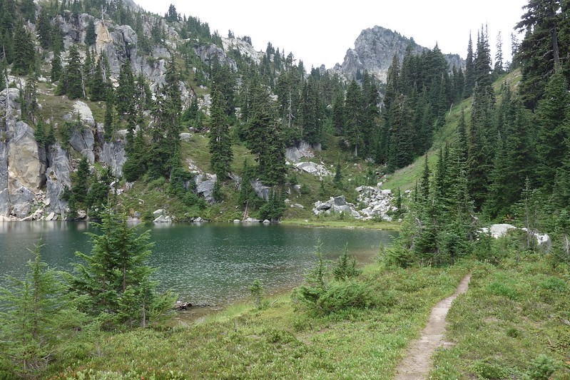
August 19: Lake Josephine to Lake Mary via Icicle Creek, Chain and Doelle Lakes, and Frosty Pass

1.
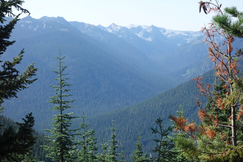
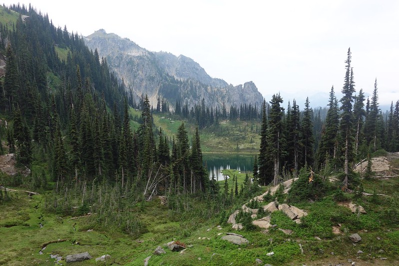
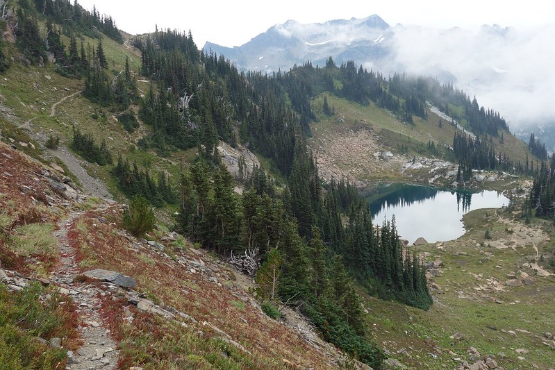
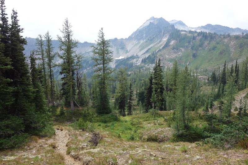
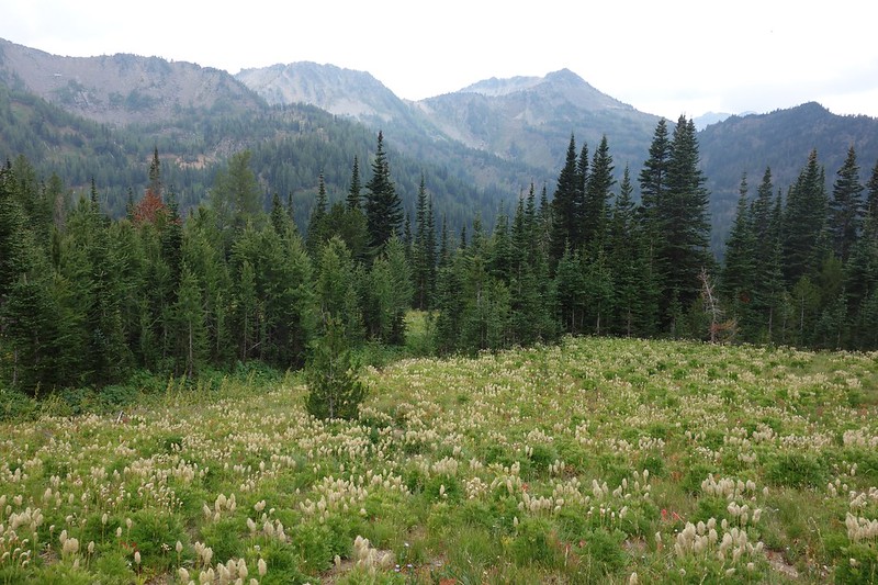
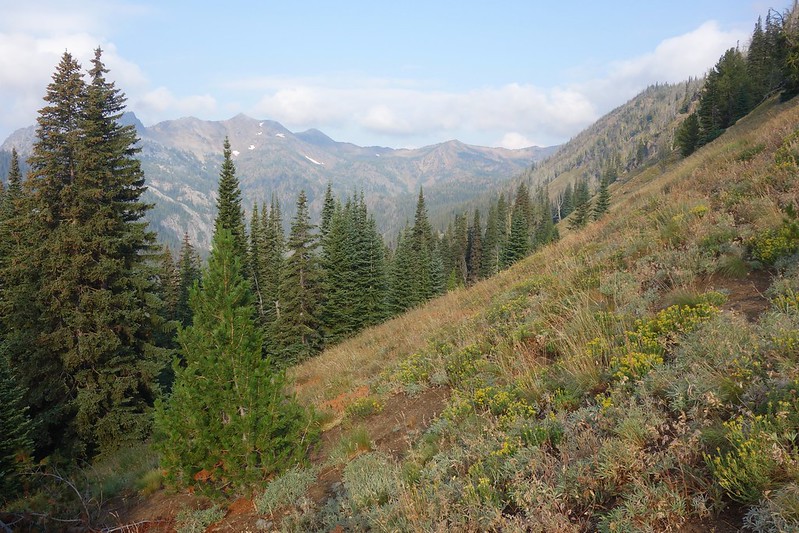
I wake to nearby thunder, lightning hitting the ridge above. There’s a cloud covering the PCT, but it’s still sunny here, so I pack up quick, and scurry down south into Icicle Creek. The storm follows me all morning—down the easy broad tread a thousand feet, then steeply up two thousand toward the Chain Lakes—but disappears by early afternoon.


At Chain Lakes, the way braids and fades. I pick the thickest path up toward the unnamed pass between here and the Doelle Lakes, then follow thin tread around the lakes’ northern shores until the official trail ends at the outlet of Lower Doelle Lake.
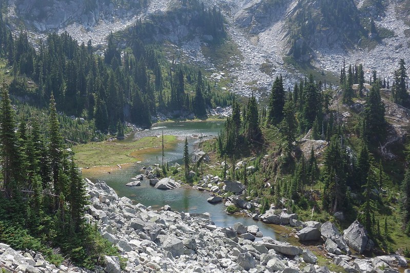

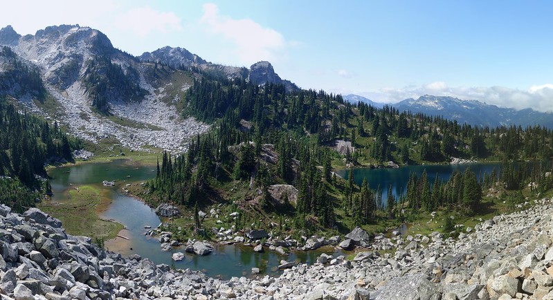

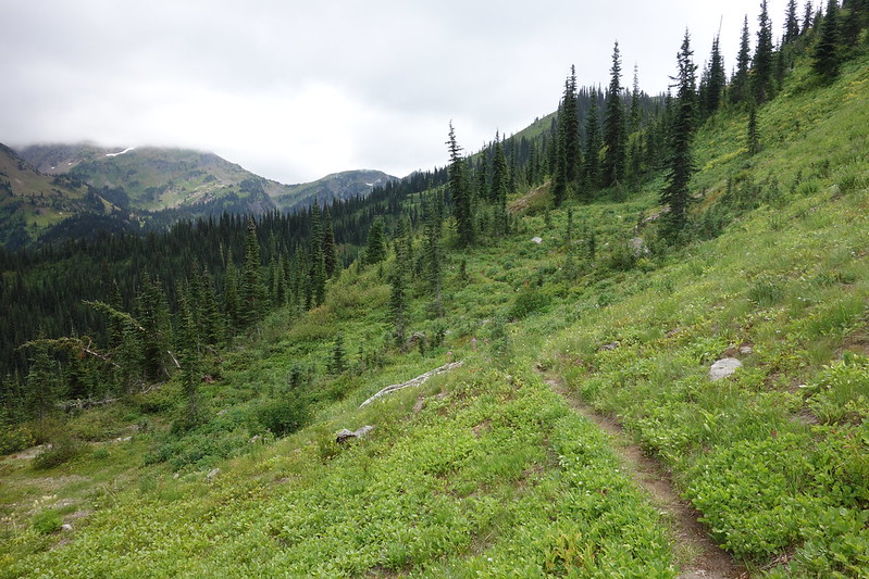
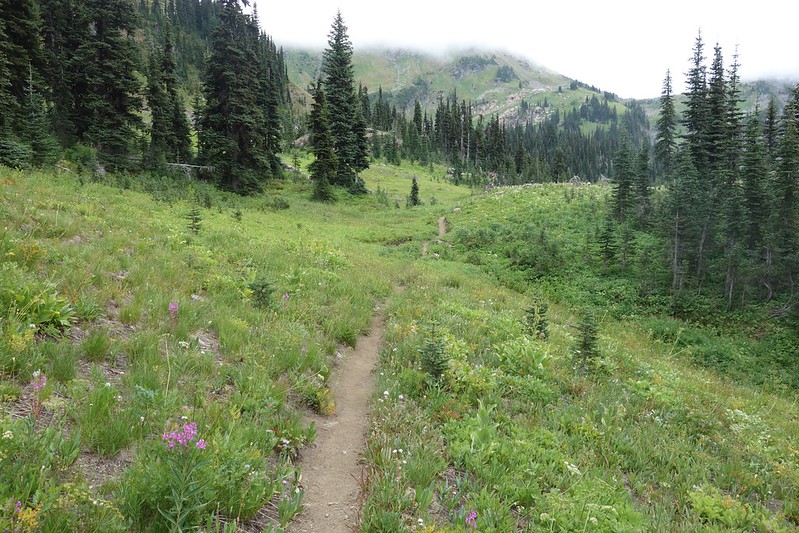
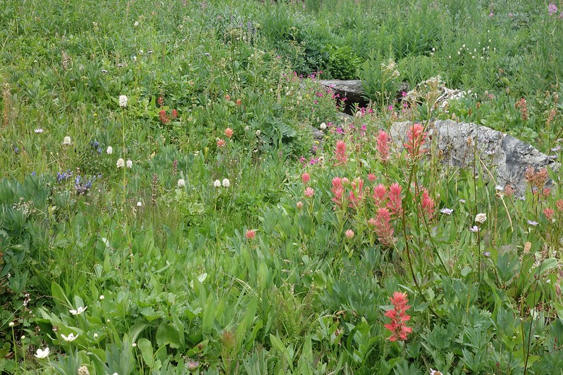
From here, it’s around three miles to Frosty Pass and the return of official trail. I’ve been nervous about this spit, but there’s a good way trail for most of the route. I follow its faint tread through the wildflower meadows that line upper Doughgob Creek—it’s more of a grassy indent than a proper trail—then through thick forest steeply up the southern shoulder of Doughgob Mountain.


2.
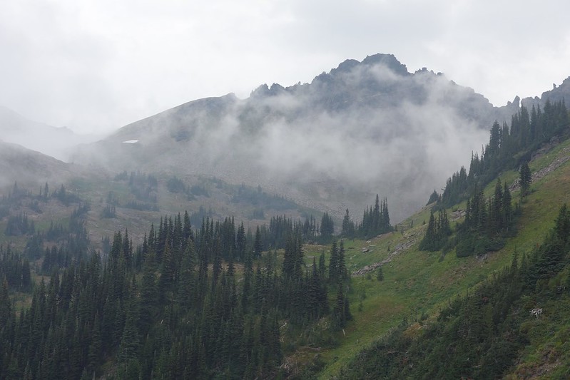
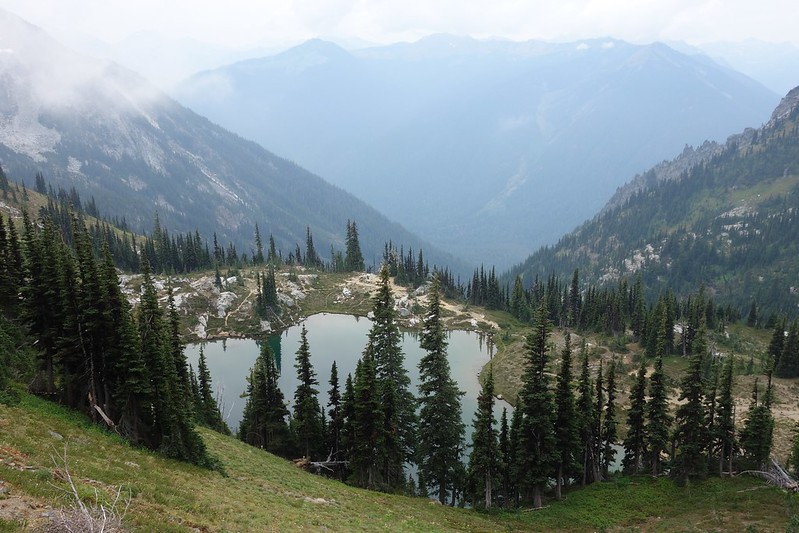
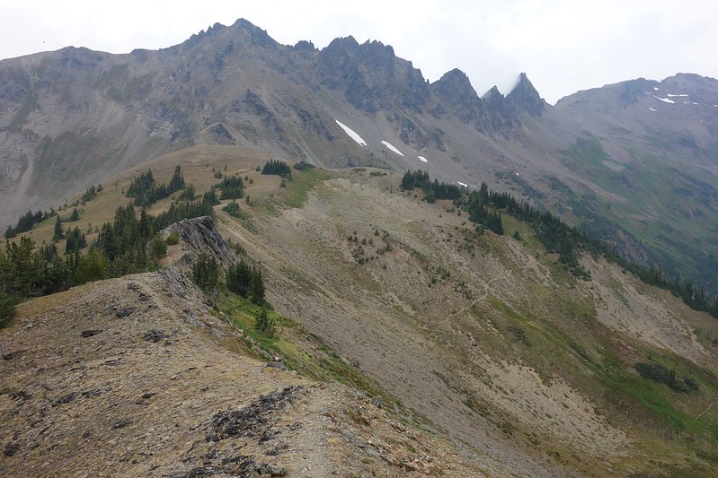
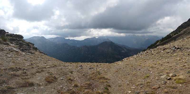
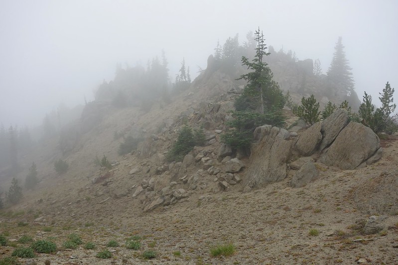
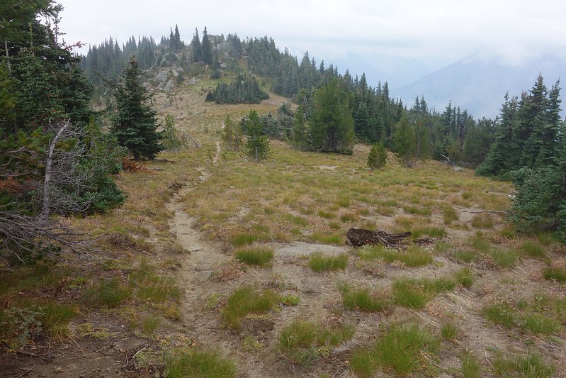
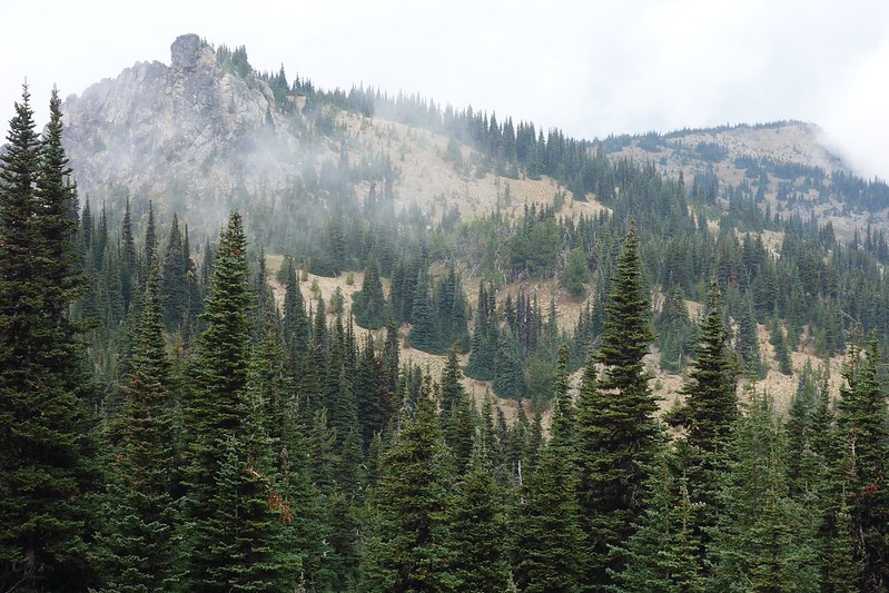
The thunder finally finds me near the pass between Doughgob and Wildhorse Creeks, but no matter: the tread’s better here, and only improves as I follow it south below Frosty Mountain. Clouds come and go, rain and sun and small bits of hail.


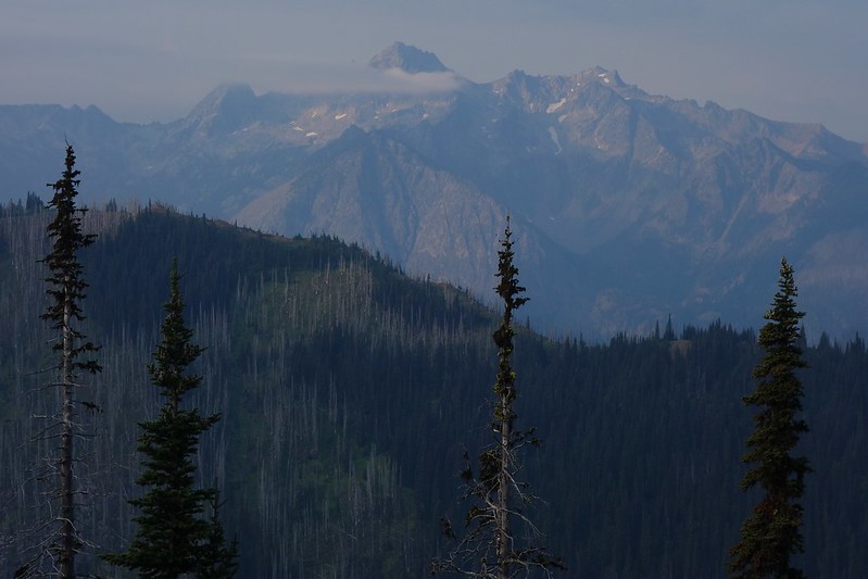
Wildhorse and Whitepine Creeks stretch north, deep canyons full of fog. There’s snow on the Chiwaukum crest, just a few thousand feet above. It’s unspeakably beautiful, and my fingers, I realize with a little shock, are so cold they don’t work well enough to turn on my camera.

3.
I stop for a while, press my hands between my legs, put on all the clothes I have. Then I rush as fast as I can through the gathering storm, up and down as the trail assembles itself.
I stop again at Frosty Pass, hide under a tree, and think of the first time I saw this place. My dad and I had hiked up in a gathering storm. I hit the pass before him, and just stood there—stood here—for ten minutes, watching snow dump on the distant ridges. I’d been to the Enchantments and through on the PCT, but I’d never seen those ridges, never connected the dots. And so I decided to come back to try to get to know the place.
4.
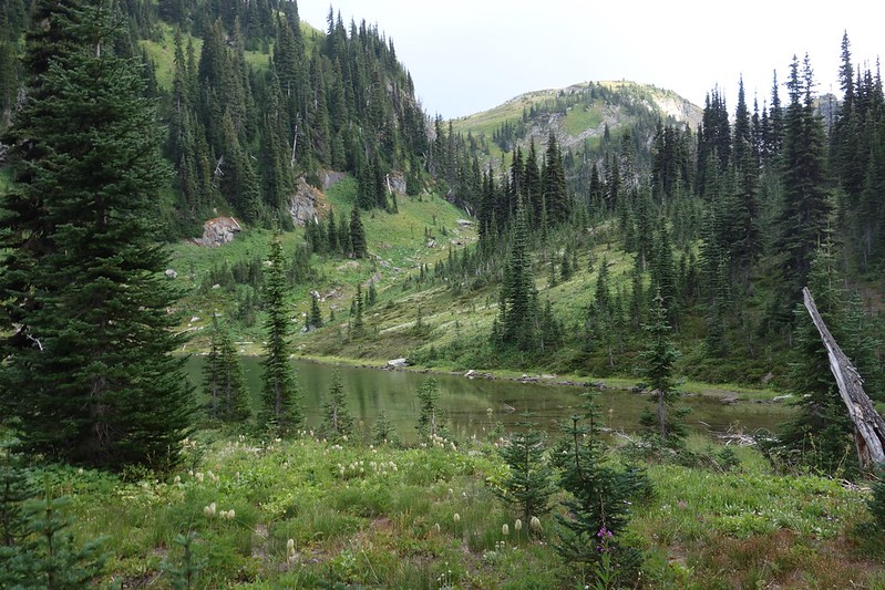
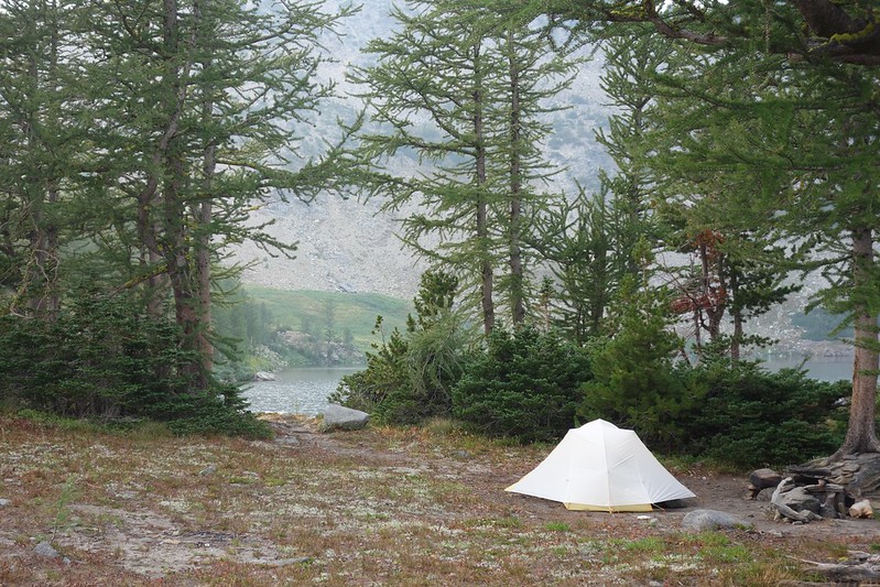
I find my way down through the rain down to Lake Mary, and set up in a broad sheltered spot on the far shore. Rain comes and goes all evening and afternoon, small wisps of white snow gather on Snowgrass Mountain’s southern shoulder.

After dinner I wander out through the dripping sunset to use the restroom, and on the way back find a couple in their mid-40s setting up camp on a soggy ledge overlooking the lake. One—a guy in a puffy coat, soaking Metallica t-shirt, and knit hemp hat—calls me over in an old-fashioned accent. “Where you coming from?” I stammer, realizing I haven’t talked all day. “Well, I guess I’m at the end of a couple week trip. I started just down there”—I point down toward Icicle Creek—“but then went down to Snoqualmie and up a different way to near Stevens and… now I’m here.” I’m a little embarrassed at having talked so much. “What about you?”
He doesn’t answer, but instead pulls out a map—this large format National Geographic thing—and invites me to sit down. I sit between my knew friends—Mike and Jess, it turns out—and we stretch the map over our legs. “Would you show us?” Mike asks, in a voice that for a reason I can’t explain almost makes me cry.
I trace my route with my finger, anxious not to take too much of their time. But they keep stopping me. Jess asks about Doughgob Creek, Mike the Middle Fork and La Bohn Gap. I feel as though they’re giving me the gift of my own past.
We talk for half an hour as the sky changes from gold to red to purple to black, Mike offering me hits of his joint, Jess nuts from her comically large bag of trail mix. We talk until I feel myself starting to shiver, then a little longer.
4.
Back at camp, half fetal and a little shaky underneath my quilt, I read the last few chapters of my book, A Short Walk in the Hindu Kush. My dad gave it to me ages ago—the inscription wishes me a happy Christmas 2014—but I’m somehow just managing to read it now.
I finish around midnight, then stumble out into the glowing night. There are clouds all around but it’s clear here. Constellations echo off the slowly shifting water. Somewhere down the valley two owls are singing out to each other.
I think again of that trip with my dad. From Frosty Pass we hurried down here, then set up camp in the deep snow in a draw that I now realize was not at all a campsite. We shivered through lunch in the tent, then ate out in the shin-deep snow, watching the frozen stars.
I look up at those same stars and wonder at the bigness of the gift my dad was giving me: an introduction to this place, a way into a wider, wilder world. The gift of future possibility, even if it’s taken me a few years to open it.

August 20: Lake Mary to Lake Augusta via Ladies Pass, Mary’s Pass, and Icicle Ridge

5.
I wake to rain, insipid and unrelenting, like a dull ache. Everything’s wet in a way that feels like it’s always been wet, like wetness is the only possible way this world can be.
I throw it all, dripping, into my bag, and begin limping up to Mary’s Pass. My legs hurt today and I don’t know why. Everything hurts. It’s that end of trip ache, the ache of a body being pulled back home.
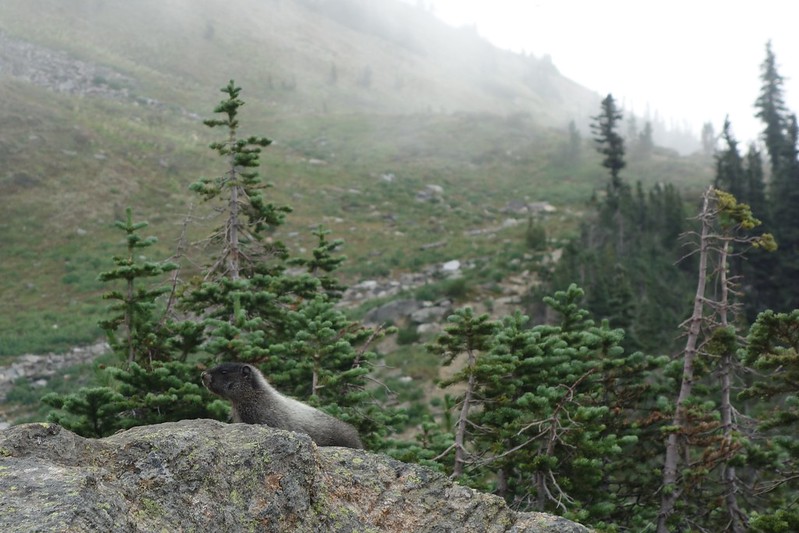
It rains then it suns then it rains again. Marmots whistle in fields of western pasque, like creatures out of Dr. Seuss. Alpine larch, still green, drip shining light from their long needles.


6.
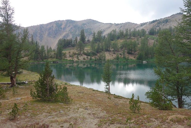
Past the pass, the trail wends its way through fields of just past prime wildflowers and little streams running south from Ladies Peak. A few hundred feet below, Upper Florence Lake waves like a sea-sick ocean in the light persistent rain.
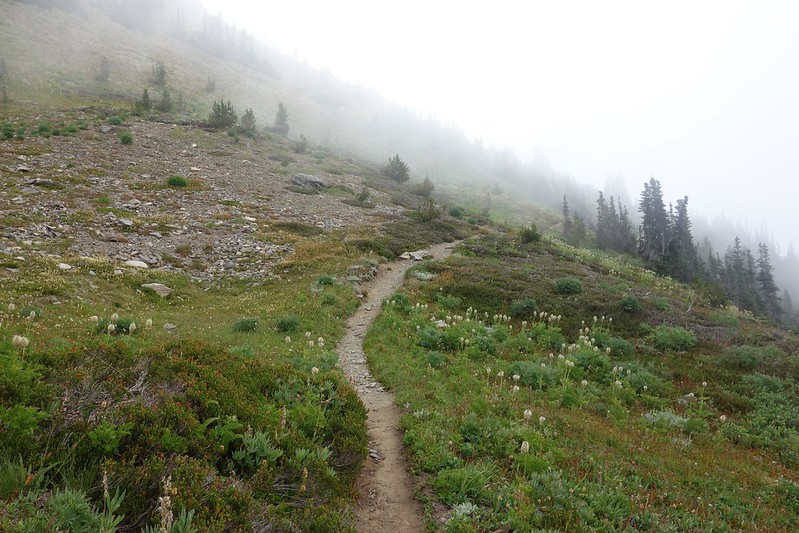
I stop at Spanish Camp Creek to filter a few liters of water and eat my morning Snickers. A small bench at the lip of a tumbling cascade. The sun comes for serious this time, and all of a sudden, the world changes color from grey and gold to every shade of green. And the birds come, dozens of them from out of nowhere, filling the sky with song and wonky squawks.
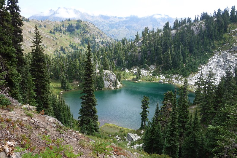
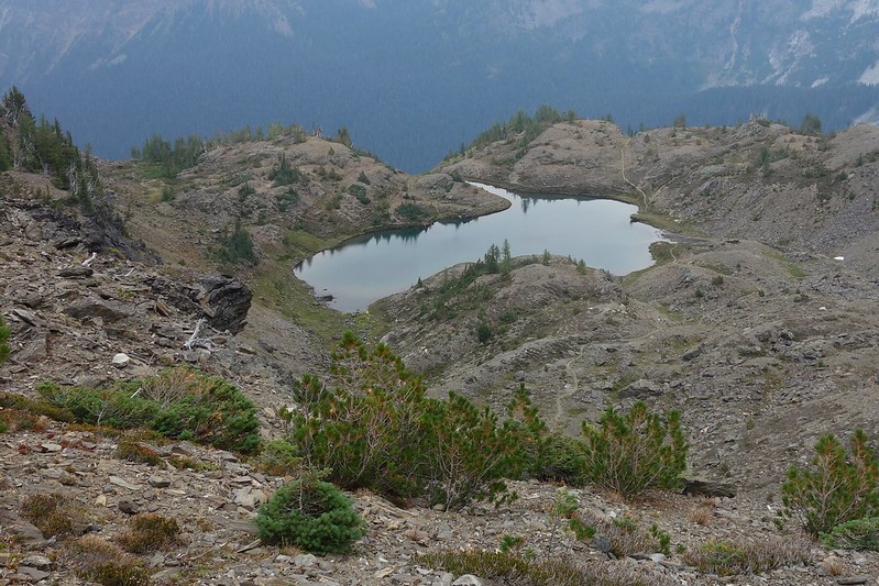
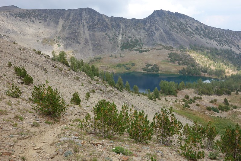
The sun comes still brighter at Ladies Pass. The trail follows a narrow ridge west to just below Cape Horn, then cuts improbably through stark fields of talus and snow to Lake Edna, where a couple kicked-in camps stand like ancient ruins among the much realer world of rock and water. I eat lunch hiding behind a high granite boulder, wind whistling overhead.


7.
Beyond Lake Edna the trail splits. Half—the more civilized half—cuts south over an unnamed pass then follows Chatter Creek to the Icicle Creek Road, near where Krista dropped me off two weeks ago. The other half, my half, drops steeply down 1500’ to Index Creek, before climbing back up a bit more than that to an unnamed pass north of Frigid Mountain.
Almost immediately after the junction, the tread disappears. Here and there old cuts give confidence that I’m on what once was the trail, but it’s mostly just a matter of picking the route of least resistance. I miss a switchback then find the trail a quarter mile later, improbably sandwiched between two fallen trees. I slip a little and fall in the mud, laughing.

8.
Index Creek is an overgrown affair, flowing over and under fallen trees and sagging ferns. I cross on what I think may have once been a bridge then climb steeply, with no semblance of a trail, toward what looks like it might have once been tread. It is… I think, and I follow it unconfidently for a little more than a thousand feet up, until it ends in an open meadow of rock and blooming red. I know where the trail needs to go, so I go there, and sure enough find better tread another 800’ up, at a complex set of passes in the shadow of Frigid Mountain.
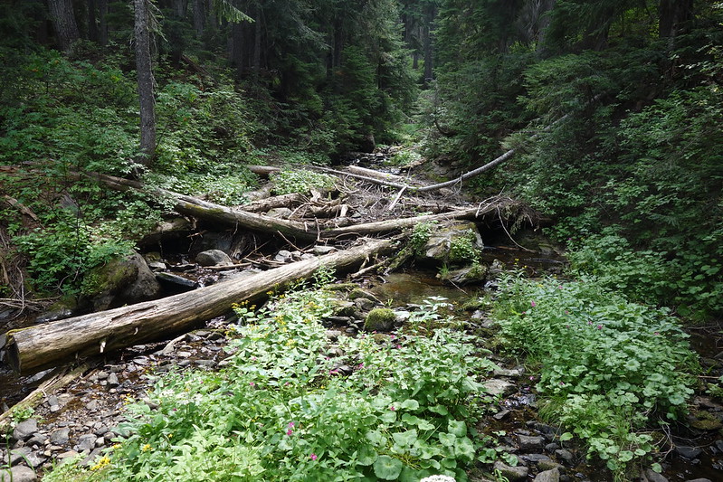

Finding the proper way down takes some doing—I have to backtrack more than once—but soon I’m wandering through an ancient camp at a shallow pool that was apparently once Carter Lake. Then Painter Creek and a convoluted traverse ‘til finally I’m climbing up a steep trail—more four-footed than two—to my final pass for the day, overlooking Lake Augusta.

9.
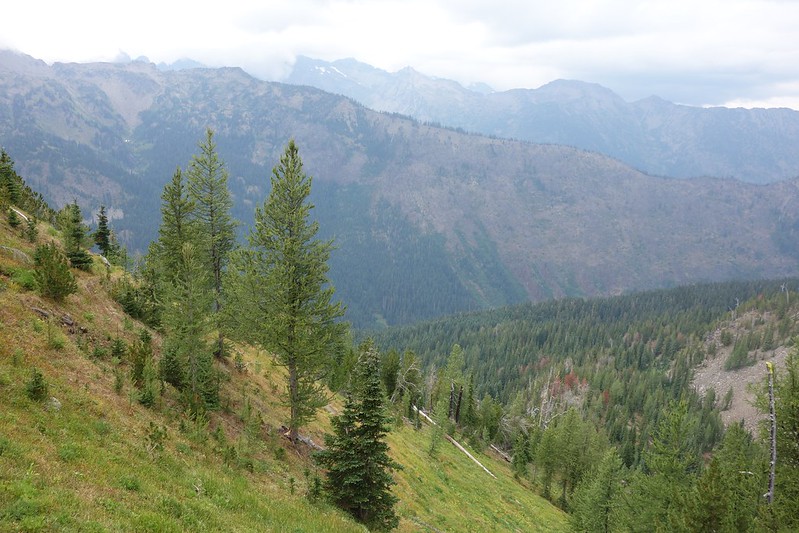
I’ve been traveling due east, and the scenery’s gone from damp Cascades to something almost like the dessert, little trees with shallow roots in sandy soil. But also… another storm’s coming. I can see sheets of rain hammering the pass I just past between Index and Painter Creeks.
I hurry down through sandy switchbacks to Lake Augusta and set up at a slanted spot so that no water will pool when the rain comes. The thunder gets closer through dinner, and closer still as I take my final walk, drinking my final little bit of EmergenC. I’ve been dreaming of this trip for years and it’s nearly over. I’m ready to be home, to be with Krista, to be in the land of water taps and baths and burritos. But there’s that funny thing about dreams: they come true, and then there are more.


10.
The storm finally comes at ten, pounding rain and hail, lightning striking the hills above. Tomorrow Krista will tell me that there was a flash flood warning here, 4” of rain in just a few hours.
The rain sounds like a train right on top of me, almost deafeningly. White, ripping noise. I lie in the flashing dark for hours, thinking of the last two weeks: that first unsteady day, the blood on my leg; the jeep girls, my camp by the road; naming the peaks with my friend at Robin Lake; memories at Peggy’s and the burning hot day; smoke and civilization at Snoqualmie; the Middle Fork’s magic; the long road up Tonga Ridge; days of rain… It’s astounding how much life can fit in fourteen days.
August 21: Lake Augusta to Icicle Creek Road via Cabin Creek, Icicle Ridge, and Fourth of July Creek
11.
The storm breaks by two, and I sleep for a few hours in the dripping dark. Then up by five. I have a lot of rough miles to do today, and I’m supposed to meet Krista at the road in the afternoon, so I pack up quickly, and start down the still soggy trail as the sun rises unsteadily over the gentle rocky hills to the east.


The trail drops a few hundred feet, then climbs back to a junction with the way to Hatchery Creek. My way drops again, in fits and starts, toward Cabin Creek. The trail starts clear, then fades, then is nothing at all but occasional bent grass and the ghosts of old cut logs. I find myself following game tracks, which seem to see quite a bit more use than the silly human one we built decades ago then left to fade.

The Cabin Creek valley bottom is full of willow, head-high and impenetrable. I find a sort of tunnel, and follow it, crawling, for a quarter mile until it dumps me at the Creek and a surprisingly well-kept camp cut into the willow.

12.
I sit for a while on the mossy cut end of an ancient cedar stump, collect the last water I’ll take this trip, make a liter of cold coffee, look for my trail.
Only… there’s no trail going the way my way is supposed to go. The tunnel dead-ends here, one-way.
So I hack through the brush toward the opposite valley wall, and I make it, after some doing. But the opposite wall poses its own problem. A fire came through a few years ago, and the hillside now’s a carpet of fireweed and blown-down trees.
This again.
But I feel stronger than I did a couple weeks ago. I an old Pig Destroyer album on my headphones and climb straight up, over crumbling logs and burnt-out tree wells. Streams grey dark with ash cut through fields of fireweed and young fir.
It takes me nearly an hour to climb just 500’, but I make it up to the edge of the burn. There’s a bright pink flag at the edge of the still-green trees, and it leads to trail—real trail!—switchbacking back up to Icicle Ridge.
13.
The tread comes and goes. It sometimes turns into a creek. But it’s the best I’ve seen since the Chatter Creek junction.
My legs are done, and I slow to a crawl for the last few hundred feet. It takes two hours to go three miles. But I do eventually make it to the old fire lookout at the head of Fourth of July Creek that marks my highpoint for the day.

14.
Past the old lookout, the tread immediately improves. It’s wide and smooth and obvious. And wonderful.


I turn off the ridge at the well-signed junction for Fourth of July Creek, then stop a few switchbacks down to eat and filter the last of my water. My last tortilla, the last of my peanut butter, the last hydration tablet.
I whisper goodbye to the mountains, to this overgrown ridge, to the wilderness that’s held me these last two weeks.

15.
Descending Fourth of July Creek, I pass the first person I’ve seen in days. Then the second and third and fourth, dozens up for Saturday strolls. I notice their smells: perfume and soap, clean laundry. I feel like one of the goats that sometimes wander into Leavenworth. My shirt is badly ripped and covered in ash. There’s a little blood on my leg. I’m seriously considering stealing someone’s food bag.
The trail fills with more and more people as I descend until, a mile from the trailhead, it feels like a city park. Families with small children, a young couple carrying a vintage picnic basket.
16.
I make it to the Fourth of July Trailhead half an hour early and set up on a hill above the lot, eat the last of my food, watch slow cars tour up Icicle Creek Road.
Krista comes precisely on time, and I limp down the hill to her—to our—idling little car. She hesitates to hug me, holding her nose.
I’m suddenly sorer than I’ve ever been, and more hungry. We join the slow procession of cars into Leavenworth, and she tells me about the drive.
“Just a mile before the trailhead, there was a whole family of bears on the road. Everyone was stopped for them. They just trundled across the road, totally unconcerned. It was magic.”
It is.
