July 19, 2015
This summer, we’re playing variations on a theme. Because the John Muir Trail’s going to eat up most of our possible time off (a refrain: oh shit oh shit oh shit…), we’re doing a lot of long dayhikes, doing in twelve or fourteen hours what, a few summers ago, took three days. Last month we followed our footsteps from 2013, heading up the Obsidian Trail into the Obsidian Limited Access Area on the west side of the Three Sisters. The plan was to hike up Arrowhead Lake, around 7000′, then, if we felt up to it, hoof it up another thousand or so feet to the pass just east of Little Brother, descend down the Collier Glacier Moraine to the PCT just south of Opie Dildock Pass, and take the PCT south back into the Obsidian area and back to the car.
We ended up doing the loop largely as planned, but, due to some pretty serious navigational mistakes – I should be clear here: due to some of my very serious navigational mistakes – it ended up being a very long day. Krista’s first 20 miler!
1.
We spend the night before the hike at the Limberlost Campground just off 126. It’s the first time we’ve car camped in years, and it all feels so ridiculously posh. I’m struck by how unlike being in nature this feels. It feels… I can’t explain it exactly. It feels like someone’s moved our living room to this patch of flat bare earth in the trees. We have chairs and coolers and real pots and potato chips. The neighbors’ kids cycle by on the world’s smallest bikes, laughing into the cooling evening air, daring each other to speed down the hill.
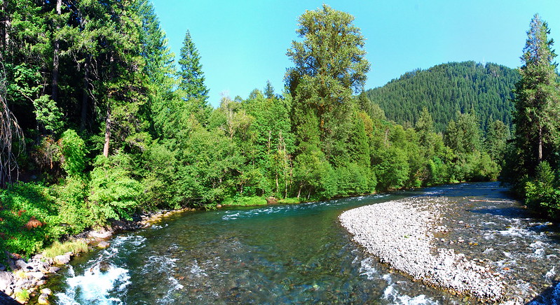
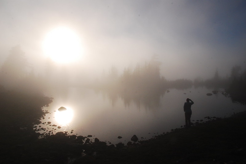
We take an evening stroll around Belknap Hot Springs, where Krista used to go as a kid. We walk along the McKenzie through their well-manicured paths and Krista tries to find a spot where her family camped years ago.

There’s a “Secret Garden.” You turn behind some nondescript stone pillar, and then… this.

I guess people get married here sometimes. I get it. We talk about celebrating an anniversary here. It would be fun to get married to each other again without all the weird pressure. Our wedding was ours in a way I get the feeling a lot of people don’t get to have their weddings be theirs, but if we did it again, it would be ours ours. I think vaguely about hiring someone to be a swamp monster in the stream.
2.
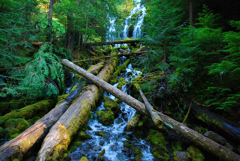
When we finish around Belknap, we still have a little daylight left, so we take a quick loop around Proxy Falls. Here’s Lower Proxy Falls:

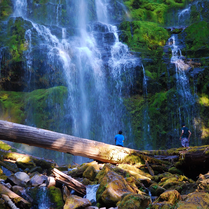
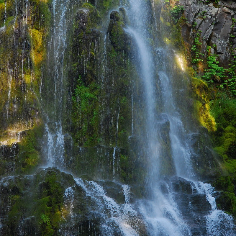
And Upper:
Okay, now for the real hike.
3.
We wake up around six Sunday morning and drive the twenty or so minutes to the Obsidian Trailhead. I’m always surprised by how curvy this road is. I feel kinda hungover, but I didn’t really drink much last night. Maybe it was the potato salad? The hot dogs? Am I allergic to Outdoor Recreation™?
Whatever. Time to hike. My stomach will figure it out.
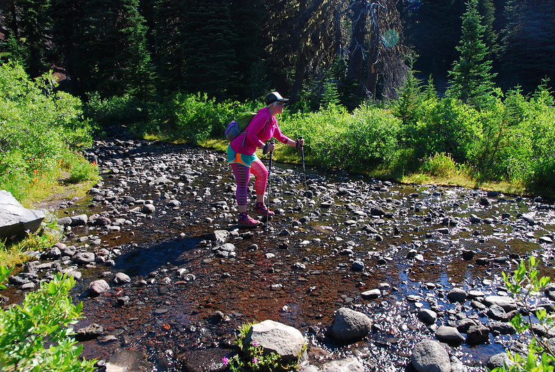
We make good time through the first few miles of “green tunnel,” stopping just once to put on mosquito repellent. Then we stop for breakfast just past the Jerry Lava Flow, in White Branch Meadow. In contrast to a few weeks ago, the creek’s running very nicely. Weird.
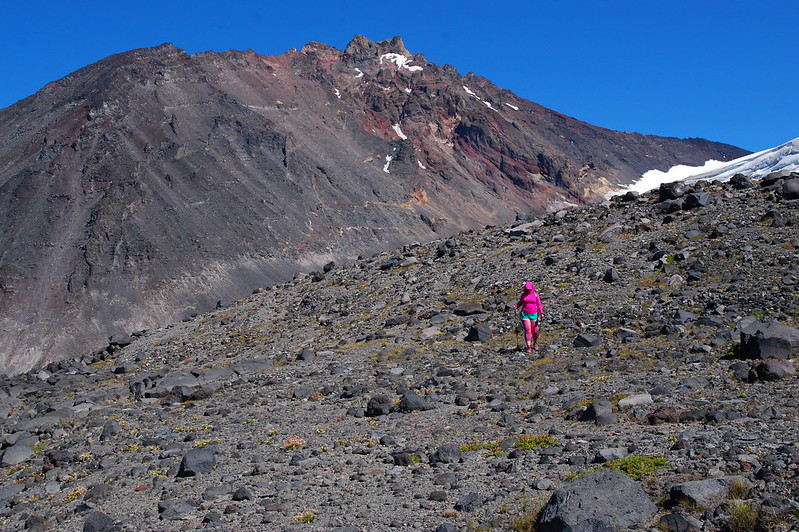
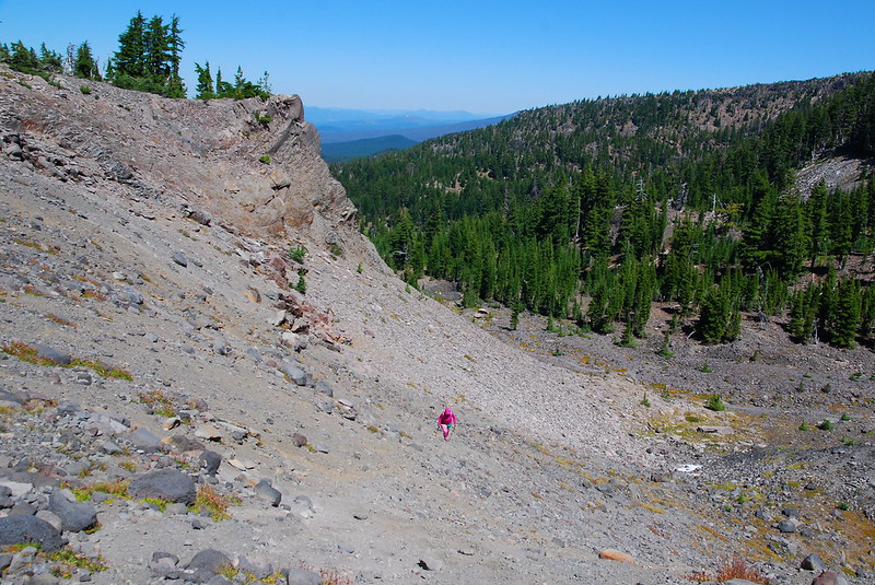
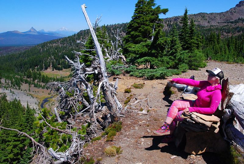
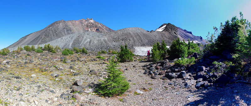
ACTION SHOT #1. Note Krista’s “backwoods fashion”:
4.
I take a liter of water from the trickling stream, and we eat breakfast in a small clearing under a tree on the far side of the meadow. There are still a few flowers.
As I’m rambling around slowly drinking coffee and staring intently at little bits of nothing in the grass, there’s a bee. I don’t know if you know this about me, but I’m completely, utterly, irrationally afraid of bees. I flee in the most undignified way possible, and Krista immediately starts to sing the Benny Hill Theme.
In my mind, we do this for hours.
5.
We’re in sort of a hurry after the long breakfast, so we take the steeper, shorter route up Glacier Way to the PCT, then continue on the PCT to the junction with the unofficial but very obvious trail to Arrowhead Lake.
We stop at the junction to put on sunscreen and I wander off to try (and fail) to get a picture of the obsidian shards that litter the ground. Or, really: the shards that are the ground.
When I get back, Krista looks like she’s seen something magic. I guess a hummingbird mistook her for a flower while I was gone, tried to pollinate her shirt.
6.
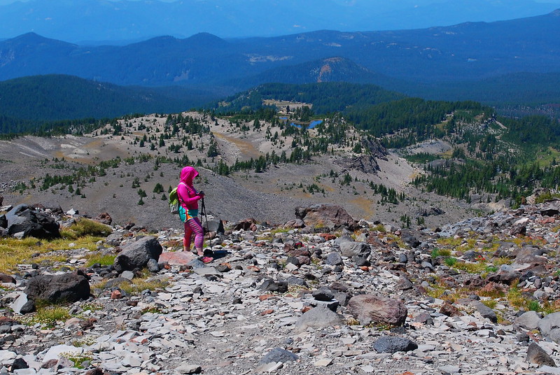
As we climb from the PCT to Arrowhead, the day’s heat catches up. It’s so, so hot. I’m sweating and it’s not even noon. It’s cooler higher up, right? Right? Right?
7.
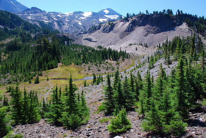
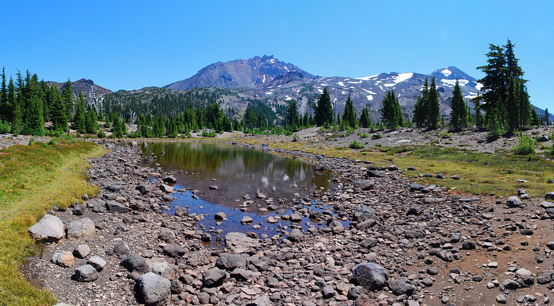
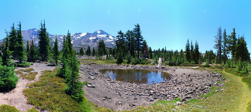
It’s nice to arrive at Arrowhead and actually be able to see the lake. The last time we were there, a few years ago…
But now…
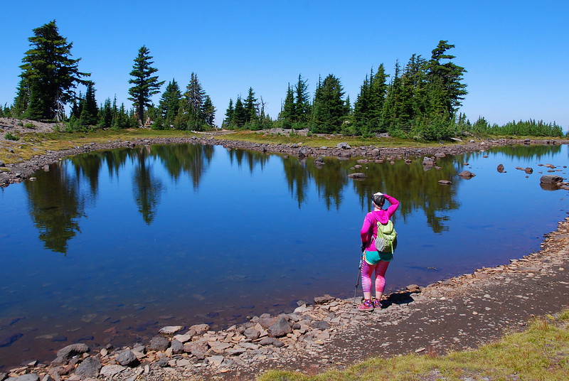
Views!
Someone’s even built a shale throne, from which Krista surveys her kingdom. “I own vast tracts of land!”
We spend a while fooling around the lake. Actually, “lake” might be a bit generous here. Tarn? Puddle? Whatever it is, you can pretty much walk through it.

8.
We’ve been waiting and seeing about going further up, as neither of us really do all that well in the heat, but it doesn’t feel too bad, so we continue upward, on the braided but obvious climber’s trail that runs generally east from the lake.

9.
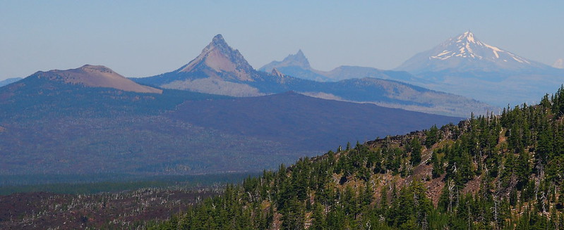
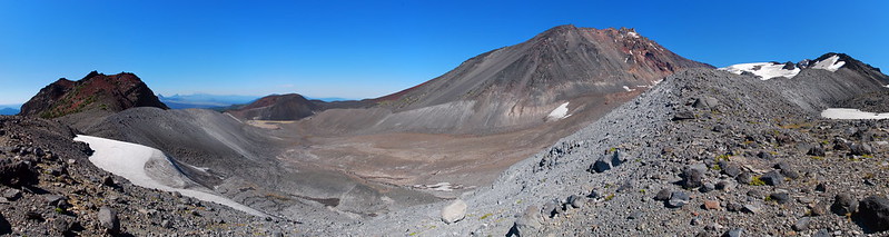
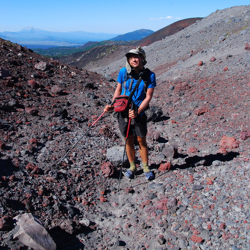
So here’s the thing: Little Brother’s summit is around 7800′, and the pass to the east of it is a few hundred feet below that. I know that we have to go a little high before turning north to hit the pass, but I overshoot. Pretty massively. When I finally bother to check the GPS, we’re around 8000′. Oh well. At least North Sister’s peeking out to say hello.
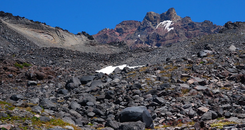
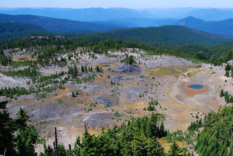
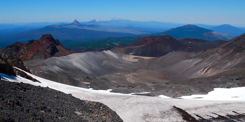
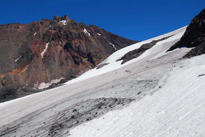
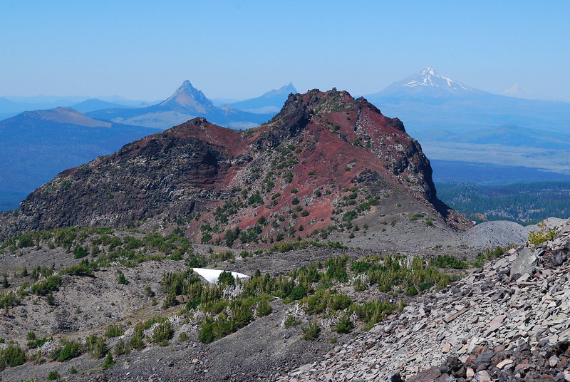
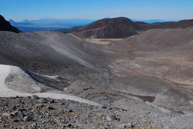
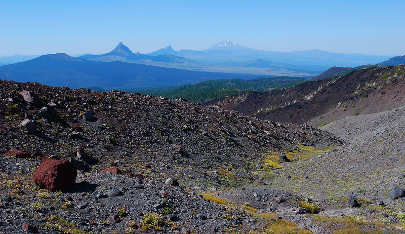
I wander over to a nice overlook of the Collier Glacier, around 8100′, to see what I can see. There’s no obviously unsketchy route down. In fact, later, looking up from Little Brother, I’ll see a complex of deep crevasses just below where I was standing. But it’s still pretty. Maybe my favorite view in Oregon:
10.
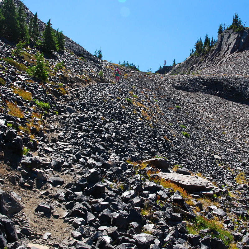
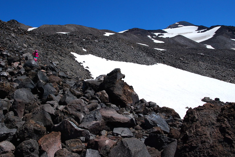
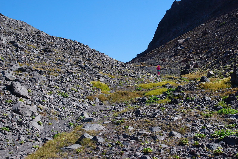
The route down to where we actually want to be isn’t exactly sketchy, but it’s filled with big unstable rocks that shift precariously with each step. If you look down into the cracks between rocks, there’s just deep empty blackness. The going’s no fun. At all. I think, for neither the first nor the last time, that I owe Krista for this one.
11.
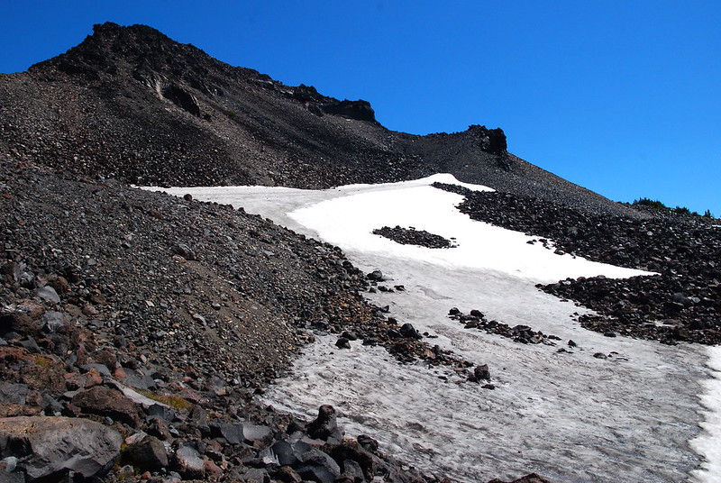
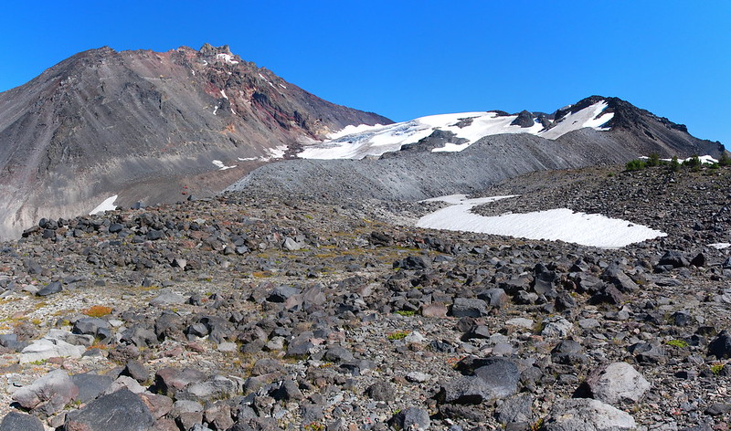
Just above the pass – maybe fifty or a hundred feet – we enter a beautiful flat area. I’m so, so relieved. If we come back, I’ll probably try to camp here.
I could spend a whole day just rambling around taking pictures there. I almost do.
12.
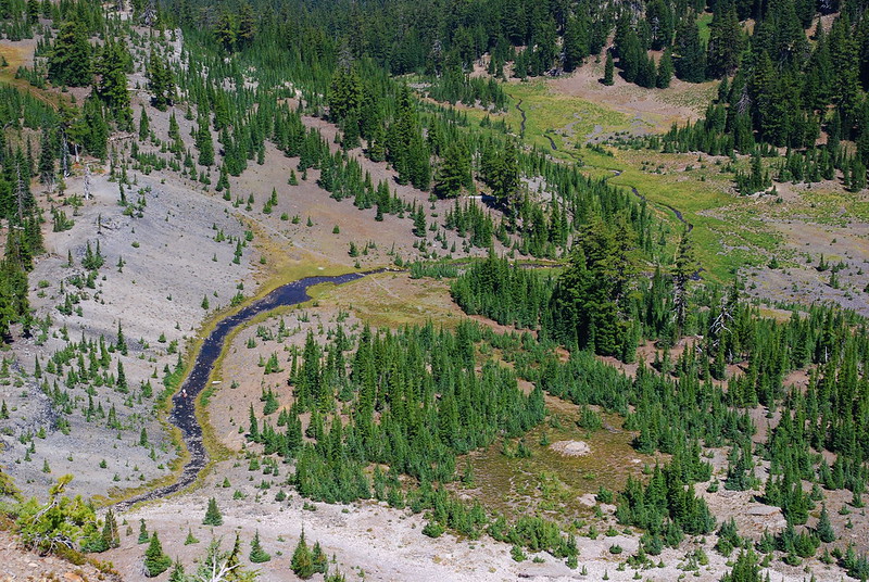
From the pass, there are two options for getting down. One follows the top of the Collier Glacier Moraine down toward the Collier Cone, and the other follows a valley south of the moraine and north of Little Brother. Already tired, we opt for the less perilous latter route. The walking’s easy, and I’m still so relieved.
13.
The valley dead ends near the Sawyer Bar, where the Jerry Lava Flow emerges from the Collier Cone. We could continue north here, climbing down through jagged lava to Opie Dildock Pass, but we decide instead to cut due west through some trees, to meet the PCT south of the pass. The route’s sort of bushwhacky, but we follow deer trails through dense saplings to mature open forest, and finally to the trail, which we greet like an old friend. We’re both so relieved, we sit down immediately and eat handfuls of trail mix.
It’s around five, which means we’ll probably finish in the dark, but oh well. We’re back on the trail, so it’s easy going from here.
14.
We motor south back to Sunshine Meadow, where we soak out feet for a while in the stream, and watch a large group of loud women put a large tarp on the fragile meadow. I want to say something, but I’m too tired, and too unsure that it will help, to bother. One of them yells out to me, asks where we’re camping. I tell her that we’re just dayhiking – that we’re headed back to the car tonight – and she doesn’t understand. Her world does not contain long hikes, and she’s apparently nervous that we’re going to set up too close to their coveted, flower-crushing campsite.
There must be a half dozen groups visible from where the PCT crosses the meadow. There’s a lot of beauty in the area. Pity for so much of the use to be concentrated in the place that can probably handle it least.
15.
From Sunshine, we hurry back to the trailhead. I run out of water around White Branch Meadow, but Krista gives me a few sips of hers, and anyway we’re moving fast enough that it doesn’t really matter.
As ever, the last mile is the longest, and we talk excitedly about pork chops and chicken fried steak. Somehow, Krista’s never had chicken fried steak. Let’s get some! Immediately!
It’s just getting dark when we get back to the car. We’ve left a couple mandarin sodas in the cooler. They’re so good, and so cold, I almost cry when I take my first sip. As I drive back down the curvy road, Krista hands me spoonfuls of potato salad. Oh my god potato salad! I don’t think I’ve ever tasted anything so good.
